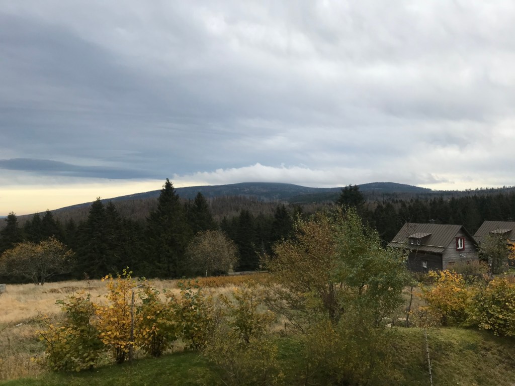
For the last multi-day hike of 2020, before winter and a new lockdown (which would last much longer than we initially thought), I left Paris on October 23rd with my favourite travel and hiking companion, my wife Odile, to walk the Harz Witches’ Trail (the Harzer-Hexen-Stieg) in central Germany. With Halloween coming up, we felt this was the ideal time of year to tackle a trail with such a name.
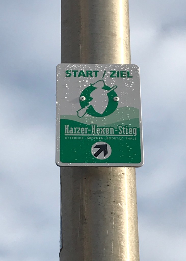
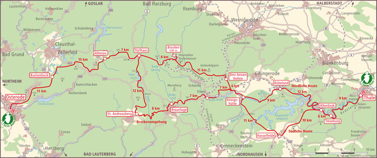
The Harz range, which culminates at 1,141 metres at the Brocken summit, straddles the German Länder (provinces) of Lower Saxony, Saxony-Anhalt and Thuringia. The Witches’ Trail runs for just under 100 km from Osterode to Thale, passing over the Brocken summit on the way. The northern route, the Hauptroute, which we would be walking, takes five days. There is a southern variant that is slightly longer and that does not pass over the Brocken. The trail crosses the old border between East and West Germany just before the summit and there are numerous reminders of the region’s rich past all along the way. As for the name of the trail, it derives from the various sites associated with witches along the way, including the Brocken summit itself where legend claims witches convened on Walpurgis Night (April 30) and the Hexentanzplatz (the Witches’ Dance Floor) just outside Thale, where the Saxons supposedly once held rituals and sacrifices to their mountain gods and goddesses.
The trip started with an easy but fairly long train journey from Paris, with changes in Frankfurt and Braunschweig, bringing us to Osterode just as it was getting dark. There was a moment of panic on the journey because of Covid-19 restrictions. We had done everything properly by getting ourselves tested the day before departure, printing out the negative results to carry with us and filling out the German government’s form online before crossing the border. But, all of a sudden, I had an email from the hotel that we had chosen in Quedlinburg for two nights after finishing the trail. They said that they would have to cancel our reservation as we were coming from France (a risk area) and that the rules in Saxony-Anhalt prevented them from giving us accommodation. I emailed them right away, telling them that we had all the certification required and that we were really keen to have a couple of days in Quedlinburg after completing the trail. Just after we reached Osterode, I heard back from them, saying that if we could prove we had walked the full trail (by showing our hotel bills) that could work, along with the negative test result, as they could say we had come from Osterode rather than France and had spent the last five days on the trail, considered a no-risk area. Phew!
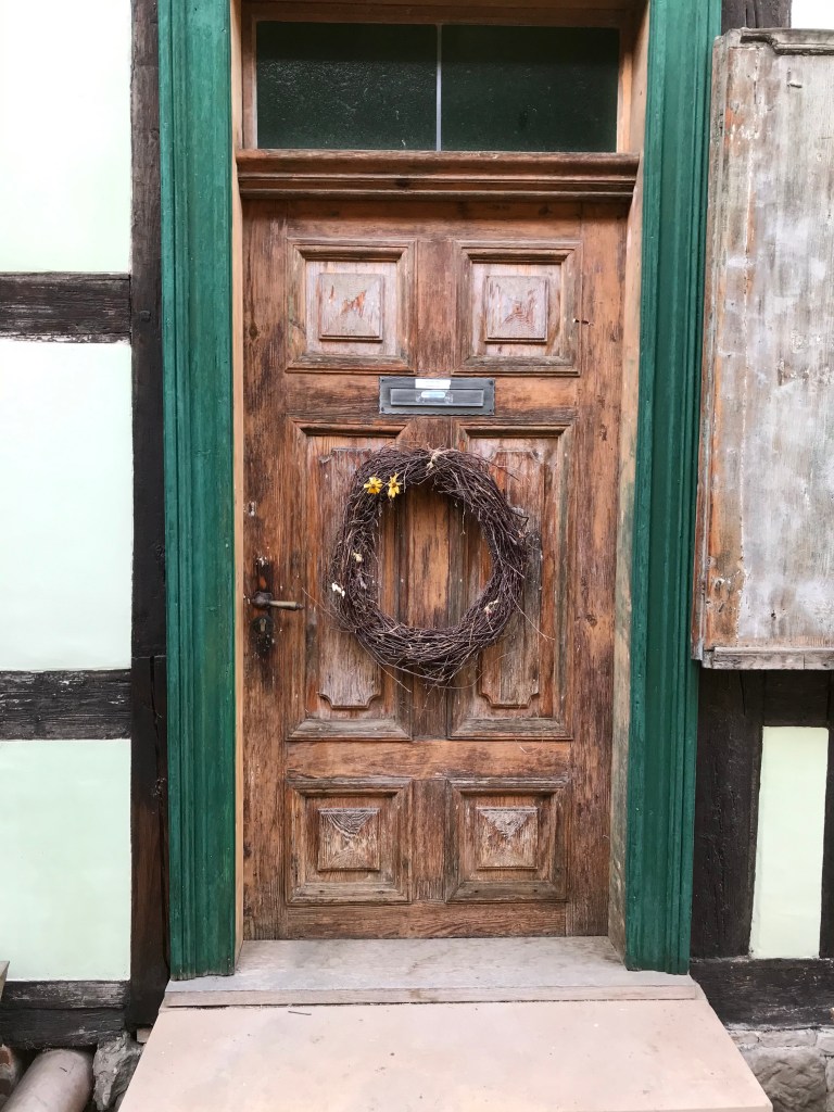
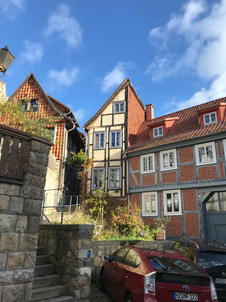
With that problem cleared up, we headed off into the centre of Osterode to find somewhere to eat, ending up in a friendly Greek restaurant that did fantastic grilled meat dishes. Osterode is a pleasant and quiet little town with lots of half-timbered buildings and a huge market square with a beautiful old church. Our hotel, the Harzer Hof, was simple but comfortable with a large room and a good breakfast.
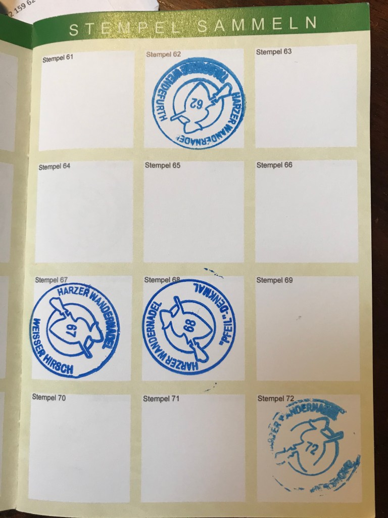
Before starting the trail on the morning of October 24th, we stopped off at the bookstore on the main square in Osterode to buy our Harz hiking passbooks. The Harzer Wandernadel (hiking nobility) allows the hiker to earn awards at different levels by walking to the various checkpoints in the network and stamping his or her passbook to record the visit. There are 222 checkpoints across five districts in the region. You need just 8 stamps for a bronze badge, but all 222 for the Emperor badge. The passbooks are popular and, over the next five days at the various stamp stations, we saw quite a few people who were well on their way to Emperor status.
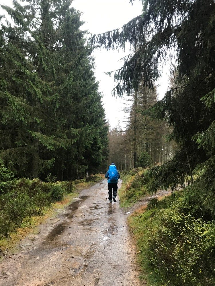
From the town centre, we crossed the Söse river, passed the cemetery and the castle ruins, then began a steady climb up from 200 metres to 600 over the course of the morning. The trail was consistently well marked on posts and trees with a stencil of a witch riding a broomstick. There were fine views back over Osterode from time to time and, even though it wasn’t sunny, it was a very pleasant morning.
After about an hour, we arrived at Eselplatz where the trail began to level off. It was a pretty muddy spot with a small hut where a group of hikers were having a coffee break. They offered to make room for us, but we decided to keep going a while longer before resting. Unfortunately, we missed the stamp station there, not realizing that there was one so soon after setting off. This meant that we would be unable to get the Witches’ Path special badge on this trip as the Eselplatz stamp is needed in the passbook as proof of having started the trail. We’ll just have to go back one day.
We carried on our way, continuing uphill at a much gentler rate, trudging through a number of logging sites where we were dwarfed by the huge piles of timber at the sides of the trail. Because of the intense logging work in this area, the trail was pretty churned up, slippery and muddy. The hiking poles were a great help on such terrain.
We didn’t miss the second stamp station on the trail – the number of people using it and the very visible position made it impossible to overlook. It was in a small hut at the edge of the Bärenbucher reservoir. From this point on, we would be on the lookout for the dark green boxes with their yellow sign and wouldn’t miss them again.
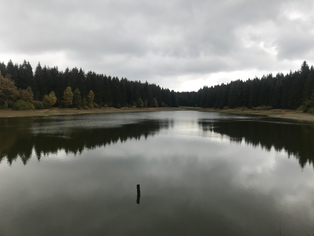
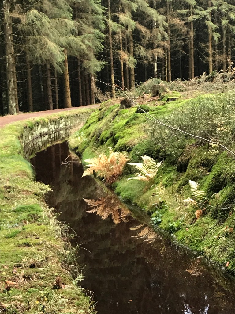
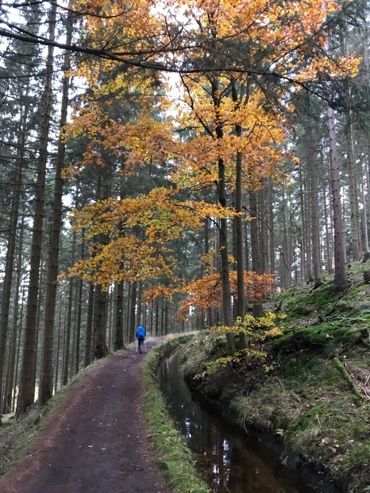
The reservoir was also where we first came across the Upper Harz Water Regale, a system of dams, reservoirs and ditches built from the 16th to the 19th centuries to divert and store water to power the waterwheels that lifted ore and pit water from the very deep silver, copper and lead mines in the area until they closed in the early 20th century, when they were no longer commercially viable. The whole of the Regale system is now a UNESCO World Heritage site and we would see numerous facets of it over the first two days of our hike, notably the water channels running along the side of the trail for kilometres on end. This totally green energy system was a colossal undertaking for the time, with the longest channel, the Dammgraben (which we would follow for part of its course), originally running for over 25 km. At one point, it even runs along the top of a huge dyke, which we would follow later on our first day.
At the next stamp station, we bumped into a friendly group of local hikers taking a picnic break and who offered us some delicious homemade cheesecake and chocolate mini muffins. They had baked a huge amount for their hike and generously invited us to take as many as we wanted!
Just after saying goodbye to them, as we were walking alongside the peaceful channel of water, a squirrel bounded across the path ahead of us and climbed a tree by the trail. As it passed, it peered out at us and, to our surprise, began chattering and chirping at us. Until that day, neither one of us had imagined that squirrels made such a sound. As a joke, we clicked our tongues in reply. And the squirrel answered! After about five minutes of tongue clicking from us and chattering from the squirrel, it gave up on us and vanished up the tree.
After crossing a main road, the final section of the day’s hike was very pleasant, despite the increasingly overcast weather. For most of the way, we were walking alongside the Dammgraben. The section along the top of the dyke was pretty spectacular and would have provided fine views on a nicer day. There’s something very pleasant and relaxing about walking alongside flowing water and this part of the trail was very easy to hike, rising and falling very gently as we approached Altenau, where we left the trail proper to descend to the village and our hotel for the night.
After this long first day (29 km from start to finish), we found the keys to our room taped to the front door of the Hotel Zum Forsthaus on the outskirts of Altenau, just opposite a pretty wooden church surrounded by a peaceful graveyard. This hotel too had been reluctant at first to take us because of the rising Covid figures in France, but an email exchange before leaving had allowed us to sort everything out and reassure the owners, as well as book our evening meal at a very reasonable price. This family-run hotel was peaceful, spotlessly clean and very comfortable. The extremely garrulous owner was a terrific source of information about the local area. He made sure (several times) that we knew the clocks were going back that night, gave us no end of information about the bark beetles attacking the trees in the area (we had noticed clumps of clearly dead trees along the way) and informed us that we would need to follow a detour the following day as part of the trail between Altenau and Torfhaus had been carried off by a landslide. He was quite a laugh too with a very squeaky trolley that he used to bring food to the three tables of diners, rather than go back and forth to the kitchen.
After a good night’s sleep and a hearty breakfast (served from the squeaky trolley, of course), we took a walk around Altenau (a sleepy little place, but with a thermal spa) before setting off uphill to return to the trail.

This second day was much shorter, just 13.2 km to Torfhaus at the foot of the Brocken, a little longer than in the guidebook because of the landslide blocking the trail. For most of the way, we followed the Dammgraben with its babbling waters providing a pleasant and relaxing backdrop to our hike. I imagine this section would be even more enjoyable in summer, with plenty of shade from the trees and cool air rising from the channel.
At one of the sluices, we came across a display of the buckets that were used to carry water and ore out of the mines before the waterwheels were installed. It was possible to lift one of the filled buckets to see how heavy they were. And it certainly did weigh a ton!

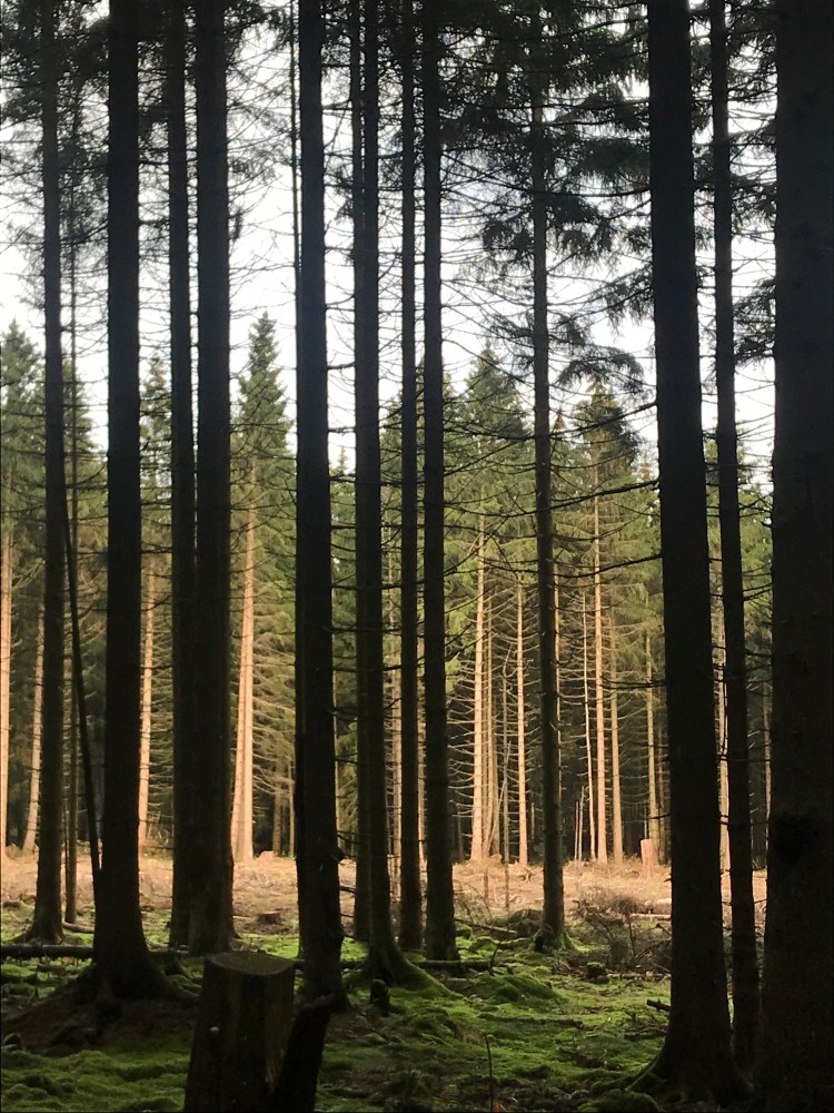
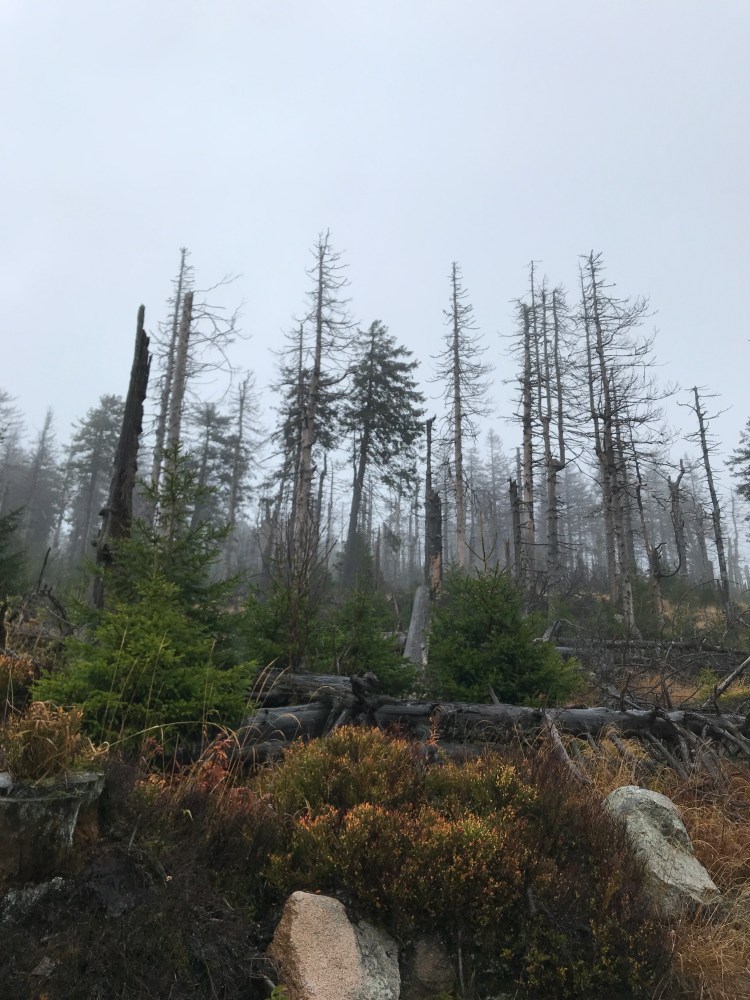
We got two more stamps for our passbooks and as we went along, we began to see more and more trees that had been attacked by bark beetles. Whole swathes of hillside were either covered with dead trees or had recently been cleared by logging (a look at a satellite image of the region shows the extent of the damage). The commercial planting of spruces, and the resulting monoculture, provides a living feast for the beetles. They block the circulation of sap by attacking the bark of spruce trees and boring holes into the tree to lay eggs, from which emerge larvae that also attack the bark, resulting in the tree’s death in less than four weeks. They have affected commercially planted spruce forests across a vast swathe of Europe from Saxony to Burgundy. Warming temperatures also fuel the beetles’ expansion as they are no longer killed off by cold winters. When I was younger, I remember hearing about the Harz forests being ravaged by acid rain from the factories in East Germany. Now, with our changing climate, the forests are subject to a new form of attack. It was pretty heart-breaking to see these masses of dead trees but there’s also hope thanks to the new planting of a greater diversity of trees that should prove more resistant to the pests that often focus on one specific species of tree.

We followed the Dammgraben all morning until we reached the spot where we had to veer off the official trail because of the landslide that we had been told about in Altenau.
The diversion entailed a steep descent into a valley and then a steady climb back up, passing a couple of ski-lifts before hitting the main road just before Torfhaus where there was a crazy amount of traffic on this October Sunday.
We arrived in Torfhaus in the early afternoon, way too soon to check into our hotel. It was a distinctly odd place, just a few buildings on either side of a main road, a real one-street town. Apart from the rather luxurious “resort” where we had a great room with a terrific view of the Brocken (until cloud covered it), there was a small outdoor sports store (where we invested in rain ponchos after looking at the forecast for the next day), a few food stalls along the side of the road and a huge Bavarian-style beer hall where we ended up eating a salad for lunch, before checking into the hotel, and then a hearty dinner. There were no other dining options in the evening as the food stalls closed down in the late afternoon and Torfhaus became a sort of ghost town by dark. Needless to say, we had a very peaceful night’s sleep!
Our third day on the trail would turn out to be the bad-weather one. We set off right after an excellent breakfast, putting on our rain gear as soon as we left reception. The rain was mere drizzle at this point so we felt no need to get out the ponchos. Even so, after a night of rain, the ground was pretty wet and muddy in places.
The trail was fairly flat at first, heading across the Torfhaus moor alongside another channel that was part of the Regale system. As we trudged along the rain grew heavier and, when we came to the first stamp station, we decided that we needed the ponchos on as the pack covers were already quite wet. Luckily, there was a small hut there so we were able to shelter as we struggled into them. The stamps in our passbooks for this station and the Brocken summit both look like shapeless inkblots because the ambient humidity meant it was impossible to make a clear imprint.

After about an hour of steadily walking uphill, we emerged onto the old border between West and East Germany, now part of the Green Belt that runs from the Baltic to the Czech border. Shortly after that, the trail levelled off slightly to follow the railway track that leads to the Brocken summit and that is used up to six times a day by the tourist steam train that climbs over 600 metres, from Drei Annen Hohne (where we would pass later that day) to the Brocken summit station. The views were non-existent by this point because of the mist that was growing thicker as we climbed higher, true to the Brocken’s reputation of spending up to 300 days a year in the clouds or mist. Even so, the tourist train was running and we soon heard it chugging along the tracks towards us. It was a magical sight as it emerged from the mist like the Hogwarts Express, barrelling past us in a cloud of steam that added to the general atmosphere.
As we climbed towards the summit, the weather gradually got worse as the rain became heavier and a strong wind began to blow. We were grateful for the ponchos bought the previous day as they provided excellent cover, despite flapping crazily in the wind. The last kilometre or so followed the road that leads to the summit and we covered it at a pretty rapid pace, eager to find a little shelter and a warm drink at the top. We were soon able to make out the railway summit station through the mist and then, after one brief final climb, the hotel, tourist information centre and cafeteria were there before us, shrouded in the damp mist and battered by the howling wind. We found the summit stamp station at the side of the tourist centre, but only obtained a second messy inkblot in our passbooks. Unable to enjoy the supposedly fabulous views, we then headed to the cafeteria for a warming cappuccino and a slice of cake, hanging our gear up for an hour or so in the cavernous but well-heated room where there were about only six or seven other visitors. Thank God we hadn’t booked a night at the tower hotel for the views…

On emerging from the cafeteria, the rain had eased off slightly and the wind was a little less strong, but the thick mist meant that it was still impossible to see much at all. From the summit, we had around 17 km to cover to our evening stop, all of it downhill after the morning’s climb (a descent of 720m).
The first part of this long but gradual descent was on the road from the summit and, after crossing the train tracks for the last time before meeting them much further down at Drei Annen Hohne, we found ourselves walking through a fairly barren landscape of dead spruces. In the mist and rain, they created an eerie atmosphere. We were surrounded by the dead trees until early afternoon when we finally reached more diverse plantations further down. At one point, a variant headed down to Schierke and, looking at it, we were glad we didn’t need to take it – it was a very rocky and root-riddled path with a warning posted that it could get slippery in wet weather.
By the time we veered off the road, the rain had more or less stopped and we were able to get a fairly good imprint of the day’s third pass stamp. From that point on, we followed pleasant forest trails, at times through wastelands of dead or felled spruces, at others through thicker and more diversified woodland, particularly as we reached lower altitudes.
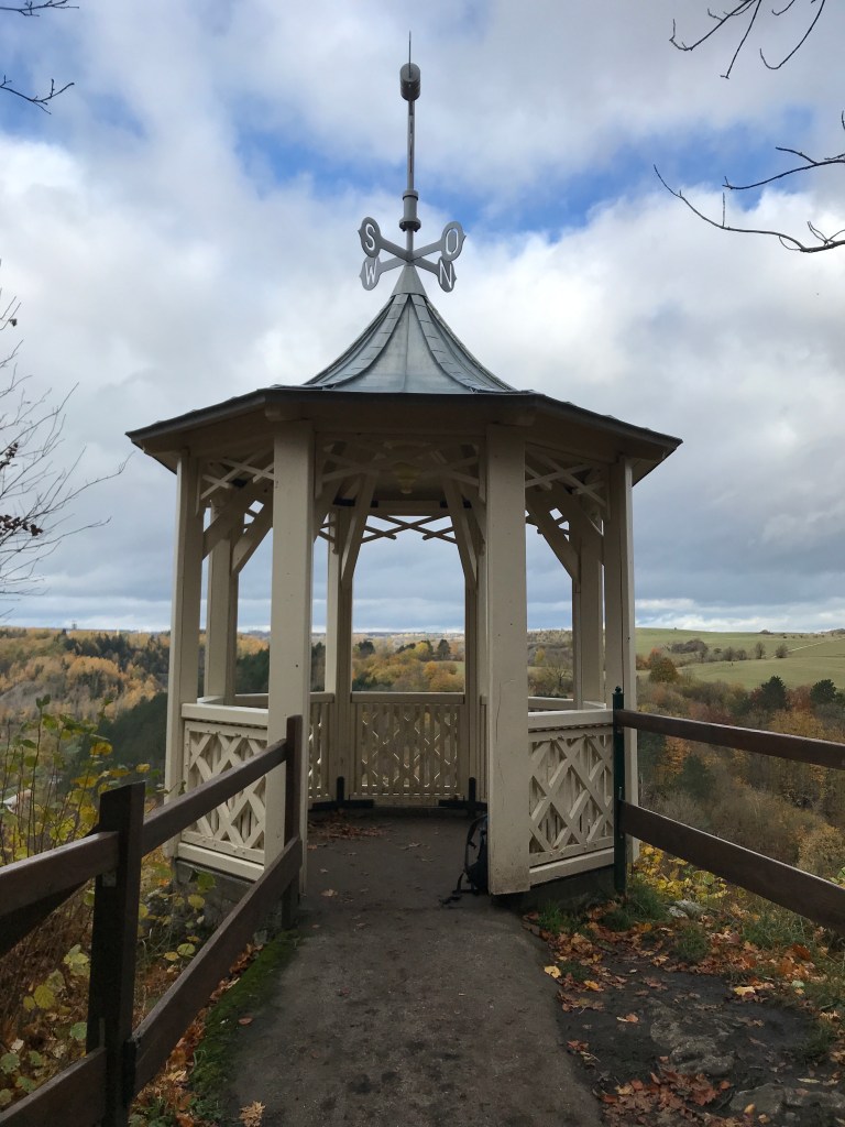
The descent was gradual, a little water-logged in places, but generally pleasant and easy. We met a handful of other hikers, but there were very few people around, just other couples hiking together or, more frequently, lone hikers. At the next stamp station, at the Trudenstein, there was a spectacular view over the terrain ahead from the top of a rock formation that was reached via a series of steps and ladders.
We continued to follow the trail through the woods until reaching a pretty orchard just before Drei Annen Hohne. We had hoped to take a snack break there but nothing much was open and we had to be content with a few nuts from our pack.
After crossing the tracks of the tourist steam train, we began the final section of the day, which meant veering off the main trail at one point to reach the accommodation that we had booked. The trail signage on this section was not at all clear and we took a wrong turn, but soon found our way back to the right path. At the first major clearing, we left the official trail to head to our hotel in Mandelholz. The route that we had to follow was pretty muddy and slippery, churned up by logging work and waterlogged from the rain. We finally emerged into a field the side of which we followed to a road that we then had to take, following a narrow path to one side of it. On the map, it seemed that we could veer off the road at one point and follow a track alongside a lake directly to the hotel. We found the turn-off, began to follow the track along the shore, but then saw it head into the waters of the lake. Looking at the satellite photos of the area later, it became clear that the dam holding back the lake had either burst or been demolished since the maps were made and the satellite photos were taken. So we had to turn back and do the last kilometre or so along the main road where there was no longer a path and some cars were passing at high speeds. We were glad to finally make it to the hotel which turned out to be a delightful little place with friendly staff and great food. The radiators in our room were more than adequate to dry out our wet gear from this very damp day on which we ended up covering almost 29 km.
After a good breakfast on the fourth day, we took a bus from Mandelholz back to the main trail at Königshütte where we had been unable to find accommodation for the previous night. Apart from a smattering of rain in the early afternoon, the day was dry but cloudy and pretty chilly. It would be another long one, close on 30 km, with a moment of panic towards the end, but more about that later.
The bus dropped us at the beautiful Königshütte waterfall, which was another passbook stamp station. The waterfall was particularly splendid on this autumn morning.
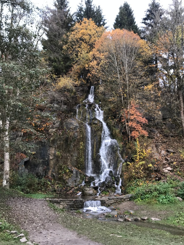
From the waterfall, the morning’s walking was almost entirely flat as we began to follow the banks of the Bode river which would accompany us until the end of the trail. Outside Königshütte, we crossed the “Warm” Bode just before its confluence with the “Cold” Bode that flows down from the flanks of the Brocken. Apparently, there is a slight difference in temperature between the two rivers before they join to flow towards Thale, hence the two names.

After meeting, the two rivers enter a man-made lake, the shores of which we followed for two or three kilometres. We missed a stamp station at the Königshütte castle ruins as a sign on the path up to them advised against climbing up following a minor landslide – another one that we’ll have to go back for.
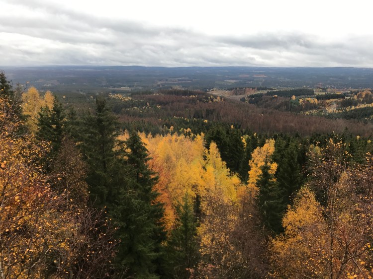
The walking was easy and pleasant. It was good to be dry after the previous day’s conditions. We even caught a glimpse of blue sky now and then between the clouds. At the end of the man-made lake, there was another stamp station at the dam and, after that, the trail stuck close to the banks of the Bode through fairly thick and diversified woodland (no dead trees here) over a carpet of autumn leaves that were a little slippery at times.

After a while, the trail veered away from the Bode to avoid following a road and headed uphill, passing a quarry where the pyramid-like heaps of rubble on its outer edge created a very weird landscape. After a steepish climb, we then headed downhill to the cliffs overlooking the village of Rübeland. On the way, we passed a very original beehive – a life-size wooden carving of a bear with a slit on its belly to allow bees access to the hive.

Shortly after the bear, we reached another stamp station at Hohe Kleef, from which we had a good view of Rübeland below.
Unfortunately, the trail skirted Rübeland so we saw no more of the village, where there were a couple of show caves. From that viewpoint, the trail descended to the valley to return to the Bode that we would continue to follow for the rest of the day, as a babbling, soothing and utterly charming river and also as the waters of a huge man-made lake behind the wall of the Wendefurth dam.
As we had missed Rübeland, we hoped to make a lunch stop at Neuwerk, the next village along the valley with a restaurant, according to the guidebook. Unfortunately, it was their day off, so we ended up snacking on our last few cereal bars and nuts at a picnic table near the old school house in the village. The sun was shining by then, even though there was still a chill in the air.
However, just after setting off from Neuwerk, we had the rain shower of the day, a light drizzle that gradually got heavier and forced us to get out the pack covers and rain jackets. However, it only lasted about half an hour before stopping completely.
As we neared the lake behind the dam wall, the trail signage began to fail us for the first time since leaving Osterode. At one point, the trail seemed to veer off to the left but, after around 800 metres of overgrown and poorly maintained track through thick woods, we met a family coming in the opposite direction who told us that we were on the wrong trail (they had gone a lot further than us before giving up). On returning to the point where we had turned off, we found a trail heading steeply downhill to the lake, but with no sign indicating that it was the right one. We took it all the same and, after about twenty metres, spotted the familiar witch stencil that we had been following since Osterode.
A little further on, we were able to return the favour to the family when another wrong turn led us about a kilometre out of our way until we found ourselves blocked on the lake shore and unable to go any further. We met them on our way back to the trail and were able to warn them not to go further. The couple’s daughter, who can’t have been more than seven or eight, was remarkably resilient and seemed to be having the time of her life, despite the two wrong turns.
When we picked up the trail again, we spotted the sign that we had missed and that was invisible from the direction we had initially come from as we would have needed to do a 180-degree turn to spot it.
The trail headed steeply uphill before levelling off and following a sort of plateau above the lake. We regularly heard screams from the long zip-line on the other side of the lake where there was also a spectacular pedestrian suspension bridge that we caught a glimpse of from time to time.
When we finally reached the dam wall at the end of the lake, after the two wrong turns, it was already quite late and we suddenly found ourselves dealing with something that we hadn’t taken into account – the hour’s less daylight since the previous Saturday. On the last two days, we had arrived early enough not to be bothered by it. We still had another four kilometres to cover and, on this grey afternoon, the light was already starting to fade. So, after a quick goodbye to the couple and their daughter who were just behind us, we set off for Altenbrak as rapidly as we could. Luckily, this final section was very easy walking along the banks of the Bode, but we felt like a couple of Duracell bunnies, barelling through the fading light at a pace of up to 6 km an hour at times!
We reached Altenbrak after almost 30 km in all just as the last glimmer of daylight was going. I stopped off at a restaurant, Zum Harzer Jodelmeister, just down the hill from our hotel, to book a table for dinner and, when I came back out, it was dark. We had to use the flashlight on our phones to open the key box at our hotel, the very simple, basic but clean Waldhotel Altenbrak, according to the instructions that they had emailed. Our room was in the attic, spacious but with very creaky floorboards and an overly soft bed, but we didn’t really care after the day’s wrong turns and the last minute rush to arrive before dark.
Dinner was rather unusual. When we arrived at the restaurant, we were greeted by the manager and his wife who were both elegantly dressed in traditional costume. He showed us to a table in an upstairs room, telling us that the ground floor dining room was fully booked for their “music” evening. The upstairs room was peaceful and the food was excellent, but then, right in the middle of dinner, we discovered where the restaurant got its name (Jodelmeister) when a spectacular yodelling performance began on the ground floor with husband and wife trading yodels in a sort of crescendo. Being unable to see them made it even weirder. They were sterling performers and were still going strong (after breaks between songs) when we left about 45 minutes later.
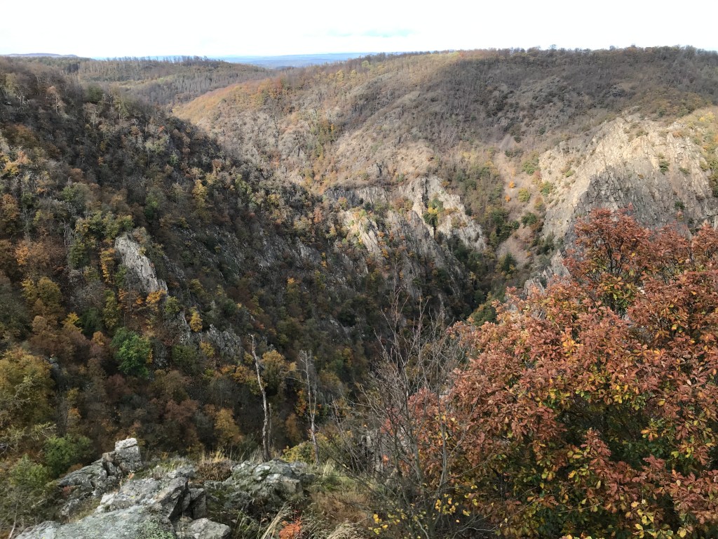
The fifth and final day on the trail had another surprise in store as the Bode valley path was closed from Treseburg on, meaning that we had to head uphill to the plateau above the valley, rather than walk along one of Europe’s most spectacular canyons north of the Alps.
Apart from this minor annoyance, which meant that we wouldn’t get the final trail stamp in our passbooks, it was another great day’s walking, with the clouds finally clearing just as we reached Thale, the end of the trail.
On setting off from Altenbrak, we first followed the Bode along a pleasant woodland trail through piles of autumn leaves.

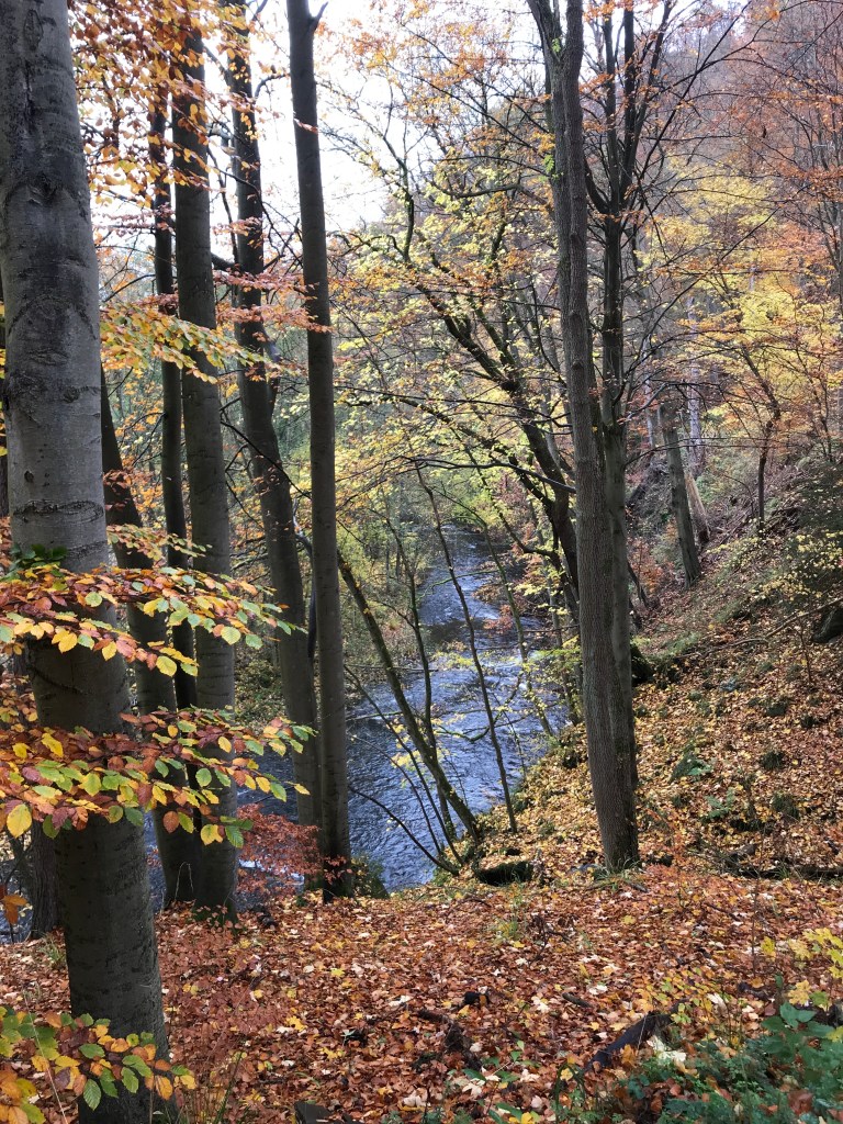
It was a joy to be walking alongside this charming river. Apart from about 10 km on either side of the Brocken summit, this whole hike had been accompanied by flowing water, first with the Water Regale system and then with the beautiful Bode river. We really should come back in summer as the shady paths and babbling streams must make for very enjoyable hiking in that season. But autumn has its charms too and neither of us regretted coming at this time of year.
After four kilometres, we arrived in Treseburg, a quaint little spot with an unusual number of elegant buildings. On crossing the river there, we found signs telling us that the Bode valley trail was blocked and indicating a diversion that entailed a steep climb out of the valley, with some great views at times, before levelling off and crossing a wooded plateau to the Hexentanzplatz above Thale.
This section was peaceful and, even though there were more hikers around than on previous days, nothing prepared us for the shock of arriving at the Tanzplatz which is a major (and rather tacky) tourist attraction with a small zoo, countless rides with a witch theme and no end of stalls selling junk. The place was crowded, with most people arriving from Thale by cablecar. After taking in the views back over the Bode gorge and a quick coffee break, we got out of there as quickly as we could.
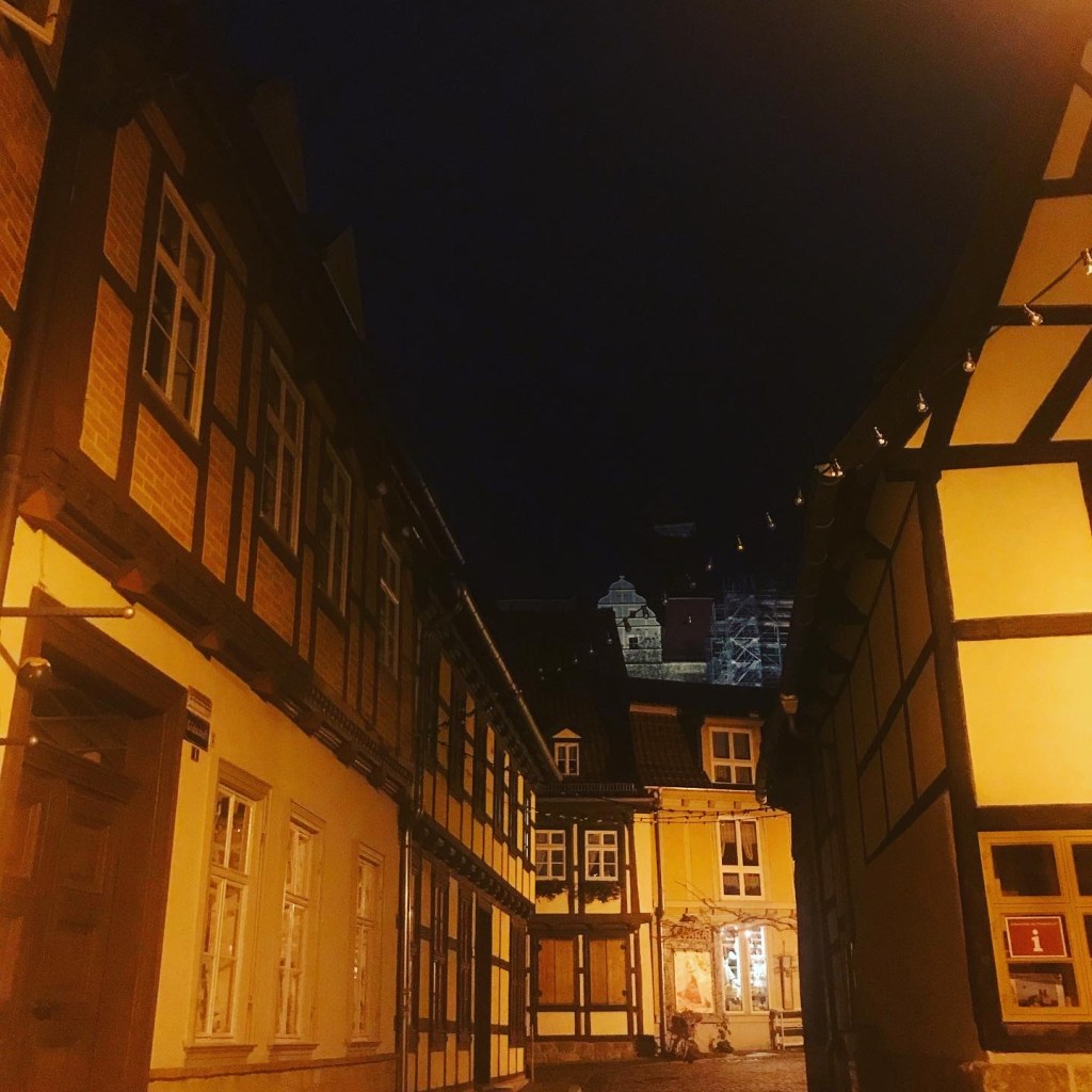
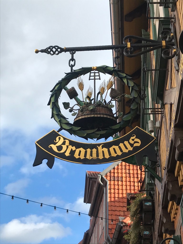
The zigzagging trail down to Thale was steep and stony, passing beneath the cablecar a couple of times. After numerous switchbacks, we emerged onto the banks of the Bode as it flowed out of the rocky gorge. From there, it was a short walk across a park to the station where we took a train to Quedlinburg, where we had a slice of the local speciality, Baumküche, in a café on the main square before heading to our very comfortable hotel attached to the local brewery. Dinner, of course, could be nowhere else but at the brewery restaurant and it was excellent, with a terrific range of beers.

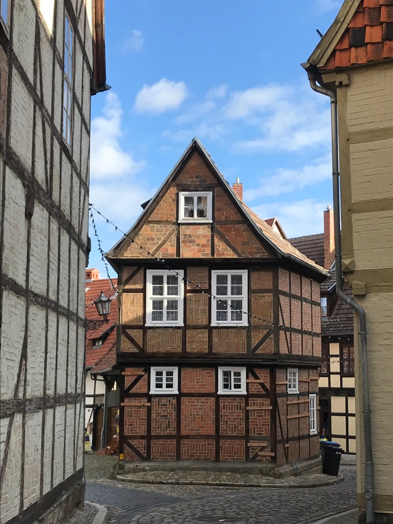
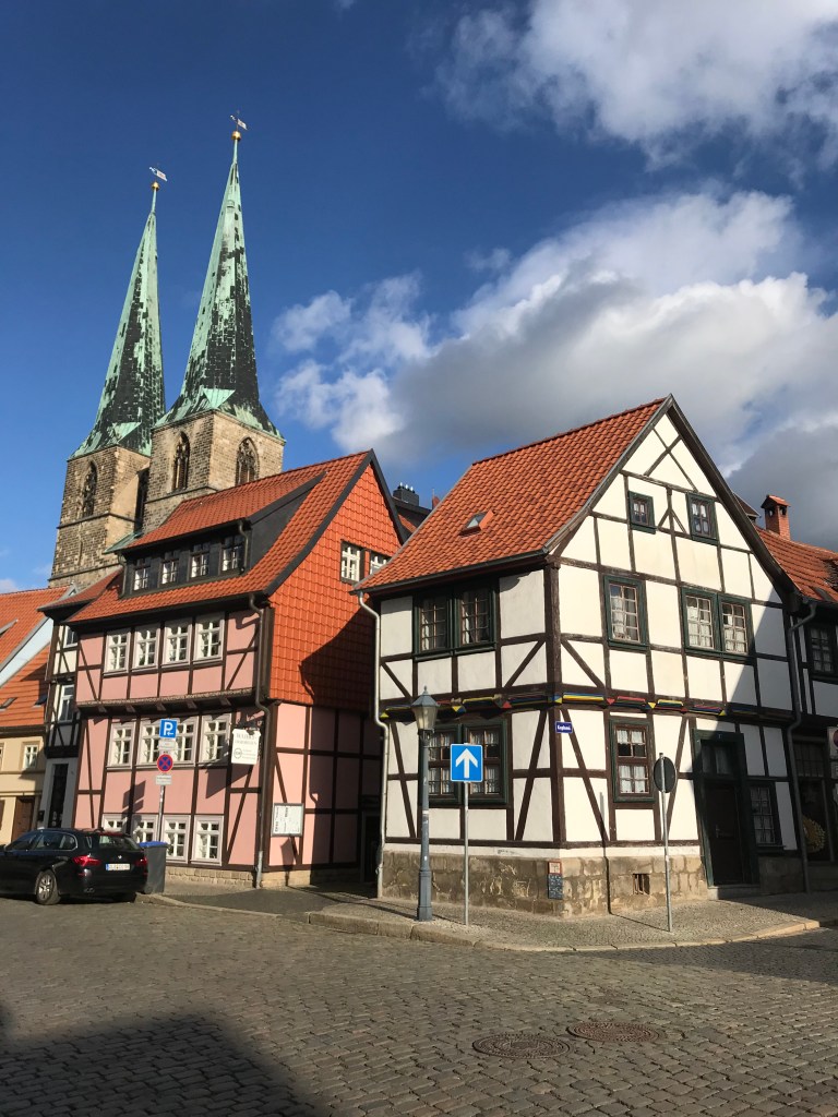
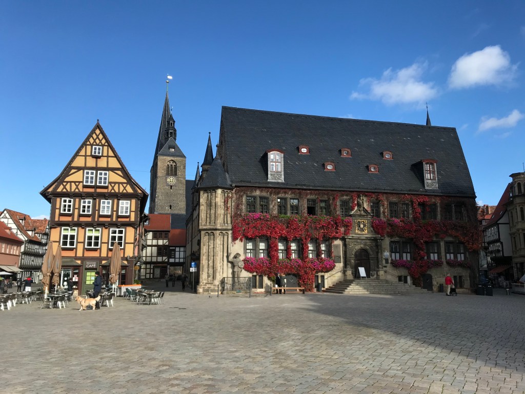
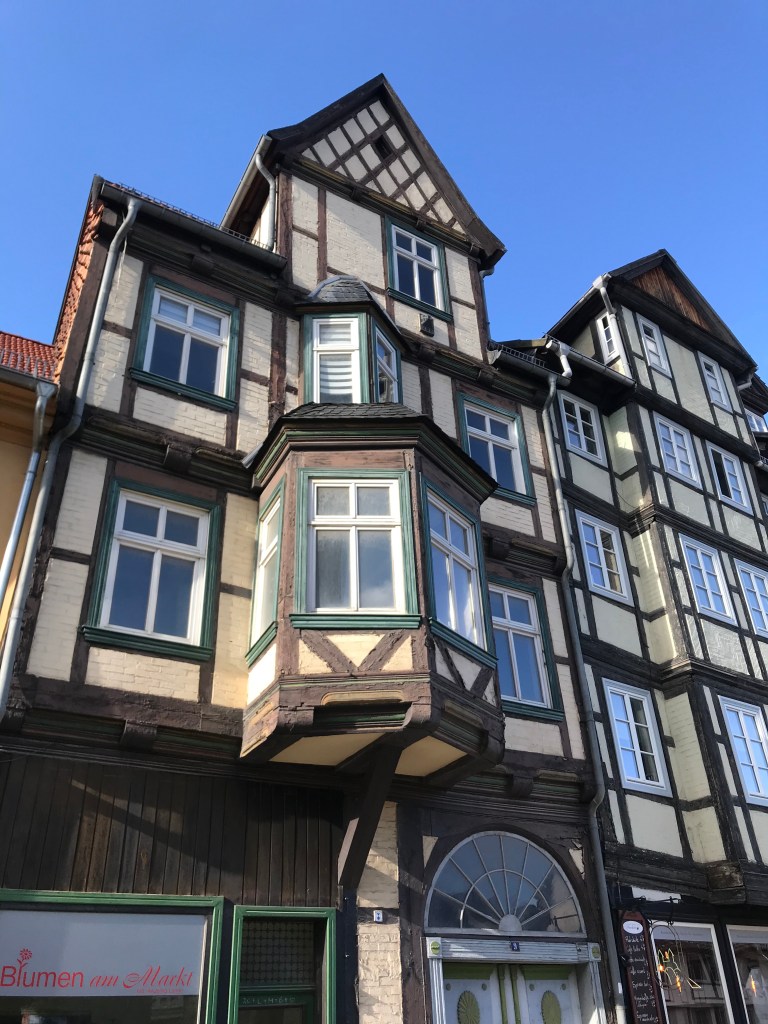
Before heading home, we had one last day in Quedlinburg, which is a beautiful old town with one of the highest concentrations of half-timbered buildings in Germany. There’s even an academy to teach students how to restore such buildings. It was a beautifully sunny day, ideal for wandering around and seeing the sights.

So that was the Harzer-Hexen-Stieg, a great little trail that allowed us to explore an unfamiliar area of Germany and discover its rich history. There are countless other trails in the area and, with a passbook to fill with stamps, I’m sure we’ll be heading back there one day.

Hello! We are planning to do the walk in October and I wonder if you might be able to let us know the name of your guidebook and also the temperatures when you walked it – wondering how many layers to take!
thank you
LikeLike
Hi there,
We did the hike at the very end of October (to fall in with Halloween!). The guidebook we used was the German one published by Hikline, which is very reliable. However, it only exists in German. I just took a look at amazon.co.uk and there doesn’t seem to be anything in English on the trail. If you don’t read German, you can find a full description on the AllTrails app.
It’s a great trail, never too difficult, although weather conditions can be a bit harsh on the Brocken.
In late October we walked in a couple of layers (merino T-shirt and light hiking jacket) with rain gear at times as well, and in hiking trousers rather than shorts.
Please get back in touch if I can provide further information.
All the best,
Ian
LikeLike