The second half of the Westweg would turn out to be as spectacular as the first, taking in a number of remarkable spots as the trail passed over several of the highest summits in the Black Forest. The weather on this section varied as much as on the first half, with gloriously sunny days and others when the rain seemed relentless.
I was up at 7:20 for my seventh day on the trail. The breakfast at the hotel was huge. As the day would be starting with a steep climb from 300 to 800 metres, I gave the yoghurt a miss (there’s nothing worse before a long climb, I find). Indeed, the guidebook had this day down as the toughest on the whole of the Westweg with almost 1,300 metres in positive elevation.
After checking out, I set off back into Hausach to pick up the trail again. The town stretched way beyond the ice cream parlour that I had stopped at the day before. It seemed like a very pleasant place with friendly locals, a couple of whom wished me a good day’s hiking.
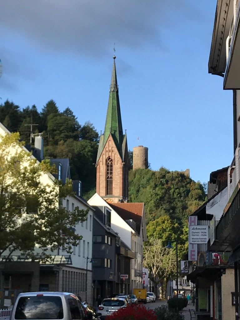
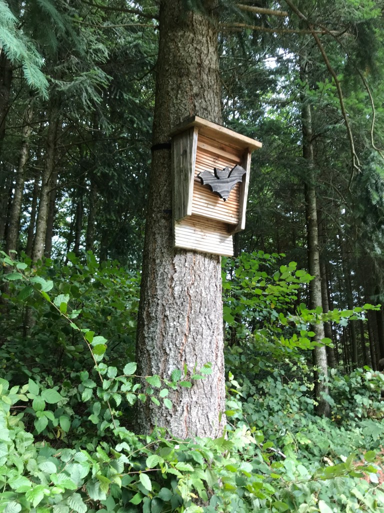
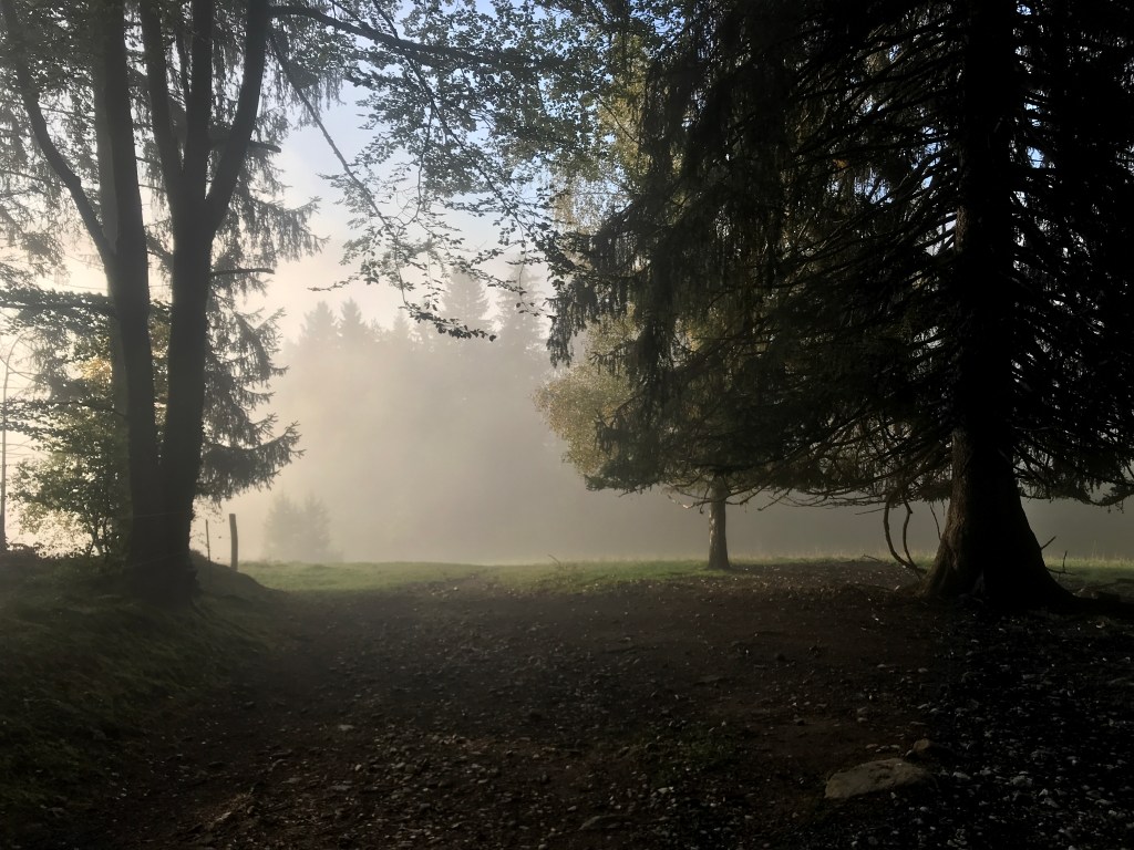
The climb out of Hausach was indeed steep, with fine views from the old fortress overlooking the town. There were some beautiful spots on the way up, with a blend of forestry trails and narrower, steeper paths from time to time. The walking poles were a great help again, giving me a steady rhythm as I climbed. The woods were thick but with occasional clearings that often provided some terrific views. At one point, I spotted a nesting box for bats that made a change from the many bird boxes along the way.
Near that spot, there was also a clearing with a musical installation made up of wooden percussion instruments and a couple of horns. I admit that I spent a minute or two making as much noise as possible with it in the morning silence. That’s another great thing about trails in Germany – the strangest surprises pop up along them now and then.

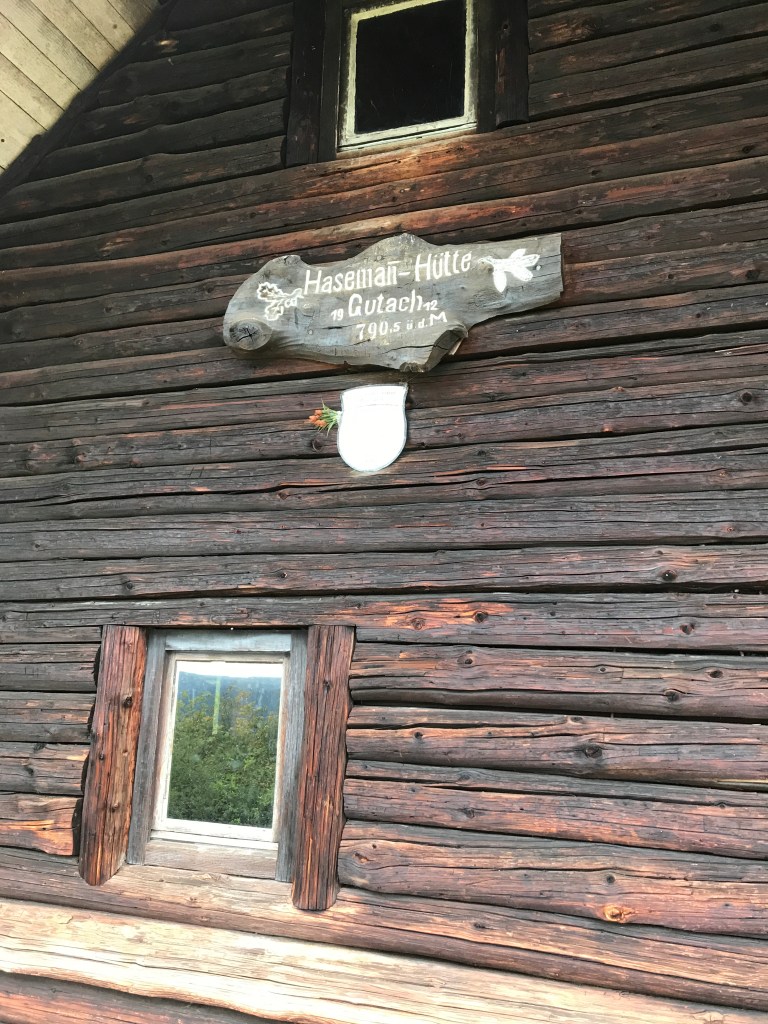
I managed to pace myself pretty well and reached the Fahrenkopf, the day’s first summit at 550 metres above Hausach, after an hour and a half. There was a beautiful hut up there, spotlessly clean, with a sleeping loft where I could have spent the night if I had known about it. I added my name to the visitor’s book and saw that I hadn’t been the first to pass through that morning. From what I could understand, a father and his son were also heading the same way as me.
After the hut, the path headed back downhill to 600 metres before climbing fairly steeply again to 850 metres. This rising and falling would be typical of most of the day, with things levelling off once I hit the 1,000 metre mark. But, until then, I carried on heading up and down, with a few rocky and root-filled sections, mostly on the descents, and some steep climbs now and then. I took a rest at the top of the Huberfelsen, a rocky outcrop with terrific views that looked almost like a ship’s prow from below.
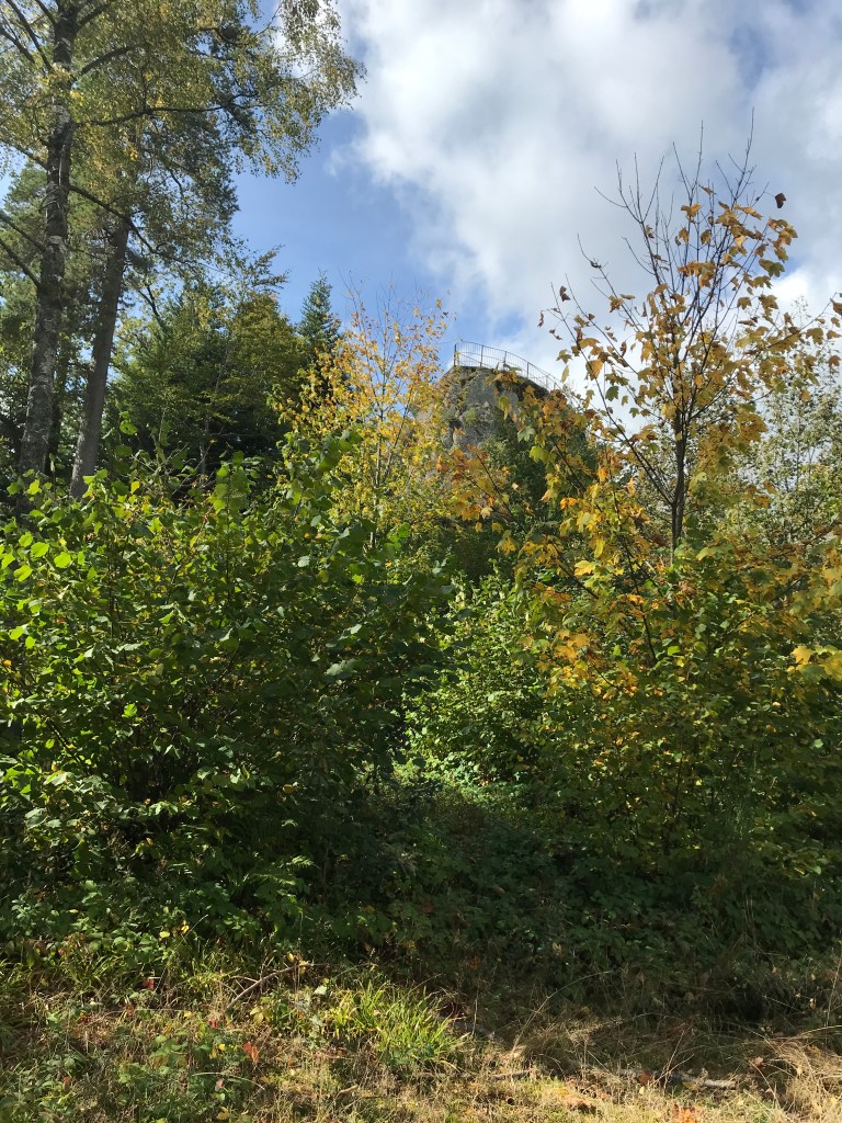
From the Huberfelsen, which was located in a major dip in the terrain at 739 metres, there was another steep climb up to the Karlstein at 968 metres. I found this climb tough, perhaps because I was beginning to tire as I hadn’t rested much since setting off from Hausach. But the view over the forest from the Karlstein, another rocky outcrop with railings to help me reach the top, soon dispelled any exhaustion that I was feeling. Plus, I knew a treat was shortly in store…

Indeed, less than one kilometre further on, I came to the Schöne Aussicht restaurant where I finally took a longish break for a huge slice of cake and a couple of fruit teas. It was a very relaxing, cozy place with a huge tiled stove and friendly staff. There was a huge terrace outside which must be a wonderful spot for tea and cake in summer.
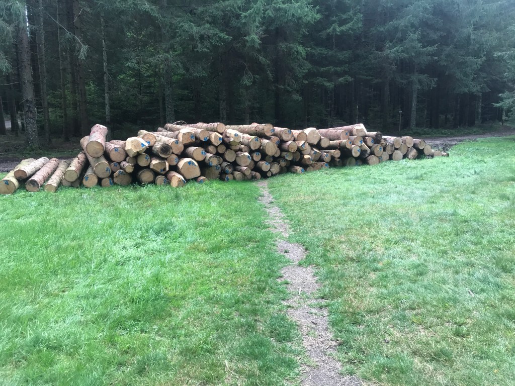
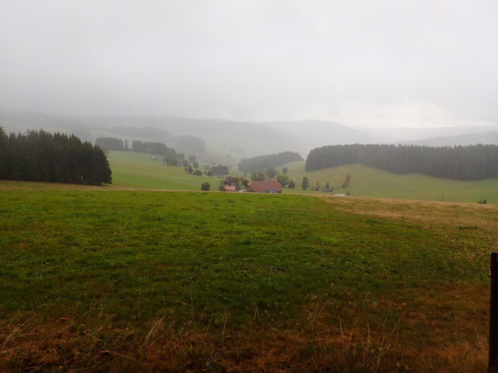
As the waitress told me on setting off, the last 7 kilometres to Wilhelmshöhe would be dead easy after everything else I had done that day. With the trail rolling along around the 950 metre line, it was very easy walking compared to the tough climbs earlier. There was a mixture of thick woods and wide clearings with beautiful farms, with a pile of felled trees right across the path in one spot. An obstacle that, fortunately, it was easy to get around.
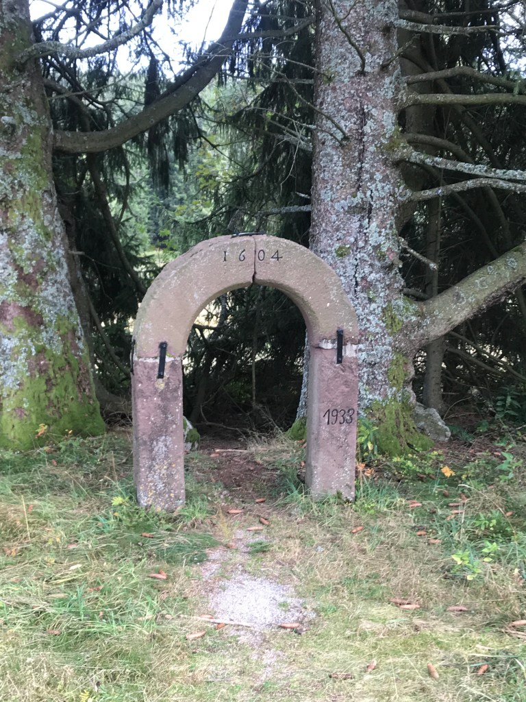
A little further on, I passed a spot where a huge farm or possibly an inn used to stand. An information board nearby said that it was dismantled after its owners emigrated in 1895. As far as I could tell, it had been rebuilt in another spot, but maybe I misinterpreted that part. In any case, the original arched doorway from 1604 was left on site. For some reason, the date 1933 was also inscribed on the doorway, but I was unable to figure out why as it seemed to have been dismantled before then. And there’s very little information on the Internet about the spot. With a little imagination, as so often in the Black Forest, it’s easy to conjure up all kinds of stories (especially given what was happening in Germany in 1933), but perhaps it was nothing more than a banal property deal.
Along the way, there were more beautiful farms. At one of them, three generations of women were collecting vegetables from a flourishing garden. I can imagine life must be pretty harsh here in the very depths of winter but, for most of the year, it must be very pleasant indeed. Further on, I came across some sheep that had escaped from their enclosure. As soon as they saw me, they leapt back over the wire and acted like little kids who has been caught red-handed doing something they shouldn’t, pretending they were totally innocent.
Shortly after, I reached the Wilhelmshöhe inn without realizing it: all of a sudden, the trail emerged from the woods onto the parking lot. This turned out to be another excellent place to stay, with great food and a very comfortable room (even if the bathroom was across the landing). When I went down for dinner, the restaurant was packed but they managed to find me a table. There was a terrific atmosphere with lots of happy diners, many of whom seemed to be regulars. The food was the standard, hearty fare, but beautifully prepared in generous portions. Just what I needed after the day’s efforts.
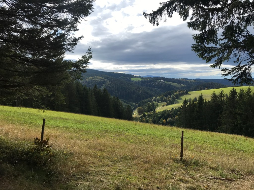
The next morning, given the great atmosphere at this place, I would have gladly stayed a little longer – the coffee was excellent, the owners friendly and the breakfast delicious. But with the next hotel booked and 22 km to cover that day, I had to get going. Just before leaving, the guy at reception told me it would be a great day for hiking. And he was right. Apart from around 30 minutes of rain in the early afternoon, it was indeed a great day. And, after the previous day’s efforts, the hiking was pretty easy with the trail undulating between 1,000 and 1,200 metres without any steep climbs for once.
After passing through another Westweg gateway opposite the hotel, the path followed a boardwalk for a short distance before heading into a more agricultural setting of broad clearings with huge old farms. On one of them, there was a beautiful old Longinus Cross. These crosses are mostly found in the Black Forest and are decorated with the instruments of the Passion of Christ. They are usually found on or near farm buildings as Saint Longinus, the Roman soldier who pierced Christ’s side on the cross and who later converted to Christianity, is the patron saint of farmers. He always features on these crosses, riding a horse and sticking his lance into Christ’s side. Interestingly, the arch over the top of this one was made from an old forestry saw.

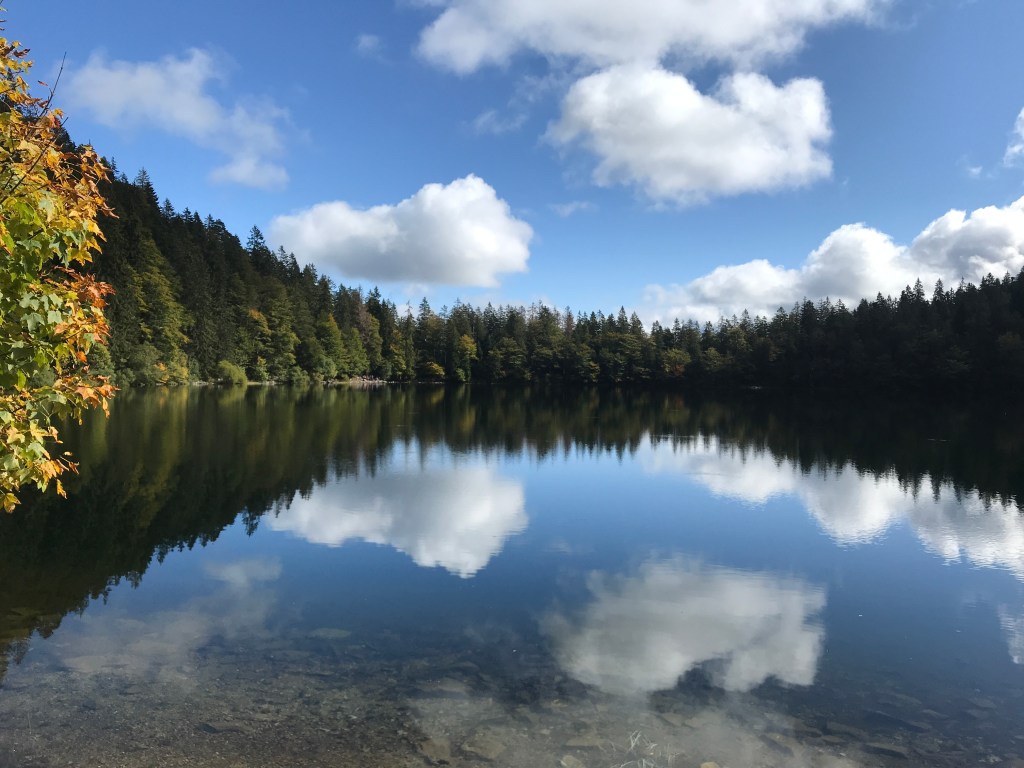
After the farms, the trail returned to the woods. One section I particularly liked this morning was around the Blindensee, a small lake at 1,000 metres. A long and very enjoyable boardwalk led across a marshy area to this pretty and almost circular lake.
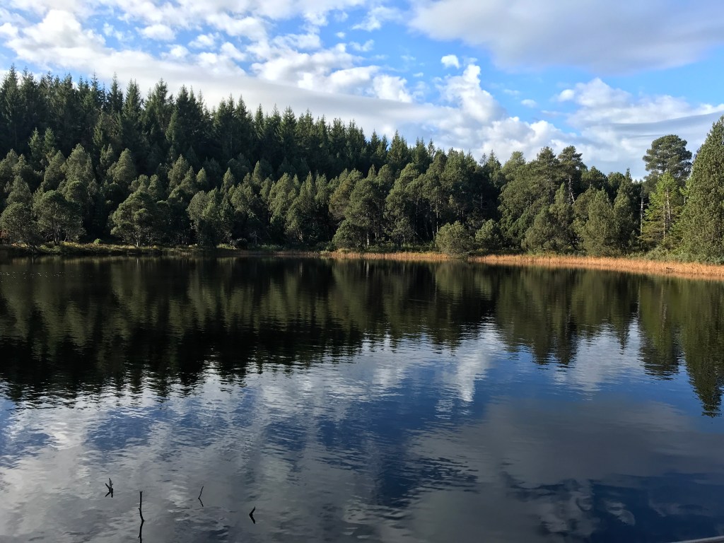
At one point, there was a rest area on a deck overlooking the lake. It was a very peaceful spot where I would have happily spent an hour or two watching the changing reflections on the lake surface.

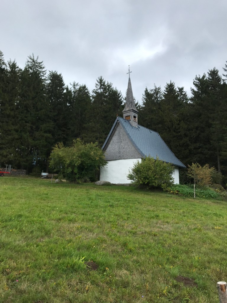
Another highlight of this morning was the Martinskapelle, a pretty little chapel whose foundation dated from the 9th century. It stood in a clearing where the trail emerged from the woods for a brief open section after a gentle climb.
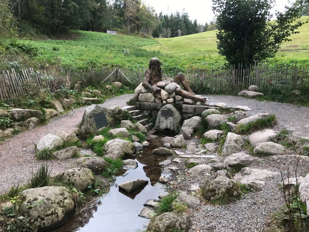
Just a short distance down the hill from the chapel lay the source of the Danube, which flows from this spot across Europe to the Black Sea. A week or two after this hike, I was going to be in Vienna and Bratislava and it would be hard to imagine that the mighty river in those two cities started off as a trickle of water emerging from these Black Forest hills. The path down to the source was lined with excellent information boards about the river and its journey. There was also a hotel and restaurant on the spot from which delicious aromas of cooking were coming, but it was a little too early for lunch so I carried on my way.
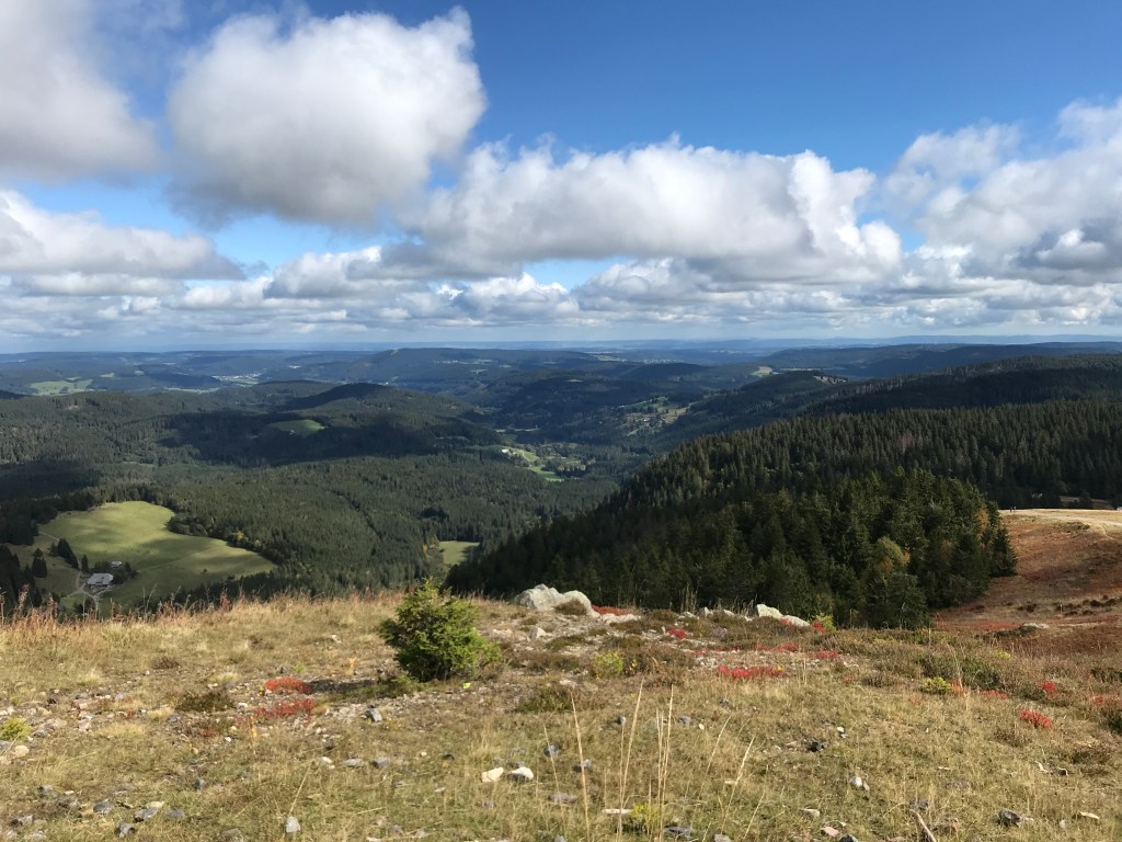
From the source and the chapel, the trail continued to climb for a short distance before reaching a sort of plateau at Brend. This was another serene and beautiful section of the trail at around 1,100 metres, with great views and shady, open areas for picnics and barbecues. A road led up to this spot, so it must be a popular outing for locals in good weather. I saw a cute young couple with a very young baby, some friendly calves that all came over to the fence to see me and, while taking a rest at the end of this section, I was passed by a father and his son whom, I suspected, were the ones who had written in the Fahrenkopf hut guest book (something that would be confirmed later that day).
All morning, I had managed to keep a steady pace of just over 4 km an hour, which would mean arriving at the Kalte Herberge inn way too early (it was their day off, Ruhetag, and they had told me to arrive between 4 and 5 pm as they would only be around at that time to let me in). So I decided that a lunch stop would be necessary and, just after heading down from the Brend heights, I came across the Goldener Rabe restaurant. The owner was standing outside when I arrived and, as the place looked pretty sleepy, I asked if it was her “Ruhetag”. She instantly retorted, “Stupid question. Would the door be open if it was?” She then added, “Even when we’re open, no one comes.” Feeling a little sorry for her, and with no other food options along the trail for a while, I went inside all the same. The outdated dining room, with its old posters and advertising, was an instant throwback to the late 60s or early 70s. The menu was like an ancient document. And I had managed to find what must be the only inn in Germany without beer on tap! I plumped for a Zurich-style dish with spätzle which I thought would involve cheese but turned out to be a substantial helping of sautéed meat with mushrooms. I have no idea what the meat was but, from the way the hotel labrador stared at me dolefully as I was eating, I began to wonder if it might not have been a friend of his. A little old lady (at least I think it was a lady as it was hard to tell in the ambient gloom) appeared at a serving hatch now and then to say “Hallo” or “Guten Appetit”. It was a distinctly odd spot and I wondered how they could make a living. The owner, after her off-putting welcome, turned out to be pleasant enough, but I didn’t feel like hanging around too long and ate my meal faster than I should have done.
As a result, when I set off again, I suffered a little. It was a fairly easy hike to my destination, but it felt like a real slog, weighed down by the huge lunch. I decided that I would never eat so much again at midday. All I wanted to do was find a spot where I could lie down and have a nap but, of course, it started raining at that point! By the time the rain eased off, I was more than halfway to the Kalte Herberge, so I just kept going (albeit at a slower pace than earlier in the day).
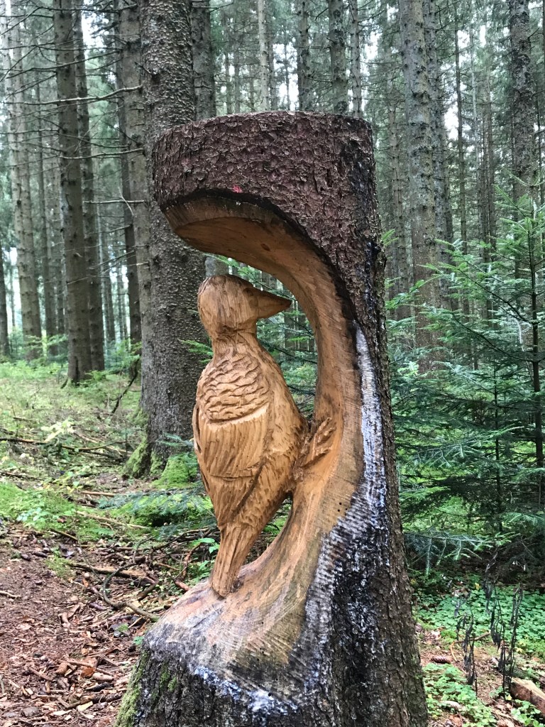
A little further on, just after the village of Neukirch, there was a spot where a sculptor had been at work on the old tree-trunks at the side of the trail. I particularly liked his woodpecker, which I found very witty and creative.
The weather began to clear up as I approached the Kalte Herberge inn where I would be spending the night. There were some great views on the final section of the day’s trail. On emerging from the woods, there was a nice, gently sloping path around the edge of a meadow to reach the inn where I arrive at 4:10 pm, as instructed.
A very friendly lady let me in and showed me to my room before telling me that a driver would pick me up at 6 to take me for dinner at a nearby restaurant as the one at the inn was closed for the day. After she had been so kind to set that up for me, I didn’t have the heart to tell her that I felt I’d eaten enough for one day. Breakfast would be at the inn, however. The room was simple but spotless, albeit a little noisy as it overlooked the road. The bathroom was just down the hallway on the same floor. And, luxury of luxuries, there was. a boot-drying room on the ground floor.
After a good hot shower, a call home and a few notes on the day, I went back out at 6 to wait for the driver. On the hotel parking lot, I found the father and son seen on the trail earlier that day and, shortly after, a car pulled up to drive us to a simple guesthouse about five minutes away for a cheap dinner with excellent beer. It turned out that the son had started in Pforzheim on the same day as me, but our paths had never crossed before. The father had joined him in Hausach on Sunday and they were indeed the two people who had written in the guestbook at the Fahrenkopf hut. I had a little trouble understanding everything they said as they spoke rapidly and had pretty thick accents. Having learned my German in Schleswig-Holstein in northern Germany, I have trouble with the accent in the Black Forest area. Nonetheless, I managed to understand that the son was a student (I didn’t get what in) and the father a computer engineer. They did a hike together every year. They were heading to Basel too, but with no precise arrival date, so I’d probably see them again at some point.
We were back at the hotel by 7:15 pm and I spent the rest of the evening writing up my notes for the day before having an early night.
The next morning, I woke to mist and rain. The day’s hike was described in the guidebook as “unspectacular” and, with the bad weather, I just lowered my head and went for it. In 5 hours, I covered 21 km, which was a pretty good pace given the 400 metres of positive elevation.
Breakfast at the Kalte Herberge was a fine spread. My two fellow diners and hikers from the previous evening were already noisily wolfing stuff down. It had been a pleasant enough evening the night before, but I couldn’t really see myself walking with them and, in any case, when I left at 9 o’clock, their boots were still on the drying rack. I didn’t see them again that day.
The day’s “unspectacular” hiking was very easy, mostly in woods or alongside fields. There were quite a few surfaced sections, which wasn’t a bad thing in the rain that was already falling pretty heavily by 10. As I said in my blog article on the first part of the Westweg, I finally began to enjoy walking in the rain on this trip, notably thanks to the excellent rain gear that I had with me. When I met a group of drenched pensioners that morning, we had a good laugh about the weather and they seemed keen to make sure that I was enjoying myself. Another group, of elderly ladies, were full of smiles and merry greetings. Everyone seemed happy to be out and about in the rain! It certainly wasn’t keeping people at home, but it did tend to spoil the numerous viewpoints along the way.
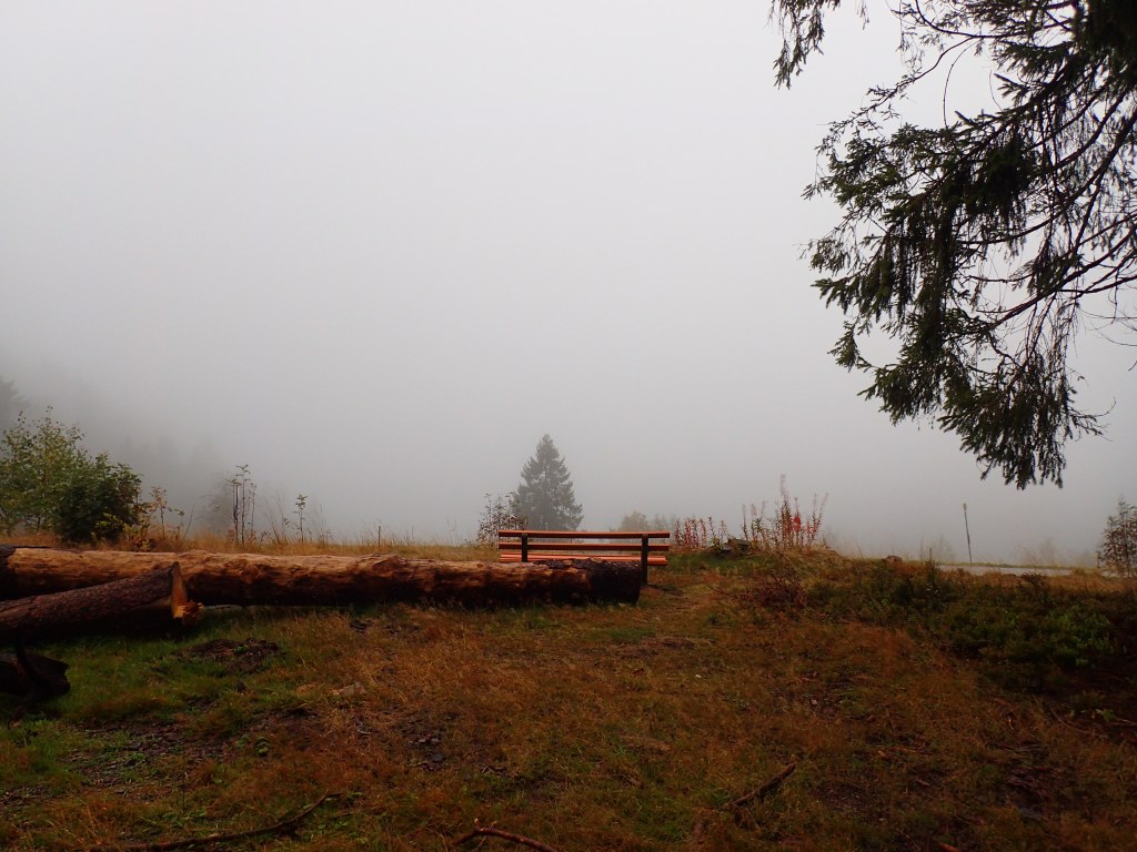
I stopped for a brief rest at a hut, Am Doldenbühl, to shake out my rain jacket and check the pack cover (which was resisting for the moment). It was pretty chilly too, so I didn’t stay long and soon ploughed on. On a nicer day, it would have been a good spot to linger a while as the views looked as if they could be pretty amazing, but the weather really wasn’t ideal for that.
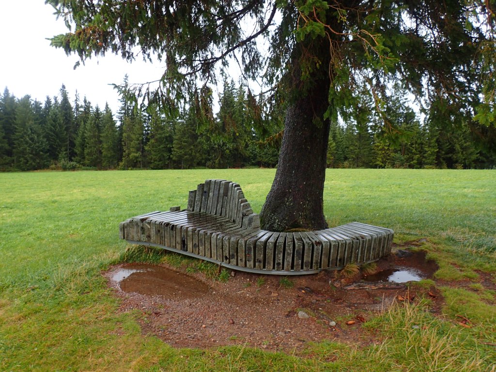
The trail headed gently uphill to the 1200 metre line, passing the Landsitz, a very elegant bench made entirely of slabs of wood standing on end. Once again, the map in the guidebook had it down as a good viewpoint, but I couldn’t see far and the bench was far to wet to sit on. A great picnic spot for the summer though.
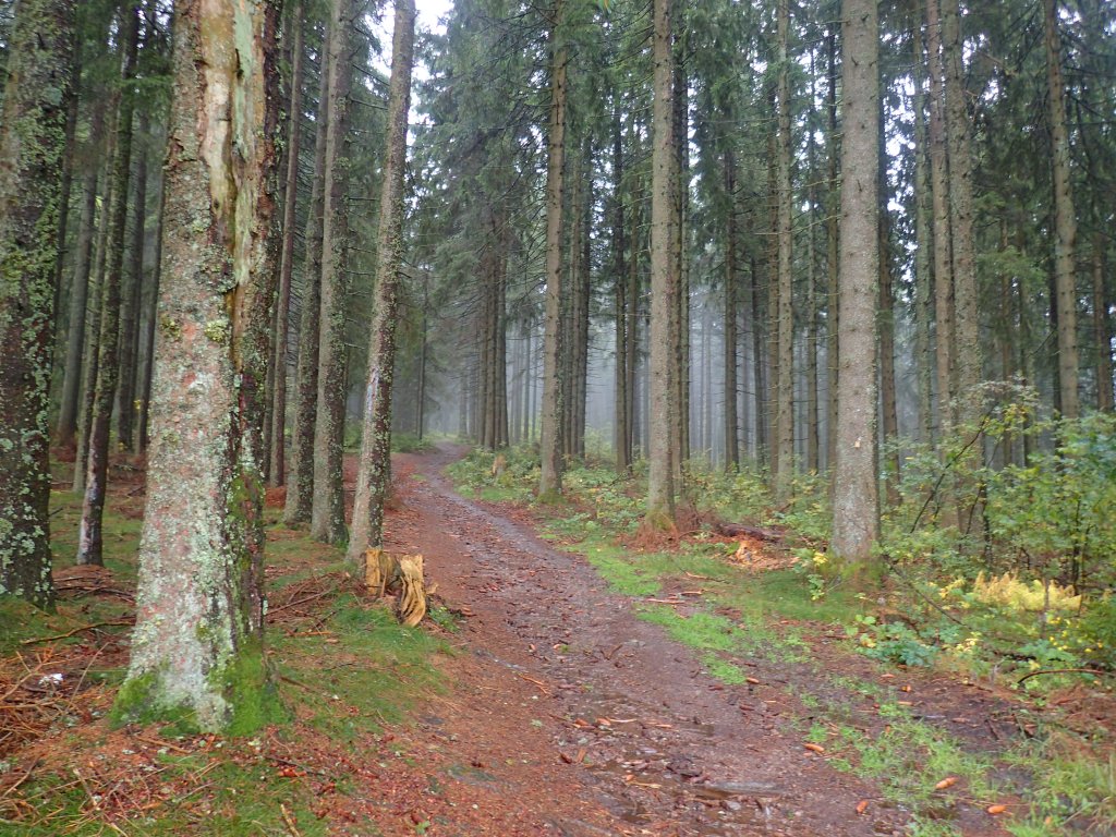
The trail continued to cross open fields and thick, misty woods on fairly wide, muddy paths. After the highest point of the day, from which there were supposed to be great views on any day but this, the trail began its gradual, 300-metre descent to Titisee and its lake.
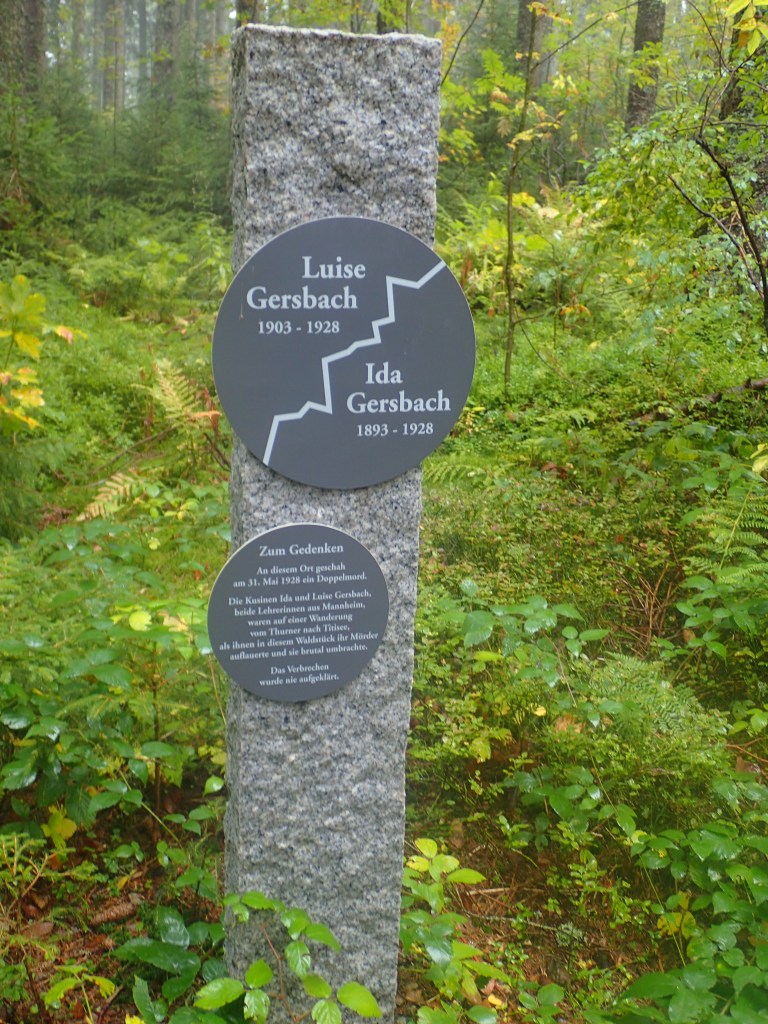
About 5 or 6 km before Titisee, I came across a modern looking memorial to two female cousins, schoolteachers in Mannheim, who were brutally murdered on the spot in 1928. The murderer was never found. When a gust of wind stirred a bush behind me, my blood ran cold and I got away from there as fast as I could. After the eerie moments on the first half of the trail, with its Macbeth-like moments, this discreet memorial added to the almost supernatural atmosphere that reigns along the trail on damp and misty days.
From there, it was an easy walk down to Titisee, a fair portion of it on surfaced roads. I was originally planning to spend the afternoon relaxing at the thermal baths but, given my drenched state, I decided to give that a miss as I didn’t want to leave my wet gear to steep in a locker for a few hours.
So, instead, I went straight into Titisee and found myself in the world of mass tourism. The lake itself was beautiful, but the endless cuckoo-clock and souvenir shops were too much. The rain had eased off just before I reached the town so I decided to go for a late lunch before walking along the lake to the youth hostel where I would be spending the night. The restaurant was huge and packed with tourists on day-trips to the lake. Despite a rather tacky decor, the food was good: a huge portion of meat, potatoes and onions that set me up for the rest of the day and ruled out dinner as an option.
The rain began falling again with a vengeance while I was eating. I waited for a while under cover on leaving the restaurant, but it clearly wasn’t going to let up so I set off, stopping on the way to buy some local salami, cheese and chocolate. It was a 2.5-km walk along the road to the youth hostel at the other end of the lake where I arrived totally drenched after this terrific downpour.
Luckily, I turned out to be the only person staying in my six-bed room. The heating was going full-blast and I was able to spread everything out to dry properly (the rain cover on the pack had given up the ghost again in the downpour). After a good, hot shower, I spent the rest of the afternoon and evening in the room, eating just a few nuts for my evening meal after the late and filling lunch. I also emailed the next evening’s hotel as I suddenly spotted on their website that Wednesday and Thursday were their days off. At least I had some cheese, salami and chocolate if their kitchen turned out to be closed. But I soon had a reply to tell me that as the next day was a public holiday for German Reunification, exceptionally they would be open and could feed me the following evening without any problem.
I woke at around 6 the next morning and tried unsuccessfully to get back to sleep. Before breakfast at 7:30, I packed, stripped my bed and swept out the room so I could leave right after. Breakfast itself was average but with enough to eat, although youth hostel coffee is always pretty bad.
I set off at around 8:15 in thick fog. To avoid going back into Titisee to pick up the trail, I used my GPS and the guidebook to work out a way back to the Westweg from the hostel. There are two options for the Westweg from Titisee and I was going to follow the western variant that took in a series of summits over three days, starting with the highest, the Feldberg, at 1,493 metres.
It was a steep climb up from the lake but I soon found myself back on the official trail, at the top of the Hinterzarten ski-jump. The sun was already beginning to break up the fog and it was clearly going to be a beautiful day.
Shortly after, I missed a turn on the trail, but I was put back on the right track by a friendly couple who warned me that the path up to the Feldberg was likely to be very wet after the previous day’s rain. In fact, it wasn’t too bad as it began to climb steadily uphill through the woods, with the occasional clearing and streams now and then (streams that had been quite rare until now). There were quite a few people about because of the national holiday. The fog had cleared and the sky was a beautiful blue, with fat white clouds here and there. I could see the Feldberg in the distance, a gently rounded and open summit almost 500 metres above me.
As I strolled along on this glorious morning, I spotted a hand-carved sign for a “getrankestation” (literally, a drinks station). I couldn’t see a café coming up, so I presumed it was a farm selling milk. But no. Shortly after the sign, there were two big benches on a rest area with a small cupboard in front. On opening this cupboard, I found it to be full of bottles, cooled by water diverted from a nearby stream. There was a fine selection of beers and soft drinks, at 2 euros a bottle, with the money to be left in the attached cashbox. I treated myself to a bottle of sparkling rhubarb juice and sat in the sun, gazing up at the Feldberg and delighted to have found this spot. The whole thing had clearly been set up by the people living in the nearby farmhouse that had a woodwork company in one of its barns.

Just after this stop, I took a “wrong” turn. I waved to a couple of people taking a rest at the Rufenholzplatz hut (1,200 metres), missed a signpost and turned onto a variant of the Westweg. The diamond markers continued on the variant and I didn’t realize my mistake for a long while. Not until I was back down to around 1,000 metres at the Raimartihof inn, which I should never have seen. So, rather than continue to head up for a plunging and spectacular view from the cliffs around the Feldsee lake before a short climb to the Feldberg summit, I ended up on the shore of the same lake with around 450 metres still to climb! The variant was not indicated in the guidebook but, apart from the extra climbing to do, it had its advantages. The Raimartihof inn looked like a great place to eat (but it was too early for food when I passed) and I got to circle the whole lake. There were a lot of people making the short walk from the inn to its shore, but once I left them behind, there was hardly anyone about, apart from a couple of mountain-bikers. It was a beautiful and calm spot.
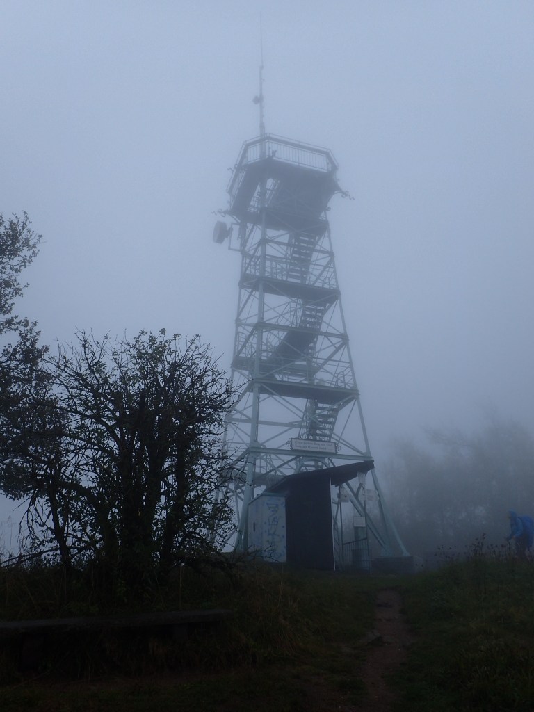
Having circled almost the whole lake back to the spot where I joined it, I finally found the trail up to the summit. It was a steep but steady climb on fairly rocky terrain that was a little slippery at times (recalling that morning’s warning). When I emerged from the woods at the tree line, I found myself in a crowded tourist hotspot, with a cable-car, tourist restaurants, a nature museum, a huge multi-storey carpark and even a fountain! It wasn’t the kind of place where I felt like lingering and, after passing another Westweg gateway, I carried on climbing up the fairly steep path to the Bismarck monument at around 1,400 metres. From there, I had a terrific view back over the route covered that morning.
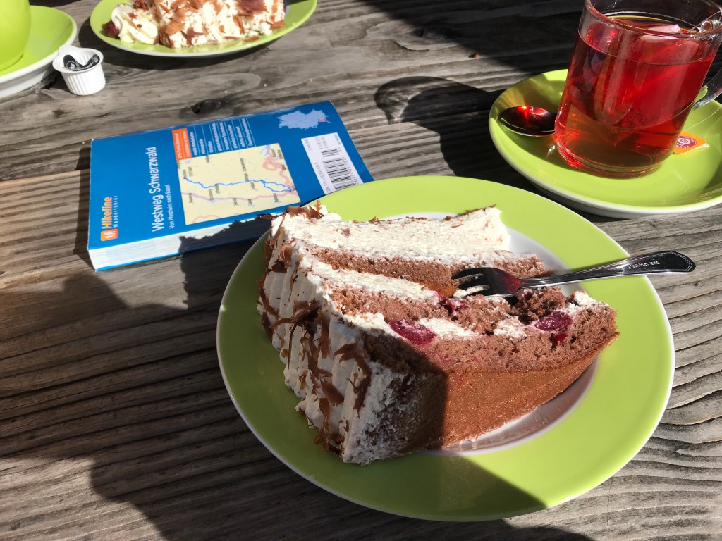
After that, it was an easy climb up to the gently rounded summit of the Feldberg, the highest point on the Westweg. There were huge crowds at the summit (most having arrived by car and then cable-car) and it was impossible to get a decent photo of the view. It was quite cloudy and a little chillier by then too, even though the clouds would blow over as I headed down from the summit to the Sankt Wilhelms Hutte. This place was packed, but I managed to find a seat at an outdoor table with two young couples and a guy who told me he had done the whole Westweg in three days by mountain-bike! I couldn’t understand all he said, but he seemed to be quite a character. As usual, I had a big slice of Black Forest cake with a warming cup of fruit tea. The perfect break.
Just as I was leaving the hut, I bumped into the father and son last seen at breakfast at the Kalte Herberge inn. They had spent the previous night in the centre of Titisee and were going on to Nötschrei where I hadn’t been able to book a room. I was surprised to see that they had huge packs for people staying in hotels. We sort of leapfrogged around each other for a while, joking as we did, but I pulled ahead at one point and lost them.
After a short climb to another summit with great views, the trail descended gently to the Stübenwasen inn where I would be spending the night. This inn stood between the forest and meadows at 1,264 metres and turned out to be a wonderful place. On arriving, I found the mad mountain-biker from the Sankt Wilhelms Hutte tucking into another slice of cake that he recommended highly. The inside of the inn was all dark wood and creaking floorboards, with a wonderful atmosphere. The friendly owner apologized for giving me the smallest room, which was more than big enough with a great view. Once again, the bathroom was down the hallway. Along with the Wilhelmshöhe inn, this was my favourite place to stay along the trail.
After this excellent day of hiking, one of the best so far on the Westweg, I opted for what I thought would be a lighter evening meal than usual, the inn’s vesperplatte. I already had a half-litre of beer in front of me when I ordered it and didn’t realize that this platter of cold cuts and fresh cheese from local farmers, gherkins, onions and bread was served with a tankard of strong cider and a glass of schnapps! By 8 pm, I was ready to turn in and sleep until the next morning, but I fought to keep awake until 10 to make a Skype call to my son in Montreal and recount my latest adventures.
When I woke the next morning, the sky was cloudy but the sun seemed to be trying to break through, despite the forecast being for rain. I began to hope that I would be in for another mostly sunny day.
When I got back from breakfast (with the usual see-through coffee), I found that I had a slight problem. I had packed before going down to eat, ramming everything in tightly so the pack rain cover would fit neatly if needed. Unfortunately, I had either overfilled the Platypus water bag or I hadn’t closed it properly and it had started to leak on the corner of the bed where I had left my pack, soaking the sheet and the mattress. I only realized this as I was about to head out of the door and felt some dampness on my lower back. As a result, I had to unpack completely, dry off the inside of the pack, partly empty the water pouch and then pack again, with a few damp items at the bottom. As for the bed, there was not a lot I could do after giving it a good rub with a towel, so I turned the heating up to high before finally leaving. From this day on, on every hike, I would at last slavishly respect the instructions on the Platypus and turn it upside down after filling to make sure there was no leakage, something that I had never really done before.
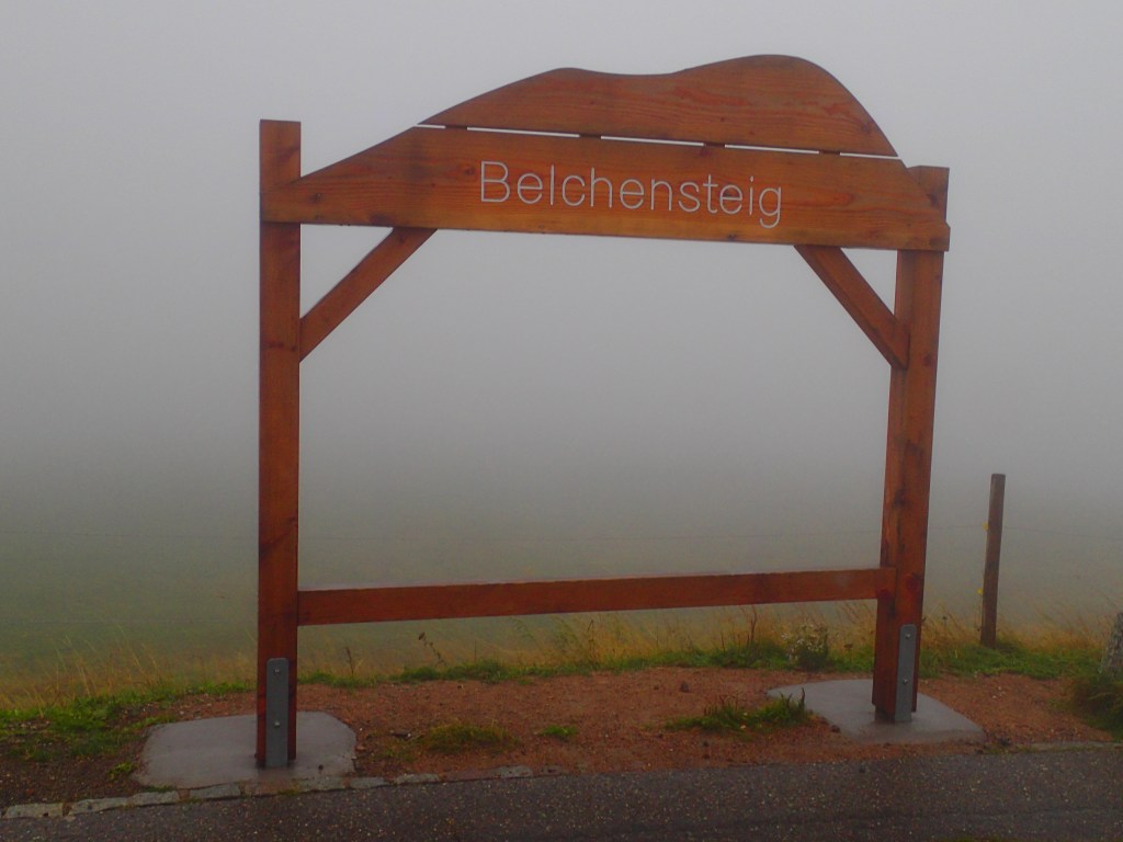
After all this hassle, I finally set off at 9:20. And, by that time, it had started to rain. This eleventh day on the trail would again involve a lot of climbing and take in another summit, the Belchen at 1,414 metres, before heading back down to 939 metres. The weather conditions, despite the sunshine glimpsed on rising, became more extreme as the day went on. But more of that later.
The walk down to the Nötschrei pass, the official end of the previous day’s stage, was very easy, despite being muddy and slippery at times. Just before the pass, there was a huge biathlon training centre and stadium in the middle of the forest with a lot of logging work going on around it. The rain was quite heavy by this point and, as two days earlier on the way to Titisee, I just lowered my head and went for it. Fortunately, over the course of the day, the rain would ease off from time to time and the wind would pick up, drying my rain jacket and trousers pretty rapidly.

I considered stopping after about two hours at Wiedener Eck but when I saw that the place was in fact a 4-star hotel, I reckoned they wouldn’t be too keen on a wet hiker calling in for just a coffee. So I carried on, setting the Belchenhaus at 1,365 metres as my goal for a break.
The climb to this new summit was fairly easy on good, wide paths until the final section that had a lot of zigzags, rocks and roots. A few people were heading down from the top, joking about the weather (by now it was pouring again) and warning me about high winds at the summit. By this point, I couldn’t really see much as, along with the rain, thick fog had settled over the range. When I made it to the top of the climb, greeted by the sudden and surreal sight of colourful cable-car gondolas emerging from the fog, I couldn’t be bothered climbing up another 50 metres to the actual summit to see nothing at all! I was in fact surprised that the cable-car was running as I couldn’t imagine why anyone would come up there on such a foul day. The temperature was down to 5°C at this point, so I headed straight over to the Belchenhaus, the café-restaurant near the cable car station, expecting the place to be empty.
It was packed! Clearly, a lot of pensioners were on a day-trip to the summit despite the weather. There were a few other hikers too, but we were clearly a minority. The place was warm and friendly with great staff and a lengthy coat rack where I hung my gear to dry out. When I asked the barman for mulled wine, he said it wasn’t the season and suggested “hunter’s tea” instead. This turned out to be hot toddy (with rum) that was just what I needed to warm up. I also ordered a flammküche (the local take on pizza) and followed it with a slice of a delicious blueberry cake and coffee. The best refuelling stop of the hike! I took a good hour over my food, relaxing and warming up nicely.


When I set off again at 3:15 for the 450-metre descent to Haldenhof, things got hairy. On emerging from the Belchenhaus, I discovered that the rain was a little lighter, but that the fog was even thicker, with visibility down to around five metres, with a very strong wind blowing, so strong it was a struggle to advance. The magnificent view that I should have had from this spot was non-existent.
There was a sign just outside the restaurant pointing to the Westweg and I set off in that direction. It was tough to see very far ahead, but I managed to find a board with a tourist map, which I misread before setting off along a road that began to head downhill. I had never found myself in such thick fog before. The wind was terrifically strong but luckily there was no traffic on the road. I soon realized that something was wrong because there was a total lack of Westweg markers, so I turned and headed back uphill. My GPS showed a path descending from the road so I tried to find that, thinking it was the Westweg. Luckily, at that point, I met a group of young hikers who told me that the path in question came from a roadside parking lot rather than Haldenhof. They got out a phone to check an app, which showed that the Westweg to Haldenhof was further up, near the board with the tourist map. I couldn’t see much at all by now as my glasses were wet on both sides from the wind and the fog. However, just then, through a brief gap in the fog, we spotted a Westweg sign at the spot indicated by the app, then another pointing along the path. I thanked them as they headed off to the summit, making sure to note the name of their incredibly precise app. Since that time, Komoot has become my favourite tool when hiking (I’ll do a blog post about it soon).
The descent was a little scary at first, on a narrow, wet track with a few stony and root-covered sections, in the howling wind and with my drenched glasses. However, after about 15 minutes, I returned to the cover of the woods that seemed to break up the fog and, after that, everything was much easier, leading down to the forestry trail that would take me all the way to Haldenhof.
Just before the final bend, there was a small memorial chapel to a local priest killed by the SS just before the end of the war. He was kidnapped for no apparent reason and then murdered. His body, left on this spot, was not found until two weeks later. This new memorial again brought home to me the bloody past of this now peaceful region.

On arriving at the hotel at around 5 pm, I was greeted by two charming ladies who took my boots to dry them in the basement before sending me off to my room for a hot shower. After hanging up all my wet gear to dry, I went back down for a good dinner of a terrific local variation on the standard cordon bleu with a copious salad and a good beer.
I woke the next morning to a better weather forecast than when I went to bed: no rain until 11 am, then that changed to 1 pm while I was eating breakfast. It was a very lavish breakfast too, possibly the best so far, with lots of fresh fruit and homemade cakes. My dry boots were waiting in the hallway along withe everyone else’s. This had been another great place to stay.
I set off at around 8:35, at the same time as three other people who had been at the hotel – a solo hiker and a couple. The day began with a stiff climb up from Haldenhof and I lost the solo hiker who was just ahead of me when I missed a turn at a hairpin bend on the road (all I saw was a sign warning hikers about a bull in a field, so I stuck to the road). As for the couple, they moved ahead during the climb because I kept stopping to take photos, but I met up with them again at the top of the Blauen, the final summit on the trail at more than 1,000 metres.
The morning was another of those foggy ones that the Black Forest seems to specialize in. There was no rain at first, but there were plenty of drops falling from the wet trees. The woods were shrouded in mist and the atmosphere was back to the old eeriness that had made my imagination go into overdrive on previous days.
The climb through the woods to the Blauen at 1,164 metres was very pleasant, atmospheric and relatively easy, apart from one steep and rocky section on the last 200 metres before the top. I emerged at the foot of a viewing tower which would have been great to climb on a clear day but, by now, the fog was almost as thick as on the Belchen the day before, albeit without the high wind. Once again, I was on a Black Forest summit renowned for its view and unable to see a thing.
I stopped off at the Blauenhaus café-restaurant for a double espresso and joked with the barman about the ghosts outside in the fog. It was easy to believe there could be some out there on such a morning.
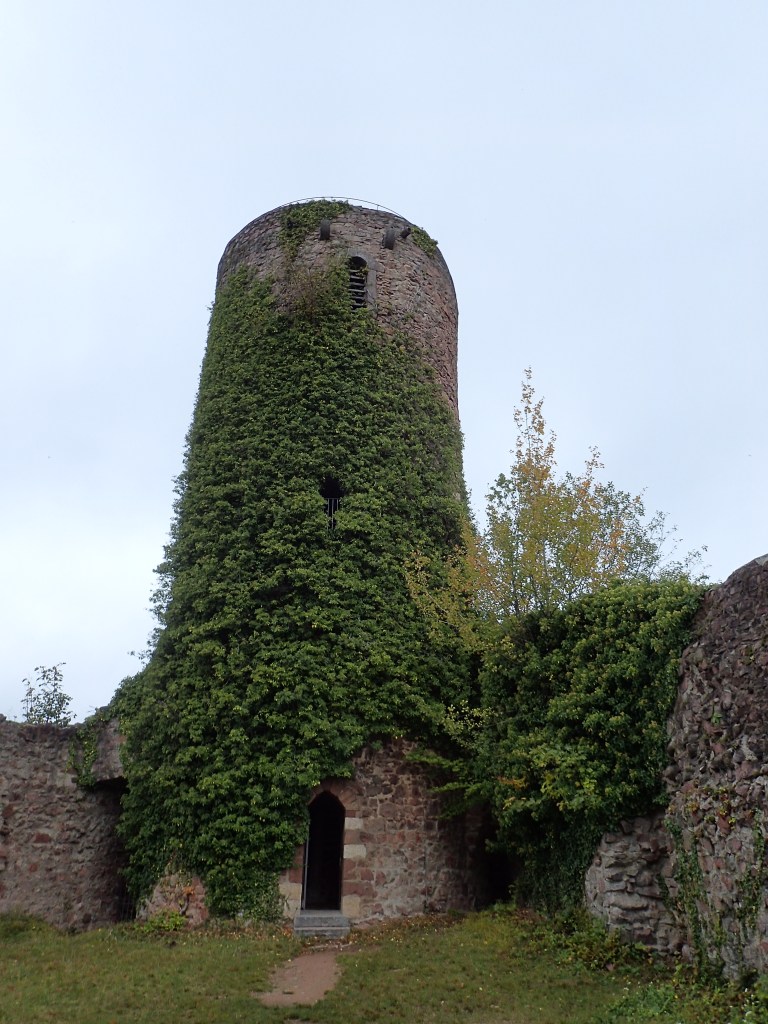
From the Blauen summit, there was a lengthy and relatively steep 800-metre descent to the town of Kandern. My hiking poles were a great help in keeping me upright on the often slippery downhill trail. I stopped for a few minutes at the Hexenplatz (the witches’ crossroads), another spooky spot with a warning about witches carved into the side of the hut standing there, and then again at the Sausenburg ruin. There was a tower to climb but it reminded me of the one that Bran Stark is thrown from in the first season of Game of Thrones, so I gave it a miss in case the same thing happened to me!
On emerging from the fog at a lower altitude, the rain began to fall more and more heavily. There was one last viewpoint over Kandern in the pouring rain before the trail headed steeply down into the town, with the ground muddy and slippery underfoot.
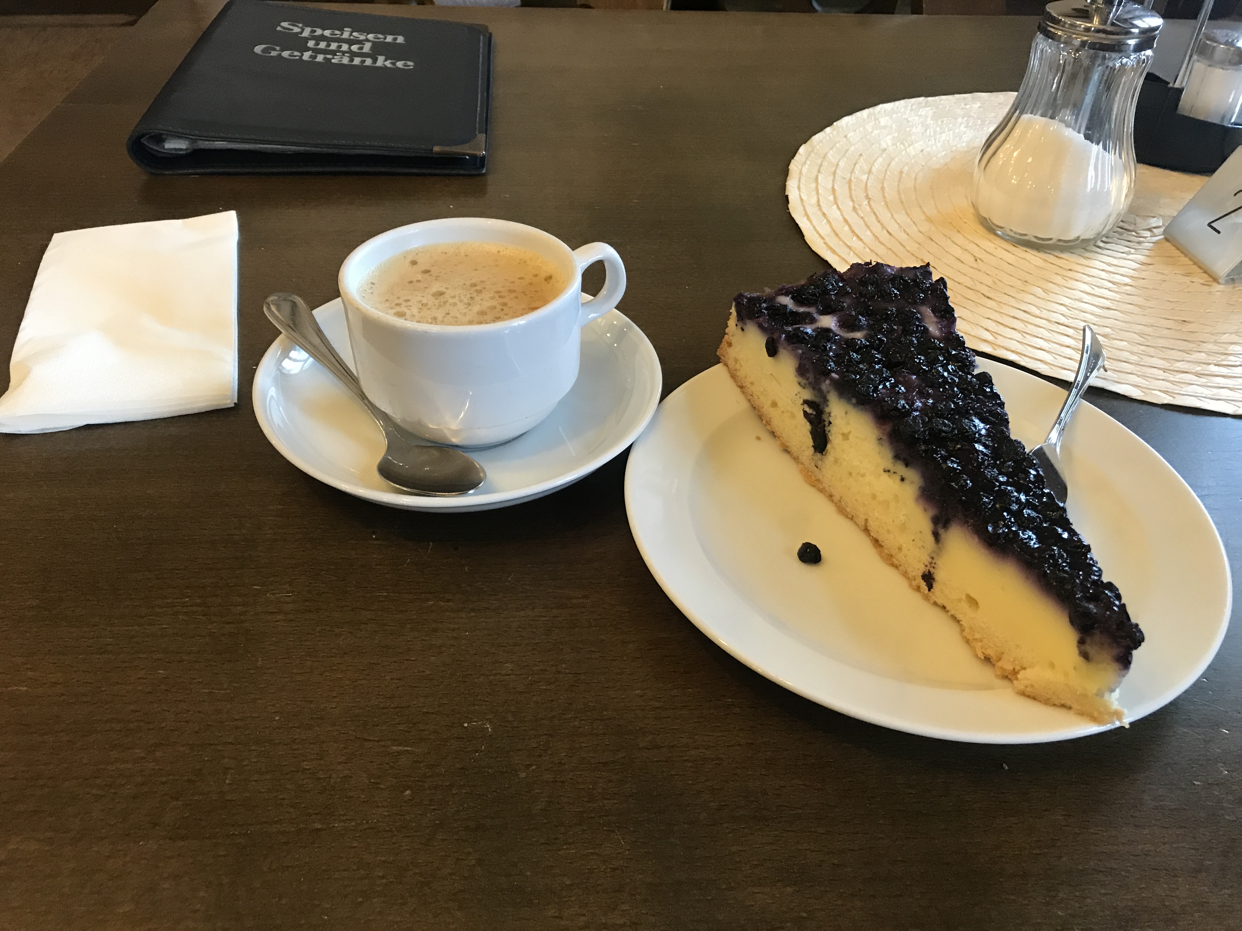
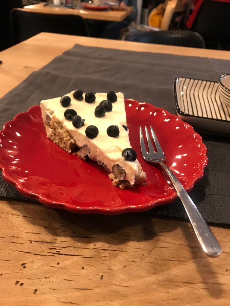
After the long descent from the Blauen, I was soaked and ready for a break. In the town centre, I found a cozy little café, Miss Gugelhupf, run by two lovely ladies who didn’t bat an eyelid at a soaked hiker. There was a nice, relaxed atmosphere in this place that was packed with all kinds of funky furnishings, books and (mostly) lady customers chatting and reading. After hanging up my wet gear in the entrance, I had a slice of a delicious blueberry cheesecake with some passionfruit and apple tea that warmed me up and gave me the energy for the last 6 or 7 km to cover that day.
Kandern was normally the end of this penultimate stage of the Westweg, but I hadn’t found a place to stay in the town and needed to carry on to Wollbach, the next village along the trail with accommodation. The rain seemed to have eased off as I was leaving the café but it was only a temporary lull. As I crossed the town and headed for the Wolfschlucht gorge, it got heavier and heavier, turning the path in to a stream of muddy water. It was just like a scene from “The Piano Lesson” with mud, pouring rain, dark trees and some very weird rock formations.
The rain eased off as I descended into the village of Hammerstein, but it had been an hour-long downpour and I was drenched, with my boots squelching. In Hammerstein, I had a choice between the official Westweg and a shorter path through orchards and farmland to Wollbach. Fearing more rain, I opted for the shorter route, which led me straight to the door of my hotel, the Pfaffenkeller, just as the rain kicked in again. I had to call by phone to be let in, but the friendly manager fortunately didn’t keep me waiting long outside and showed me to a very comfortable attic room furnished with an eclectic range of items (an old radio set, antlers, a teddy bear or two, etc.). Unfortunately, the hotel restaurant was fully booked for dinner, but he recommended a couple of places in the village. After a good, hot shower, I hung everything out as best I could, stuffing my boots with newspaper and hoping they would be dry by the next morning. I stepped back out into more rain, so I opted for the closest restaurant of those recommended, the Alte Krone. They found me a place at a huge group table in an old, atmospheric cellar where I had a delicious and excellent steak with a tasty salad and the tasty local Waldhaus beer. It was an expensive place but good value for money all the same.
I was woken early next morning by the bells of the church just across the street for Sunday mass. Breakfast was particularly good at this place, with a great selection of cheeses and unusual cold cuts, freshly baked bread and croissants, home-made jams and a delicious yoghurt and granola mix.
After saying goodbye to the friendly owner who complimented me on my German, which must have been improving over the last 12 days, I set off for my final day on the Westweg at 9 o’clock. Just outside the hotel, I got chatting to a young couple who were also doing the trail, but in stages of 3 or 4 days at a time. That seemed to be pretty much the norm for the locals and, apart from the son walking with his father, I didn’t meet anyone else doing the whole trail in one go.
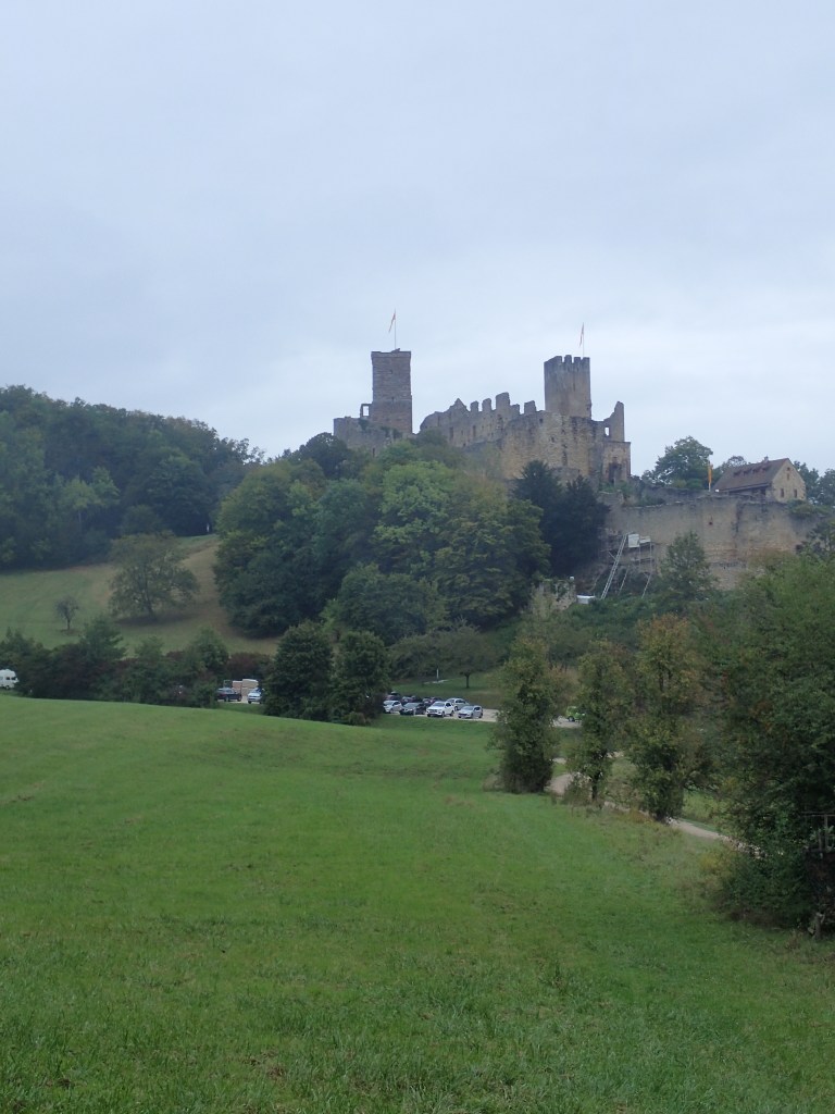
There was a steep climb out of Wollbach but, after so long on the trail, I didn’t find it that tough. There were quite a few people around on this Sunday morning, getting a walk in before the rain forecast for 11 o’clock. The walking was very pleasant on the first section, in woods with lots of squirrel activity all the way to the huge castle in Rötteln.
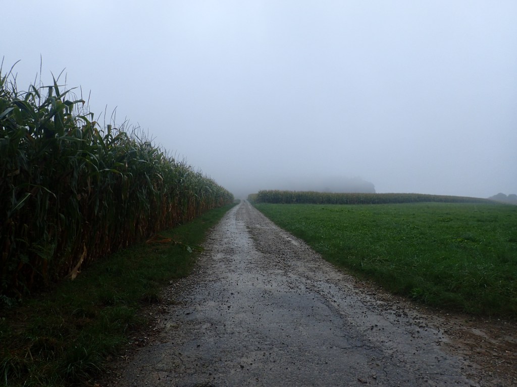
From the castle, the trail descended to the church in Rötteln and that’s where the rain began to fall. I had seen it from a distance, a thick, grey curtain heading up the valley. It began bucketing down like the previous afternoon as I headed uphill on the final climb of the trail through cornfields, mostly on roads and muddy tracks.
At the top of the slope, I stopped at a hut to shelter for a few minutes and to eat an energy bar. A very sweet lady, who was waiting for someone to join her with an umbrella, seemed impressed to hear how far I had come. From the hut, the path was mostly through more sheltered woodland before emerging at Tüllinger Höhe with its views of Basel. Fortunately, the rain had hidden Lörrach and its valley from my sight but Basel was visible in all its hideous industrial glory – smoking chimneys, factories and huge apartment blocks. This sight came as a real shock after 13 days of woodland and peaks.
The rain had eased off by then and, shortly after, the path turned and the view vanished from sight as I headed down through vineyards to the Swiss border, which I crossed at some point without noticing. The only real indication of any change in country was that the Westweg diamond markers vanished to be replaced by the Swiss yellow wanderweg ones.
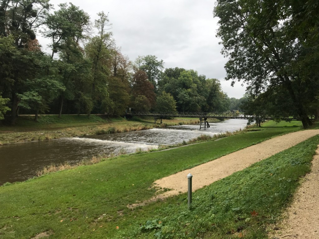
After crossing a bridge over the Wiese river, there was a long slog along the riverbank for about four or five kilometres. I tried walking right by the water but the track there was a little too narrow so I followed the top of the embankment instead. This was the one truly boring section of the Westweg, livened up only by the frequent low weirs on the river with ducks and the number of people out and about.
After the long trudge along the Wiese, the path veered off just after the Basel zoo to lead through a suburban neighbourhood to the Badische Bahnhof, the official end of the trail. This railway station in Switzerland is operated by German railways and is not the main station in Basel, which lies in the city centre across the Rhine. That is where I would be catching my train back to Paris and so, after a brief stop to call home to say that I had finished the Westweg, I set off for the city centre to add a few more kilometres to my hike, stopping for lunch in a funky foodcourt where I had an Argentinean-style meal.

Basel on a Sunday is not the liveliest city in the world. There were quite a few people around, mostly tourists who seemed to be wondering why they’d come there for the weekend. There wasn’t even a decent café open where I could have waited for my train. I took a quick look at the cathedral and the view from it over the Rhine, but it started raining again, so I went straight to the station, arriving two hours early. It wasn’t the nicest place to spend time, with very few facilities and nowhere to change into dry clothes. The mezzanine level was a little better, with a good chocolate shop and a newsagent selling books in English, but I ended up spending most of the time in a draughty and gloomy waiting room, finally changing into some dry clothes when I got onto the train.
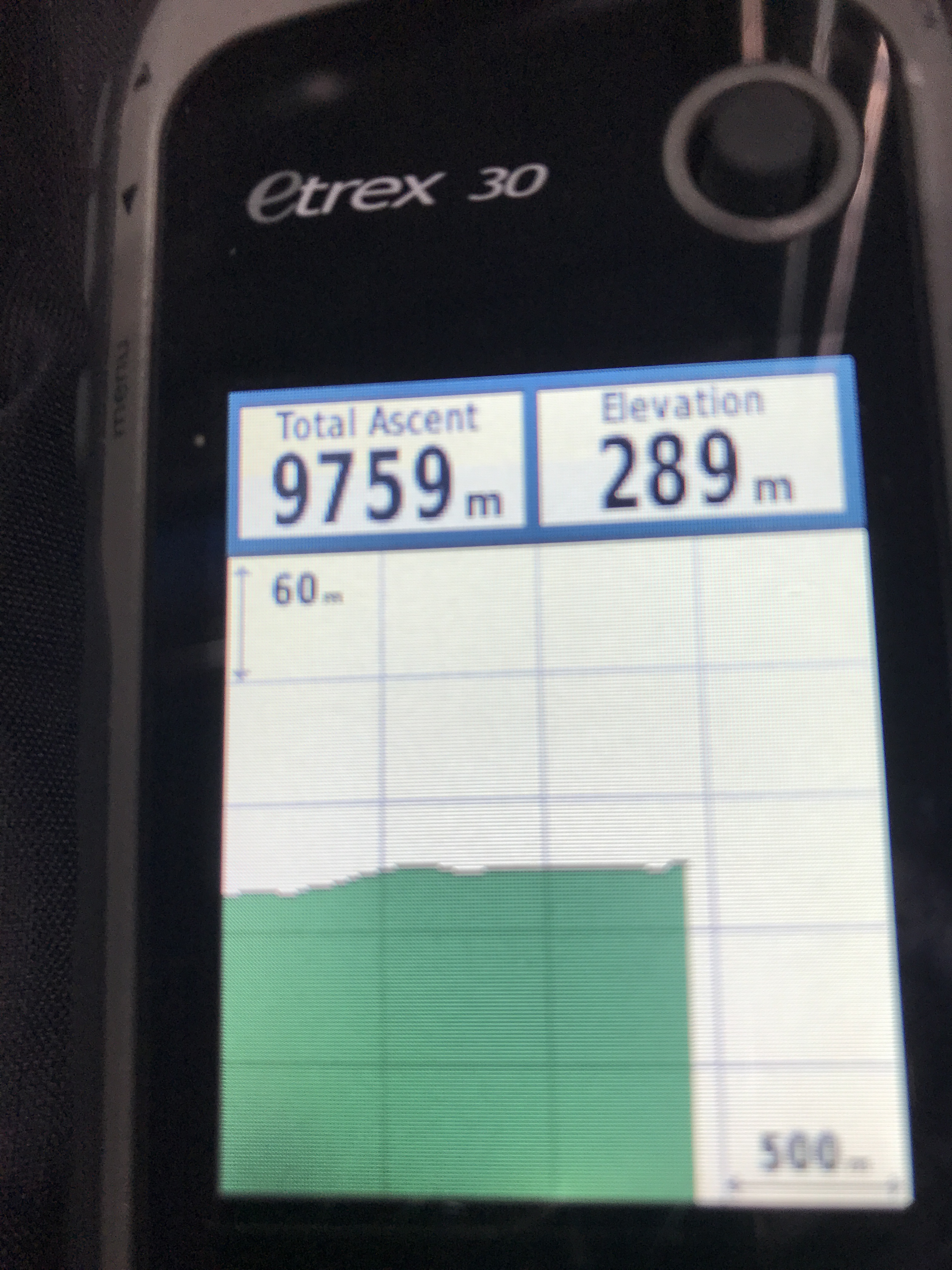
So, that was the Westweg done. 333 km from the station in Pforzheim to the main station in Basel, with over 9,000 metres of positive elevation. It was a great experience on every level, one of the best long-distance trails that I have ever walked and even the often relentless rain didn’t get to me too much (apart from between Kandern and Hammerstein on the penultimate day). I was looking forward to doing the other two trails across the Black Forest, the Mittelweg and the Ostweg, as soon as possible.