
The Black Forest in south-west Germany, just across the border from France, is criss-crossed by numerous hiking trails. Three major ones run north to south, the Westweg, the Mittelweg and the Ostweg. All three begin in Pforzheim and end, respectively, in Basel, Waldshut and Schaffhausen on the Rhine. The Westweg, with its 13 days of hiking, is the longest of the three and was the one I set off to walk on September 23rd, 2019. The last days of September and early October turned out to be fairly rainy that year but as a Scottish ferryman once told me, “The human body is waterproof”. And, after walking in some terrific downpours on the Westweg, I can confirm that is true. Moreover, as the saying goes, “There’s no such thing as bad weather, just bad hiking gear.” And I fortunately had some great gear, although my boots, which had taken a pounding earlier that year on the stony trails of the Costa Brava, failed to keep my feet totally dry.
The starting point of Pforzheim is easily accessible by train from Paris, with a change at Karlsruhe. Basel, at the end of the trail, has a high-speed link to the French capital several times a day. By the way, I always buy my tickets on the German railways site as there can often be huge savings compared to prices on offer on the SNCF site. This site can easily be switched into a language other than German to make things easier.
I arrived in Pforzheim late on the afternoon of September 23rd, just a little too late to pick up a card at the tourist office that I could have stamped at a number of gateways along the trail in order to get a souvenir badge. Pforzheim, which took a beating in World War Two, is not the most beautiful of places although it lies in a pretty valley and has some fine parks, one of which I walked through to the Golden Gate at the Kupferhammer Inn marking the start of the trail, before heading uphill and down again to Dillweissenstein where I had my first night booked at the huge and comfortable youth hostel built around the ruins of an old castle. This led me off the official Westweg, but I would easily be able to return to it the following morning by following the main road outside the hostel.
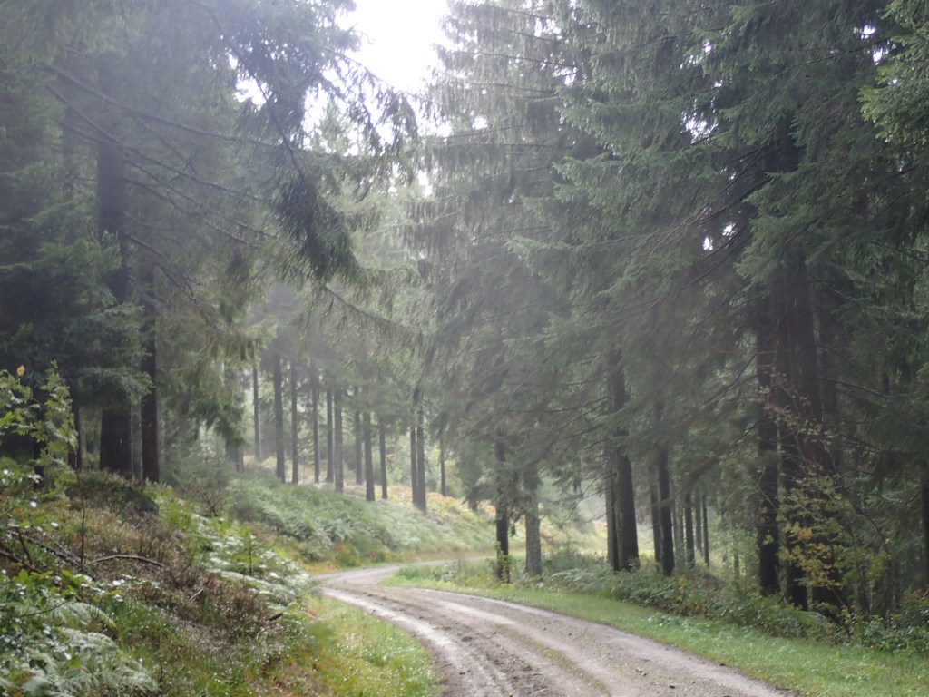
And so, after breakfast the next morning surrounded by school-kids on a trip, I set off for my first day of hiking, from Dillweissenstein to Dobel, around 24 km, a steady uphill climb for most of the day. The weather was good, not overly sunny, but dry at least. After hooking up with the trail (so well marked all the way to Basel, I would never lose my way, except a couple of occasions), there was a short, steep climb through the wealthy suburbs of Pforzheim before entering the woods where I would be spending most of the next 13 days. Despite a little too much noise from a main road and a railway line across the river, the walking was very pleasant along the Enz valley on a riverside path built by solders in 1914, according to a memorial plaque. There were a few other people about, mostly walking their dogs, all very friendly.
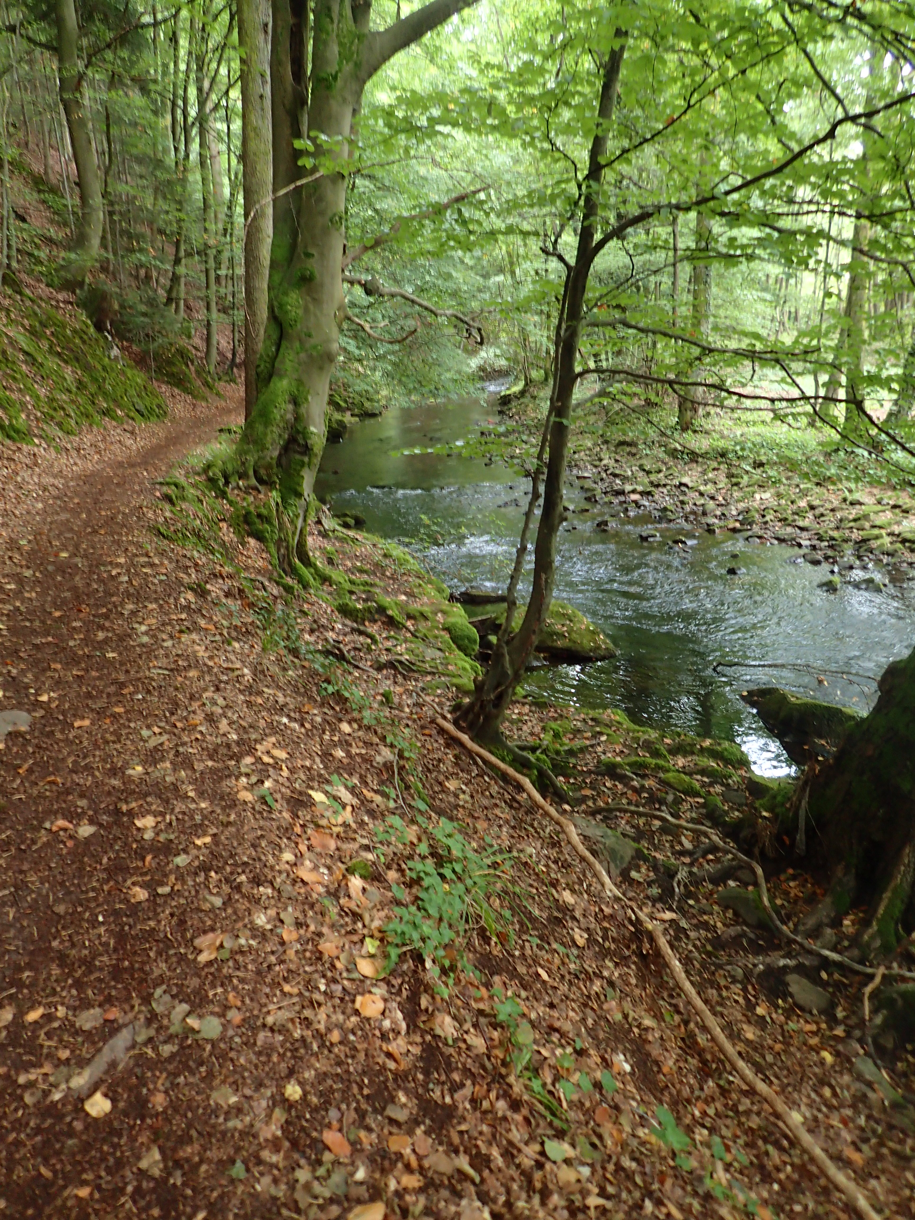
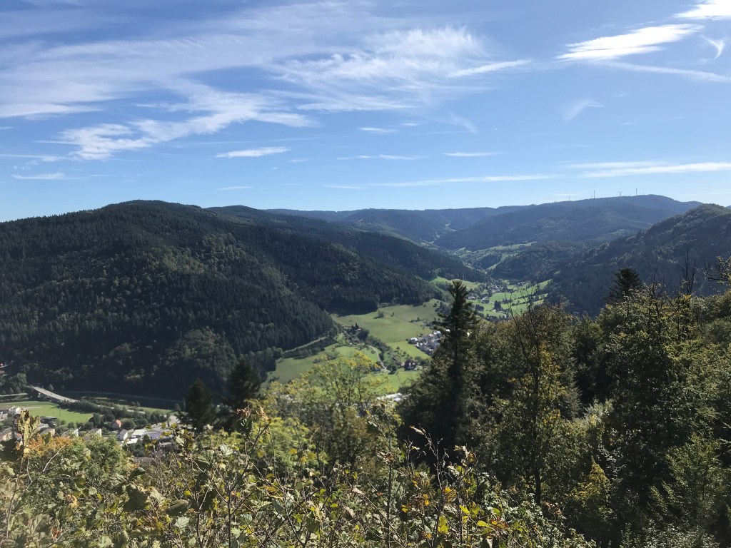
On reaching Neuenbürg, the trail headed up steeply to the castle above the village from which there were some great views over the valley below and the woods ahead. It then descended sharply to the village itself where, all of a sudden, despite the typical Black Forest architecture, I suddenly found myself in Italy in Little Italy, a café packed with gossiping Italian ladies where they served terrific coffee. A great stop to set me up for the steep climb out of the village to return to the woods on the other side of the valley.
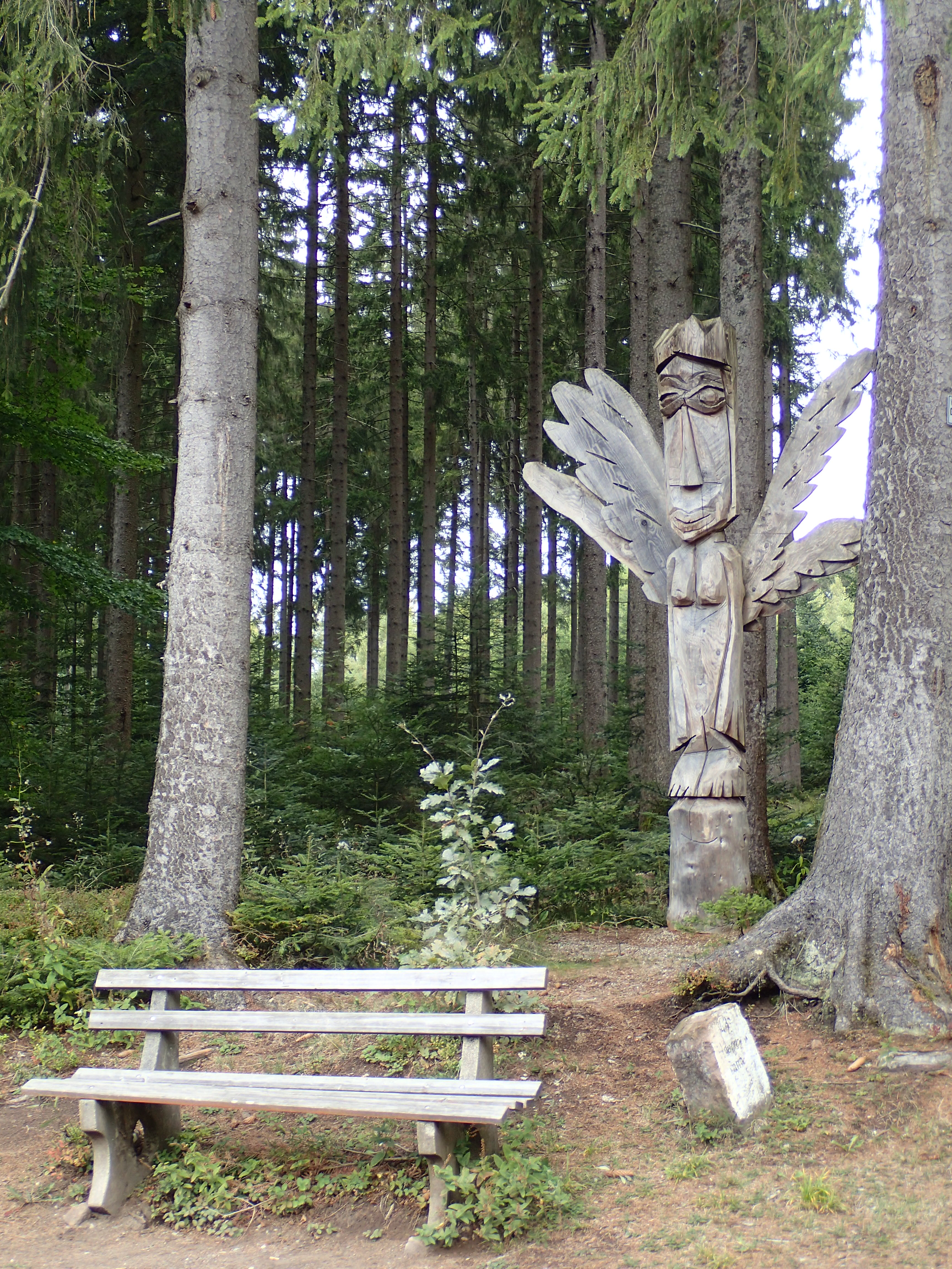
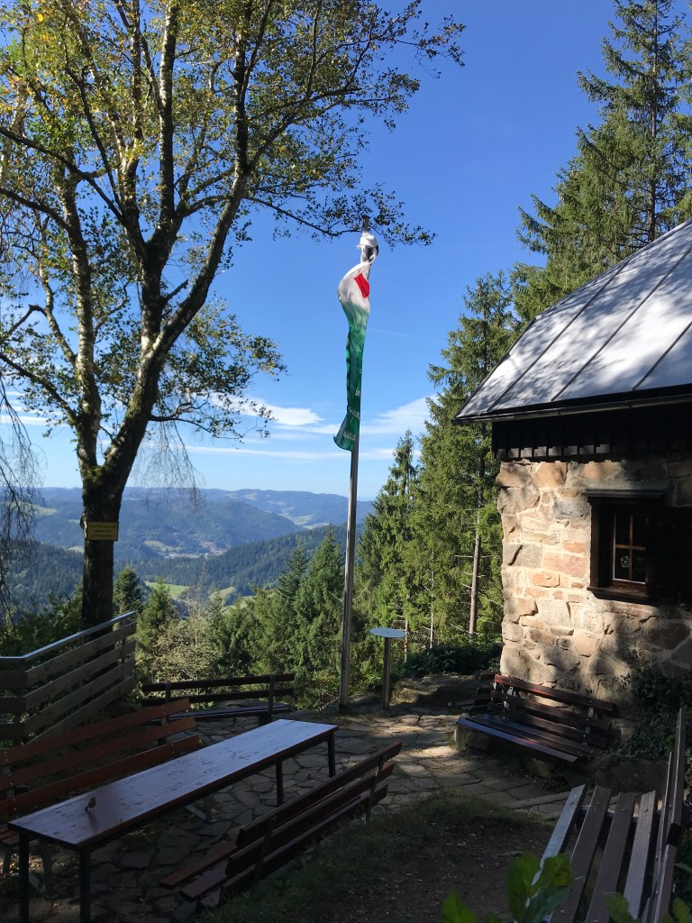
And a steep climb it was, from 300 to 500 m over a very short distance. From that point on, it was woods all the way, and a much steadier climb up to an altitude of 700m, until emerging into the fields around Dobel, the end of the first day. There were a few surprises along the way: a view tower (a regular occurrence along the Westweg), a group of 10-metre high limestone blocks in one small area that reminded me of the Fontainebleau forest near home and, more surprisingly, a serious of pictures of angels with quotes from churchmen and philosophers before a totem-like angel at the side of the trail.
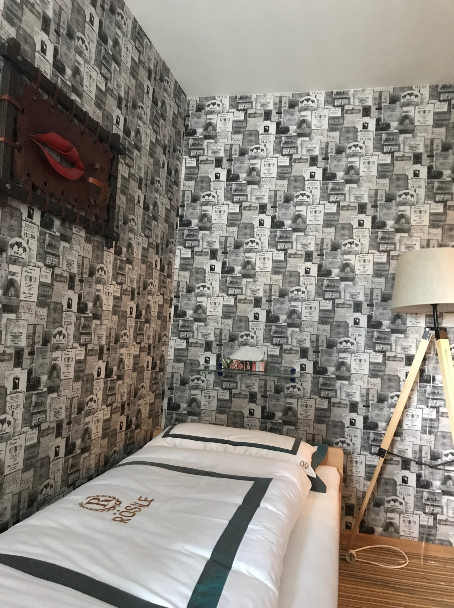
On approaching Dobel, the first drops of rain began to fall, giving me a chance to test my rain jacket and the cover contained in a pouch under my pack. Both were perfect in the light rain that grew steadily heavier as I crossed the village, which seemed a bit like a ghost town with a lot of stores and restaurants closed, possibly for the day although in some cases the closure seemed permanent. My hotel, the Rössle, was easy to find and the room was comfortable but with a totally weird decor of wine labels and a Daliesque work of “art” on the wall. There was something a little oppressive about it, but for 45 euros, with an excellent breakfast included, I wasn’t going to complain!
When it came to dinner, the choice was limited as most places were indeed closed. The only restaurant in the village was consequently packed but they had a table free for me for an excellent flammküche and a salad. I spotted a couple of guys I had seen on the trail earlier that day who were clearly heading in the same direction as me. However, it tuned out that they were only walking a couple of stages rather than the whole thing. That would be the case all the way along. Thanks to the excellent train and bus network covering the Black Forest, it’s easy to do a few days rather than the whole trail from start to finish. In fact, I only met a couple of other people walking the whole distance.
The second day was cloudier, wetter and tougher with 972 m of ascents (and 1,075 m of descents). The climbs were steady rather than steep so it was pretty easy going, apart from the very steep 700-metre descent to Forbach at the end of the day. The breakfast room at the hotel was so packed, I at first thought that the trail was going to be pretty busy. But some of the guys there didn’t really look like hikers (the gear wasn’t quite right) and, on leaving, I discovered that they were mostly loggers off to work in different areas of the surrounding forest. I would come across their work later that day.
From the start, I had to get the rain gear out. I would need it for a fair share of the day. Although I was able to remove the rain jacket from time to time, I kept the trousers on all day, finding out that they were a truly excellent item (I had never needed to wear them before). There was a cold wind too but the rain jacket was great at cutting the chill, as was the micro-light Haglöfs top that I picked up in Norway in 2015 (an incredible item that weighs next to nothing but which is amazingly warm). The walking was pretty easy, mostly within the forest. After yesterday’s angel paintings, today’s path had a European theme, with benches for the different EU nations and tacky statues alongside them. At an intersection of trails, the Westweg emerged from the woods to follow a balcony-like logging road with views over the mist-filled valley below as I headed up the 900-metre line.
I cheated a little after this, continuing to follow the trail despite signs not to take it because of logging. There was no diversion indicated, so I didn’t feel like wandering off the main trail and, besides, in the silent woods, I couldn’t hear a sound apart from that of raindrops falling from the trees, so I decided to risk it. There were lots of cut branches across the trail, but not a logger in sight, just one very dark, almost black squirrel that bounded across the path at one point. Maybe loggers don’t work in the rain, even though those I saw at the hotel were setting off for work that morning.
I stopped for a rest at a beautiful stone hut, actually finding a patch of sunlight to sit in to warm up and dry out a little. I got chatting to a guy who was checking out of the hotel just after me that morning. We ended up having lunch together in Kaltenbronn, the next village along, where I was surprised to find a couple of ski slopes at an altitude of just 869 metres. And a very pleasant lunch it was (beef sausage with spätzle and cabbage). It turned out that my lunch companion, an IT technician, was just walking the first two days of the trail before heading back home to work. He seemed impressed that I was doing the whole trail in one go. The conversation ranged from work to Brexit to our kids, with me blathering away in my poor German before he came out with some pretty good English! After lunch, I let him move on ahead as he had a very light pack and a train to catch in Forbach.
From Kaltenbronn, there was a pleasant climb up to the Hohlohsee at 981 metres. I would find similar lakes and marshes on the high plateaus all the way along the trail, but this one was the first.

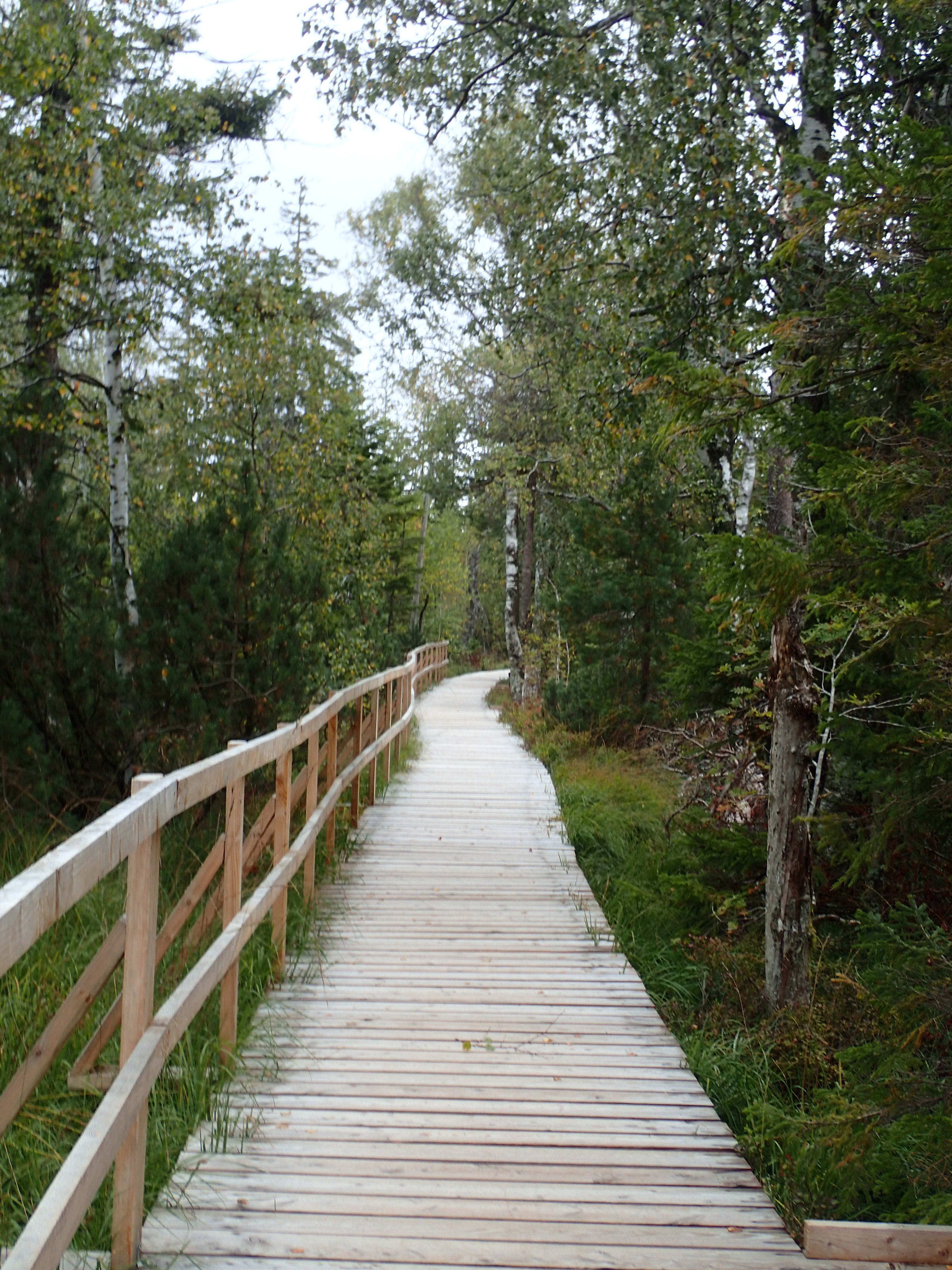
And in most cases, these marshy areas were crossed by well-maintained boardwalks (bohlenweg in German) that were a true delight and became my favourite terrain in the course of the hike. They give a spring to your step and you just seem to fly over them. There’s even an Instagram group (#bohlenweg) devoted to boardwalks all over Germany and elsewhere, so I reckon I’m not the only one who appreciates them!
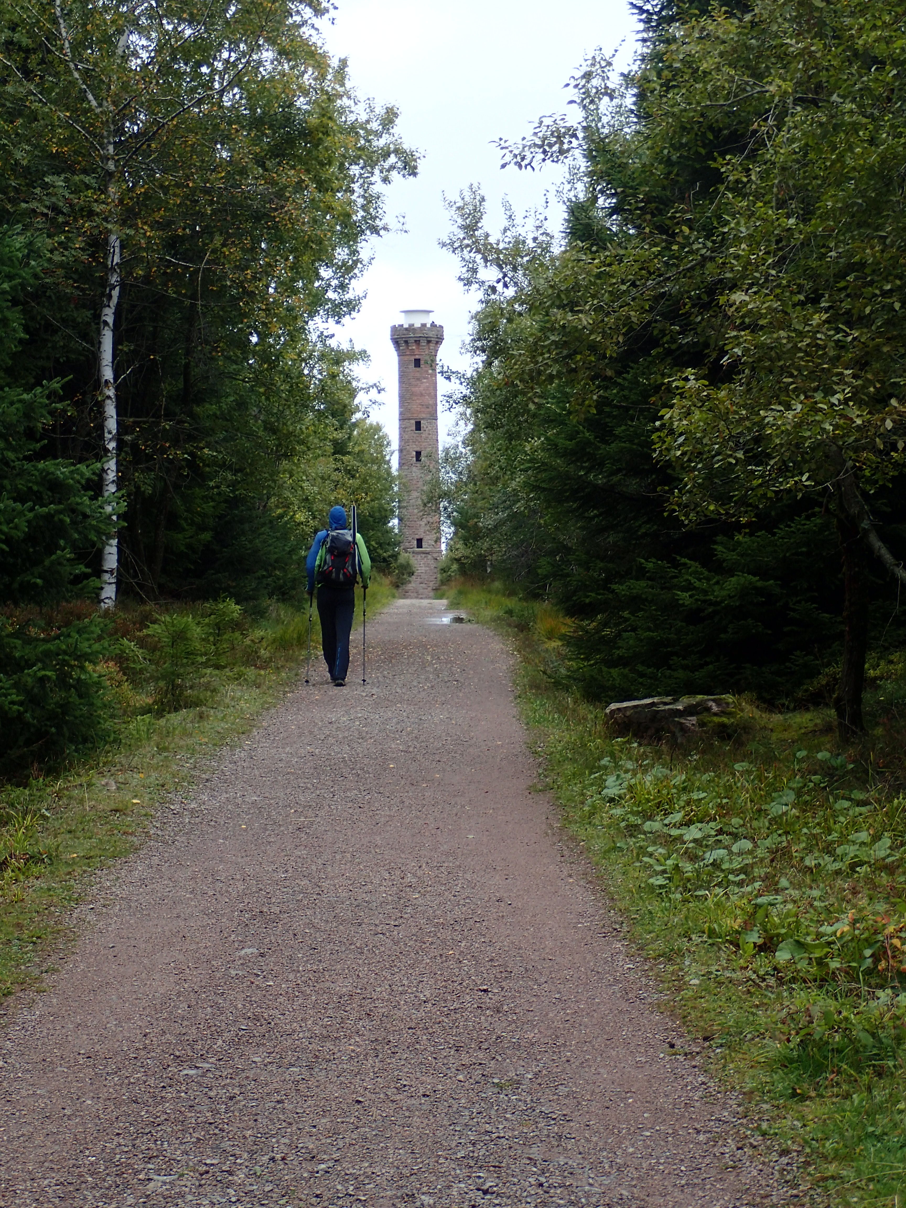
Shortly after, I made a quick stop at the Kaiser-Wilhelm-Turm at 986 metres. Climbing this 14-metre viewing tower allowed me to attain an altitude of 1000 metres even though the path itself would not reach that height until the next day. The views from the top of the tower were stunning – thick forests and rolling hills stretching as far as the eye could see, with just a few clearings here and there.
Just after the tower, the rain began. It wasn’t too heavy at first but it made the steep descent to Forbach (a loss in altitude of around 700 metres) a little tricky at times as some of the rocks were pretty slippery. Thank God for the hiking poles.
The rain grew steadily heavier and it was bucketing down by the time I reached the Heuhüttental, an almost Alpine-looking valley full of small chalets above Forbach. I’d never really been keen on hiking in the rain, possibly because my glasses can make it tough to see much when covered with drops of rain. But, for this trip, I finally had the right hat, a simple cap with an excellent brim that really shelters the glasses and keeps them more or less dry. Thanks to the excellent rain gear that I had with me, I actually began to enjoy the rain on this trip (although some days would test my tolerance of falling water).
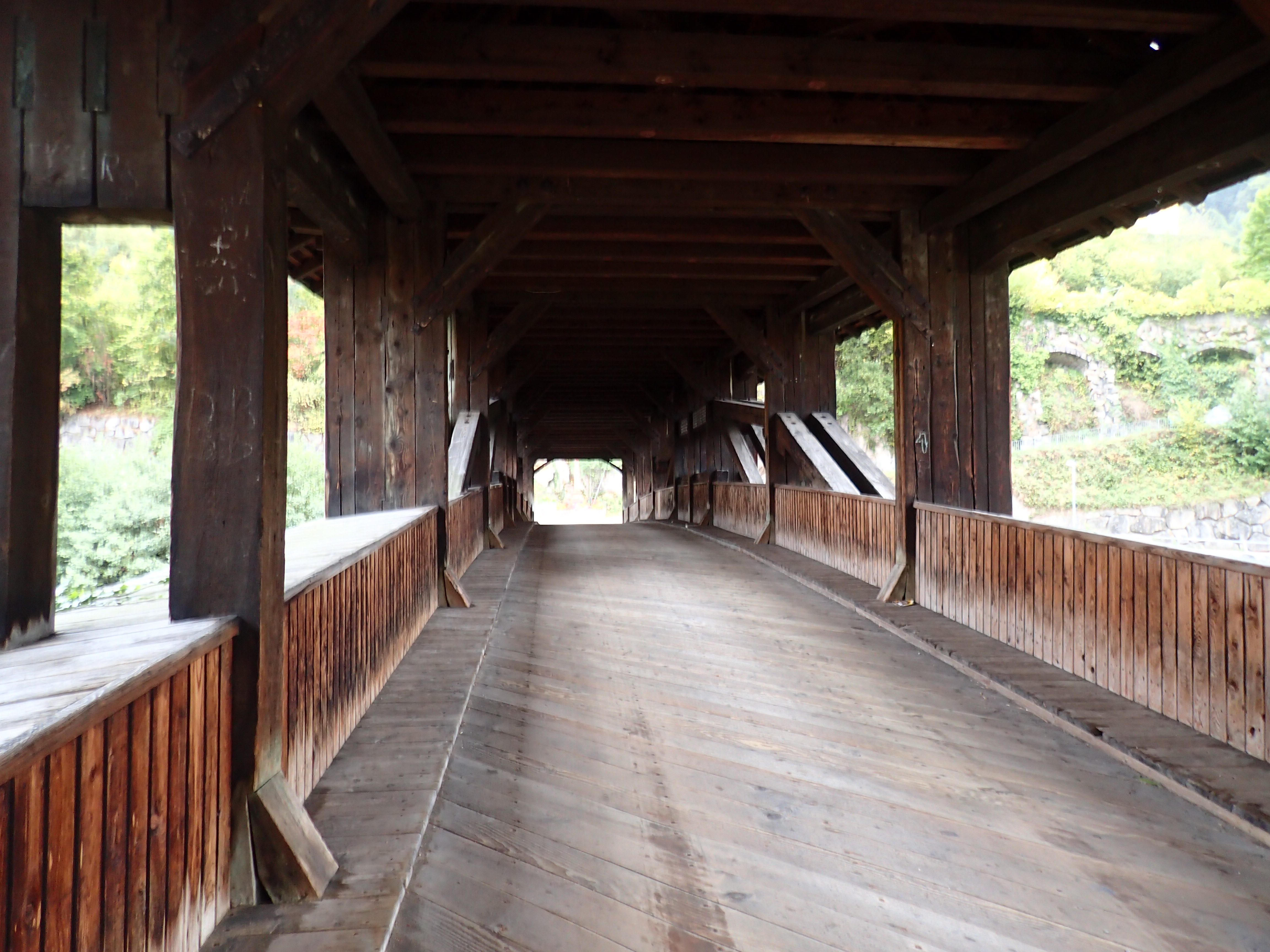
Like Dobel yesterday, Forbach seemed pretty much deserted, with lots of places that seemed to have shut down. Very odd. Perhaps the place would be more vibrant in the height of summer. My hotel, the Waldhaus, was on the other side of town, just next to a beautiful old covered bridge. I was drenched when I arrived but the friendly lady at reception didn’t bat an eyelid. After a good hot shower, I hung my stuff up. This was something that I would need to do most evenings on this hike, depending on the strength of the rain. Tonight, it wasn’t so bad, with just the day’s gear and the pack cover in need of a good dry.
I went for dinner at one of the few places open in the town, a very simple spot where I had a huge bowl of spätzle with cheese, speck and mushrooms. Good hearty fare after the 26 km of the day.
Then it was back to the hotel for an early night. There would be a long climb out of Forbach the next morning (back up to over 1000 metres) in what looked as if it would be an even wetter day according to my weather app.
On the third day, after a great breakfast at the hotel (with an excellent double espresso), I took a few photos of the covered bridge before starting the steep climb out of Forbach, from 300 metres back up to 1000. It began to drizzle while I was on the bridge and it would rain on and off for most of the day. More on than off.
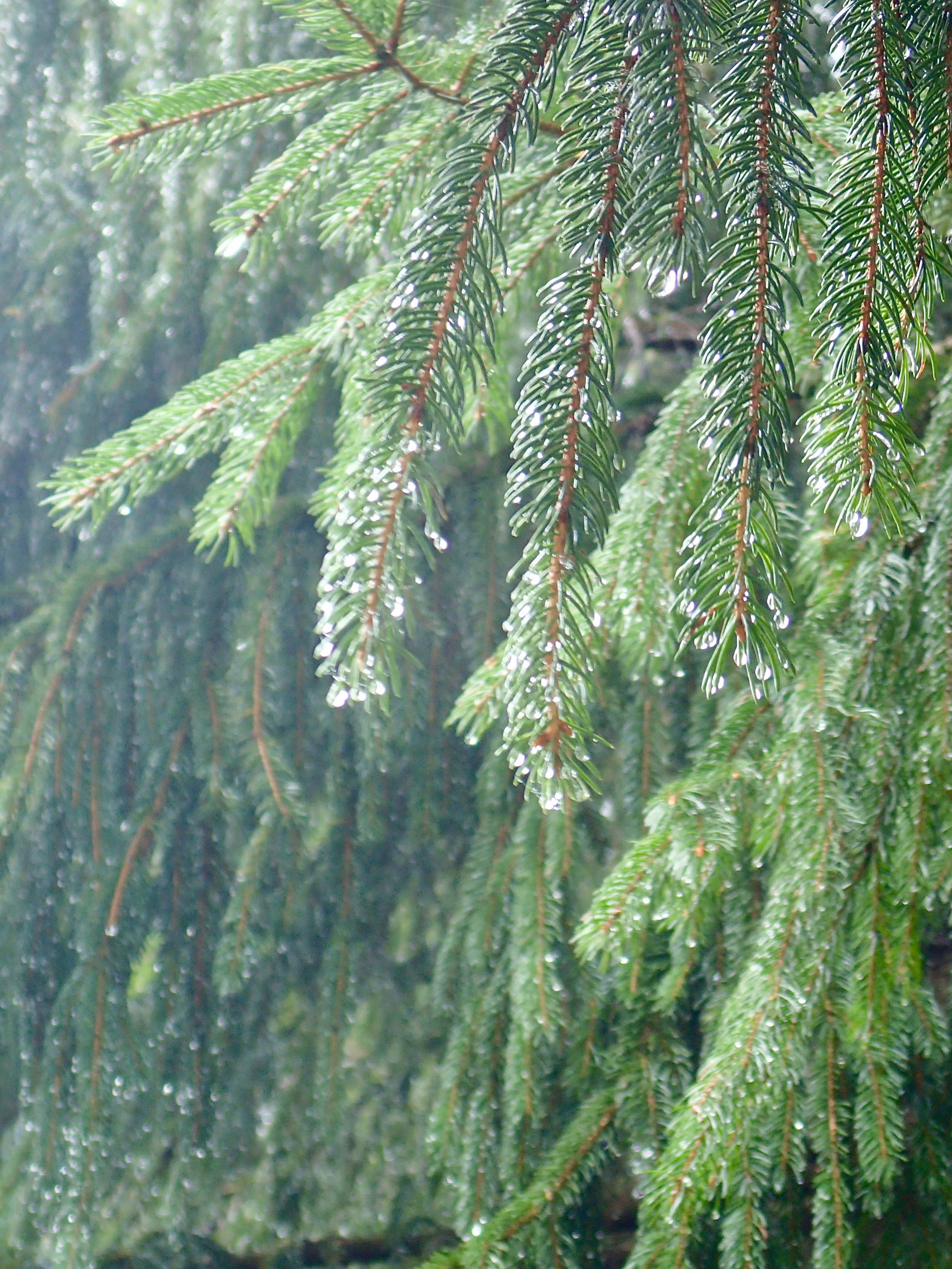
The climb was indeed steep but pretty regular. This was the morning I first noticed an intriguing phenomenon that would accompany me for the rest of the hike. As the Black Forest is the first real massif (with the Vosges in France) that clouds heading west from the Atlantic and the North Sea encounter on their journey, they hit the trees of the forest and cover them with moisture. This then falls to the ground, giving the impression that it is raining when in fact it isn’t. This was the case throughout the climb up from Forbach and it wasn’t until I emerged from the woods onto an open track around the Schwarzenbacktausee that what I thought was rain was merely water falling from the trees. Once I was out of the cover of the trees, I was perfectly dry. This no doubt explains the greenery of the Black Forest. In fact, some days I could be in bright sunshine yet still surrounded by moisture falling from the trees where it had no doubt settled the previous night.
Another result of the clouds’ encounter with the massif were the thick mists that created an incredibly eerie and almost supernatural atmosphere at times. I have a lot of imagination and there were a couple of moments when it ran wild, but more of that later.
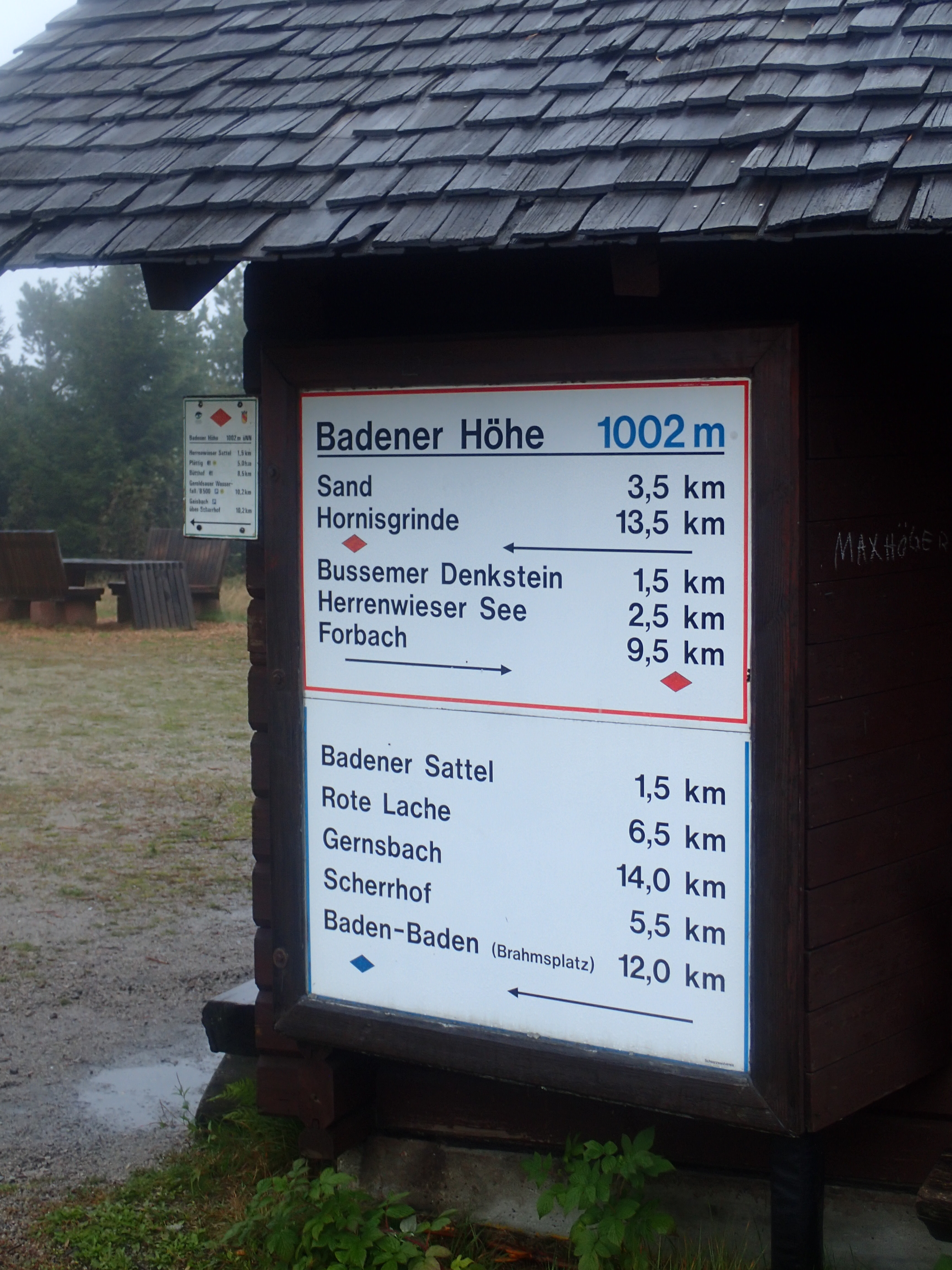
I actually lost my way at one point on the track around the Schwarzenbacktausee. This was entirely my fault as the way marks were perfect. But my attention was distracted when I got chatting to a couple of guys coming in the opposite direction and missed a turn. After going about 2 km too far along the lake track, I realized my mistake because there hadn’t been a marker for so long and, on reaching a fork, there were none to be seen (the marks on the Westweg are always very clear when several trails intersect). So I turned back and finally took the right path that began to climb steeply again to a small lake at 850 metres, before reaching a plateau at 1000 metres where there was a memorial to Phillipp Bussemer, the person who marked out the trail from Pforzheim to Basel in the early years of the 20th century.

The plateau was shrouded in thick mist and rain, real rain this time as there were no trees around, apart from a few stunted pines. It was all very atmospheric, with a fairly strong wind blowing and only a couple of other hikers (only going as far as Sand, the next village along). I stopped for around fifteen minutes at the Badener Höhe at just over 1000 metres to shake the rain off the pack and my rain gear. There was another viewing tower but, as I couldn’t see the top, there was no sense in climbing it for the view.
The rain was still falling when I set off again. It wasn’t particularly heavy but it was pretty relentless all the same and would continue unabated until I arrived at that night’s hotel. From the plateau, the trail headed downhill again to the small ski resort of Sand and then on to Hundseck where I took a break in the one café that was open, for a coffee and a good slice of Black Forest Torte (one of my favourites).
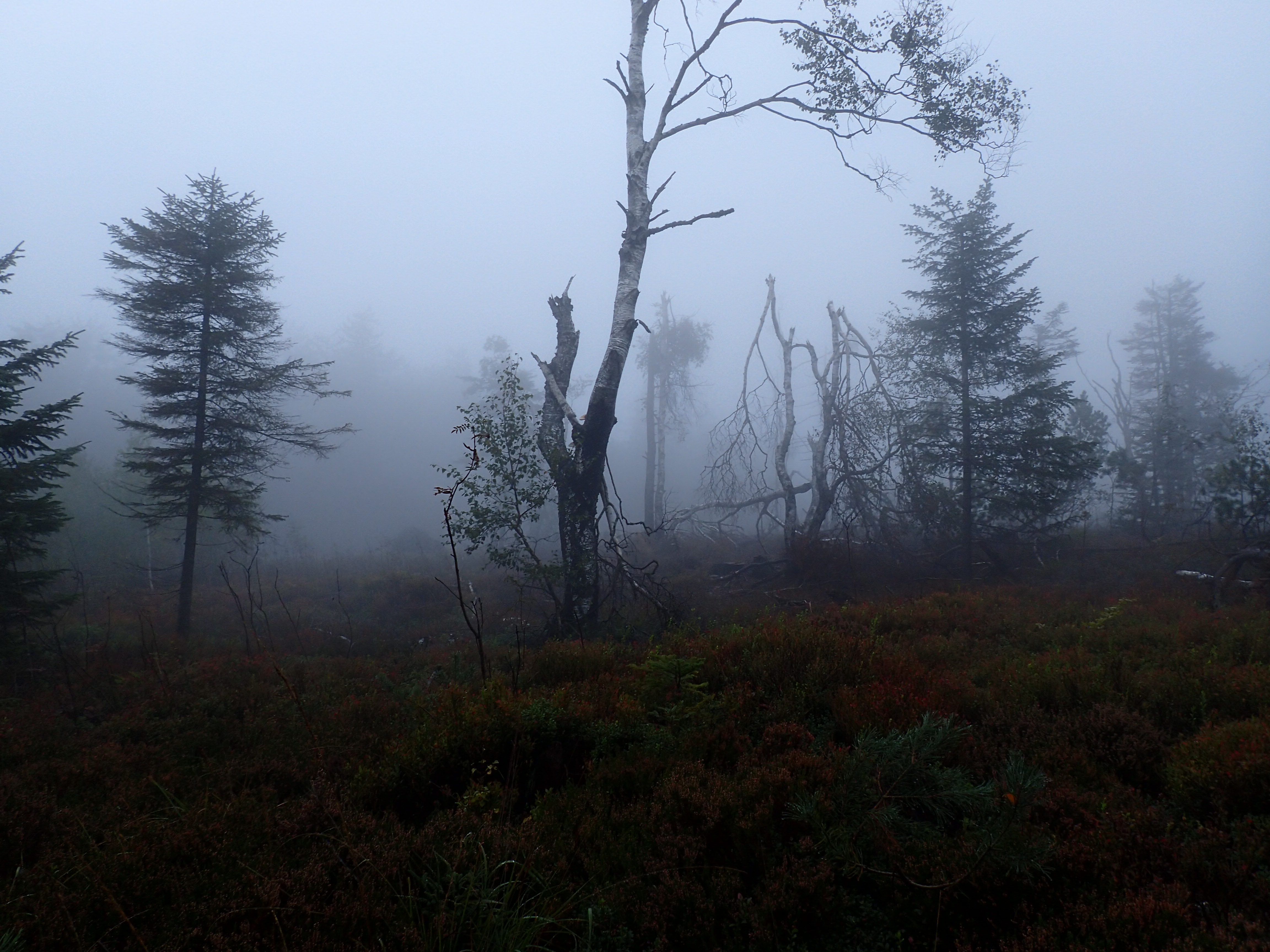
From Hundseck, it was another 120-metre climb up to the Hochkopf moor. This was even more atmospheric and downright eerie compared to the previous plateau and my imagination went into overdrive. It was already like being in the opening scene of Macbeth, but when a stunted, twisted tree just ahead start shaking, I’m not ashamed to admit that my blood ran cold. I think I even yelped in fright! I was expecting witches to suddenly appear from all sides! In spots like this in such weather, it was easy to see why so there are so many legends and tales about the Black Forest. I’m sure the moor would have been spectacular on a sunny day, but I was glad to see it like this for the atmosphere.
From there, it was an easy walk down to Untertsmatt. With the witches at my back, I did it in next to no time. I emerged onto a large parking lot in thick fog and it was tricky to spot my hotel Zur Grossen Tanne right away. I finally glimpsed a light shining through the fog and made my way towards it. It was a simple place but I had a huge and comfortable room (with three beds) and a towel dryer in the bathroom that helped to get all my gear dry with some help from the radiator. My boots, however, were soaked and were still damp the next morning. Dinner was at the hotel, a simple but tasty meal of sausage and fried potatoes, good hiking fare.
The fourth day turned out to be one of the wettest on the Westweg, the one when sections of the path vanished under water. Even so, when I set off, the terrain was pretty dry as a strong wind had been blowing most of the night and the rain had eased off. There was still a fair amount of mist (or maybe clouds at this altitude, given that the day would be spent between 900 and 1200 metres) and I set off at around 8:20, pointed in the right direction by the owner of the hotel (where I think I had been the only guest apart from a couple of guys working for a building firm).
The day’s trail began with a steep but steady 200-metre climb up to the Hornisgrinde summit. Even though the terrain just after the hotel had been fairly dry, the higher I climbed the wetter it got, with slippery rocks at times. I was back in a thick mist and was unable to see the upper part of the huge telecommunications tower that stands on a ridge up there. Even so, it wasn’t raining (yet).
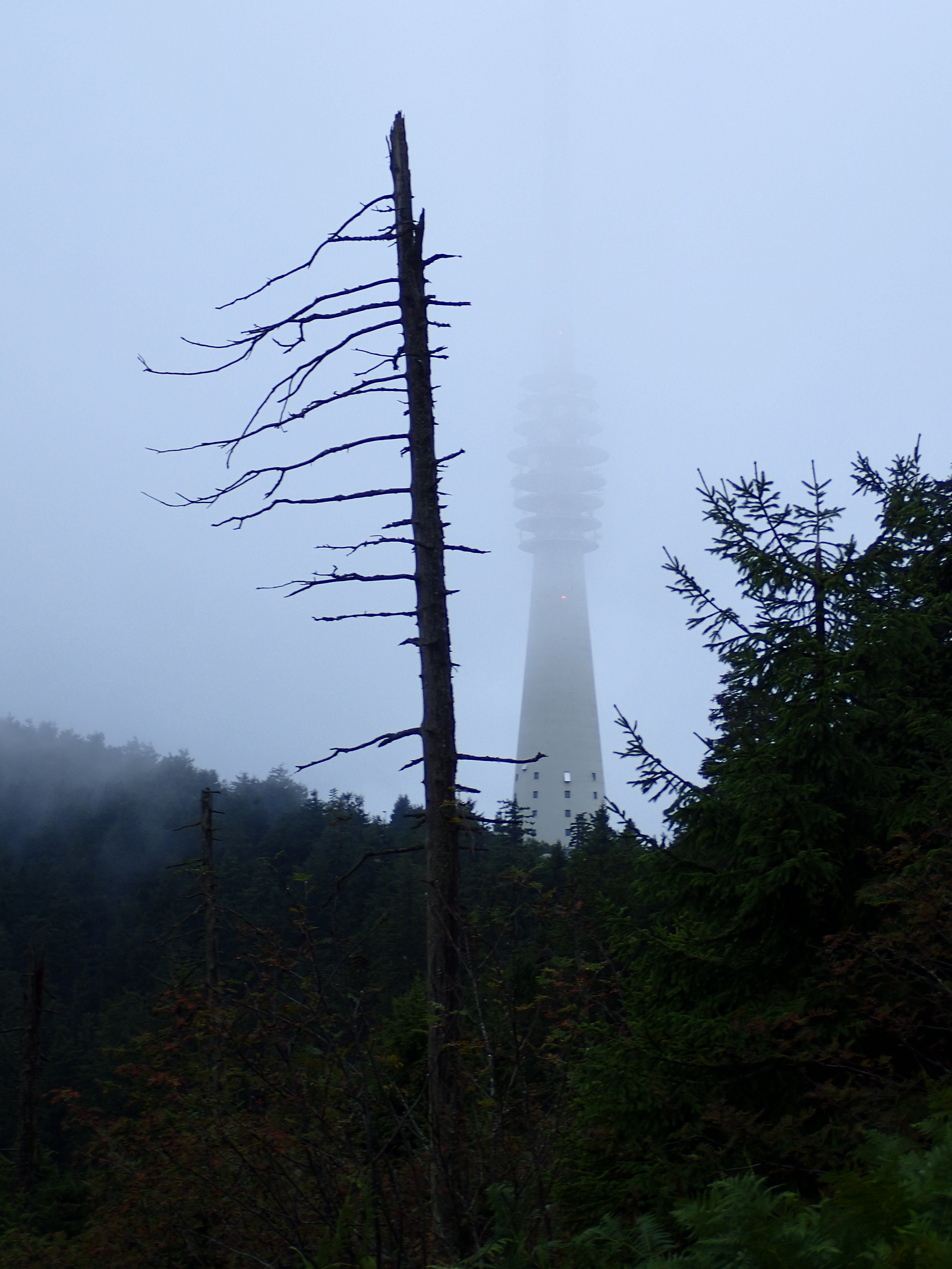
The eerie atmosphere of the previous day was back with a vengeance. The Black Forest seemed determined to prove to me that ghosts exist (not that I’ve ever had any problem believing they do). Shortly after the telecommunications tower, as the trail continued to climb to the Hornisgrinde summit, I started to hear a weird wooshing sound in the mist, but was unable to see what was making it. More goosebumps! On climbing higher, things finally became clear – it was a wind turbine spinning at top speed, something that I had never heard at close range before. Nothing supernatural at all, but still uncanny in this misty setting.
By that point, I had more or less reached the Hornisgrinde summit, not that I could tell as the mist was so thick the views were non-existent. Near the small Bismarck tower, which clearly wasn’t worth climbing for the view from the top, I took a wrong turn, lured off the Westweg by a beautiful boardwalk across the moor. I couldn’t resist the pleasure of following it, not realizing until about a kilometre later that it had taken me way off the path. But it did lead me to a clearing where there was a huge flat block of black stone, surrounded by smaller stones. The perfect dining table for a coven of witches! Unfortunately, I have no photo of it as the light was really poor, but it was yet another spooky spot.

When I finally made it back to the official trail, it was an easy walk down to the Mummelsee, an almost perfectly circular lake which, to continue with the legends, is said to have a ghost or a monster living in its depths! It was a fairly touristy place with lots of coach parties and a good shop where I bought some chocolate and a sausage for midday snacks.
Shortly after the Mummelsee, I had to make a stop to get into my rain gear as the weather was turning progressively wetter. After a steep climb up the side of a ski-slope, the trail became narrower, with a fair number of fallen trees to negotiate, before winding its way across moorland high above the road. Given the high elevation and the plunging drop to the valley below, I imagine that the views would be spectacular on a clear day. The rain was getting heavier and heavier and I only caught a brief glimpse of the Wildsee lake far below through the mist and rain as I ploughed on to the pass at Ruhestein, diving into the only place open there in the hope of drying off a little (the rain had already made it through the backpack cover by then). Unsurprisingly, the place was packed with people sheltering from the rain (a lot of them pensioners on coach trips taking in the Black Forest peaks), but I managed to find a place at a table with a young couple playing cards and a group of German pensioners who seemed to want to chat but whose thick accents I couldn’t understand. I managed to make a plate of tasty maultaschen with salad (the Black Forest version of ravioli) last a good hour before plucking up the courage to return to the downpour, which had not eased off in the least during my time inside.
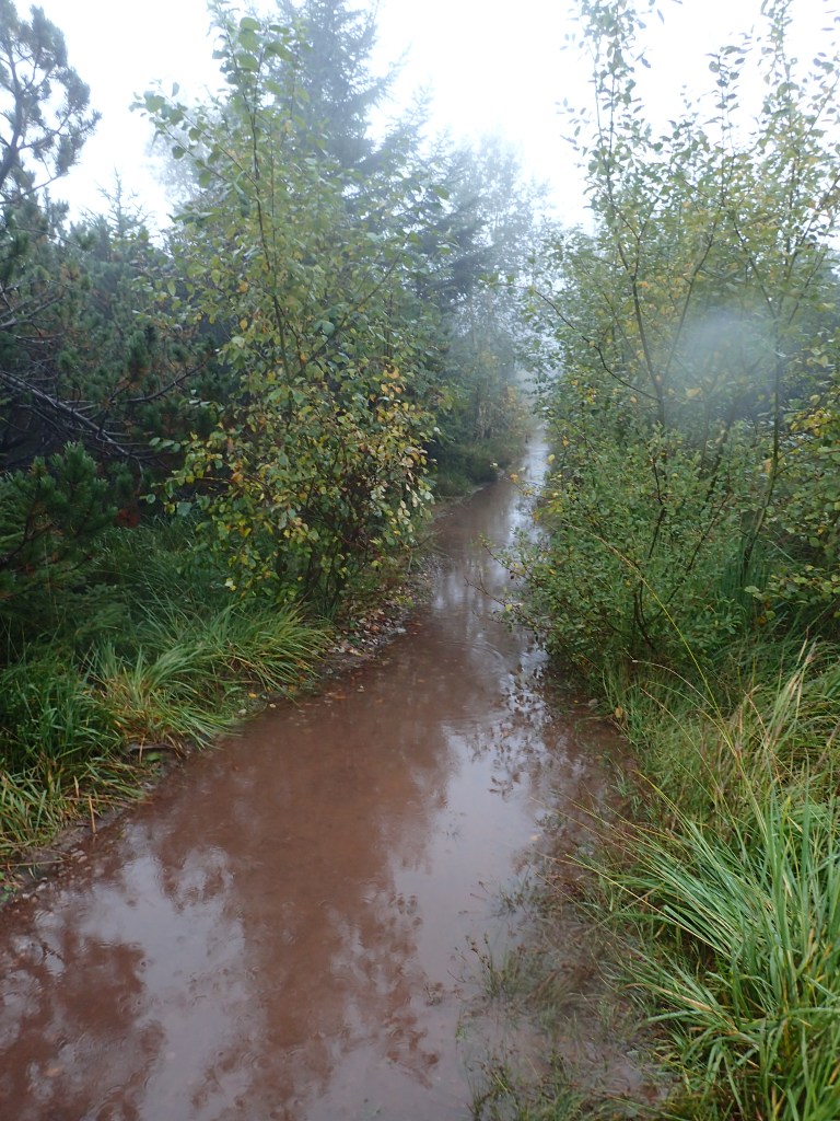
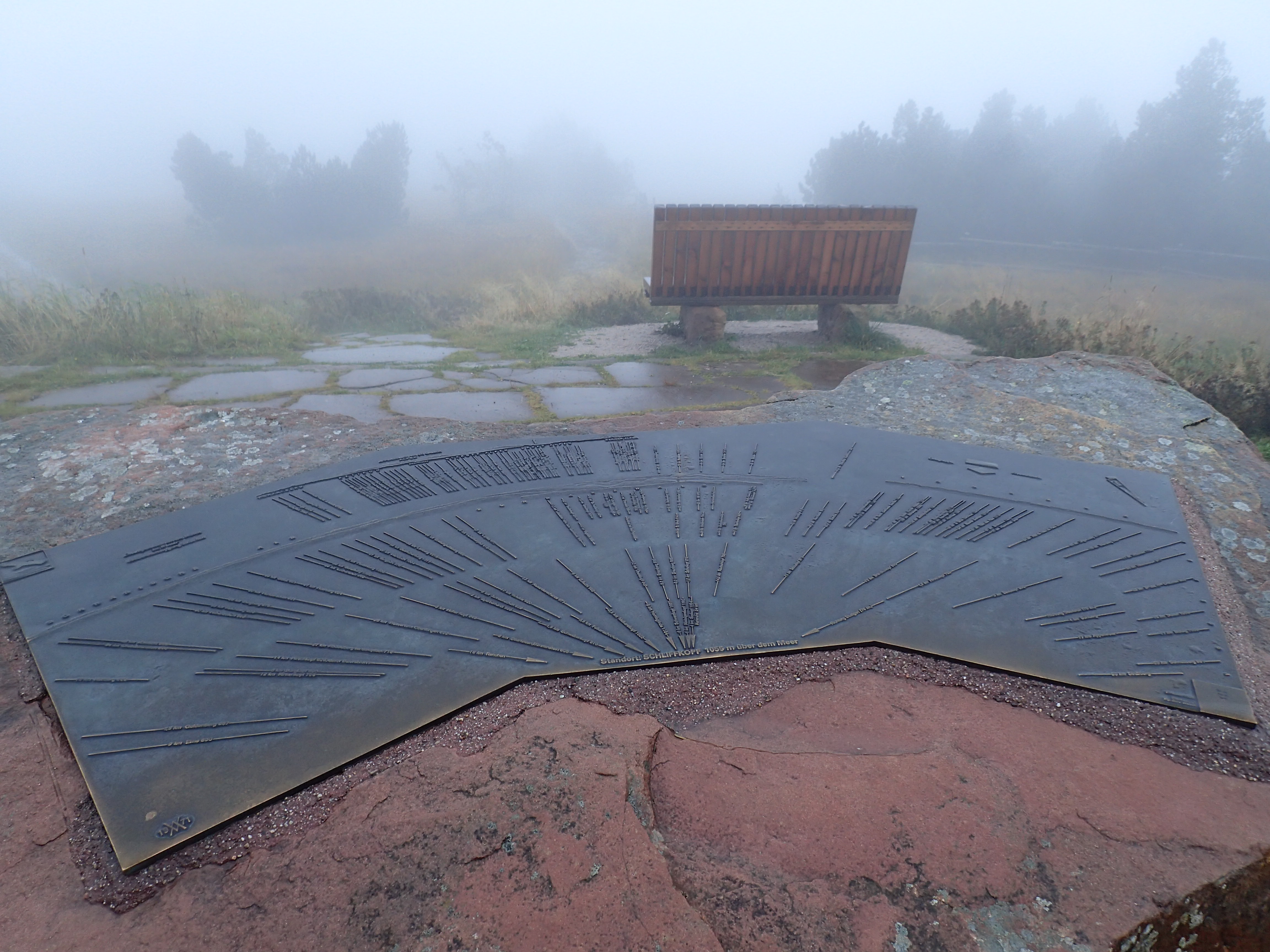
From the restaurant at the pass, the trail led to the top of the local ski-jump (they must still get snow here, despite the low altitude, to justify all these ski installations). It then headed up to the Schliffkopf peak at 1055 metres. The path was flooded with water at a number of points and resembled a stream rather than a hiking trail (see the photo at the head of this article). My boots turned leaky and squelchy after being water-logged for two days. As for the summit, there were some great viewing benches and a detailed orientation table, but the mist was so thick I couldn’t see anything beyond the first trees!
From there to my hotel at Zuflucht, it was an easy walk high above the invisible valley in a fairly strong wind. The rain eased off now and then, but never for long. Along this section, there was a nature trail explaining the damage left by the hurricane of December 26th, 1999, but I decided to skip it as I just wanted to get to my room to dry off.

The path emerged right opposite the hotel where I got a friendly welcome from the guy at reception, in my hesitant German before he switched to excellent English. The room was small but had a good radiator and lots of hangers. After putting everything out to dry (the pack cover cannot provide total protection from such relentless rain) and stuffing my boots with the local newspaper, I went to warm up in the hotel sauna (much appreciated) before a whopping schnitzel for dinner in the peaceful hotel restaurant. Needless to say, after the day’s adventures, I slept like a log. No nightmares about witches, thank God!
I woke to find my boots and all my gear bone dry. Sheer luxury! Plus the rain seemed to have eased off in the night as all I could see from my window on waking was thick mist. After a good breakfast (with terrible coffee), I set off at around 9:20. Indeed, it was not raining, even though the was plenty of water dripping from the trees. On the first easy section through the woods, the mist began to lift slightly.
After 3 km, I reached the Alexanderschanze pass, the end of yesterday’s stage, and discovered I had been right to stop at Zuflucht as there were absolutely no facilities there. Indeed, there wouldn’t be anywhere to stop and get refreshments or food before Hark, 17 km further on. But after the hearty hotel breakfast, that was not a problem. And the walking today was pretty easy. The trail was starting to dry off after the previous day’s flooding, the air was crisp and the sun was beginning to pierce the mist in places. There were more people about (it was Sunday), both hiking and mountain-biking, which made for friendly encounters along the way.
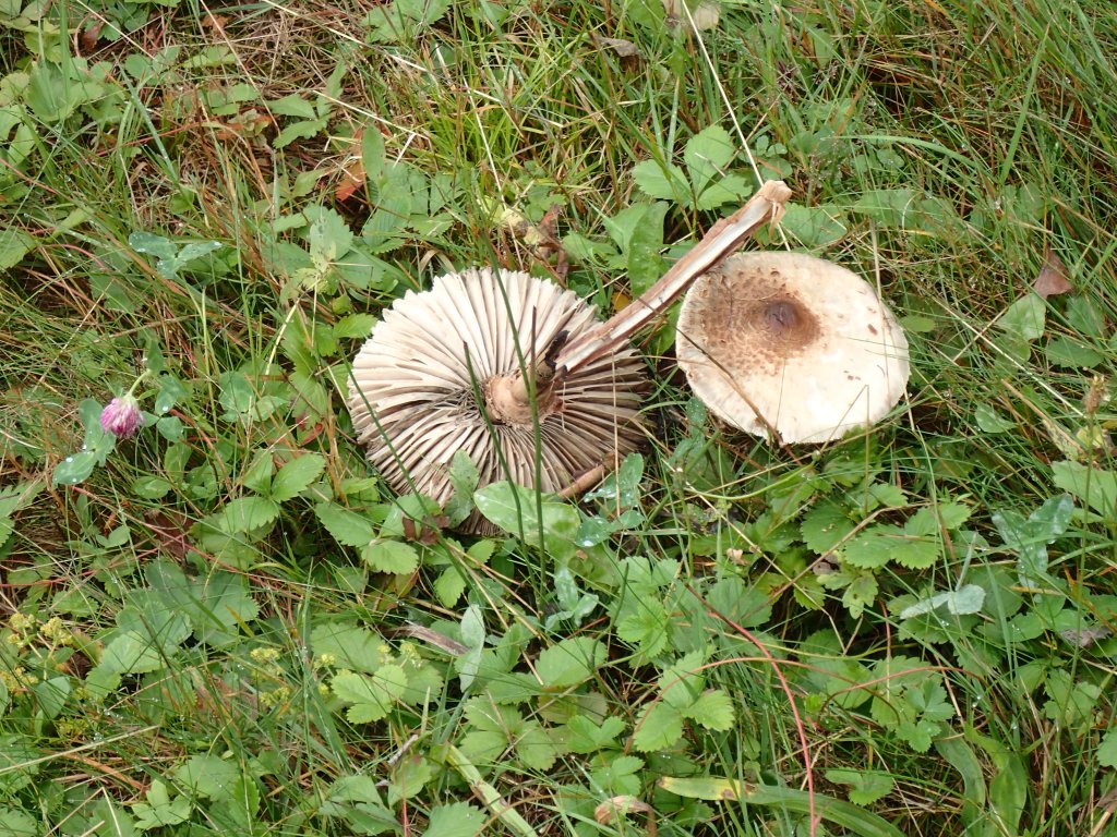
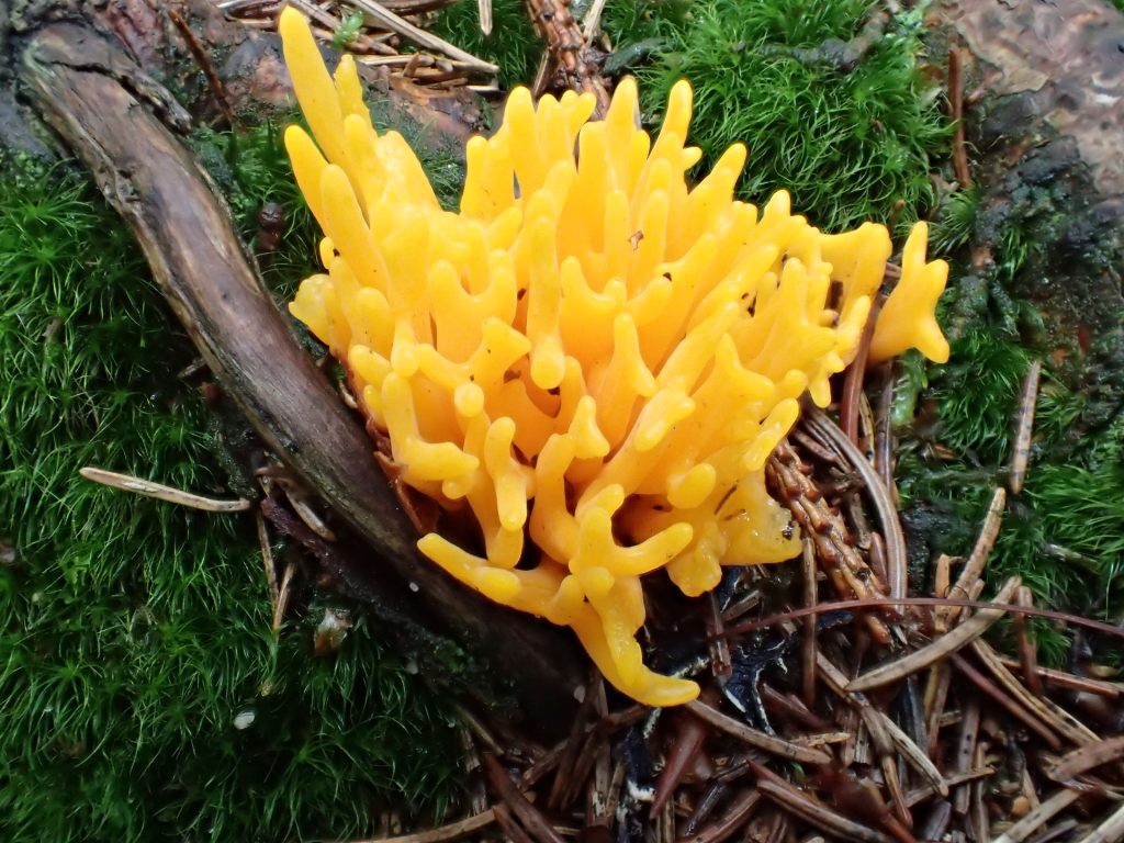
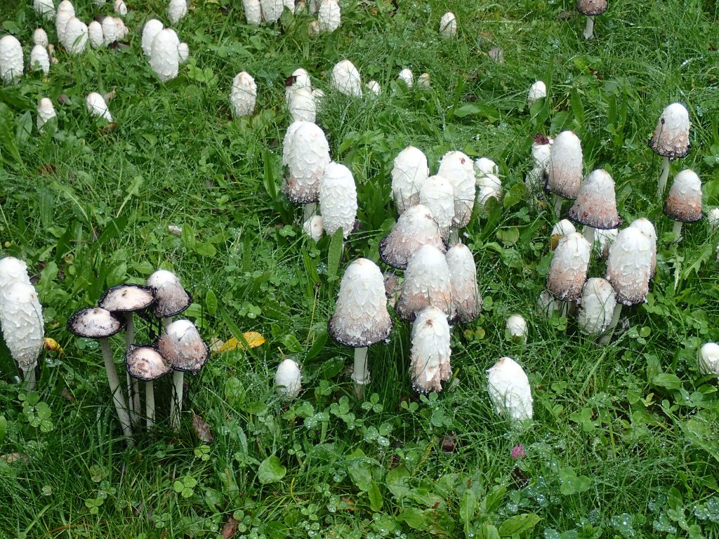
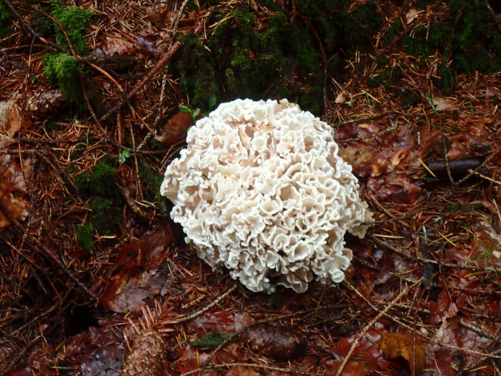
After the last few days of rain, the trail was lined with mushrooms and fungi of every kind, even some that looked like yellow coral.


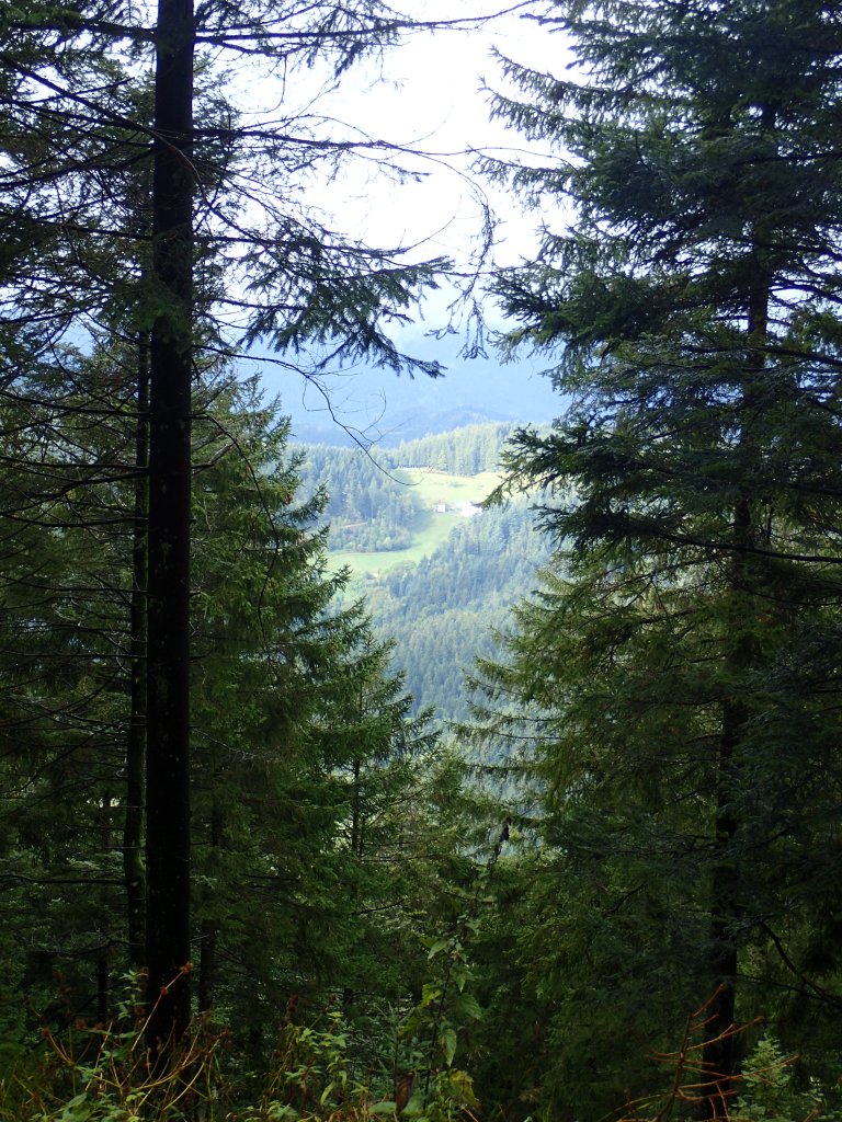
Most of the day’s walk was on forest tracks or good, level hiking paths. After the long climbs and rain the previous day, this was more than welcome. As the mist began to clear, I had a few good views of the valley and of the pretty Glaswaldsee far below.

The trail carried on through the woods (the map of the day’s section in the guidebook was almost entirely green), rising and falling gently all the way to Hark.
I met a very friendly group of two families with children on mountain bikes (with the youngest in a trailer) and we sort of leap-frogged around each other all the way along the trail. We finally had a longer chat at Hark and they were impressed that I was already up to 130km since Tuesday.
Hark itself was a surprise: a Swiss-like setting with a beautiful old farm, huge meadows and cows with bells. When I emerged from the woods, there were three huge chairs overlooking the valley, another of the quirky installations the the Germans are so fond of.

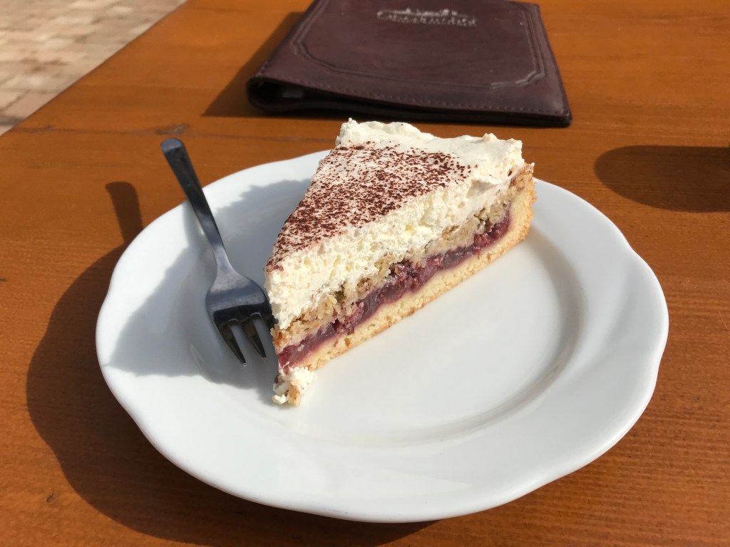
The Harkhof hotel was fully booked for the night, which was a pity as it would have been a great place to stay. There was room at the restaurant though for tea and cake, taken out on the terrace to make the most of the dry weather. The cake itself was also a surprise – a Black Forest torte redesigned as a fruit tart. Delicious and the fuel I needed for the last section of the day.
From the Harkhof, it was a 210-metre ascent to the Brandenkopf Wanderheim which I’d picked as a substitute on discovering that there was no room in Hark. The climb was a sheer joy – a steady ascent on a wide forest trail with a good rhythm set by my walking poles. And in shorts at last, after three days of rain trousers! Even so, after around 23 km, I was glad to hear the Brandenkopf wind turbine and know that I was nearing the top.
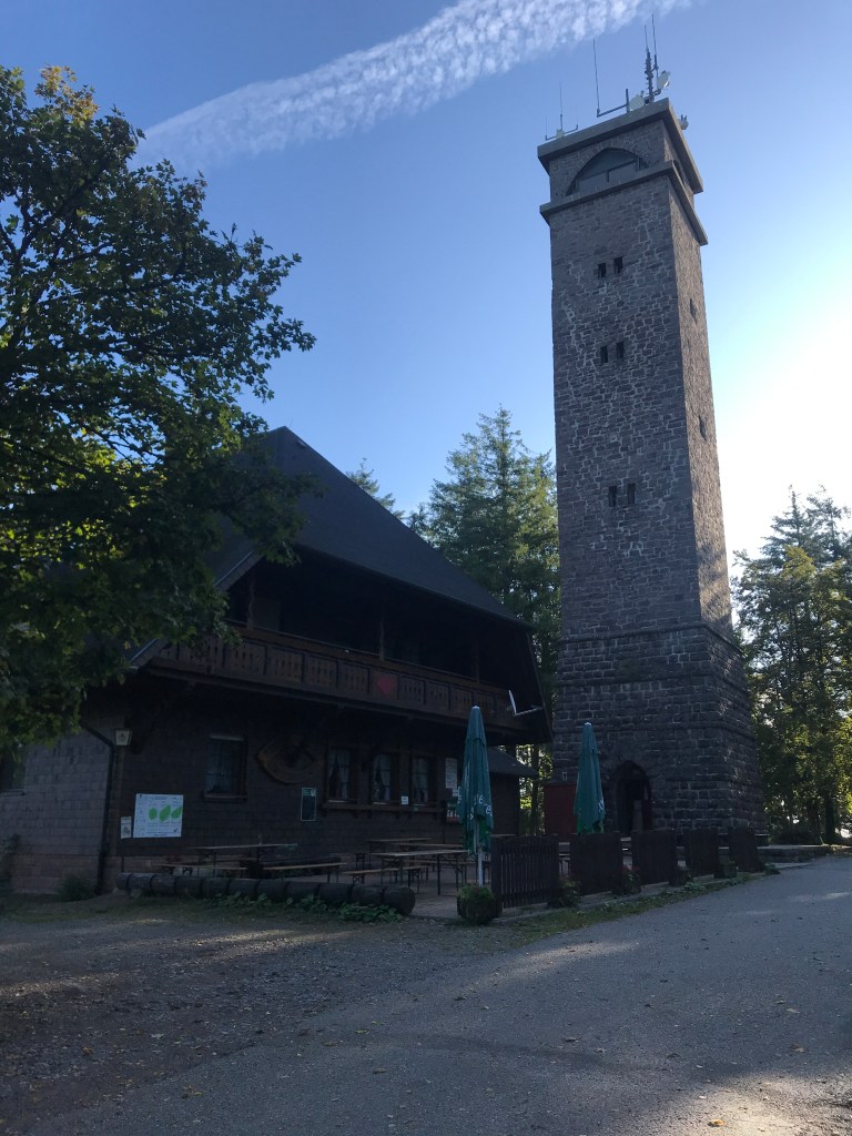
The Wanderheim, at an altitude of 945 metres, was a huge place just next to another observation tower, a cross between a mountain refuge and a youth hostel. It was very basic but spotlessly clean. My single room turned out to have three beds and plenty of room to hang out my stuff to air, with a good radiator to dry out my damp boots (even without rain today, the trail had still been pretty wet after the downpours of the previous three days). The toilet and shower were just down the hallway, but that was not a problem as I seemed to be the only one using them.
Dinner was a huge and tasty cordon bleu with a great local beer. The restaurant was pretty packed and lively with a large, friendly group of hikers out for the weekend. I had seen a lot of them on the path in the course of the day. They made a bit of noise when they went to bed at around midnight, but that didn’t prevent me from having another excellent night’s sleep, about nine hours in all.
The next morning, I woke to bright sunshine and clear blue skies for the first time. Breakfast was simple, with terrible coffee again. The delicious espressos in the Italian café on the first day and at the hotel in Forbach were sorely missed. At breakfast, I got chatting to a lady at my table who was just doing a couple of days on the trail, finishing at Hausach later that morning. I was really wondering by now if anyone else was walking the whole trail like me.
The day’s hike was one long descent from 945 metres at Brandenkopf to 250 or so in the Hausach valley below. I set off at around 9:20, determined to take today easy as the next stage would be a lot tougher. The walking was very easy, with a nice, gradual descent through the woods, with occasional views back up to the Brandenkopf. The sky remained clear, the sunlight was slicing through the trees and it was a fantastic day (at last!).
The highlight of this glorious morning was the Hohenlochenhütte that I reached after about an hour and a half. This hut belongs to the local hiking club and stands in a spot with terrific views of the whole valley. It is a beautiful, spotlessly clean and well-maintained place with a beautiful old-style kitchen. A lady there told me that it’s mainly open at weekends. The local hikers bring up home-baked cakes and do coffee or tea for passing hikers who pay what they like. The warmth and friendliness of her welcome and that of the guys with her was touching. I had a cup of coffee with them, popped three euros in the cash box and then went on my way, heartened by what they were doing there and the perfect atmosphere they created. Quite frankly, I’d have gladly stayed there all day chatting and comparing hiking stories.
After the hut, the path was a little rocky and uneven at times. After passing a group bringing cakes up to the hut, I emerged onto another Alpine-like meadow with two huge wooden recliners to make the most of the view. Unfortunately, both of them were occupied when I passed. From there, the path was more even and took me to a rather weird spot in the heart of the forest, the Weisses Kruz, with a crucifix and benches like an open-air church. From there, I had a sheroot climb up to Spitzfelsen, a very windy spot on this sunny day, from which I had great views of the Hausach valley below.
From there, it was a 300-metre descent to Hausach, which was pretty tough on the knees, but it was sunny and getting warmer by the minute. As I tramped along happily in the sunshine, I lost my way again when I began following the red diamond of a mountain bike trail rather than the hiking trail one. When I spotted the night’s hotel far below in Gutach, I realized I had gone wrong as Hausach was in the opposite direction!
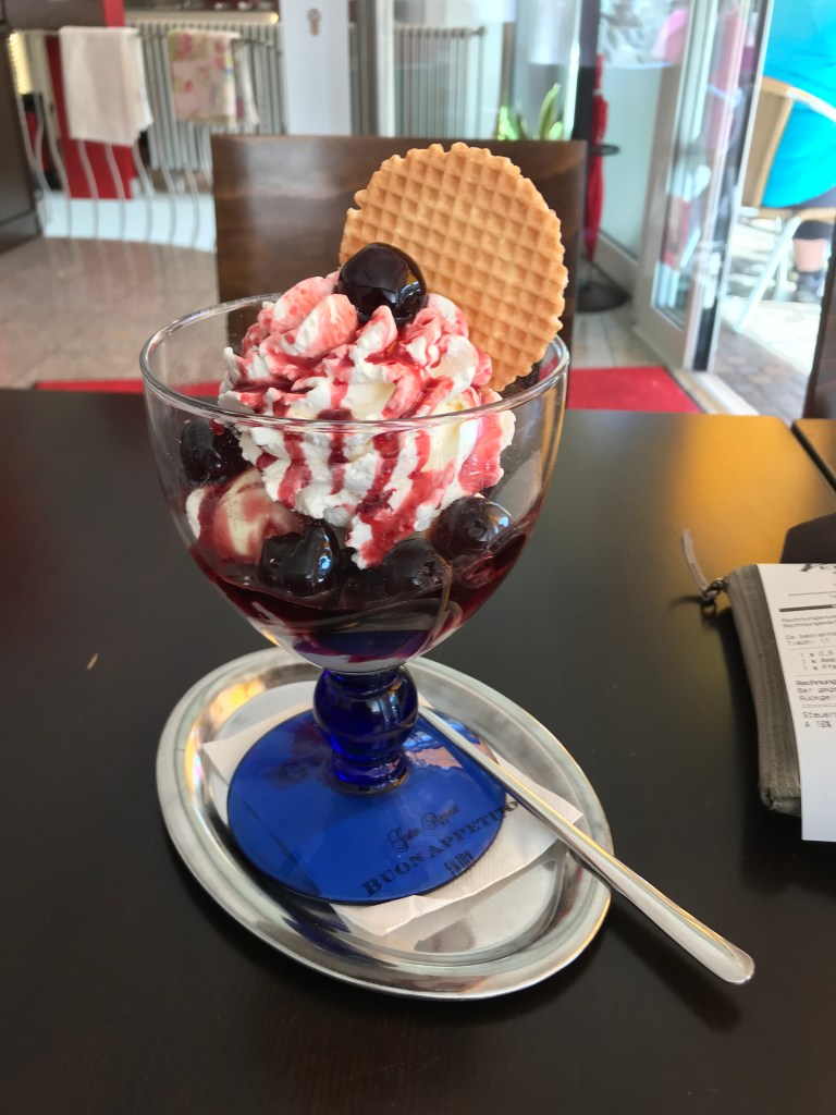
I finally made it down to the valley and headed into Hausach to find some food. There was not a lot open, but I found a great Italian ice-cream parlour that did the trick.
It was a 1.5-km hike from the centre of Hausach to my hotel in the neighbouring village of Gutach, the Hirsch, a beautiful old place with a separate modern wing where my huge room was. I arrived at around 3:30 pm and spent the time until dinner relaxing on my balcony and calling home. For once, I had nothing to hang up to dry! There was a spattering of rain around 6 pm but it soon cleared up and the forecast for the next day was cloudy but dry. Would I actually get two days in a row without a drop of rain?
To be continued…
