And so, one year on, I come to my final day on the Moselsteig. Again, this will be a fairly easy hike with a distance of around 15 kilometres to cover to the point where the Moselle meets the Rhine, just over 200 metres to climb and one very flat final section along the riverbank into Koblenz.
The hotel was very quiet and peaceful during the night and I didn’t see or hear any other guests, but the breakfast room is surprisingly packed when I go down at around 8:30. Still, there’s plenty of food with the staff regularly replenishing the buffet.
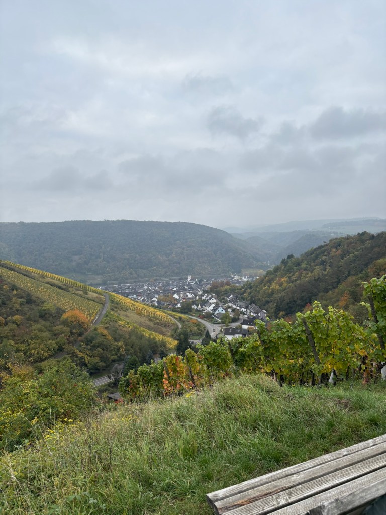
I set off just after 9 o’clock, beginning the day with a steep but pleasant climb up out of Winningen through the vineyards. It’s cloudy again, but there is no rain forecast and it’s not too chilly.
On reaching the higher ground, the trail levels off, weaving between farmland and the woods, with an occasional view back over Winningen below.
A little further on, the trail descends slightly to the valley. Just before crossing the road, there’s a spring, a rarity on this trail. And, even rarer, it doesn’t have a “Kein Trinkwasser” (No Drinking Water) sign on it. It’s surprising how tough it is to find springs or fountains with water you can drink in Germany. There are fountains in every village and town, but 99.9% of the time, they have a sign saying the water can’t be drunk. I carry a Steripen with me but I’m always wary of using it without further information. Is the water undrinkable because it hasn’t been treated (which the Steripen can deal with) or because it contains metals like lead that the Steripen could do nothing about. As I always fill my water pouch before setting off, today’s spring is not needed. But thinking back over the years and my hikes in Germany, fountains and springs with drinking water have always been a rarity, except in the Alps. Weird…
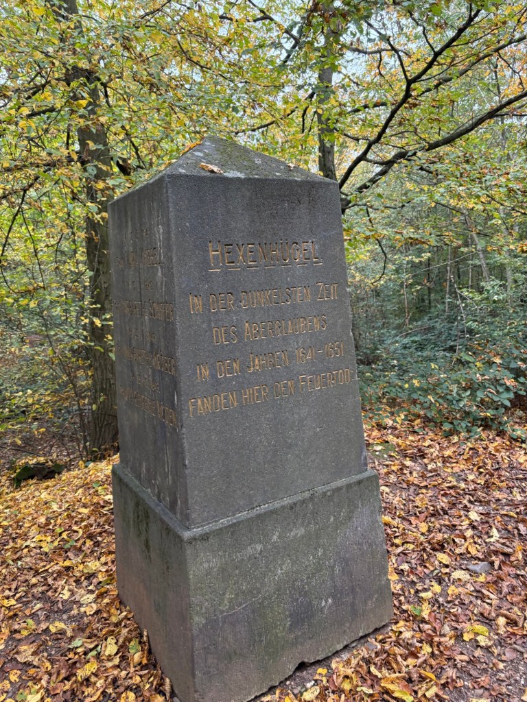
After crossing the road, the trail heads gently uphill again, towards the Winingen-Koblenz “airport” (more like an airfield). Just before following the side of the runway, the trail passes a monument to the witches of Winningen. As I mentioned yesterday, the village has a statue of a witch on the main square, albeit a very “Halloween” image of one, complete with broomstick and pointy hat, which whitewashes the horrific events that happened here. The monument names a total of 21 people, women and men, who were executed on this very spot between 1641 and 1651 for witchcraft. Mark Baines, a fellow hiker who passed here a few days ago, has sent me a link to an excellent web article that explains the whole story, told by a descendant of one of the witches. As with the execution site I came across on the Black Forest Ostweg in Calw a few years ago, this one is some way out of the village and on top of a hill, meaning the condemned had to be dragged up here for their punishment (and, possibly, to keep the village free of their supposed “maleficence”). It’s a chilling spot, despite being set in the heart of these beautiful woods, and I can’t help thinking of the poor souls who perished here through the sheer ignorance and jealousy of their peers.
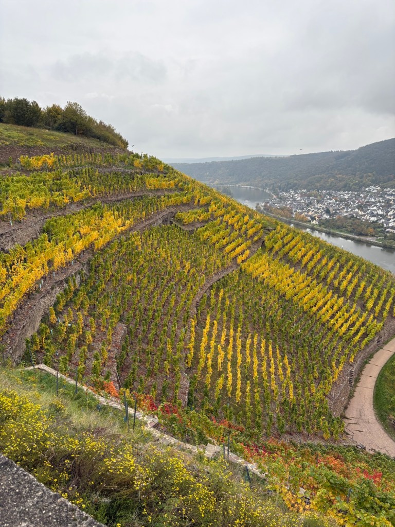
After a few hundred more metres in the woods, the trail enters the vineyards for the last time and begins a gentle descent to Güls where I shall cross to the right bank of the Moselle for the last time before beginning the long slog along the river to the Deutsche Eck in Koblenz where the Moselle flows into the Rhine.
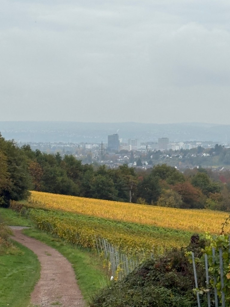
As the trail approaches the river, I have the first, rather uninspiring views of Koblenz in the distance. I’m not at all keen to return to such an urban environment after the last five days.
The vineyards and orchards then give way to the first houses on the outskirts of Güls. Shortly after, the trail reaches the Moselle and then follows it for the remaining six or seven kilometres.
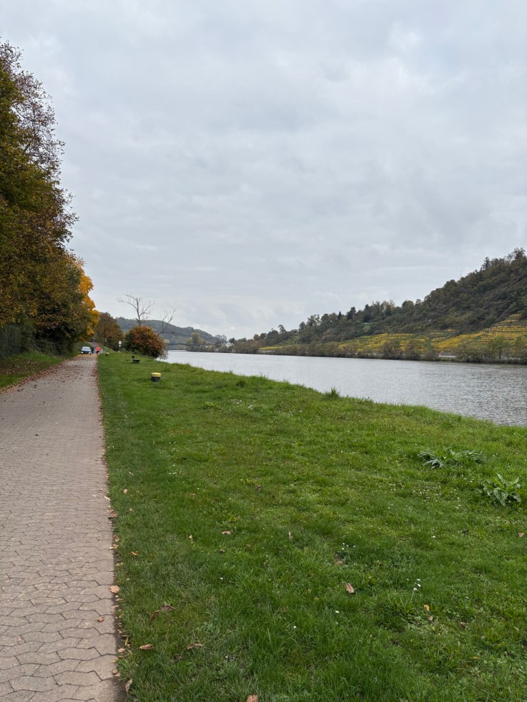
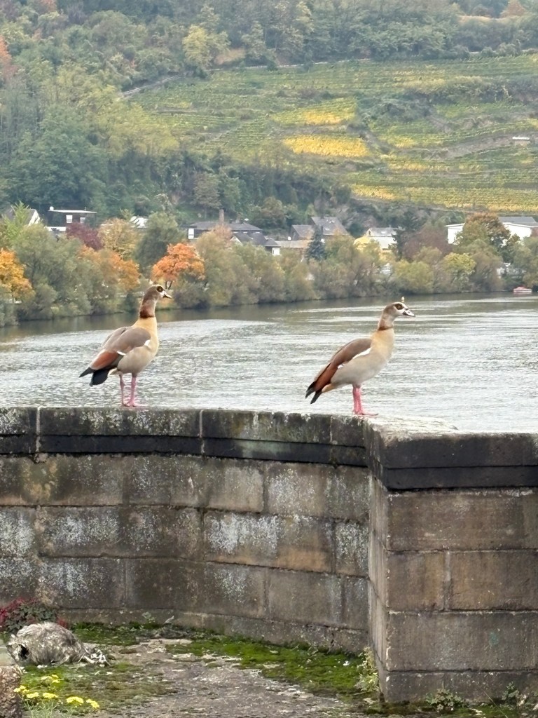
In the centre of Güls, the trail crosses the Moselle for the last time, on a pedestrian walkway at the side of the railway bridge that I shall be travelling back over tomorrow on my journey home. There are two magnificent Egyptian geese perched on a parapet. The first ones I saw were at the end of my first day on the Moselsteig a year ago so it seems fitting that this couple should show up today.
There really isn’t a lot to say about this final section from the railway bridge to the Deutsche Eck. It’s just a long, flat trail along the river through an urban setting. There are some beautiful houses along the river at first and plenty of trees but, as I approach the centre of Koblenz, everything becomes modern and charmless, the result of bombing during WWII and the subsequent rapid rebuilding. There are a few old churches and buildings in the city centre but it’s definitely not Germany’s prettiest town.
After passing a hydroelectric power station with a handy fish ladder at the side for migrating salmon and a couple of other bridges, I finally arrive at the Deutsche Eck, the end of the Moselsteig. It’s a fairly spectacular spot, with the Moselle flowing into the the mighty Rhine on its journey to the North Sea and the Ehrenbreitstein fortress high above the city on the opposite bank, connected to it by cable-car.
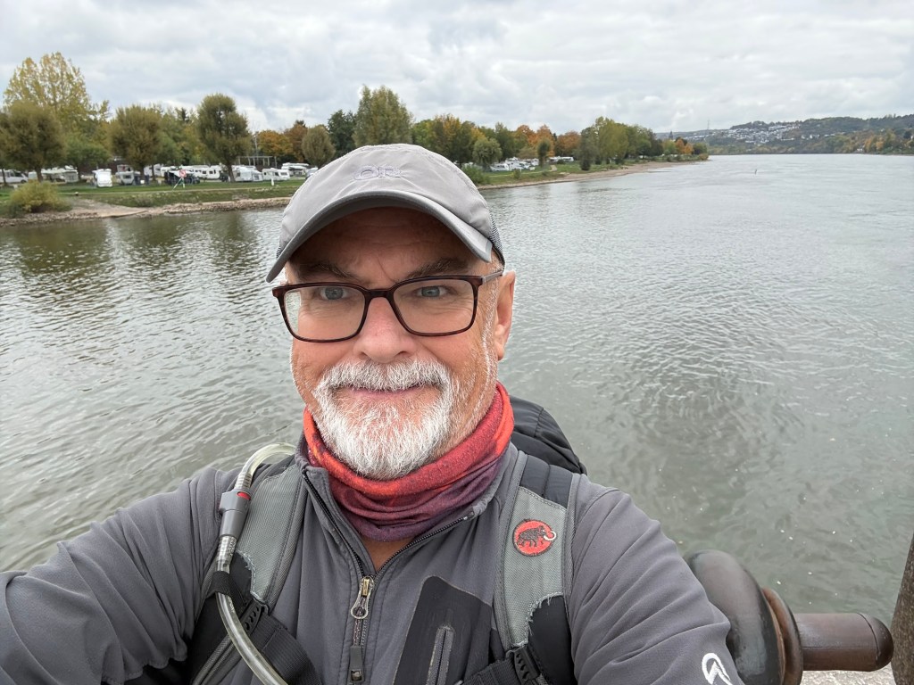
In the last five days, I’ve hiked 102 km, with a total of 2,700 m in ascents. Combined with last year’s 336 km over 16 days and 7,710 m in ascents before my calf muscle gave out, that makes a total of 438 km and 10,410 m in positive elevation on one of the most satisfying and delighful trails that I’ve hiked so far in Germany. Can’t wait for the next one…

Thank you for your Winningen ways 😉
I look guard to future instalments.
LikeLike