After my lazy day between Guadalviar and Griegos, this would be another long hike. I had taken a look at Komoot and found an alternative route along another GR hiking trail that would have taken me to Tramacastilla in around 20 km, but that would mean missing out on what promised to be a rather spectacular section just before Calomarde. So I decided to follow my official route, with the idea of perhaps altering it slightly after Calomarde to reduce the amount of ascents.
It was a cold and misty morning in Giegos with the temperature hovering at around 5 degrees at 8:30, meaning I prepared for the day with three layers of clothing for once. Breakfast at the hotel was simple but tasty and, after paying a very reasonable price for everything I had consumed there, I said goodbye to the friendly owner and set off into the chilly morning.
The sun was already breaking through the mist and clouds when I passed through the gate to the “dehesa” to go back over the path I had covered the previous day as far as the Fuente Coveta picnic area.
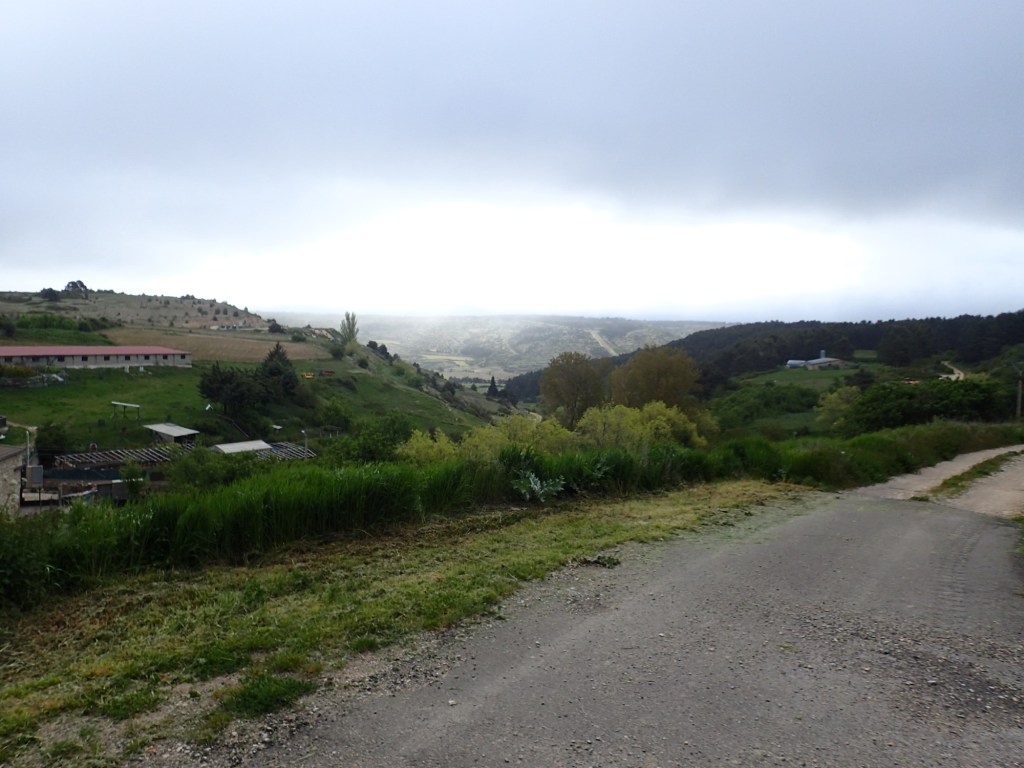
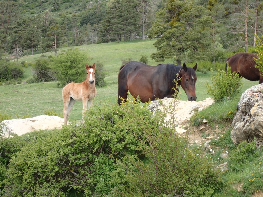
There were a lot more animals on or near the trail today. I had seen them from afar the previous day, above or below the trail. But now the horses (with foals) and cows (with calfs) were much closer. Some of them seemed particularly intrigued by my presence as they grazed.

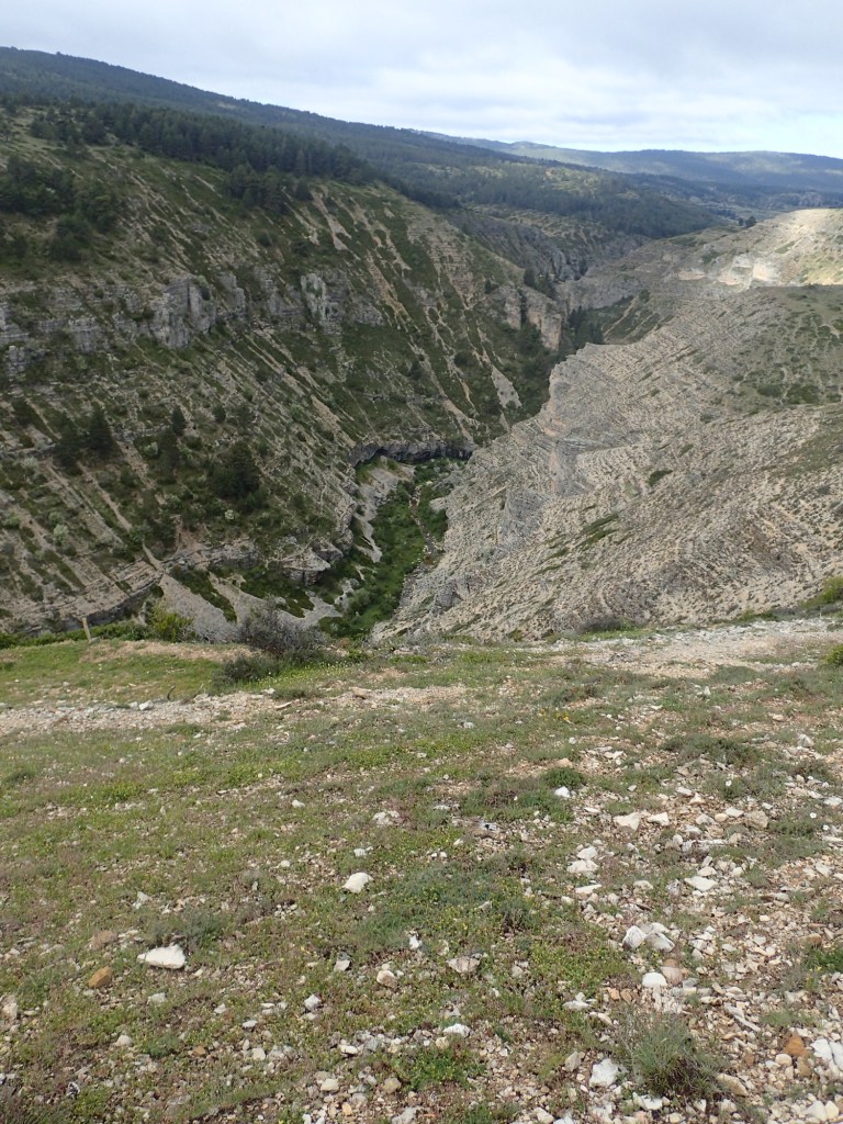
The trail led downhill past the picnic area and, shortly after, I passed through another gate, meaning I had left the “dehesa”. The trail joined the road near a small chapel dating from the 15th century and a tiny fold packed with sheep. After around 200 metres along the road, the trail veered off to the left and began to head uphill over some rather barren land towards an electricity pylon on a small peak. On reaching the top, a spectacular sight awaited me: the Guadalviar gorge, a sort of canyon below the village where I had slept two nights earlier. The photos I took unfortunately don’t do it justice, but it was a stunning spot. There were eagles gliding above the gorge below me and the trail stuck closely to the edge, a little too close for comfort at times.
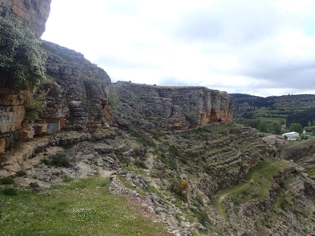
Then, on rounding a rocky outcrop, I discovered the village of Villar del Cobo below. The trail would lead me there, but it was hard to make it out on the side of the canyon.

In fact, the trail turned out to be pretty easy to follow, once I found it. The initial part was tricky to negotiate among the rocks and stones, but once I was on it, it descended to the village in a series of hairpin bends without any further problems.
From Villar del Cobo, the trail followed the Guadalviar river for a couple of kilometres. The trail stuck close to the water but was tricky to follow through the tall and very damp grass. After a while, I decided I’d be better off taking the road that ran alongside the river. That turned out to be a good idea as there was very little traffic on the road and there was one point where it would have been impossible to follow the trail along the river because of a landslide.
I left the road after about 200 metres and crossed a bridge over the river to head up a side valley where the stony trail climbed uphill to reach a dirt track that was much easier to walk on.
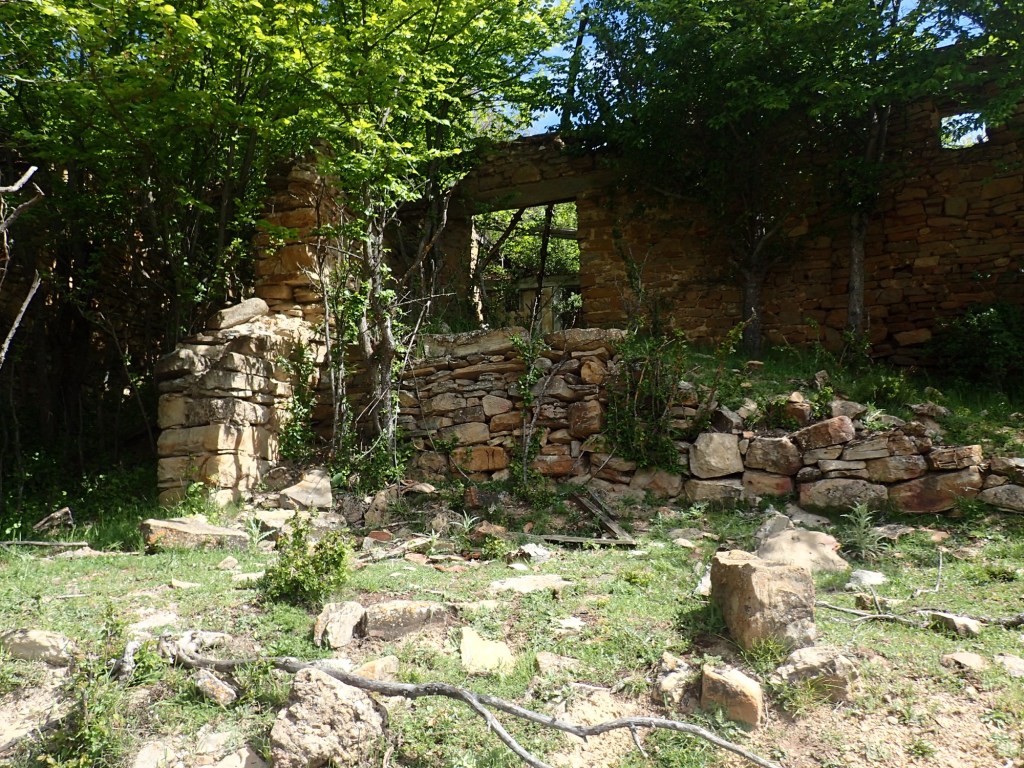
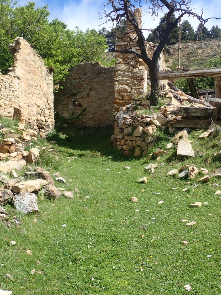
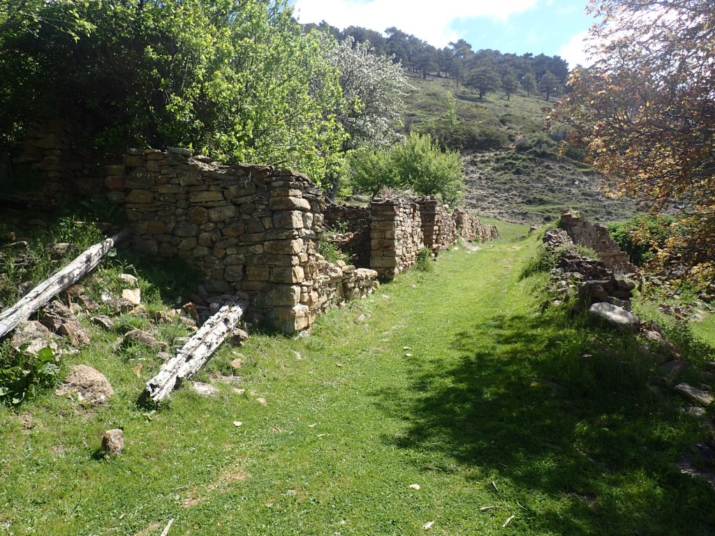
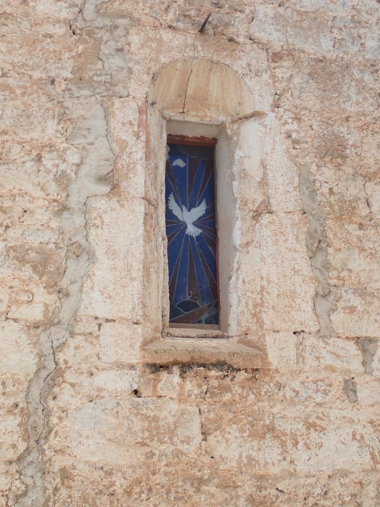
The dirt track continued to climb gently and, after a couple of kilometres, led me to the abandoned village of Las Casas de Frias. This was a particularly striking spot, a whole village of ruined houses on a sunny and green expanse of land high above the valley. The only building still totally intact was the small chapel that was clearly well maintained. At first I thought the village must have been abandoned a century before, but then I spotted a disused electricity substation, showing that it had been hooked up to the grid at some point and couldn’t have been abandoned that long ago. I later found a very interesting article online that told the story of the place. The younger poeple had begun to abandon the village in the 60s and 70s because of the lack of general services (they had to go to Villar del Cobo to get mail, the local doctor rarely visited and food supplies were done on a barter system). The final inhabitant, Sebastián Soriano García, died in 1984 after a fatal accident with one of the electricity cables. Since then, with the exception of the chapel, the whole village has become a ruin. It was very moving to be in such a place and try to imagine the lives people had led there.

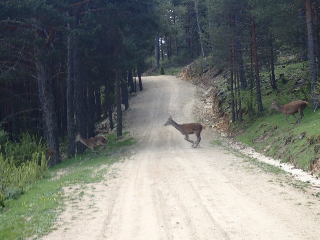
From the abandoned village, the trail headed downhill to the bottom of the valley where it entered a beautiful pine forest and followed a forestry trail through it. I had seen quite a few deer on previous days, either lone ones or up to three at a time. But, all of a sudden, in this section of forest, a herd of around twenty came racing down the hill and across the track ahead of me. There were so many, I was actually able to grab a photo of them for once.
The trail continued through the forest, passing a large pond where frogs were singing as if their lives depended on it. This was a particularly beautiful section of forest, calm and shady on this sunny day. Once again, apart from the deer, there was no one else around, despite evidence of a little logging activity further along and a car park with information boards and picnic tables around a rather spectacular and ancient tree.
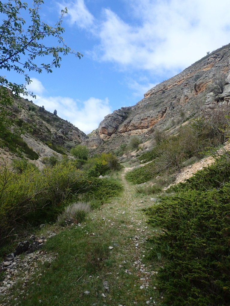
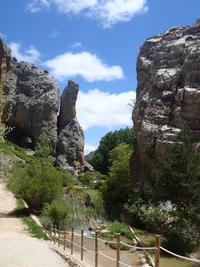
After a lengthy and gentle descent through the woods, at a small, round forestry hut, the track veered off to the left and continued through a blend of woods and agricultural land to a ruined mill that marked the start of the trail through the Barranco de la Hoz, a gorge that would lead me to Calomarde.
This was the only section of the trail where I saw other people. Not all of them were hikers as most were just doing the 4 or 5 km trail through the gorge and they didn’t all have the right gear. But it was a change to actually see other people and stop to chat from time to time.
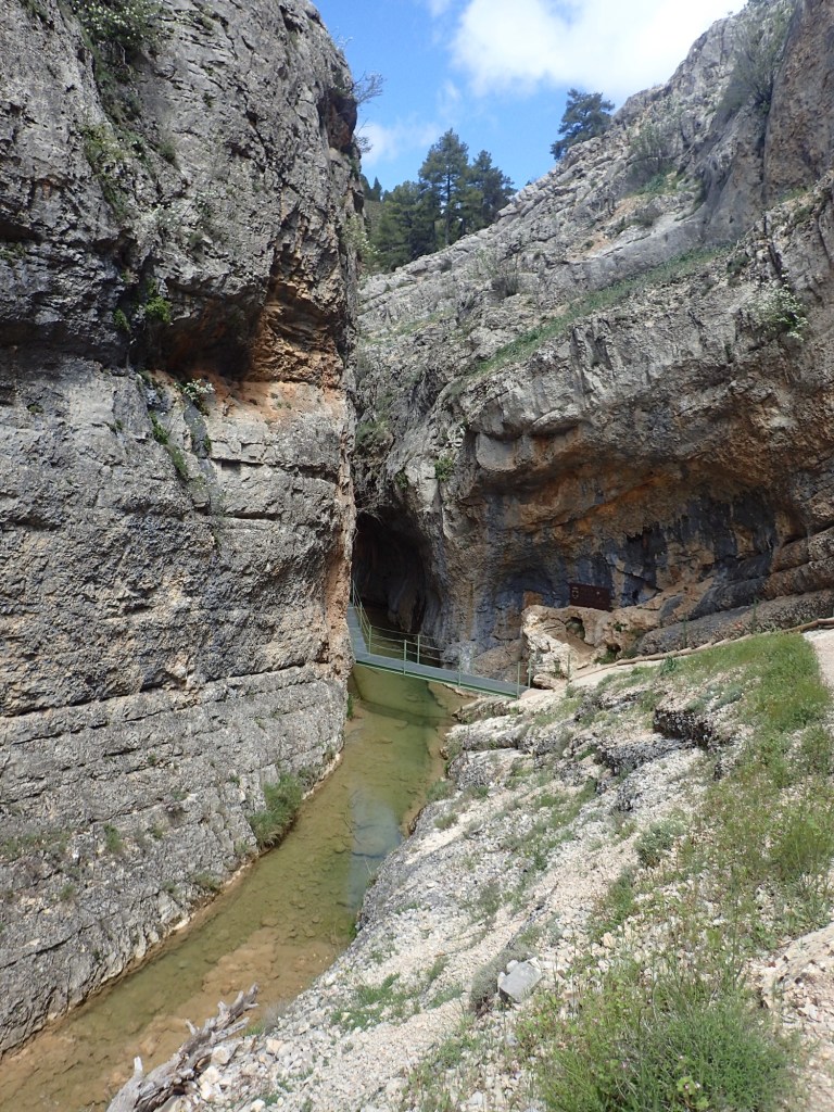
And it was a spectacular section of the trail, with the path closely following the babbling river as the rock walls on either side slowly closed in.
Unfortunately, it was also the scene of a rather undignified accident when I lost my balance on a rocky section with steps that were a little too high for my stumpy legs. On falling back, I somehow landed with the full weight of my body, plus the 10 to 12 kilos of my pack, on one of my hiking poles. I was carrying a pair of the light, foldable carbon ones and I now know that such poles are not resistant to heavy weights falling on them! The lower third of the pole split open, the internal spring came flying out and I ended up sprawled over the rocks. Fortunately, there was no one else around to witness this humiliating incident. Apart from a painful blow to my elbow, the only real damage done was to the hiking pole that was now useless and, of course, to my pride.
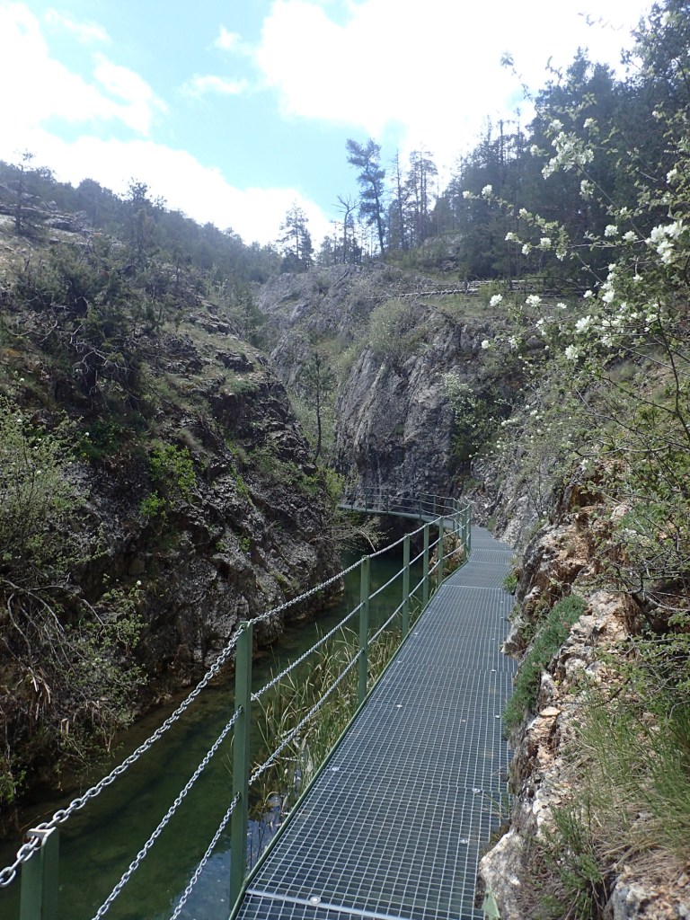
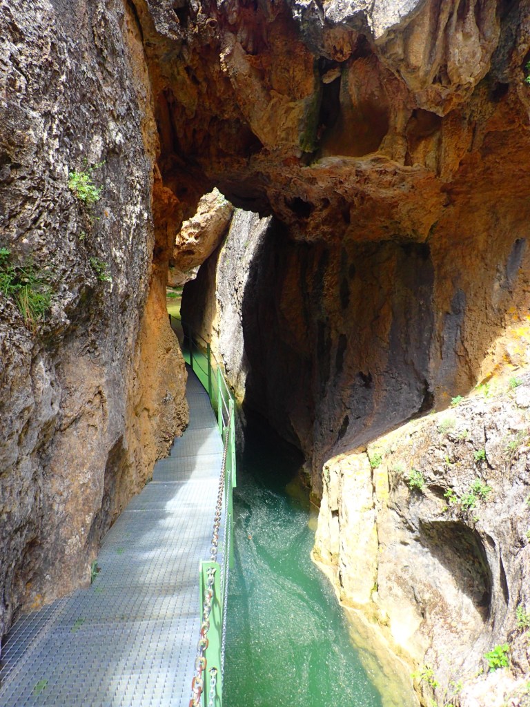
After pulling myself together, I set off again, the broken pole in one hand and the undamaged one in the other, quickly realizing that two poles are much better on uneven terrain! However, this was not too big a problem as, shortly after, the gorge became even narrower and the trail followed walkways along the rock face above the river. This was a wonderful and well-maintained section of trail, with the walkways ascending and descending over the rocky terrain and even passing under a natural bridge of rock at one point.
On emerging from the gorges, the trail widened for the final approach to Calomarde. Here, the path was much smoother and had clearly been designed with tourists in mind as there were rest benches, information boards and even streetlamps along the last 200 metres before the village. It was clearly a local attraction with some rather spectacular rock formations.
By this time, it was around 2 pm, the perfect time for lunch in Spain, and Calomarde (a charming little place with a pretty church) provided me with just what I needed in the shape of a great little restaurant where I had a very good and tasty meal. As I ate, I considered the path to take from there. My original trail to Tramacastilla was around 10 km with 300 metres of positive elevation. It also looked as if it would be fairly rocky at times. However, Komoot came up with an alternative: 7 km with just a 200-metre climb, a gentle ascent to a pass and then an equally gentle descent on the other side. As the first option would have meant doing over 30 km again, I went for the second (and ended up doing over 30 km anyway as my hotel was some way out of Tramacastilla!)
After dumping my broken pole in a bin, I followed the main road out of the village before turning left and heading uphill. As it would only take a couple of hours to complete this final section, I decided to stop for a nap to digest lunch and dry out my gear after a slight water bottle leak. An hour or so’s rest in the shade of a tree set me up beautifully for the last 6 km and the climb to the pass was relatively easy once I picked up a stick of wood to replace the lost hiking pole. I had definitely chosen the right option!

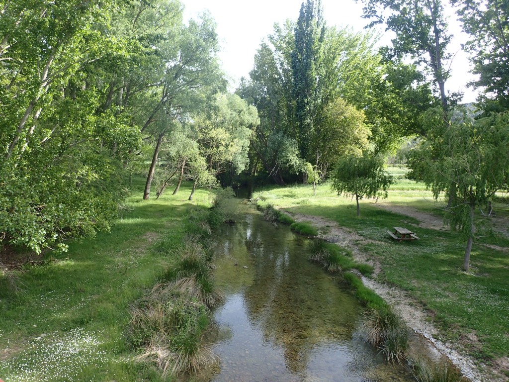
From the pass, the trail headed gently downhill. The last 3 kilometres were magnificent as the trail entered the Tramacastilla valley where farming was clearly still a major activity and irrigation was definitely not a problem. Streams flowed from all sides, a pleasant breeze was blowing, the sky was blue and the fields were a vibrant green. In fact, I hadn’t seen so many shades of green since a trip to Bali in the 1990s. This was a stunningly beautiful and peaceful spot, with the silence broken only by the sound of rushing water, the wind in the trees and someone chopping wood on the far side of the valley. A wonderful conclusion to the day’s hiking.
Tramacastilla was another pretty place, with a beautiful church and a welcome fountain with cool, fresh water on the main square. It seemed a livelier place than other villages, with a couple of hotels and a bar.

From the centre of the village, I set off along the road to Albarracin, before veering off near an old chapel to walk through fields of poppies to reach my hotel, the Hospederia El Batan, after a total of 31 kilometres. This was the most expensive hotel of the trail, with a Michelin-starred restaurant attached. I hadn’t been able to find anywhere else in the area as most places required a minimum stay of two nights. And a very fancy place it was too, with a friendly owner and a very comfortable, spacious room with a balcony. I didn’t eat in the Michelin-starred restaurant, which would have made a serious dent in the budget, but in the hotel’s “tourist-class” restaurant, which was still pretty expensive. The food was incredibly good and inventive, and the owner recommended an excellent local red wine, but I was a long way from my previous menus del dia at 15 euros, with three courses, wine, water and bread included. Still, the meal provided the perfect end to a great day.

“reduce the amount of ascents”?! Are you going soft in your old age? 🤣
LikeLike
No, but it was a tough trail with some long days. And the terrain was horrific at times.
LikeLiked by 1 person
Yes, it looked really tough – enough to make you tumble, which must have given you pause.
LikeLike
True. The next hikes will be with the missus.
LikeLiked by 1 person
Sorry to hear about your fall! Sounded kinda nasty but again you escaped serious injury. The photo from the top of the gorge made me think I wouldn’t trust myself to make the descent, but then I was reassured by the photos from below. Thanks for the great report!
LikeLike