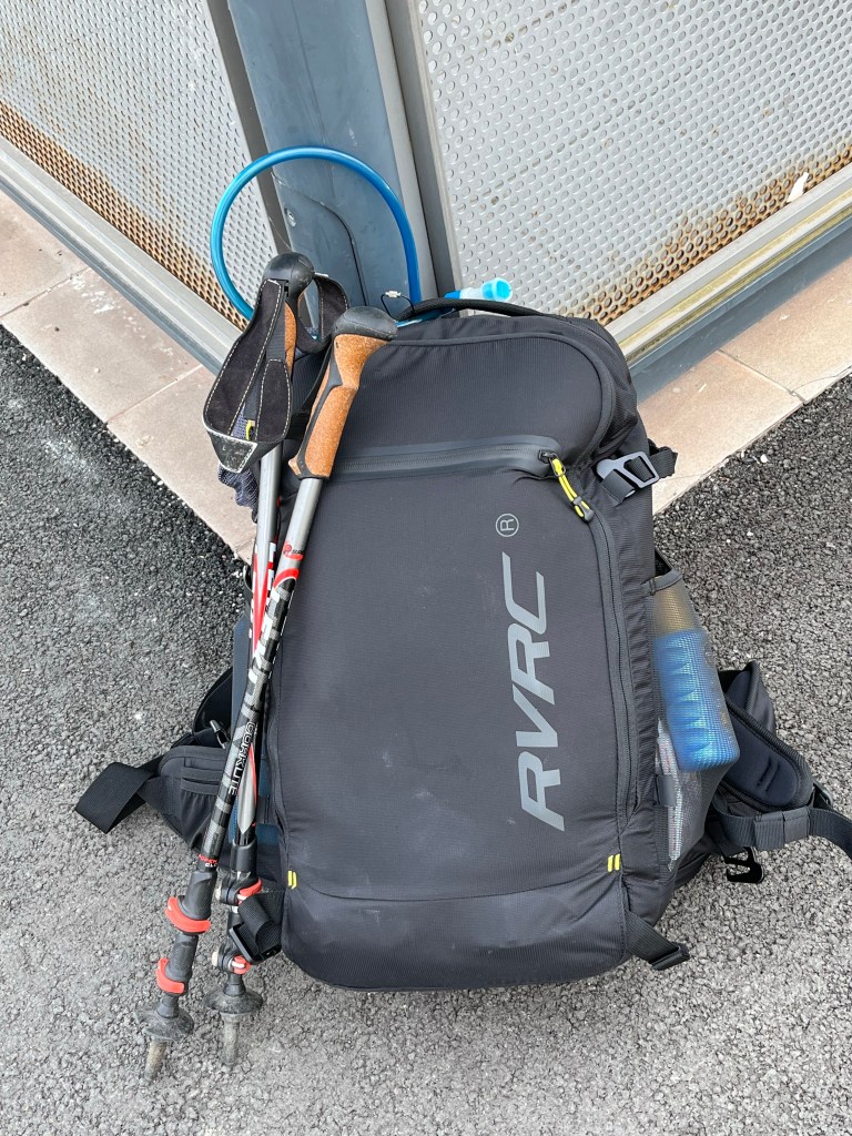
On May 19th, 2022, after completing my annual marathon of work for the Cannes Film Festival that had opened a few days earlier, I took a train from Paris to Pforzheim via Karlsruhe to hike the Ostweg, the third north-south Black Forest trail, after the Westweg in September 2019 and the Mittelweg in September 2020. Rather than the autumn hues and mists of my two previous hikes, this one would unfold amid the vibrant greenery and lively birdsong of spring. And, quite frankly, that was not a bad thing.
After a good night’s sleep in Pforzheim, I was rested and ready for an early start at 7 AM to tackle the 25 kilometres or so to Bad Liebenzell before the heat kicked in (the forecast was for almost 30° C that afternoon). There were very few people around at that early hour as I made my way through the large park south of the town centre, following the familiar route to the Kupferhammer, the starting point for the three trails, where I turned left this time rather than right as I had done on my two previous trips.

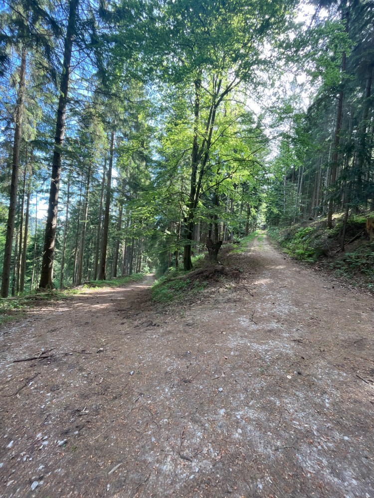
As soon as I set off along the trail to Bad Liebenzell, I found myself in the woods. Unlike the other two trails that involved a lot of climbing from the very beginning, the Ostweg began by following the Würm valley with just 400 metres to climb over the 25 kilometres of the first stage. On this first section, the sound of a busy main road on the other side of the valley was a nuisance at times, but I was nonetheless able to enjoy the mass of lively birdsong that filled the air in the woods.
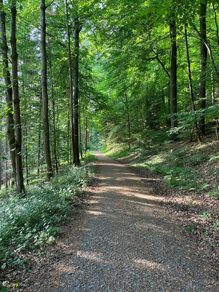
The walking was very easy and the temperature reasonable for the first few hours. I had seen the day’s hike rated as difficult on a website, but that was a huge exaggeration as the trail mostly followed wide forest tracks that were very easy on the feet.
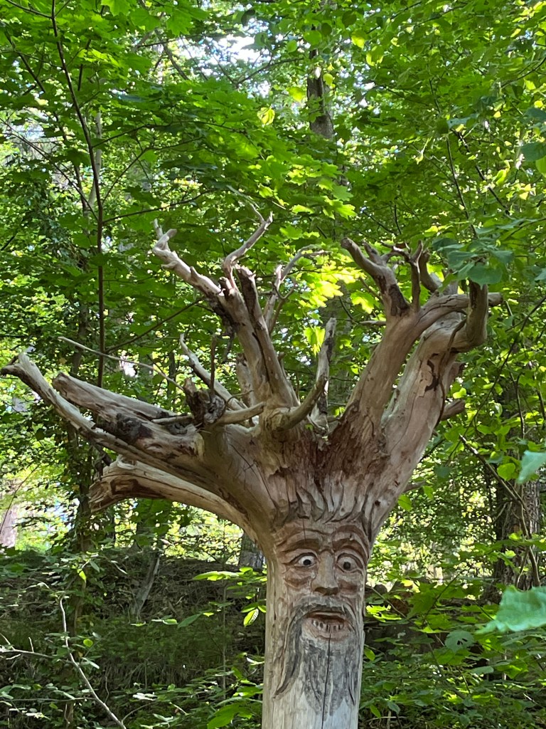
I took my first break after around two hours at the ruins of the Liebeneck castle. Unfortunately, it was impossible to have a look around the ruins as they were shrouded in scaffolding for a lengthy restoration project. However, there was a pleasant picnic area to rest at, along with a few sculptures of Black Forest spirits that were comical in the sunny spring weather but would no doubt have been quite eerie in the mists and damp of autumn.
From the ruins, the trail headed steeply downhill to the valley floor to cross the Würm before ascending again.
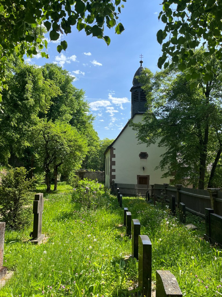
The climb took me up to the Steinegg castle which was in much better condition, but also impossible to look around as it belonged to some kind of religious youth group and was not open to visitors. Just next to it, in the heart of the woods, there was a pretty little chapel with a peaceful cemetery. Such chapels, in out of the way places, would be a constant feature along the trail and were always a pleasant find.
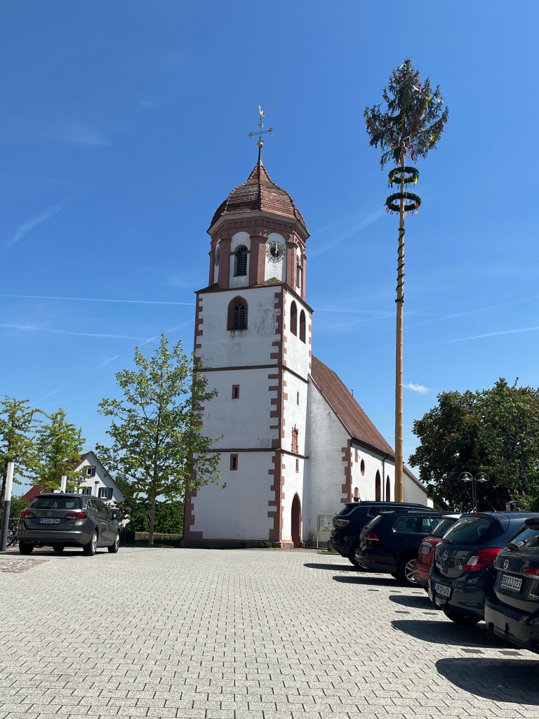
From the castle, the trail left the woods for the open fields before following a main road (on a track to the side of it) all the way to the relatively large village of Neuhausen, passing yet another country chapel. The sun was beating down but a welcome breeze took the edge off the heat.
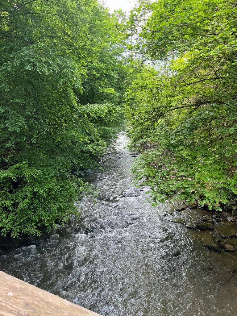
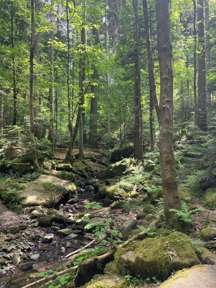
After crossing Neuhausen (and its small industrial estate), the trail descended into the shady woods of the Monbach valley. The going was tougher here as there were a lot of rocks and roots across the path, but the shady forest was particularly beautiful and a relief after the sun-baked open fields earlier.
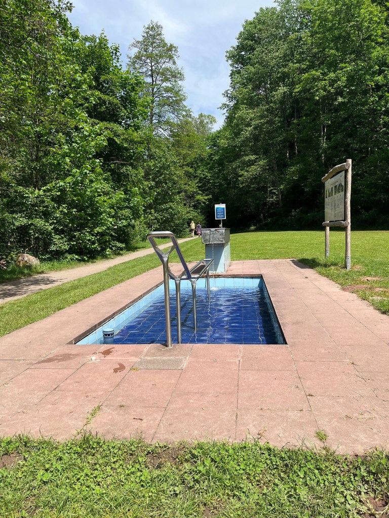
At one point, I stopped to give my feet a soak in the river to cool them down but then, shortly after, I found a wonderful Kneipp set-up (foot and arm bath) in a park on the outskirts of Bad Liebenzell. So my feet got another dip!
After a good soak in the ice-cold water, I set off refreshed for the last couple of kilometres into Bad Liebenzell itself. The heat was pretty intense by now and that made the going a little tough. Thankfully, the path was flat and well-shaded all the way into the town, running alongside a new river, the Nagold.
I arrived fairly early and spotted an ice-cream parlour on the square just opposite the hotel, so I treated myself to an amarena sundae to cool off while waiting for check-in time.
The hotel was comfortable, with a friendly owner who offered me a welcome drink before giving me a few recommendations for dinner. I ended up eating in a great Italian place up a hill across the river where the vitello tonnato and pasta with asparagus were exceptional.
Fortunately, the heat eased off during the night and I slept pretty soundly after hiking 28 km (plus three more to dinner and back). Not bad for the first day!
Fortunately, the second day was much easier with just over 18 kilometres to cover. There were a few steep climbs, but the temperature was a little lower and, once again, a lot of the walking was in the woods, with a plenty of shady rest stops.
After a tasty and well-presented breakfast, I set off along the Nagold through Bad Liebenzell, heading through the very peaceful and green Kurpark before crossing the river and starting a steady climb through beautiful woods, accompanied yet again by endless birdsong. I stopped a number of times to identify the different birds (blackcaps;, song thrushes, wrens, common firecrests, robins, goldcrests, chaffinches, etc.) with the excellent BirdNet app on my phone.

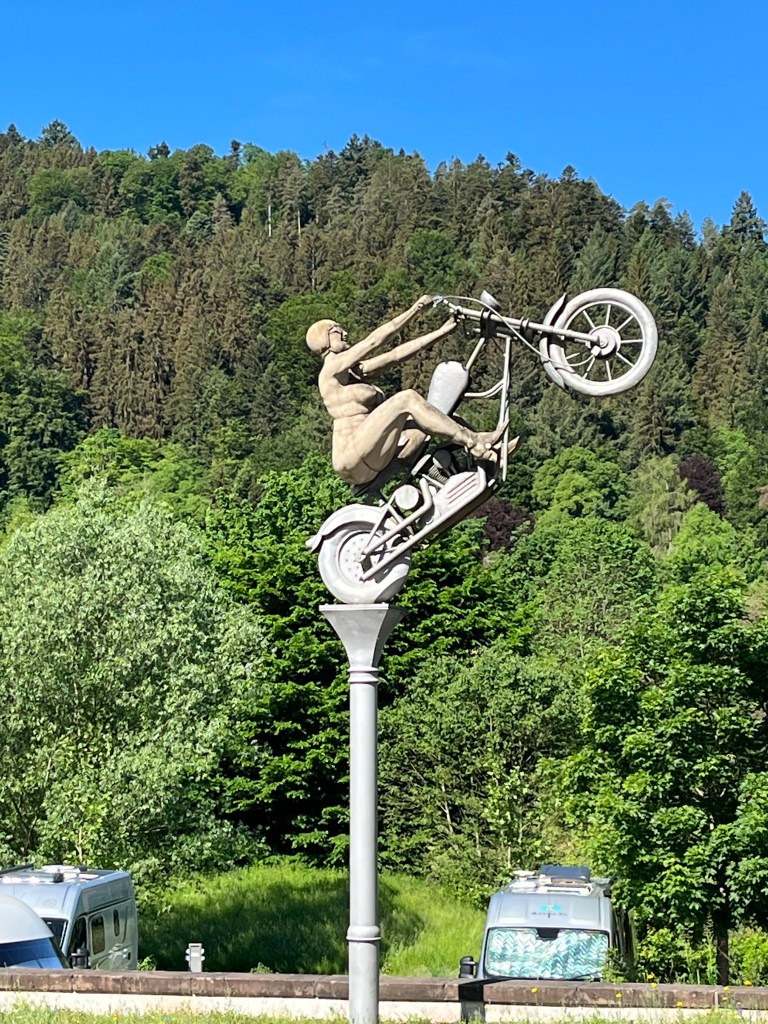
The trail continued on forest tracks and narrower paths above the Nagold valley before descending to Hirsau where there was a very odd statue of a naked lady on a motorbike next to a mediaeval-looking one of a monk holding a group of what seemed to be children and another of a knight. I couldn’t find a sign on site explaining what these statues were, but a Google search that evening told me that the monk was Wilhelm von Hirsau, abbot at Hirsau Monastery in the 11th century, the knight was Ezéchiel de Mas who set fire to the monastery in 1689, and the naked biker was a “rocker chick” driving away from the town and its history, all three by Peter Lenk.
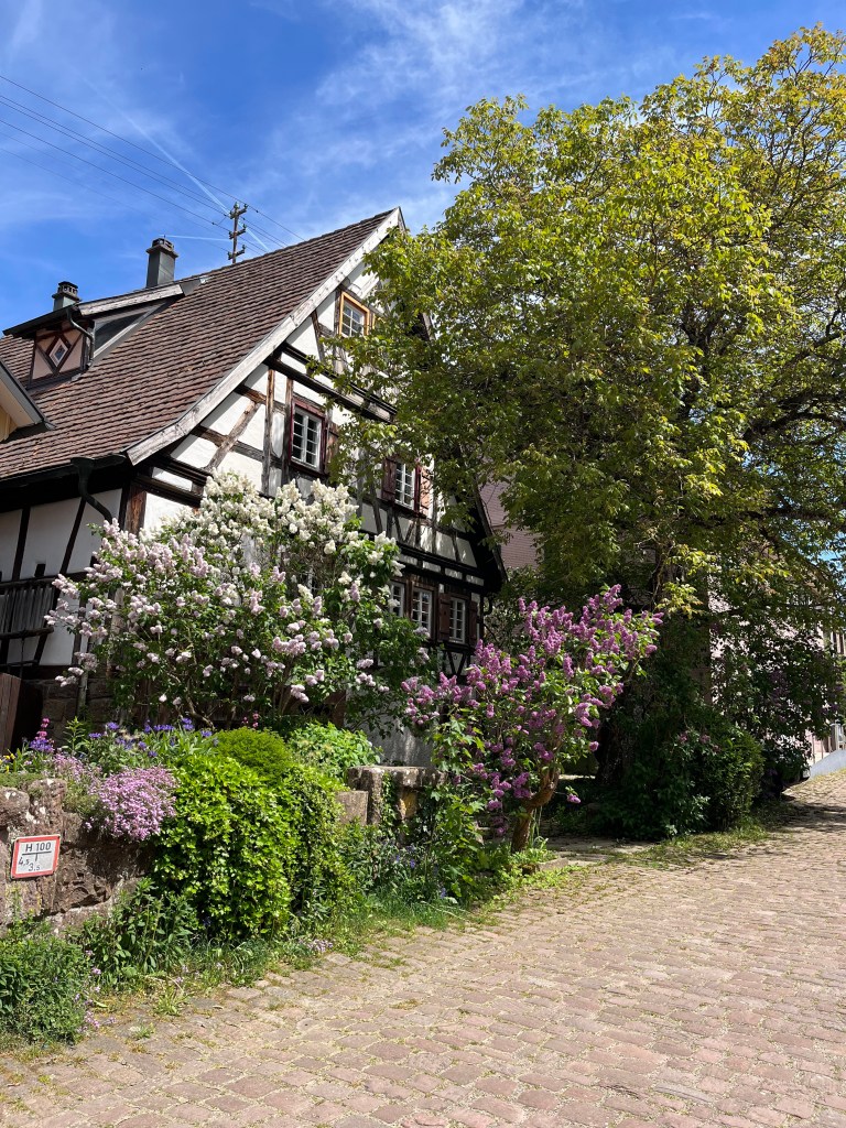
I lost the trail for a minute or two, but soon got back onto it, crossed the river and headed uphill again, passing the abbey ruins, for a couple of kilometres in the woods before descending to the valley again just outside the pretty town of Calw, birthplace of Hermann Hesse. It was a handsome place with no end of half-timbered buildings and I made my first stop there for a coffee (having already covered 10 km) before wandering around the lively Saturday market.

The climb up out of Calw along the Hermann Hesse trail was tough and steep. I don’t know if old Hermann often took this path but, if he did, he must have been in pretty good shape. There were signs all along explaining various things, but they were in German and too complex for me to understand.
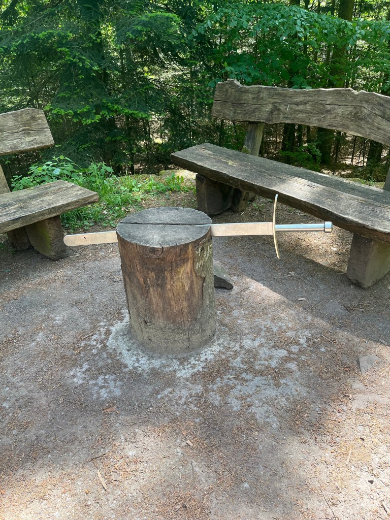
After reaching a stone platform with a great view back over the valley, the trail headed into the woods and led to a spot where a sword was lodged in a tree stump. Rather than some weird reference to King Arthur and the sword in the stone, this turned out to mark the site of the executioner’s block where people were beheaded in mediaeval times! I’ve no idea why they were dragged up the steep climb from the valley to be executed here, but it was further proof of the dark past of the Black Forest that I had seen on my two previous hikes across the area.
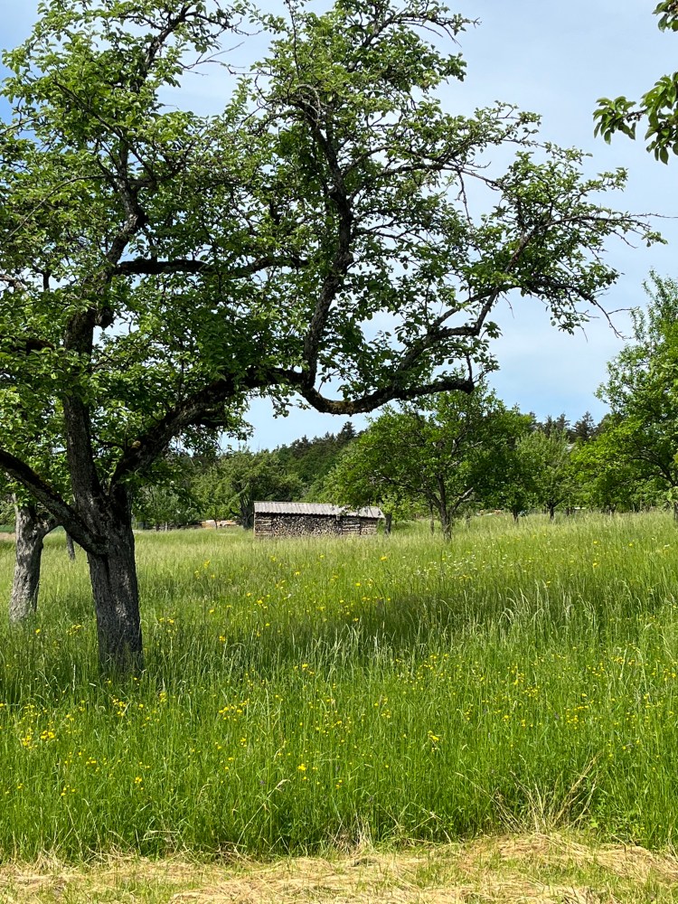
From there, I carried on through the woods before emerging into the open to cross a beautiful area of orchards, meadows and old farms. There was very little shade on this section and I was glad to reach the pretty village of Zavelstein where I stopped at a friendly café for some cake and a pot of tea.
After this final break, there wasn’t a great distance left to cover. After heading down the peaceful (and car-free) main street to the castle, I left Zavelstein behind and began the steep descent to Bad Teinach. I arrived at 3 PM and spent the rest of the afternoon basking in the sun on the huge terrace of my simple room before going for a hearty dinner just along the street to set me up for my third day on the trail.
A third day that would be one of the longest on the trail with over 30 km to cover as I had not been able to find accommodation at the official end of the second day and so had spent the night in Bad Teinach, over 5 km away. Moreover, I wasn’t able to make an early start as it was Sunday and breakfast at the hotel didn’t begin until 9 AM. I ate quickly (but without overdoing it as I knew the day would begin with a climb) and set off at 9:20. The weather was good and, despite the distance to cover, I felt pretty positive about the day ahead.
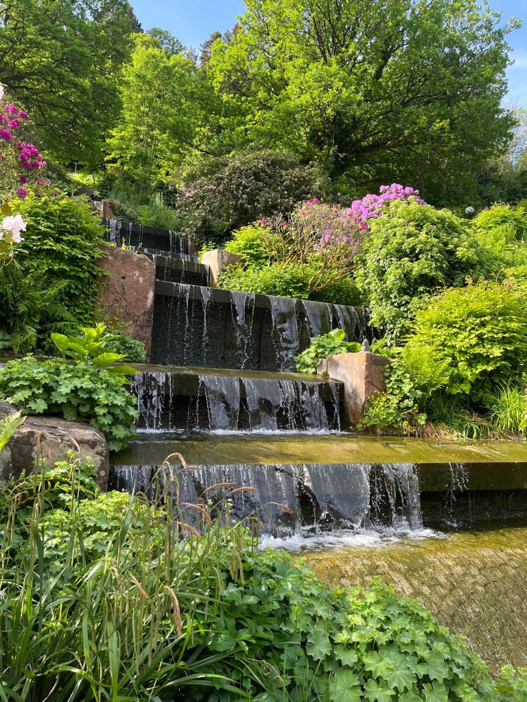
On my way out of Bad Teinach, I discovered a huge network of spa installations that I hadn’t seen the previous day as they were at the other end of the town from my hotel. They looked very luxurious and were surrounded by a beautiful kurpark with a waterfall.
The trail passed the swimming pool and its patio where the hotel guests were in the middle of breakfast, then began the climb up out of the valley through thick woods. It was another sunny and peaceful morning, with birdsong filling the air again.
After about 2 km, I emerged from the woods into a vast expanse of rolling farmland with pretty old barns and green orchards. There were a few people about, making the most of this sunny Sunday. The walking was easy and pleasant and I was able to stick to a pace of just over 4 km an hour.
After Oberhaugstett, a quiet village that was the official end of day 2, the walking remained easy and took me through beautiful countryside. I was really appreciating the difference with autumn. That season is atmospheric and beautiful, but the sheer vibrancy of spring, with all the greenery around, was working its charm on me.
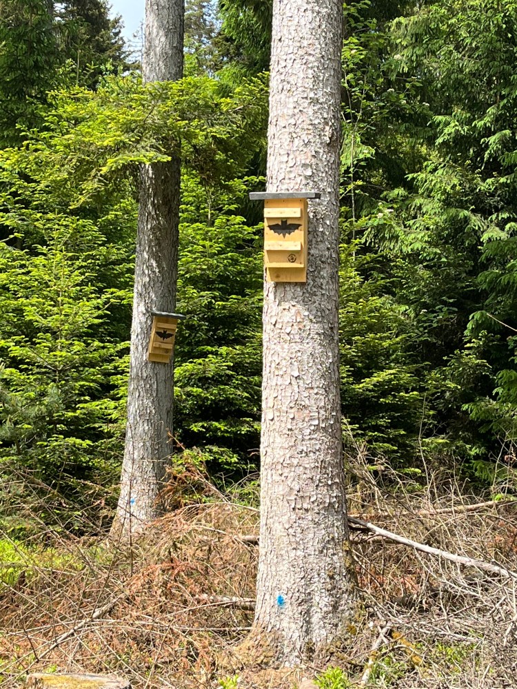
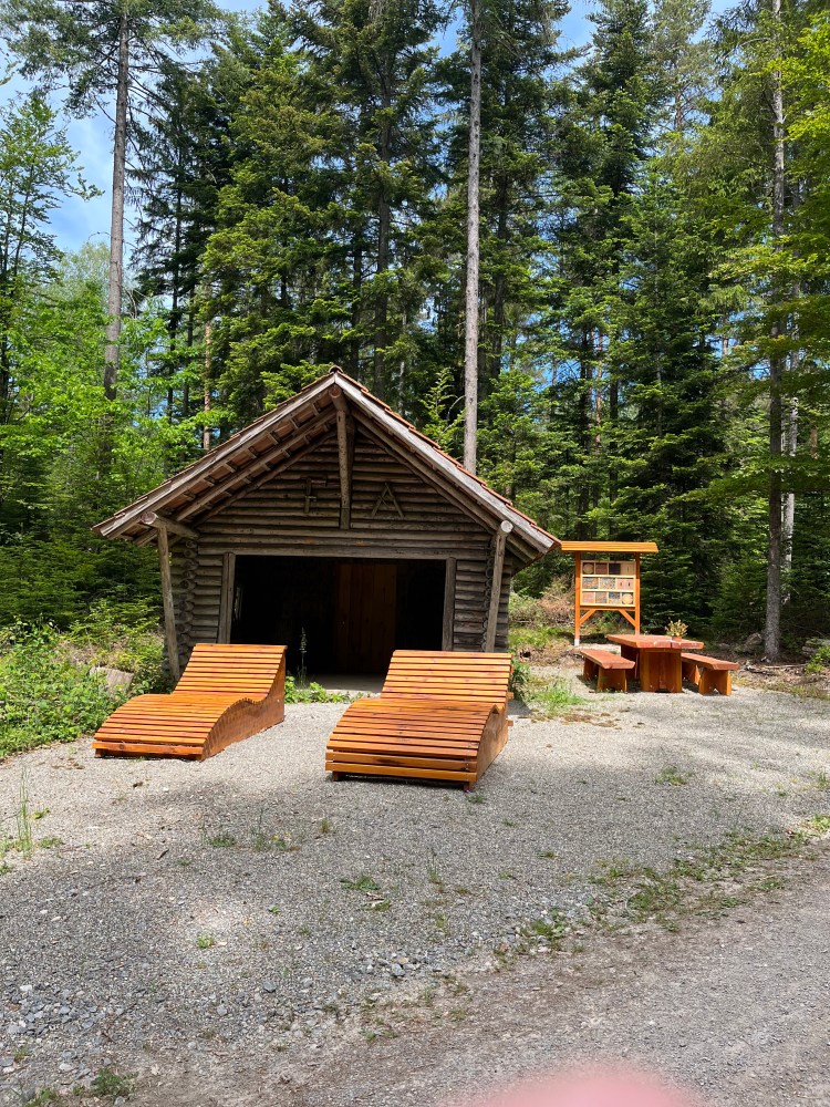
An area of woodland followed, as wonderful as all the other woods crossed in the previous two days. The temperature was ideal for walking in the shady woods with their nesting boxes for bats and well organized rest stops.
The woods ended with the descent to Berneck, which was particularly beautiful, through meadows and orchards, with the spectacularly tall castle towering over the village.

The trail headed uphill again after Berneck, crossing more meadows, before descending again, this time to the beautiful old town of Altensteig with its castle, half-timbered houses and pretty main square.
I took a break there at around 3 pm to eat a couple of energy bars as I hadn’t really rested since setting off that morning. There was a quiet park at the edge of the town where I had a brief nap before setting off along Zinsbach valley, initially following a sort of peaceful irrigation canal, past parks where people were out grilling sausages.

The trail mostly stuck to the forest and was very pleasant as it wound its way along the pretty valley.
I veered off the Ostweg proper at the Zinsbachmühle, when I was nearing the 30 km mark, as I realized that I could shorten the day’s hike by a couple of kilometres (and do 33 instead of 35!) by taking another path to the hotel. I was pretty exhausted by this point, nearly out of water, and just wanted to arrive. Even so, there was still plenty to see, notably a “bat cellar” at the side of the path.

It was a terrific relief to reach the hotel, which was nestled in the woods outside the village of Pfalzgrafenweiler. I had a very spacious room with a balcony where my boots spent the night. After a good shower, I went for an excellent dinner in the hotel’s restaurant. As it was the middle of asparagus season (a big event every year in Germany), I was able to sample some very tasty food before collapsing into bed for a well earned sleep before what should have been an easier hike the next day…

If you have Google translate on your phone (and an Internet to hand), then you can use it to read the signs translated in real time. On my recent Camino, I was impressed to be able to view a mural origami written in Korean as if it were in English. I can imagine that be an would not be too much of a challenge for it. 🙂
LikeLike
Wonderful to see your write-up of the third Schwarzwalder Fernwanderweg! Thanks for sharing your story and photos – they inspire me to get back out there again.
LikeLike
Thanks, Peter. I’m way behind with this, as you have seen, but I have a little spare time ahead over the Christmas period and hope to get the whole Weg written up in the next couple of weeks.
LikeLike
Hi Steven,
As a professional translator actively involved in the struggle against AI trying and failing as yet to replace us, I’d be loath to use Google Translate (indeed, the idea never crosses my mind). I’d much prefer to find a local who can help, to keep the human connection. In Gemany, I always try to muddle by with my basic but improving German (the hiking and food vocab is good, but the rest is shaky). However, on the Hesse trail, the signs were more than mere sentences but whole paragraphs, two or three at times, full of details about local history. I reckon a translation app would have struggled too. And there wasn’t a local about to give me pointers. But I’ll keep your idea in mind for future travel in lands with non-Roman script, say.
LikeLike
Good to know you’re following in any case.
LikeLike