For the first time on this trip, I found myself unable to write up this blog last night. The reason will become apparent as I go along.
I knew this would be another long one. The guidebook said it would be around 30 kilometres, but as I have ended up systematically doing a longer distance than that announced each day, I was wary. In the end, I’d hiked 36 when I hobbled into my hotel in Trier. One good reason not to write up the blog!
After a really great sleep in a very comfortable bed and a hearty breakfast, I set off from Denis’s Hotel in Zemmer at 8:45. Over breakfast, I got chatting to a friendly couple who had also started in Aachen, but who were doing shorter stages than me in order to visit all the museums and castles along the way. That day, they were only going a little further than Kordel, the end of stage 14.
Before I left, Denis warned me that I would have to leave the trail at one point. I didn’t exactly understand why, but I got something about following the train tracks and avoiding the half-hourly trains!
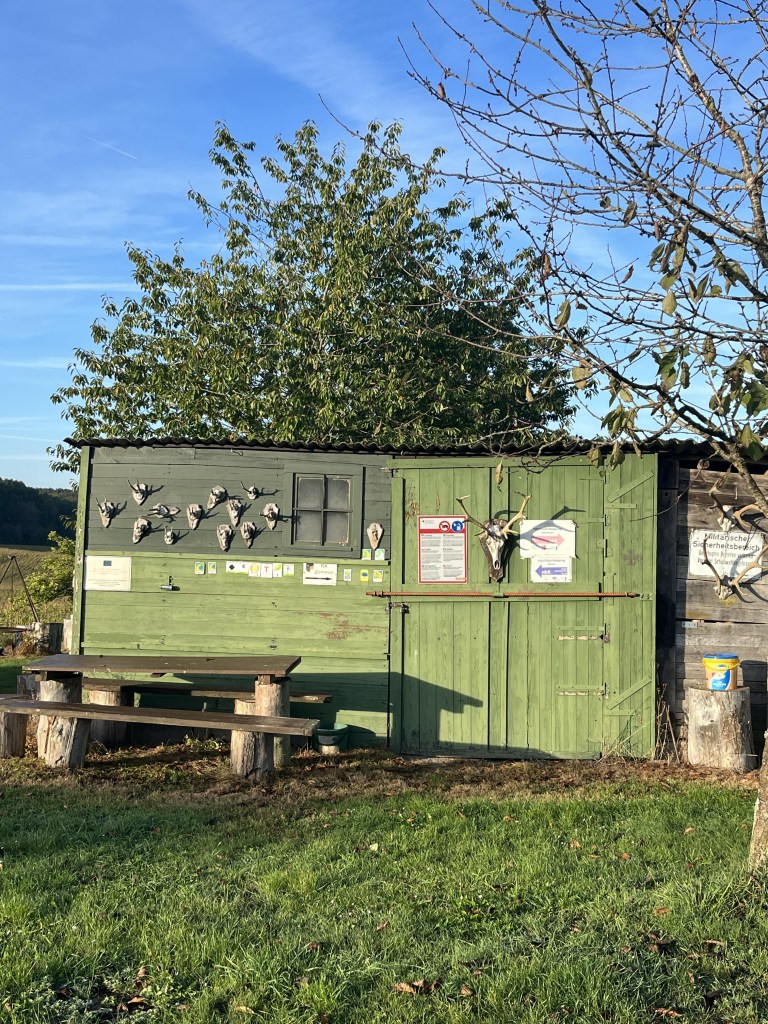
On the way out of Zemmer, I passed a small shack that was marked as an Eifelsteig rest stop. Given the number of deer skulls hanging on the outside, I reckon it was more a hunters’ gathering spot. Apart from a few shots heard in the distance the other day and the stench of rotting carcasses in the woods above Bruch, this was the only other sign that any genuine hunting activity actually takes place.
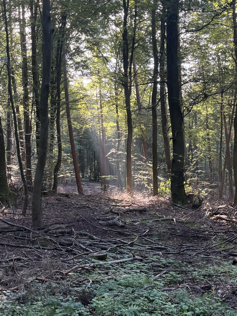
The morning was already quite warm and, in this higher area, there was no mist around. The first few kilometres led through the forest, with the sun creating some pretty effects from time to time.
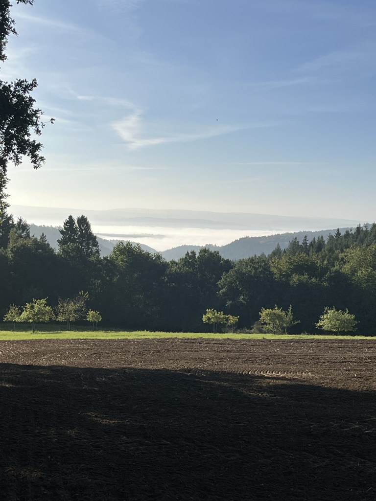
As I approached the village of Rodt, I realized that there was mist about, but down in the valleys…
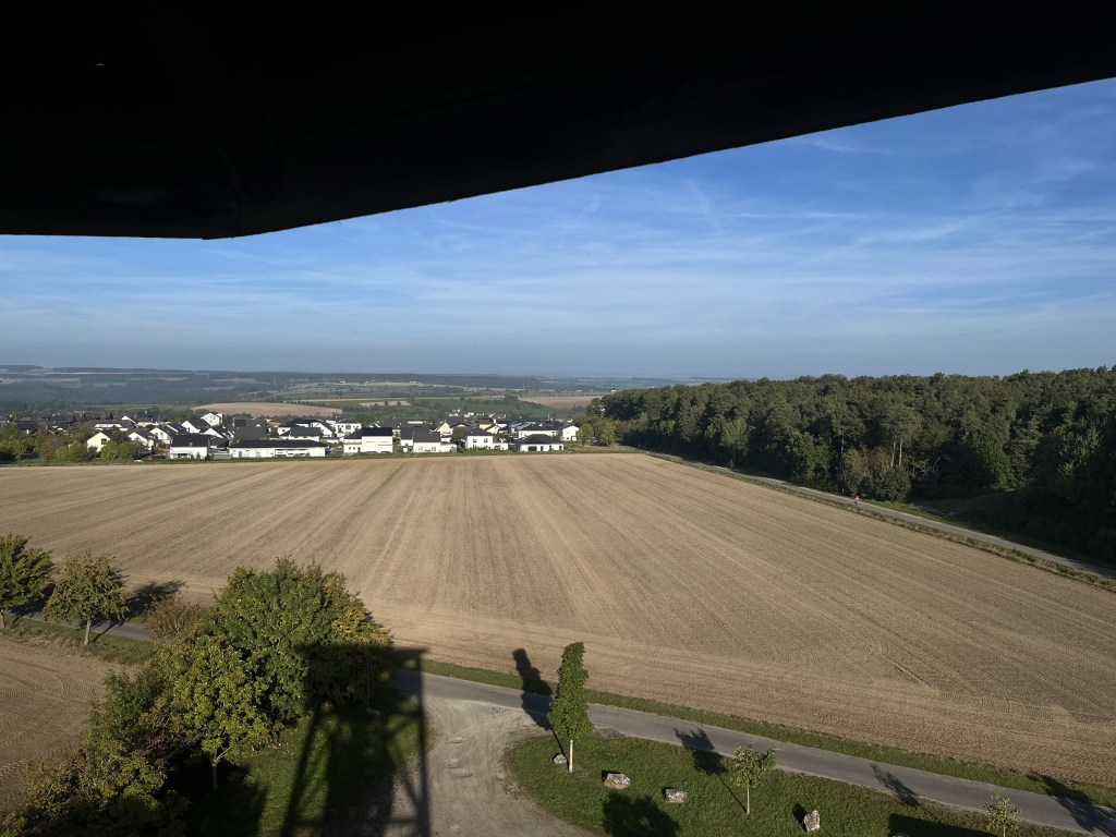
Just outside Rodt, there was a huge viewing tower that provided magnificent views of the surrounding countryside. I thought I had taken a photo of it, but it turns out that all I have is its shadow!
As I came into Rodt, I saw the couple of hikers from breakfast pass by along a trail perpendicular to the one I was on. As I had left some time before them, it was obvious that they had taken a shortcut. In fact, on looking at the map, I saw that it was possible to follow a road all the way from Zemmer to Rodt, cutting out everything I had done so far that morning.
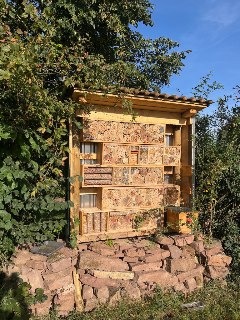
They took a rest shortly after and waved me on my way as I began to descend towards the Kyll river at Mühlenflürchen. This section crossed open farmland and, just outside one of the farms, I spotted the biggest insect hotel that I had ever seen.
On reaching the Kyll, I finally realized what Denis had meant that morning. The bridge to cross the river and follow the Eifelsteig on the other bank simply wasn’t there anymore! A man passing by with his dog told me that I would need to follow the road. I did this for a short distance, but I didn’t like the idea as there was quite a bit of traffic. So, at one point, I left the road to take Denis’s advice and follow the railway tracks. At first, there was a handy little path at the side of them. And, just as I was about to step on it, a train came by so I knew I had half an hour before the next one.
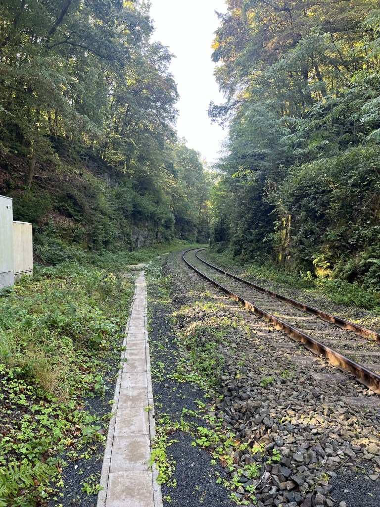
After a while, this pathway came to an end, but, fortunately, there was a narrow road on the other side of the tracks so I crossed over to that. The Eifelsteig descended to it at one point from the area I hadn’t been able to reach, so I was back on the trail. But then it left the road to head sharply uphill. At the spot where it left the road, someone had sprayed a warning sign on the rock. This matched what I had seen in the guidebook which mentioned an awkward section of trail prior to arriving in Kordel that was prone to landslides. So, rather than risk heading up there only to find the trail blocked or worse, I decided to stick to the road all the way into Kordel, the official end of stage 14. This means that I didn’t do the Eifelsteig in its entirety. Sticking to it would probably have added another 3 km to the day, which was already going to be long enough.
In Kordel, there was a pharmacy where I bought a pack of Compeed for my blisters. This was not a good idea as it turned because Compeed is better for preventing blisters than curing them – a simple plaster would have been better. Still, the Compeed I applied to my foot while sitting on the banks of the Kyll got me most of the way to Trier before I realized it had been a bad idea.
It was Monday so everywhere was closed in Kordel, except for the local supermarket, where I managed to pick up a little food to keep me going for the rest of the day, as there would be no where to eat until I got to Trier.
From Kordel, the trail climbed very steeply out of the valley, back up into the woods.
It then stayed on the level for a while before descending to the Butzerbach valley, again very steeply, particularly in the last section to the car park at the entrance to the valley. By this time, I was looking for a place to take a long stop, but every bench I came across was already occupied. With a national holiday for German reunification the next day, people had clearly taken Monday off as well and were out hiking.
The trail then climbed gently up the pretty valley, below the Rammstein castle, which I never actually saw because of all the trees. This was a very peaceful section, with just the sound of birdsong and the splash of the river.
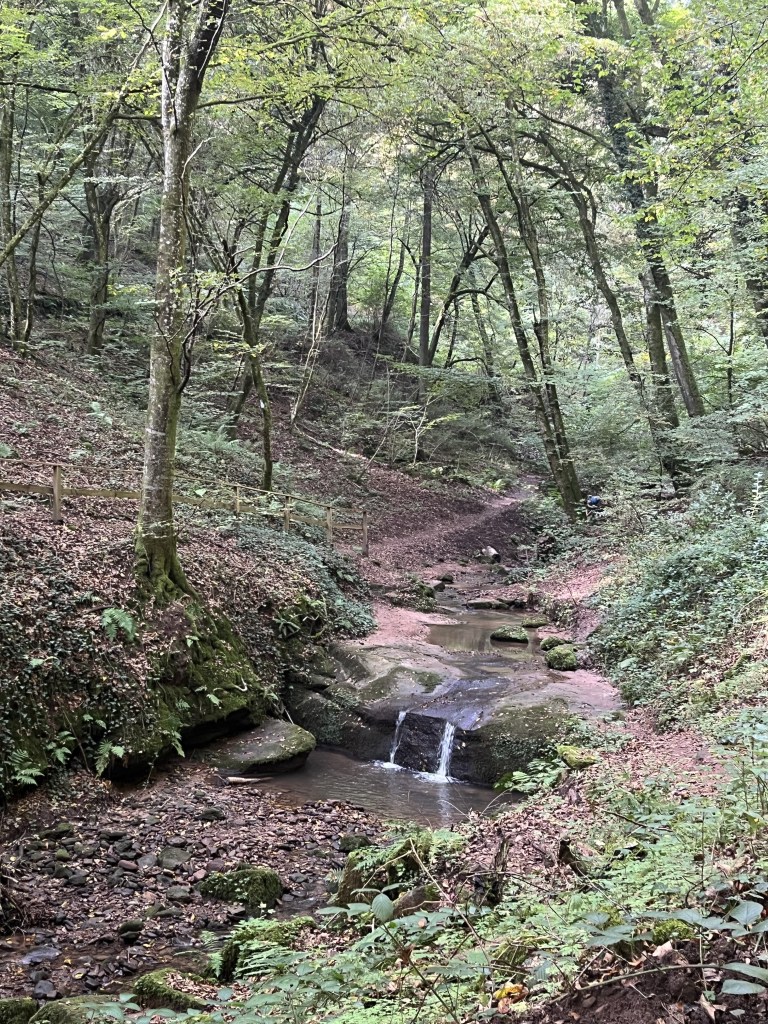
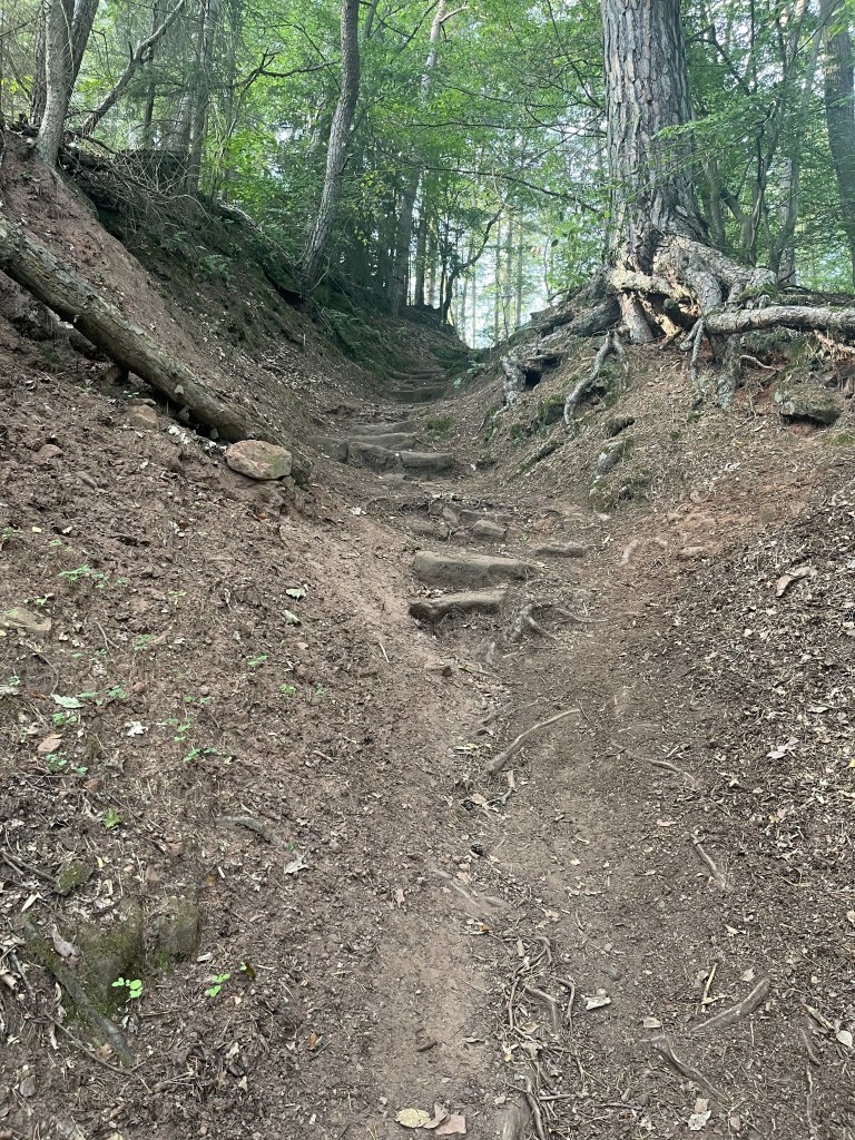
This pleasant section ended with a very steep and long flight of steps that were clearly designed for long German legs rather than stumpy British ones! Fortunately, at the top, there was a bench waiting for me where I flopped down to eat my lunch and rest for a good half hour, greeting all the sweaty hikers who emerged from the flight of steps.
The trail then headed along the other side of the valley, this time above the Rammstein castle, which I actually glimpsed one wall of between two trees.
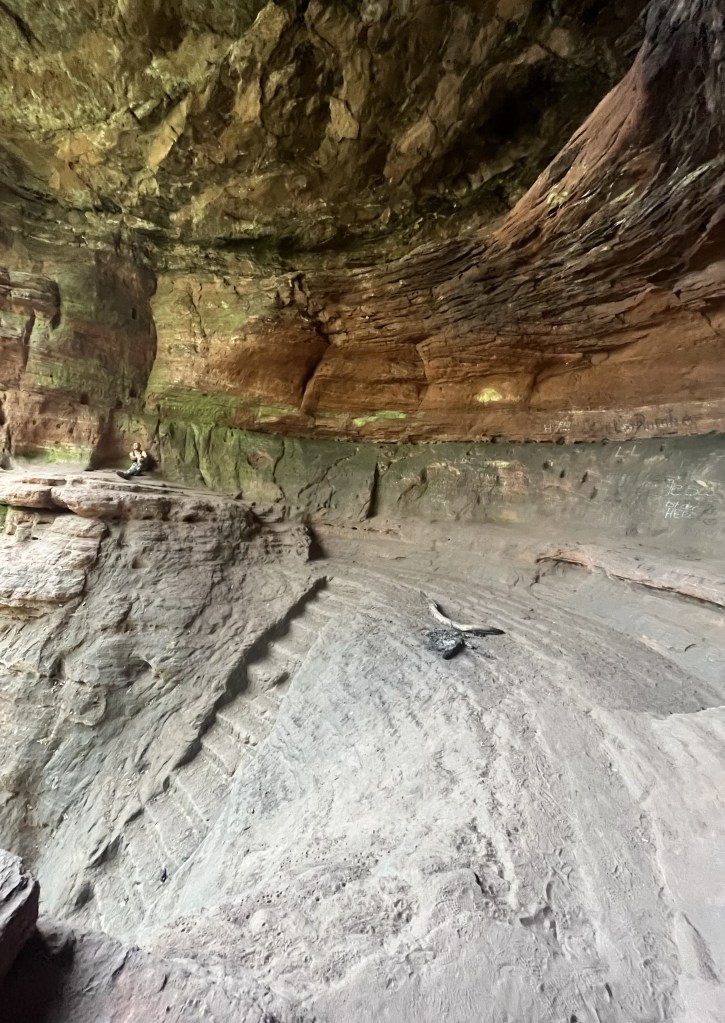
For the rest of the afternoon, the trail went up and then down again, taking in a couple of huge sandstone caves, with more steep flights of steps to reach them. I was unable to get a picture of the first cave, the Klausenhöhle, as there were too many people around. Apparently, that cave was inhabited until the 18th century. However, in the second cave, the huge Genovevahöhle that was abandoned in the Iron Age, I thought I had the place to myself until I took a closer look at the photo that evening and spotted the guy on the far left.
There was a steep climb down from the cave, then another climb back up to pass under the motorway before a tricky descent to the town of Biewer on an extremely eroded section of trail.
By this point, I was up to 28 km and the Compeed on my foot was starting to feel like a very bad idea. I could have taken a bus from Biewer to Trier, but I didn’t want to give up so close to the end.
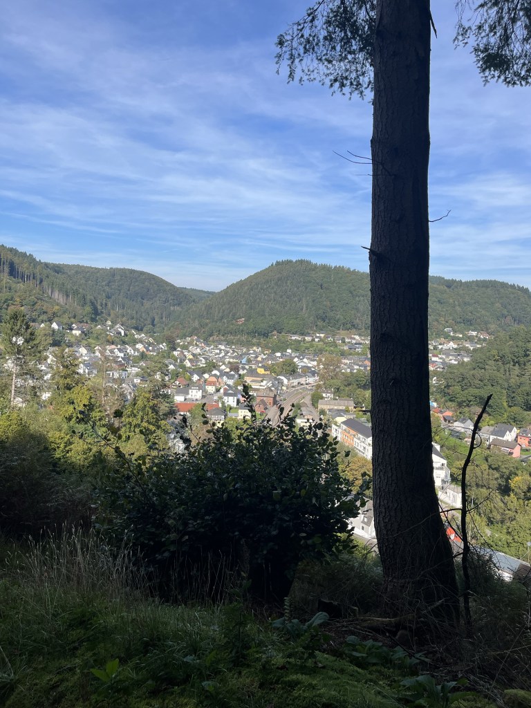
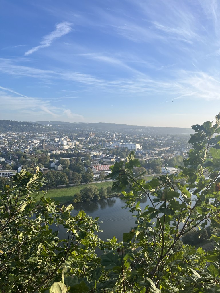
From Biewer, the trail climbed sharply to reach the cliffs above the Moselle. For this final section to the parking lot outside Trier, I would be on a section of the Moselle trail that had been my other option for this trip.
The views over the river and the city in the distance took the edge off a fairly tough section where the trail kept rising and falling over a distance of around 3 kilometres.
By the time, I descended to the parking lot marking the official end of the Eifelsteig, I was totally exhausted. My feet were killing me and I had done well over 30 km by that point.

Komoot came up with an itinerary to get me to my hotel on the opposite side of the city (of course!) and so, after a brief rest, I set off for this final section.

As I hobbled along wearily, I passed a couple of interesting looking churches and Karl Marx‘s birthplace. The city immediately struck me as a rather pleasant place with lots of tree-lined streets.
I finally made it to my hotel at around 6:45 PM, a very late arrival for me on this trip but then again, I had never walked so many kilometres in one day in my life before. As I said at the start of this post, I ended up covering 36 km.
So, for once, I did something I rarely do: I took a hot bath. That did my aching muscles, a power of good, but stupidly I tried removing the Compeed patch from my foot, and that only made things worse. Those damn things stick like glue and are hell to get off. When I went out a little later for dinner, I was limping badly, staggering on the uneven, cobbled streets, and probably looking like a drunk before I’d even had a beer!
All the same, despite the pain in my feet, there was a huge sense of satisfaction at completing the trail. I’ll do one final post on the train back to Paris to sum up my thoughts about it and to relate my day in Trier.

Interesting to read about Compeed. There have been many conflicting views on its use, and your experience is of great practical value. Well done on completing a long and at times arduous trail.
About the distance discrepancy between guidebook and your measurement: what setup are you using to measure your distances? For all our walks, my phone was our only GPS device. I used Garmin Connect, paired with a Vivosmart activity monitor which took its GPS from the phone. Relive and MapMyWalk also took their GPS from the phone. There was as much as a 10% discrepancy, with Garmin Connect reporting consistently longer distances than either other app.
LikeLike
I was using Garmin Connect, Komoot and AllTrails. The distances were more or less the same on all three. The distance of 313 km given in the guidebook and on the tree near the start didn’t take into account the times I had to walk an extra distance off the trail to find accommodation, which was all but nonexistent in some villages, or the wanderings around abbeys, etc.
LikeLiked by 1 person