This was another terrific day in great weather with a host of new discoveries and some interesting encounters.
I woke in great shape after about ten hours’ sleep. It was another chilly morning, but I decided to risk it in shorts, with three layers of clothing on my upper body all the same. After a simple breakfast and a brief chat with the hotel manager who turned out to be from Surinam, I set off at around 8:45.
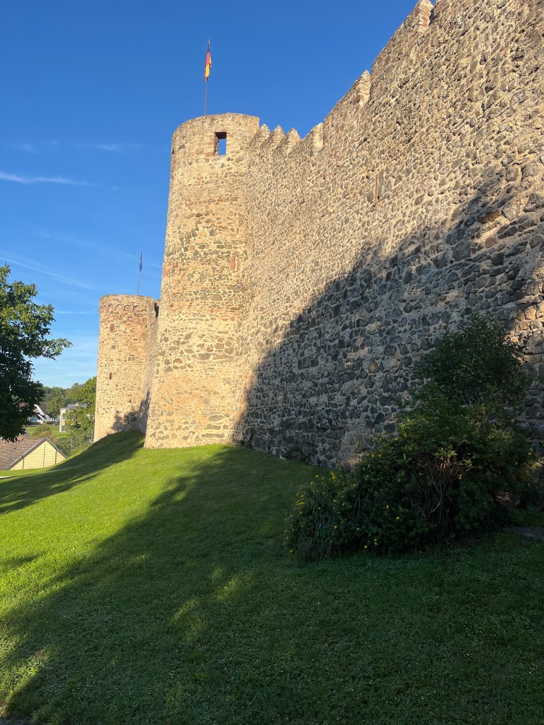
On the way out of Hillesheim, there was a great view of the old town walls in the morning light
The first 5 kilometres were the easiest walking of the Eifelsteig so far. The trail led out of Hillesheim, passing the local sports ground and a pretty lake, the shores of which were laid out with all kinds of fitness equipment. There was also a pathway for walking barefoot over various surfaces (gravel, rocks, sand, pine needles, etc.).

From time to time, I regretted my choice of shorts as it was a cold morning, around 5 or 6 degrees, and a lot of the first section of trail was in shadow. However, as soon as I stepped into the sun, its warmth made me realize that I wouldn’t have lasted long in my hiking trousers. And at least I didn’t have the hassle of changing out of them.
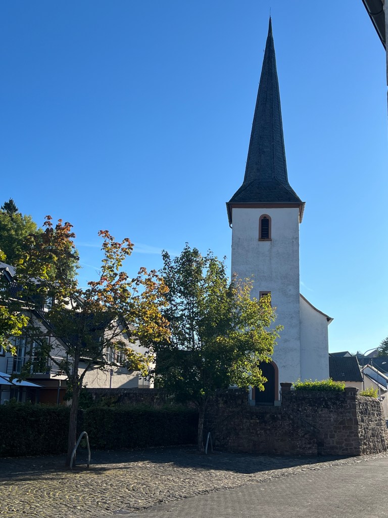
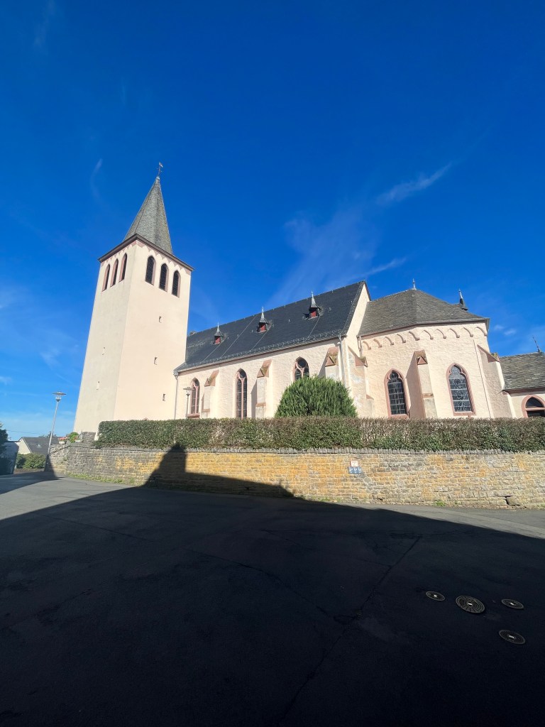
The trail descended gently as it made its way through the villages of Bolsdorf and Dohm with their pretty churches.
There were very few people around, just a grandmother and her grandson who had clearly just learned to ride a bicycle. She had two dogs with her who took a close interest in me because, she said, they thought I might have food. Once they realized I had nothing on me, they ignored me.
At one point, I passed a small pond with an intriguing sign…
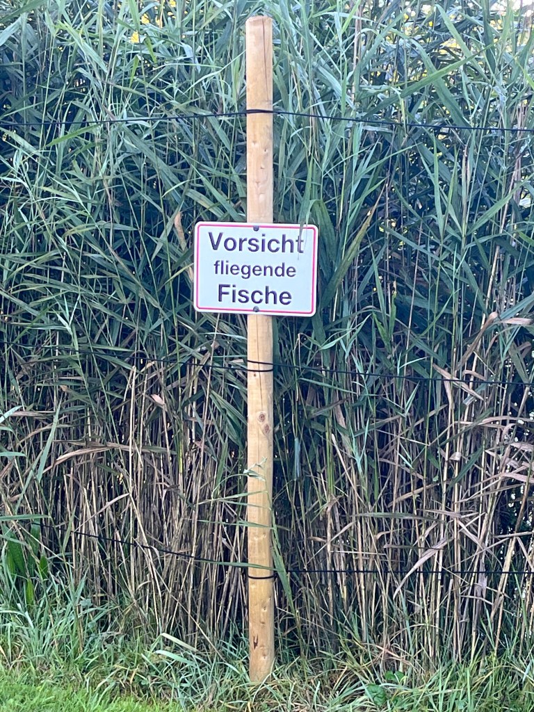
…which translates as “Watch out for flying fish”!
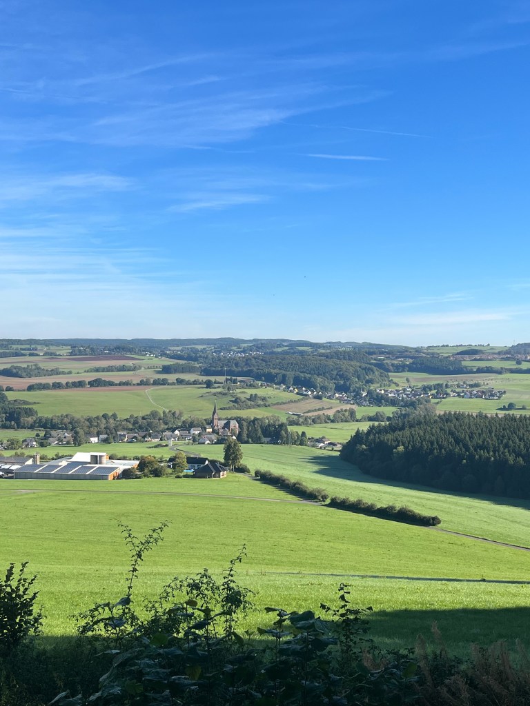
Just outside Dohm, the trail began to climb steeply through the woods, rising about 175 metres. It was an easy climb on forestry tracks and I was rewarded with a great view from the Heimatblick Hut at the top back over the morning’s trail, all the way to Hillesheim, about 8 km away.
At that point, the two Dutch guys turned up. They had had a fun night at the Crime Hotel, sleeping in the Sherlock Holmes room and partaking of such delights at dinner as “poison soup” and “murder schnitzel”. However, the “crime breakfast” had been perfectly ordinary and no one had died during the night. Apparently, the hotel even has an escape room. Sounds like a fun place to keep in mind for a future trip.
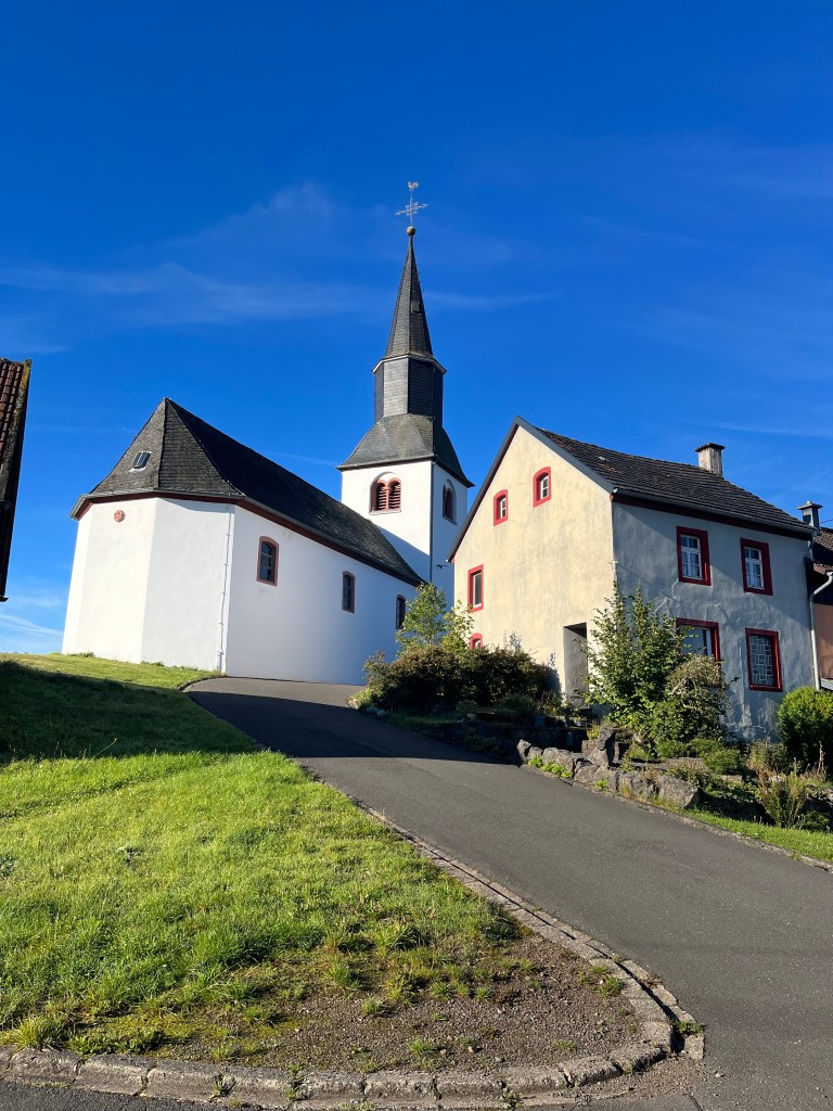
As the guys were carrying such small packs, they soon moved on ahead of me as the trail led us down to the village of Roth, where there was another fine church.
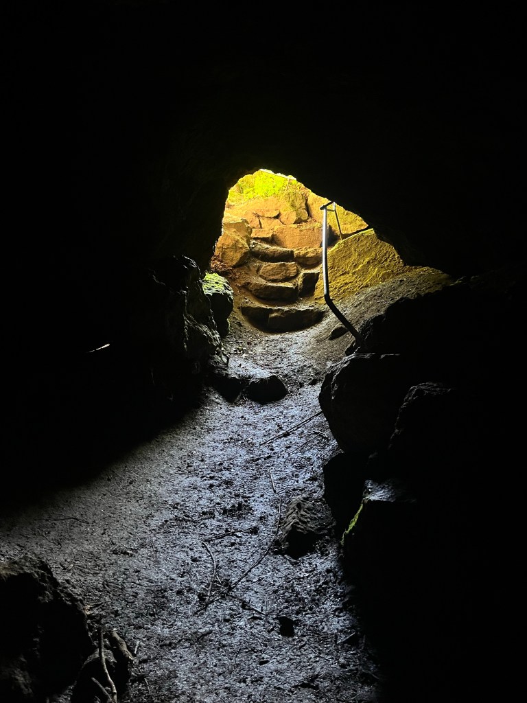
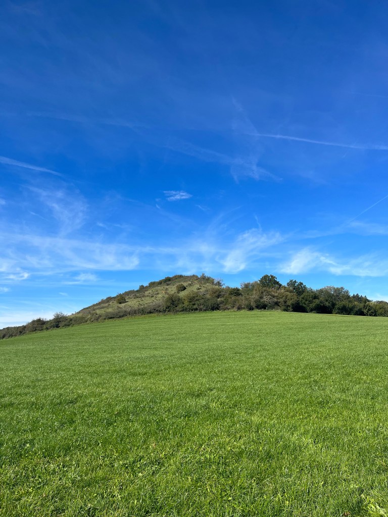
From Roth, there was another steep climb to the day’s highest point, the Rother Kopf, at nearly 600 metres. This section of the trail was marked by a number of caves. The guidebook recommended entering them with a flashlight. I gave one a try, but realized that the flashlight on my phone may seem very bright at home, but is pretty useless in a deep, dark cave so I didn’t venture very far.
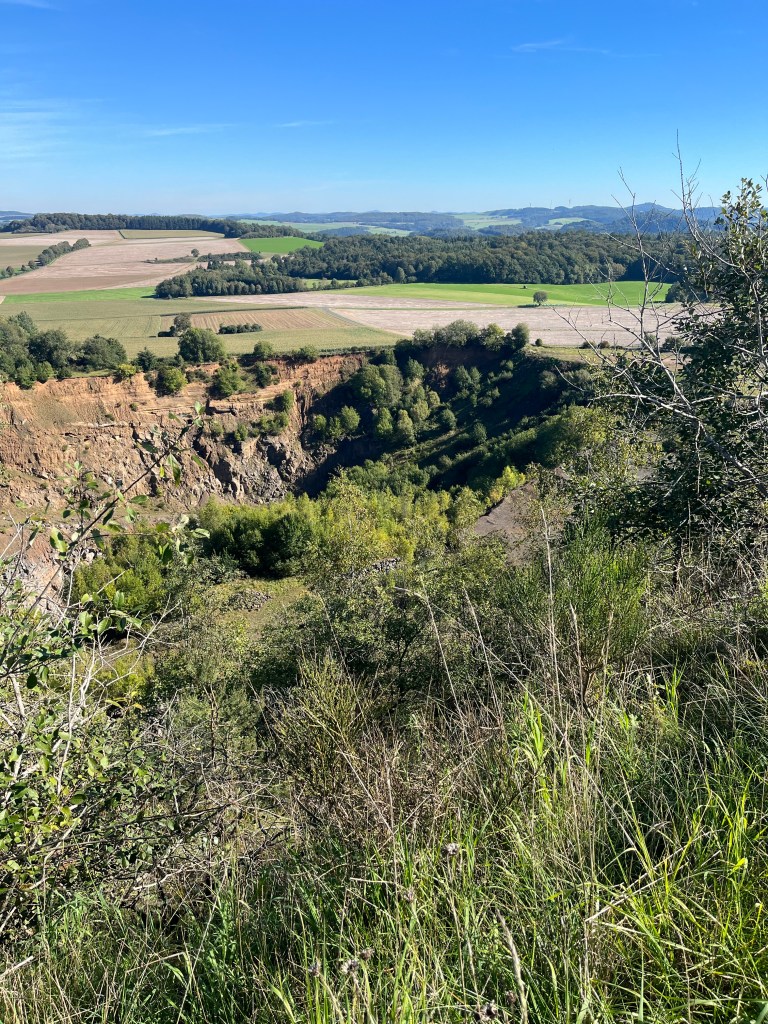
I was well into the old volcanic area by now. The Rother Kopf itself was a former volcano, and the trail followed its rim to a viewpoint over the old crater. I met the Dutch guys there again, and we joked that the summit probably got its name from the fact that the earth all around it is red.
I took a break on one of the magnificent curved recliner benches that are often found in scenic spots in Germany. The sun was now blazing down, and it was getting quite hot. As I sat there taking in the view, an elderly couple arrived. We started chatting and they turned out to be two of the loveliest people met so far. At first they thought I was Belgian, but when I told them I was English and living in France, the lady spoke a little French because, as she said, it’s only natural to do so as we’re all Europeans. They had both travelled extensively and the husband had happy memories of his time in the UK as a boy on an exchange visit. And when it got around to talking about my line of work, I was delighted to discover that they actually knew what a subtitle was and didn’t ask the usual question that I get when I tell people I translate films: “Do you do all the voices yourself?” All the more surprising in Germany, a country where films are generally dubbed. A wonderful couple, and a real delight to chat to.
From the Rother Kopf, the trail began to descend fairly steeply towards Gerolstein, mostly through open fields with an occasional patch of woodland.
There were clearly two different trails leading towards Gerolstein, my destination.

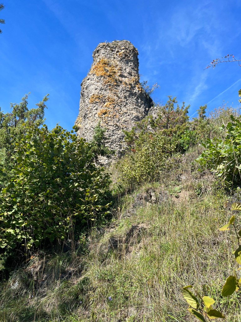
Obviously, being an Eifelsteig completist, I opted for the upper trail which led past a small lake and then to the Auberg where I got my first view of the dolomite rocks and cliffs that surround Gerolstein. The Auberg is topped by one of them…
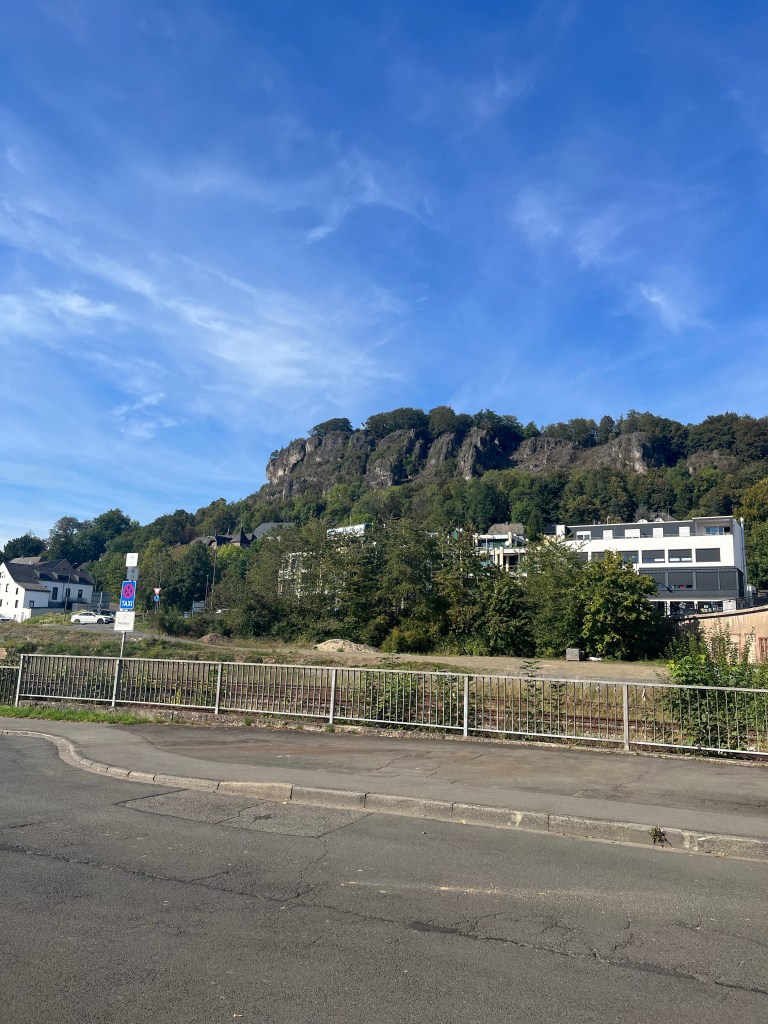
…but the majority are to the north of the centre of Gerolstein, and that is where the trail led me next, on a 5 km loop around the town before depositing me at the railway station. After the easy walking first thing, this was the really tough part with a total climb of 200 metres as the trail wound its way up and down, passing at the base of the cliffs before climbing to the Munterley outlook at the top for a fine view of the rather uninspiring town. This section was good preparation for the next few days when the total climbs would be of 900 metres or more.
Before reaching the town, the trail passed another deep cave, the Buchenlochhöhle. I took a look inside, but once again didn’t go very far because of the weakness of my flashlight. The trail then skirted a very large old volcanic crater, and finally began to descend to Gerolstein.
The town turned out to be a bit of a disappointment. Gerolstein is known all over Germany for its excellent mineral water, and I expected to find a few spa facilities, including a Kneipp bath for my weary feet, but unfortunately there was nothing of the like. There was a very pretty park with a spring where people could fill their water bottles, but otherwise it was a pretty nondescript place.
My hotel, on the other hand, turned out to be an absolute delight. The owner’s daughter was learning French and had translated all the instructions that I would need so that her mother could give them to me. A very charming gesture, typical of the hospitality I have found in many places along the trail.
Dinner was in a Croatian restaurant where I said goodbye to the two Dutch guys who would be heading home the next day. They had been good company along the trail, and we parted saying that maybe we would meet again one day on another trail somewhere. Who knows?

Is it common on your hikes to encounter people again and again, as you did with the Dutch guys? I had always imagined that would be rare.
LikeLike
Actually, on many of these long-distance hikes, a sort of brotherhood forms, made up of people we see regularly at various points along the way. On the Austrian part of the Alpe-Adria, there were around ten of us at one point. At times, we’d walk together, then not see each other for a couple of days. Here in Germany, very few people do the full trail in one go, so the brotherhood doesn’t form as easily. That said, after seeing people a couple of days in a row, you get chatting, even if they’re only doing three or for days.
LikeLiked by 1 person