Our 25th day on the trail saw us leave Slovenia and cross into Italy, once again unable to fill out a traveller locator form as the Italian one didn’t provide for arrival on foot either. To reach Italy, we had a 1,000-metre climb to the border, high above Tolmin.
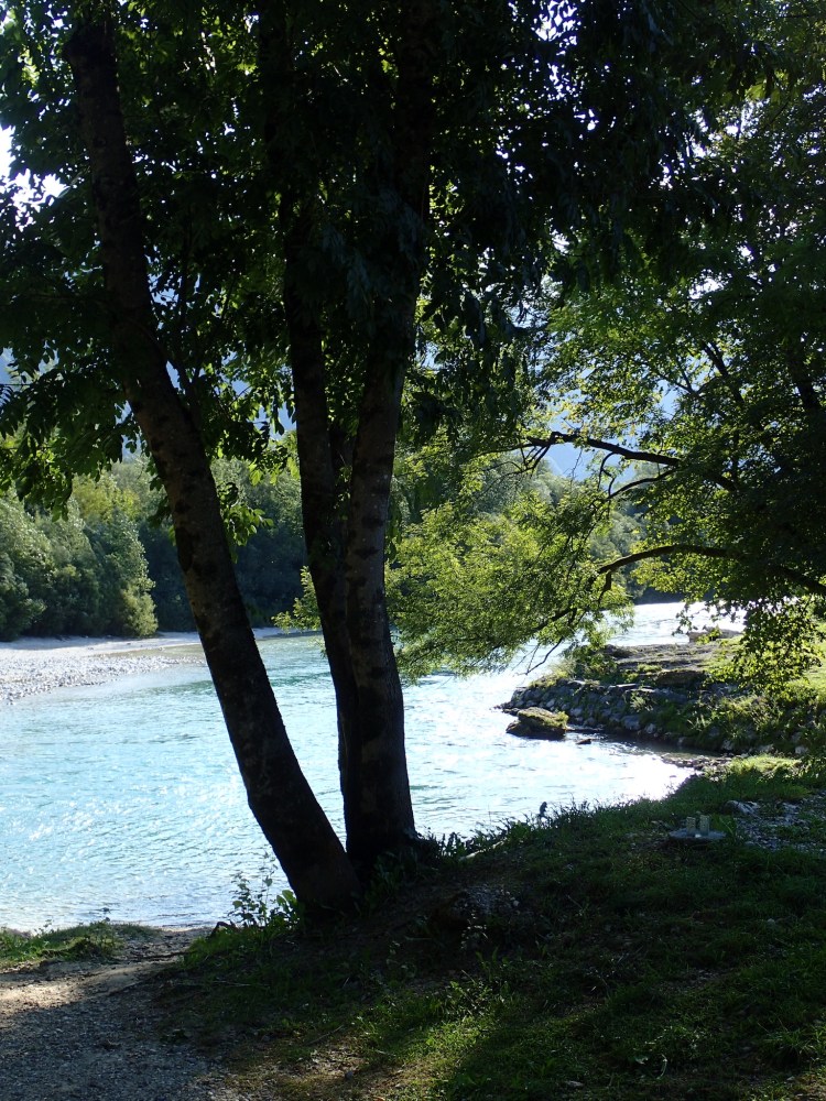
After a hearty breakfast and a goodbye to the French cycling honeymooners, we heading back across Tolmin, taking care to cross at the lights, to the spot where we had arrived in the town the day before. From there, the trail headed towards the Soča, past the cemetery, before reaching the river that we crossed for the last time with this name. In Italy, it would become the Isonzo and we wouldn’t see it again for a few days.
After the bridge over the river, we began our climb, gently at first to the St Daniel church and then more steeply after the village of Volče.
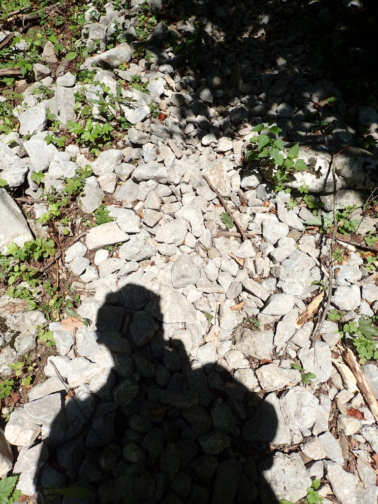
After the village, things got serious with an 800-metre climb over the next 5 kilometres that became especially steep on the final section to the border. And the terrain was incredibly stony once again, even though heading uphill made this less of a problem.
At around 850 metres, we took a rest at a grassy area near a small memorial to a skirmish between Slovenian and Italien forces in 1943 (from what I could decipher of the Slovenian text on it). It was a peaceful spot and it was hard imagining anything terrible ever taking place there.
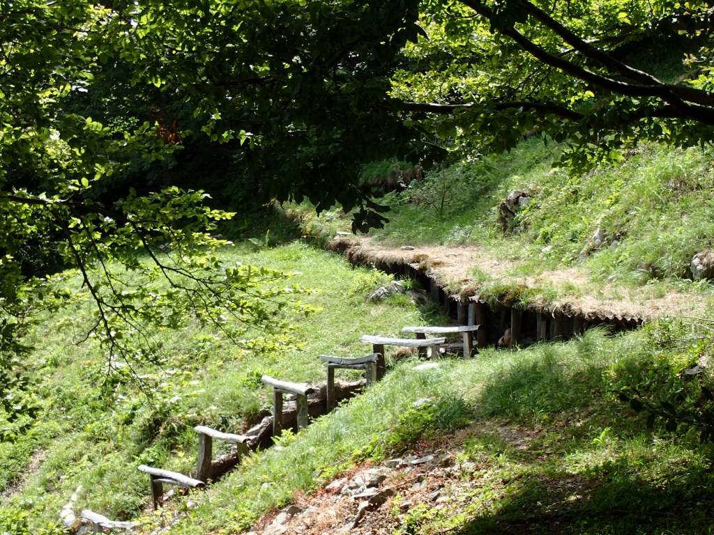
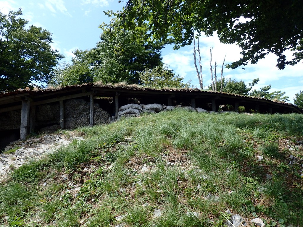
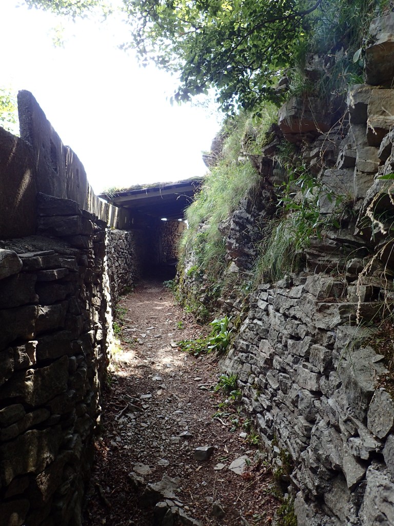
From the memorial, we had one last steep climb, emerging onto the road just opposite the Kolovrat open-air museum on the site of the Isonzo Front from World War One. This museum was mostly made up of a series of trenches that gradually led us up to the border on the Kolovrat ridge at 1,114 metres which would be the last “high” point of the trail as we would never attain such an altitude again.
The trenches, part of the Italian third line of defence in World War One, were incredibly well-preserved (with a little restoration), probably because they were lined with stone. We were able to follow them along the ridge for quite a way and couldn’t help thinking about other soldiers, much further north, in the mud and horror of the Western Front. Things were tough here nonetheless, especially in winter, and the battle between Italy and the Central Powers (Germany and Austria) in 1917 left 40,000 dead, 30,000 wounded, and 600,000 internally displaced people, all for a 150-kilometre advance into Italian territory.
The site is now part of the Walk of Peace, a trail along which places once marked by the horrors of war stand as memorials and reminders. We would be following a fair section of it all the way to Trieste and would frequently come across reminders, not just of the First World War, but also of the sordid conflicts at the end of the Second World War.

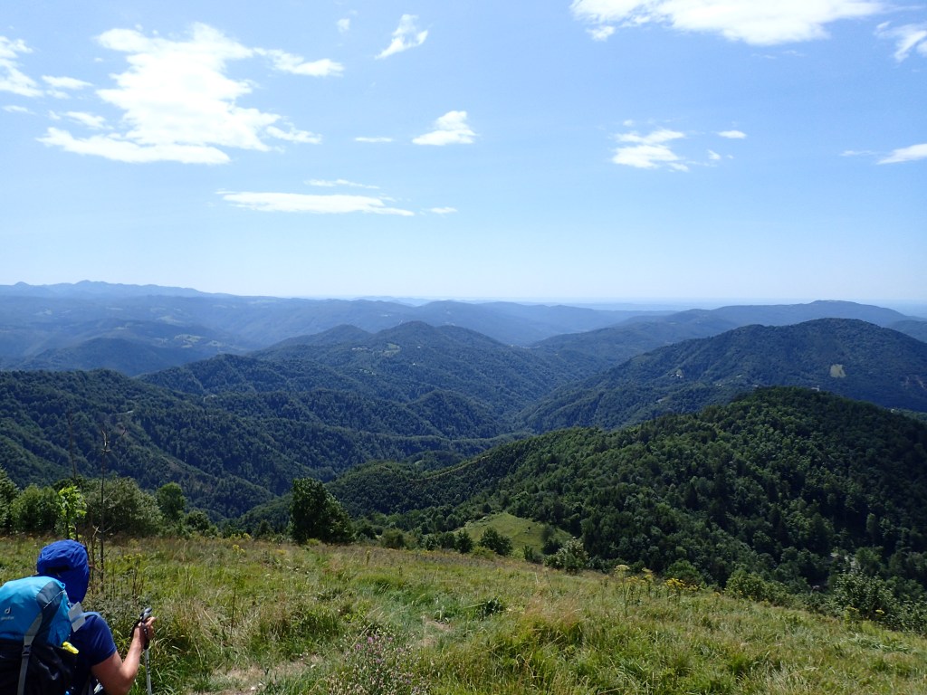
On emerging from the trenches, we found ourselves just by the Italian border, marked by stones similar to the ones between Austria and Slovenia.

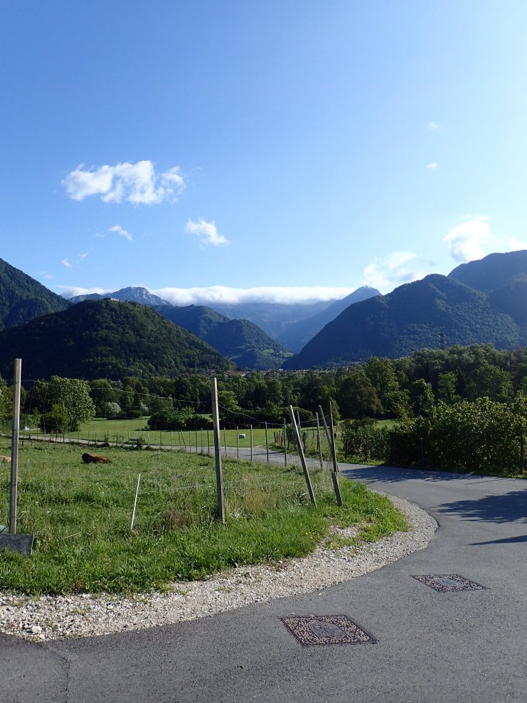
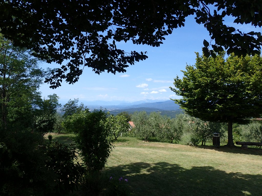
I don’t think I’ll ever forget the view from the border into Italy. I don’t know what I was expecting, but I thought we’d see a few villages or towns in much drier terrain. Instead, we were treated to a spectacle of green, forested hills rolling off as far as the eye could see with only a few isolated houses here and there. A truly magnificent sight.
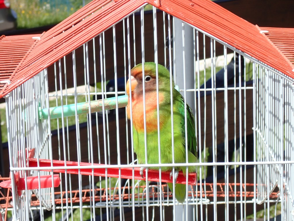
After a short but steep descent from the pass, we reached the Rifugio Solarie, a mountain restaurant where we stopped for our first Italian pasta. Unfortunately, they were rushed off their feet with huge crowds of day-trippers and we had to wait for a good hour and a half for our food. But the rest was welcome after the morning’s climb, there was an entertaining Italian group at the next table and we were sitting next to a very cute parrot. When the food finally arrived, it was delicious and set us up for the rest of the day. A dish of pasta at midday is the way to go!
Because lunch had taken so long, it was already close on 3 pm when we set off again to reach Tribil di Sopra where we were expected at 5 pm for a rather special check-in. And so we cheated for once (something that we would do more often, unwittingly at times, on the remainder of the trail). Rather than do a 200-metre climb to another summit, we followed a very peaceful shady road. It wasn’t a short-cut as we did a couple of kilometres more than the distance noted in the guide, but it was less exhausting and meant that we arrived in time for our check-in.
I said a special check-in because the place we were staying at for the night was in what the Italians call an “albergo diffuso”, which means that the hotel rooms are in the different houses of a village. It’s a system used in Italy to revitalize dying country communities and works pretty well. In Tribil di Sopra, we found ourselves with a whole village house to ourselves. It took us a while to find it as the numbering of the houses seemed to conform to a weird kind of logic. The house in fact had three bedrooms, but we were the only people staying, as confirmed by the guy who had come up from a neighbouring village to welcome us.
The night’s stay also included dinner and breakfast and we were told to go to the old village school (now a hostel for visiting groups) at 7 for dinner, after which we would be given a basket with all we needed for breakfast. And so, after freshening up and relaxing a little, we set off for the heart of the tiny, deserted village. The old school was huge for such a small place and we initially got lost in it before finding the dining room. There we found a delightful lady from Lausanne who was going to cook just for us. And so our first dinner in Italy was the classic Italian meal with antipasto, primo (pasta), secondo (turkey filets) and dolce, washed down with a great bottle of wine. The lady from Lausanne was delighted to speak a little French and told us all about the local area. We left with a big basket of bread, cheese, ham, fruit and coffee for breakfast the next morning.
This very pleasant evening continued back at our accommodation with a rather comical encounter with the neighbour. A little old man of 80 or so, he had been around and listening in during our check-in, so he knew I spoke Italian. After dinner, I was sitting at the dining room table with the front door open, answering emails, when I saw him outside, moving along the terrace with a tape measure, acting nonchalant but glancing pointedly at me from time to time. After a few minutes of this, I went out and asked him what he was doing. He answered that he had never measured the facade of the house and had decided to do it that evening. A pretty original excuse to come and break the ice! We ended up having a long chat about his life – he had spent many years in Canada working in the oil industry. He also told me that his wife was more or less incapacitated and mute following a stroke, so he was clearly happy to have someone to talk to. Shortly after, his son turned up for dinner with him and took him away after checking that we were happy with the accommodation (that in fact belonged to him). And, by the way, the house façade was 18 metres long!
The following day, we were expecting a fairly easy stage with a 25-km hike to Cividale del Friuli, mostly made up of a gentle descent, with a steep drop and climb into and out of valley at one point. However, thanks to a wrong turn at one point, we ended up doing over 29 kilometres, and the morning’s stony terrain turned out to be worse in places than in Slovenia!
We set off from the house at 7 in the morning, when our façade-measuring neighbour was still asleep (or we’d have been in for another long chat). On leaving the village, we passed a fresco of the Virgin Mary that, for some mysterious reason, had eyes and a nose that looked as if they had been blackened with ashes.

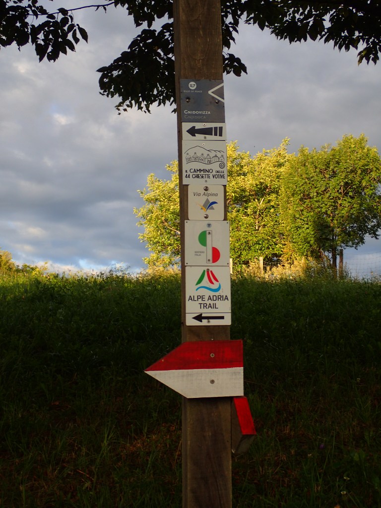
The trail resumed at the top end of the village where we had arrived the previous afternoon and where a marker post showed that we were not just on the Alpe-Adria now, but on a whole host of other trails that gradually branched off it as the day went along.
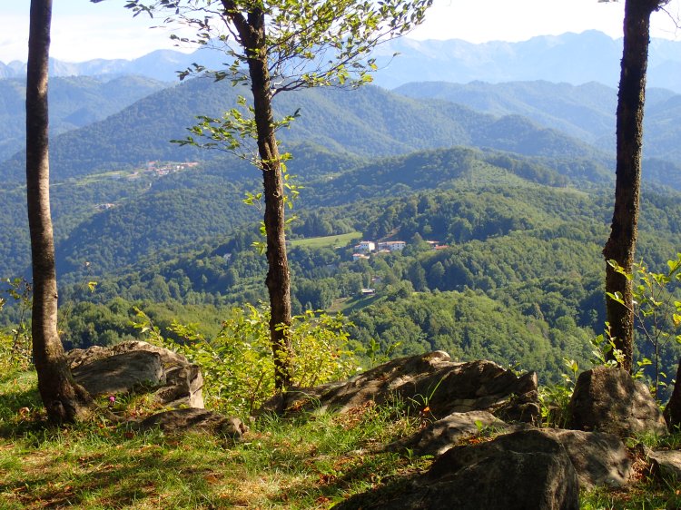
The morning unfolded between forest (fairly thick at times) and a few small, open areas where a little subsistence farming was done amid tiny orchards. Life must be pretty tough up here, given the lack of roads and farming land. That probably explains why a fairly large village like Tribil di Sopra is so deserted nowadays.

The walking had been very easy down to Tribil di Sotto (also pretty much deserted) and this probably made us less attentive because, on reaching the small settlement, we took a wrong turn, led astray by the markers for one of the other trails. And we carried merrily on our way on this beautiful morning. After a while, we began to suspect something was wrong as we were heading downhill sharply when we should have been on the level. On checking the maps against the hiking app showing where we were actually walking, we realized we’d gone about 1.5 km out of our way and now had a steep climb back up to the trail!
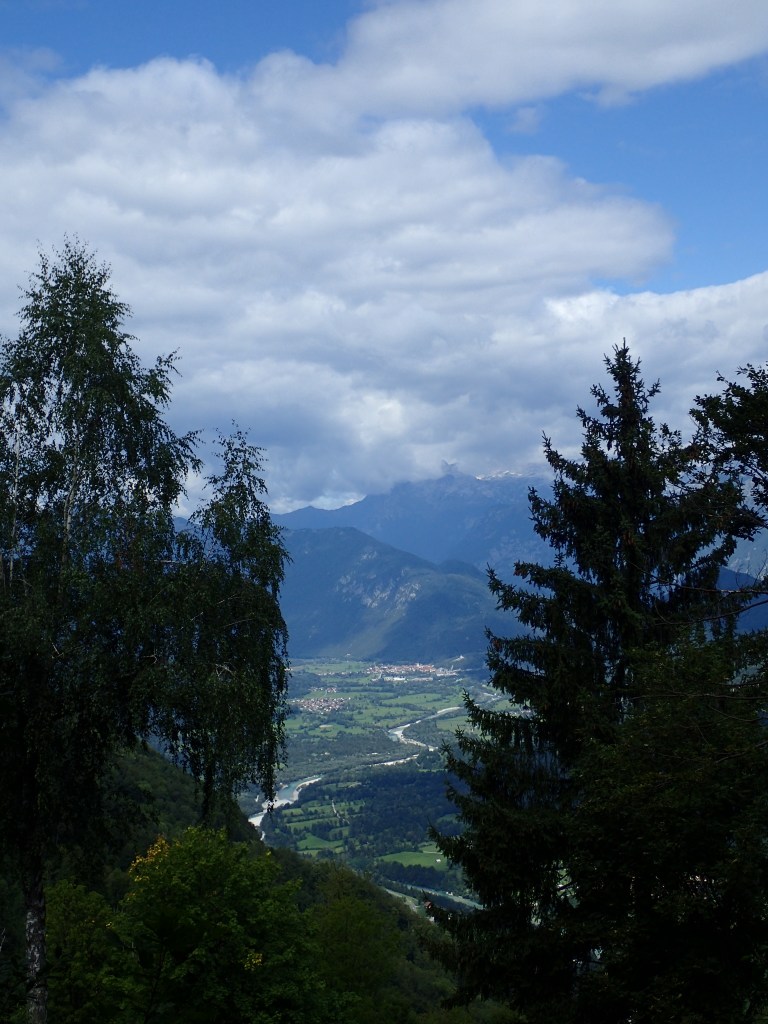
When we finally returned to the Alpe-Adria, we found ourselves on a very stony trail, as bad as anything seen in Slovenia. There were trenches from time to time, although not as well preserved as those on the Kolovrat ridge. There also were some terrific views from this section of the trail which continued more or less on the level until the isolated church of San Nicolò.
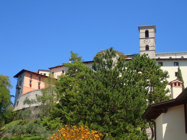
Shortly after, we had a 200-metre descent to a valley, followed by a 200-metre climb on the other side to the village of Castelmonte. This was the worst section of the day, with a horrifically stony section where every step sent stones rolling out from under our feet. We met a group of Italian hikers going in the opposite direction who were suffering as much as we were. From the bottom of the valley, we could see Castelmonte above us, even though it didn’t seem to get any closer as we climbed. When we finally made it up to the village, we were in need of a rest, despite the encouragements of a Italian couple who cheered us on with cries of “Bravi, bravi!” after asking us what we were doing and how far we’d come.
After taking a quick look around the small, pretty village with its sanctuary erected around the oldest chapel in Friuli and terrific views over the surrounding hills, we headed for a small restaurant just below the huge car-park (no doubt designed with buses of pilgrims in mind) for a delicious dish of gnocchi that set us up for the last 10 kilometres or so into Cividale, all downhill from this point.
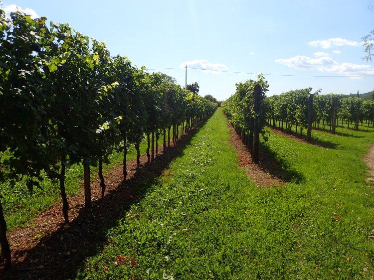
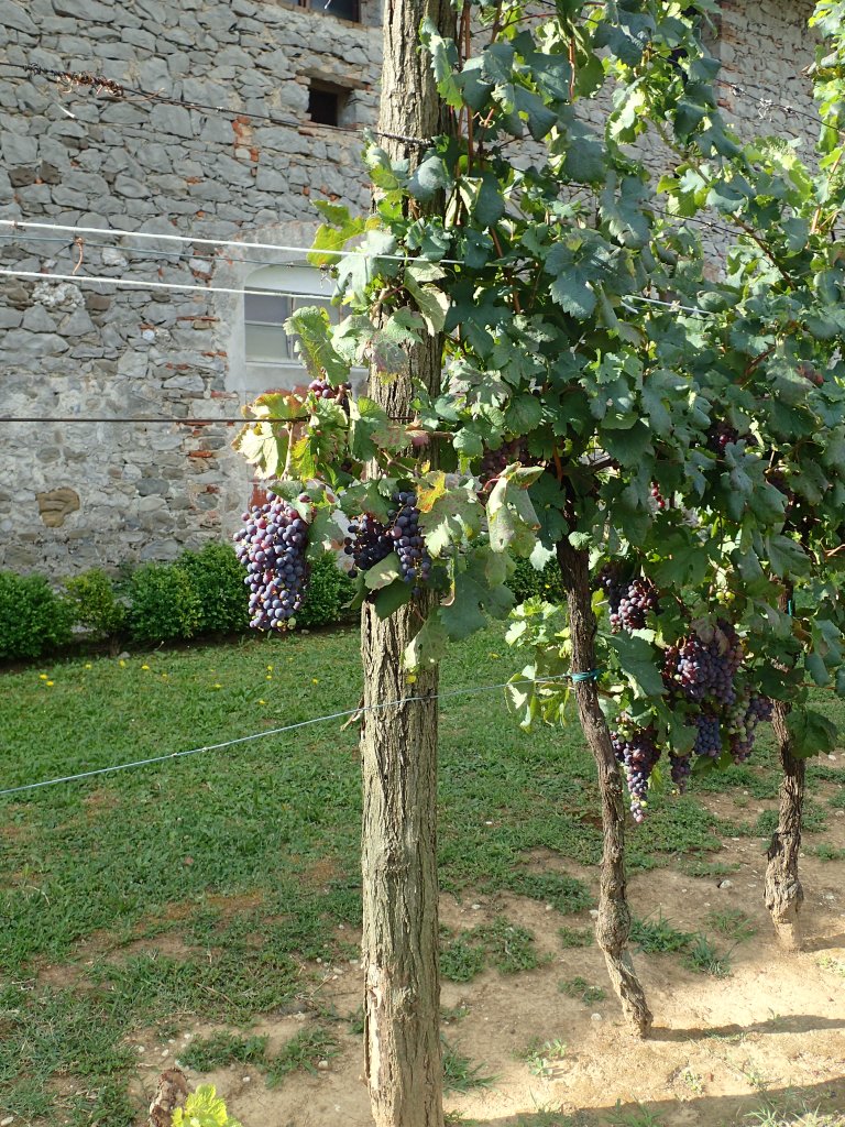
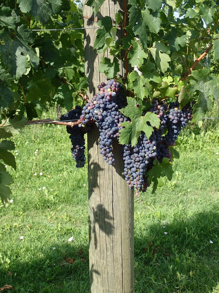
The rest of the day’s hiking was a real pleasure after the morning’s trials, until the last two or three kilometres into Cividale, which were quite boring and flat. We followed the road very briefly on leaving Castelmonte before veering off into the woods for a shady descent to the village of Purgessimo where we came across our first vineyards (of which there would be plenty more in the coming days).
From Purgessimo to Cividale, we found ourselves walking past vineyards on a dusty trail with very little shade. But the flat terrain meant that we were able to barrel along at a good pace and this boring section was soon over. Just after getting our phones zapped at the Alpe-Adria checkpoint on the outskirts of Cividale, we were approached by a German couple in their sixties who asked if we had an accommodation recommendation for them. They had been all over the town but there were no vacancies anywhere. They hadn’t booked and, unlike us, didn’t know that there was a huge vintage car rally on that day. The guy looked exhausted as he was carrying what seemed to be one huge pack for two, while his wife was as fresh as a daisy. They were on the trail for a couple. of weeks but hadn’t booked any accommodation, which I pointed out was pretty risky in high season. After a while, they wandered off, looking put out, but there was nothing we could do to help them. I even thought at one point that they were about to ask if they could share our room!
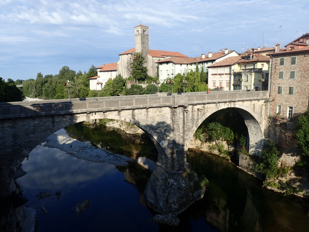
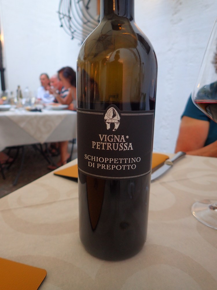
After crossing the Ponte del Diavolo (Devil’s Bridge) into Cividale, we found ourselves in a beautiful and typical Italian town with its piazzas, cafés, cathedral and delicious ice cream shop where we made a first stop before heading for our B&B in the town centre. It was another great place with a spacious, comfy room and a friendly owner with great dinner recommendations. We ended up in a restaurant run by a friend of his, the Antica Trattoria Nardini, where we had a truly delicious meal that featured one of our favourite dishes (stuffed courgette flowers) and a “gubanisu”, a tiramisu with the local speciality, the gubana, a glorious turban shaped cake stuffed with dried fruit and chocolate. On the advice of our charming waitress, we discovered a new wine too, Schioppettino di Prepotto from a vineyard that we would pass the following day, a rich and beautifully full-bodied wine. After a bottle of that, the excellent dinner and a grappa on the house, we headed back to the B&B for yet another excellent night’s sleep.
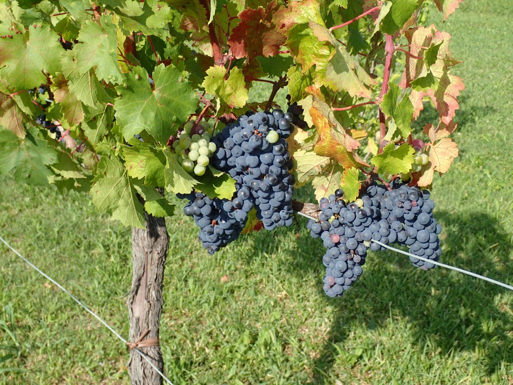
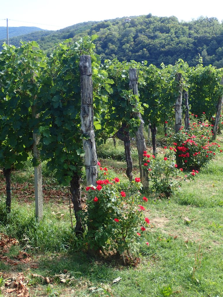
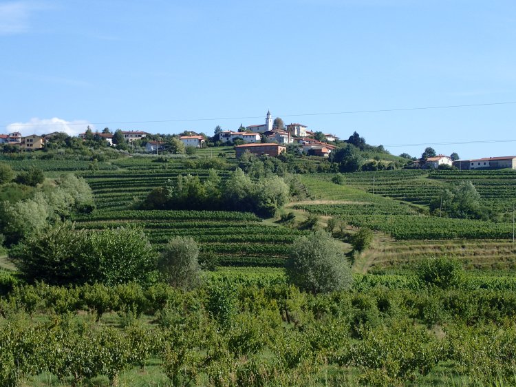
After a great breakfast the next morning, despite the presence of a rather unfriendly group of cyclists who acted like they owned the place, we set off through the streets of Cividale, back over the Devil’s Bridge and part way along the route taken to arrive the previous day, as far as the church of San Rocco where we turned off to follow the trail through vineyards for most of the day. The vines were heavy with grapes of various hues and there were a number of vineyards with roses growing at the end of each row as you often see in Tuscany.

This was a very easy day’s walking and we would be doing one and a half stages, going as far as the Venko hotel and casino in Slovenia. The terrain was mostly flat through the vineyards, then began to climb near Prepotto (last night’s wine) to return to the Slovenian border at the village of Golo Brdo.
After passing back into Slovenia for the rest of the day (and half of the next), we had a steep 250-metre climb up to the church of St Andrej high above Golo Brdo where there was a shady picnic area and even a tap with drinking water, the first we had seen in days (and the last viable water source we found on the trail, apart from bars and hotels).
We had a long rest in this pretty spot with its great views. It was quite a hot day, but the place was shady, with a gentle breeze that took the edge off the heat. However, when we set off again, at around 2:30, we found the heat a little hard to take at times, especially on unshaded sections of the trail.
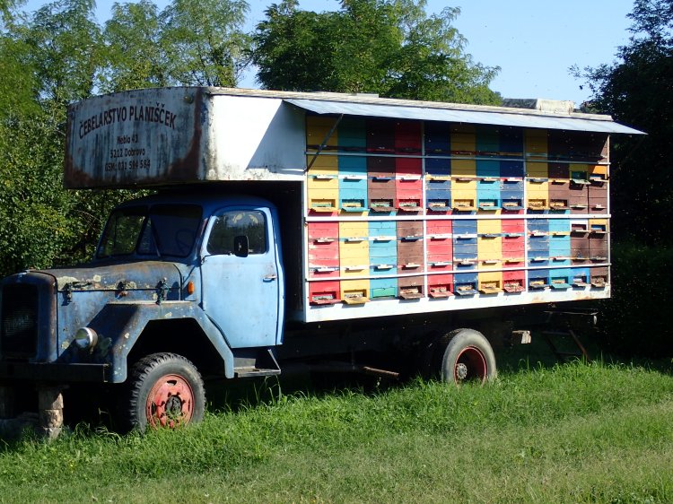
Shortly after passing an old truck in a field brilliantly transformed into a mobile bee-hive, we made another stop at the Gostilna Peterel restaurant for a cool drink (and a slice of strudel for Odile).
Having covered nearly 20 kilometres by this point, with still some way to go to our night’s accommodation, we decided to take a short-cut and follow the road rather than head into the hills for a lengthier route on the official trail that would have meant doing close on 35 km that day (we ended up doing 28 in the end).
The walk along the road was not too unpleasant as, most of the time, we were able to follow a narrow path at the side of it, and there wasn’t much traffic either. The few long sections on the tarmac were tiring, but the scenery around us was glorious and, shortly after passing through the village of Neblo, we were able to veer off the road to follow a dusty track through the vineyards for the last couple of kilometres before returning to the road around 500 metres from the Venko hotel and casino where we would be spending the night.
It was an odd place (with palm trees in the forecourt) and we stood out among the majority of the hotel’s guests who were clearly there for the gambling in the casino where we never set foot. Apart from the very comfortable room, the great thing about the place turned out to be its restaurant where we were offered a very tasty and filling 19-euro menu consisting of a delicious seafood starter, a main course of fresh fish, dessert, a bottle of excellent red wine and mineral water. Another great find for the last night we would sleep in Slovenia on the trail (even if we would be in and out of the country over the next few days).
