We woke on day 19 to clear blue skies, bright sun (the weather that would accompany us for the next ten days or so) and a magnificent view of the mountains from our balcony. It would turn out to be one of the easiest days on the trail (before a very tough crossing into Slovenia) and, having slept 2km from Velden, we were already some way along the day’s stage.

Our sweet and entertaining host was especially attentive during breakfast, making sure we had enough to eat for the day ahead. When we went to check out and pay, she suddenly vanished behind the bar and returned with a tiny flashlight for us, saying we might need it further along the trail if we stayed in mountain huts or got lost after dark. After telling us that she had been very happy to host us almost two years after I had made a down-payment on the room, she sent us on our way. We were actually quite sad to say goodbye to her, she had been so kind to us, but Slovenia was calling.
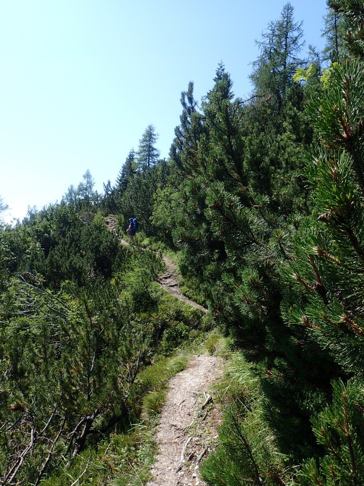
We set off along the road outside the hotel before veering off into the woods to pick up the Alpe-Adria again. The woods were beautiful and the walking was easy, but we soon encountered a problem that would hound us until the final steep climb to the night’s hotel: countless cyclists on the trail. We were in the heart of a holiday area and lots of people had clearly rented bicycles for the day or the week, without really knowing how to use them on a trail. For most of the morning, we were continually stepping aside to allow them to pass as many seemed to feel they had priority over us. There were very few other hikers about and, from this day on, we rarely met other people on the trail, apart from the occasional day-hiker.
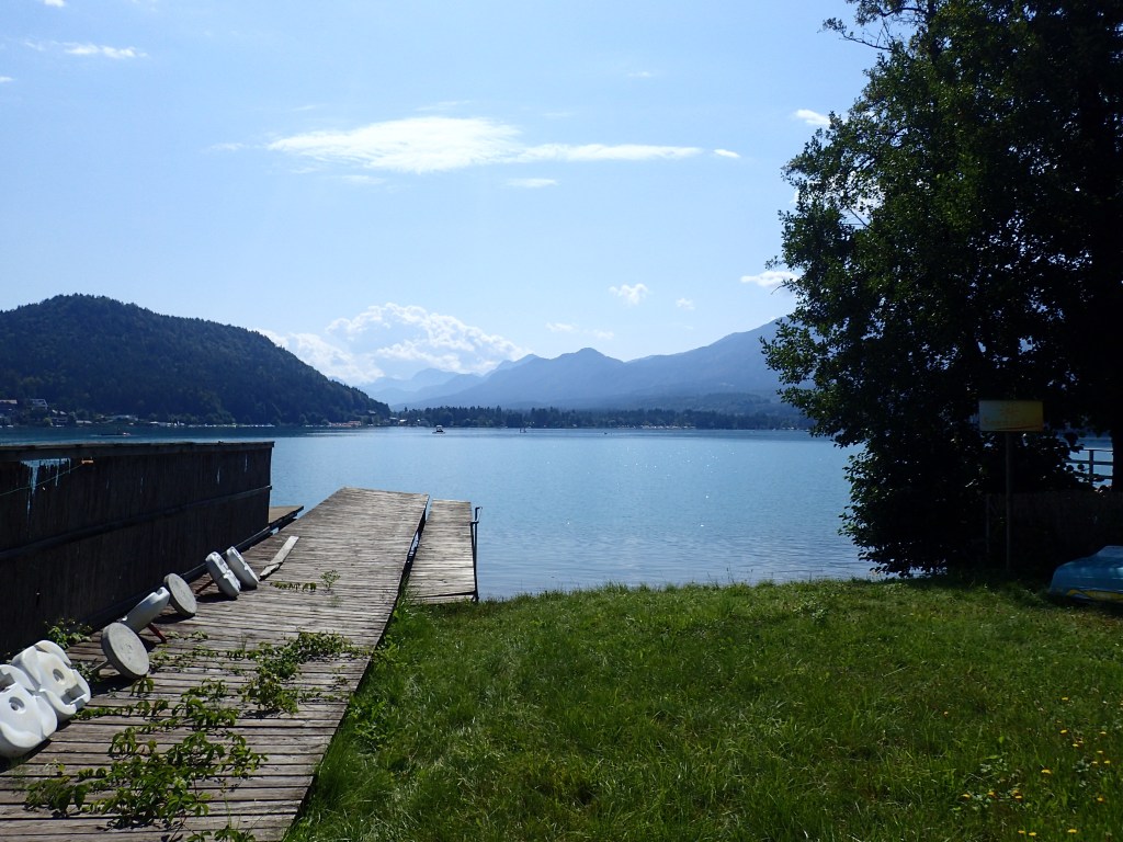
On emerging from the woods, we had a long slog along the banks of the Drau. There was not a scrap of shade along this section and the sun was already beating down. However, there was a light breeze blowing to take the edge off the heat and, after crossing the motorway and the pretty village of Bogenfeld (where a charming old lady urged us on), we came across a thoughtfully positioned drinks’ dispenser after a steep climb. Revived by a cool drink and coffee, we then had a brief section along a busy road before veering off to follow the path around the Faaker See, once again trying to dodge all the bicycles. We found this lake much more pleasant than Velden. There were pretty little holiday huts at the water’s edge and much less bling on display. The whole place seemed much more normal, with a pleasantly nostalgic air of summer holidays in simpler times.
We stopped for lunch and supplies for the next day in the village of Faak am See. Our lunch, a pleasant break on a shady terrace, was followed by another longish section of trail without shade in the midday heat before the 400-metre climb to our hotel at Baumgartner Höhe.
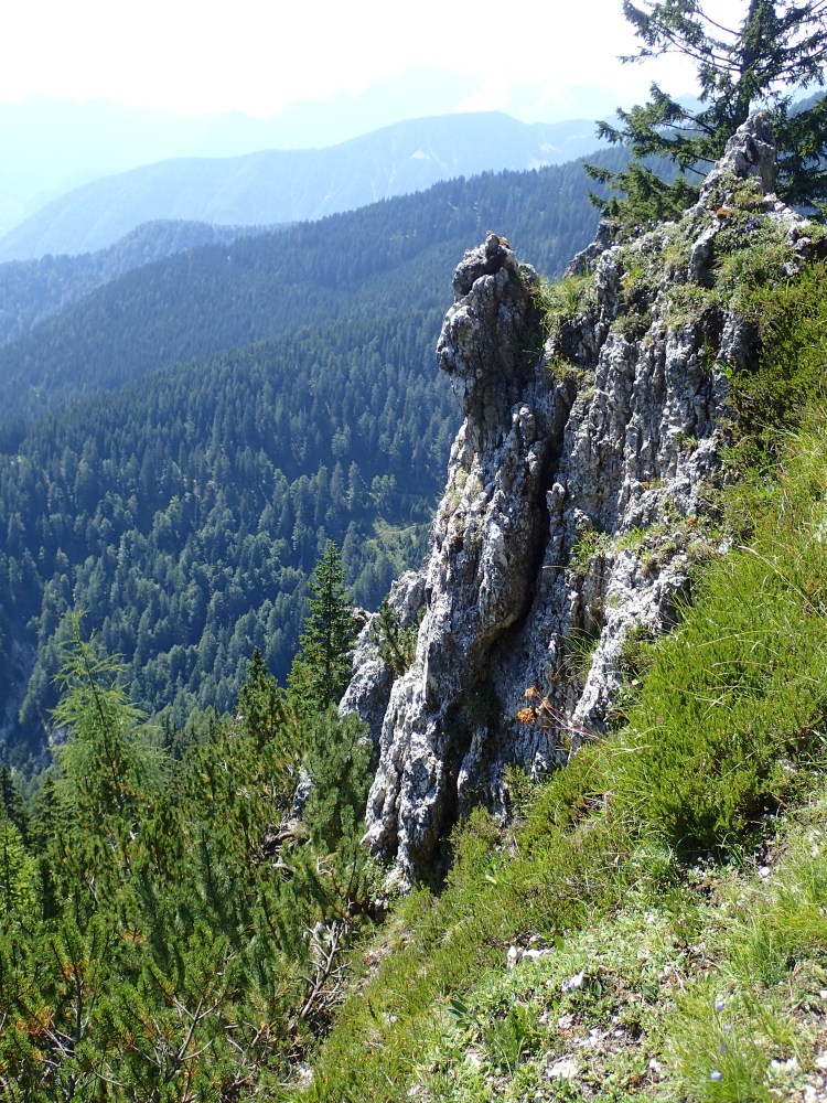
Fortunately, we soon completed this exposed section and, just after the pretty village of Pogöriach, we entered the woods for the steep climb to the Finkenstein ruins, a spectacular old fortress perched on a rocky outcrop. We then had an easier climb to Baumgartner Höhe despite another detour for a blocked path.
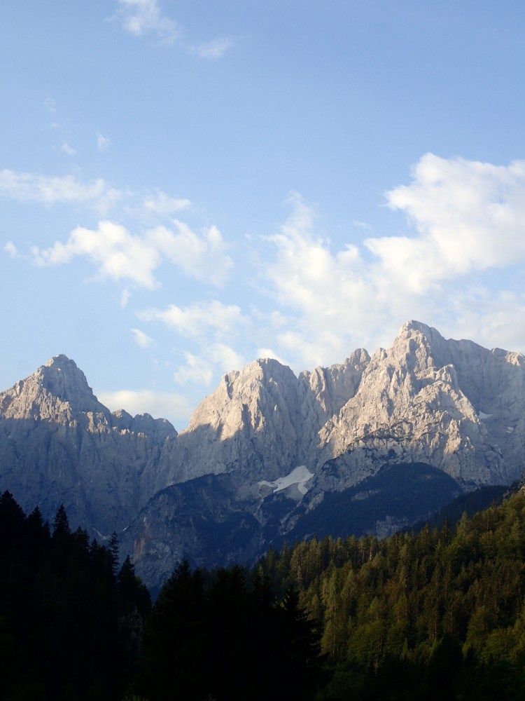
This hotel was in a terrific setting. The huge terrace, where we had a reviving beer on arrival, had a magnificent view back over the trail covered in the previous days, with the Faaker See, Velden, the Gerlitzen and the Falkertspitz clearly visible. And our room, on the other side of the building, had a view of the Karawanken range and the peaks that we would be climbing the following day. It was an impressive and slightly daunting sight.
We had a great evening at the Baugartnerhof, enjoying an excellent dinner on the terrace with its wonderful views before retiring for a good sleep to set us up for the next day’s efforts.

In our Kompass guide to the Alpe-Adria, which used various colour codes to indicate the difficulty of each day’s hike, the stage from Baumgartner Höhe to Kranjska Gora was the only one marked in black, the toughest category. With an ascent of 1380 metres and a descent of 1470, it indeed turned out to be the hardest day on the whole trail. But the difficulty was offset by some of the most spectacular scenery since the Grossglockner glacier.
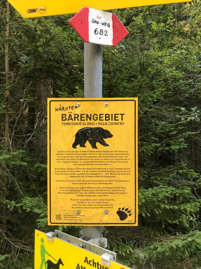
After a fine breakfast on the hotel terrace, we set off beneath clear blue skies, eager to reach Kranjska Gora and meet up with three Slovenian friends. We were surprised to find the trail heading downhill at first but that soon changed and the steep climb began through the woods to the Jepcasattel where we would cross into Slovenia and say goodbye to Austria. Just after a spring at around 1100 metres, we came across a sign warning us about the presence of bears. We knew there were plenty in Slovenia (my friend Polona had sent me a video of one in her back yard), but we had no idea they could be found on this side of the border too. Shortly after, I heard a grunt that seemed to come from the woods to the left. Odile swore she hadn’t made a sound and that she didn’t hear the grunt, but I like to think that there was maybe a bear foraging a short distance away.
After one final, very steep section, we found ourselves on the border, indicated by a small sign in Slovenian and a line of border stones marked RS on one side and RO on the other. It was pretty underwhelming, not that we were expecting a brass band to greet us. I recall crossing from France into Switzerland in the 80s on the GR5 trail and having to show my passport to a lone Swiss border guard, bored out of his mind in a mountain hut. But there was nothing like that here. Indeed, we hadn’t even been able to fill out the traveller locator form (required in both Slovenia and Italy in the Covid summer of 2021) as there was no box to tick for arrival on foot. I guess “green” travellers slip through the gaps.
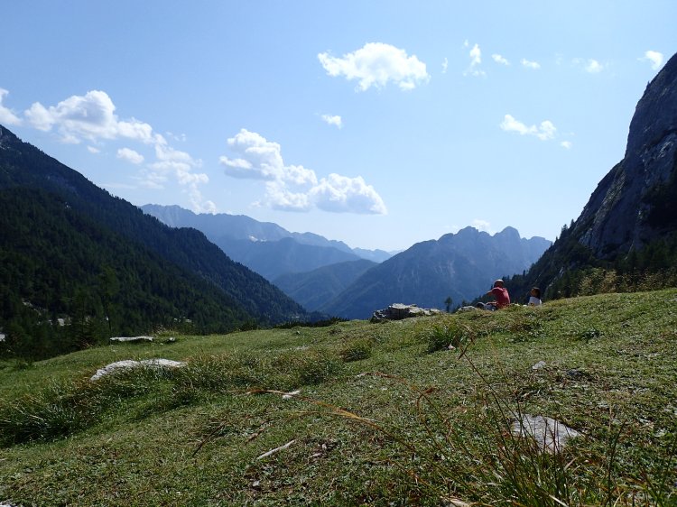
If the border itself was underwhelming, nothing else was. As we followed the narrow, undulating path along the border, just inside Slovenia as indicated by the border stones every few metres on our right-hand side, we were treated to truly spectacular views of the new country that we had just entered. This section of trail was a total delight. I had expected an exposed ridge walk from the line on the map, but the ridge turned out to be thickly wooded with big patches of shade as we went along. There was also a light breeze blowing and, in the shady patches, it created refreshing “cool-air showers” that took the edge off the day’s heat. Without a cloud in the sky on this glorious day, every bit of shade was welcome, even at this altitude.
As on the path up to the Gerlitzen, there were numerous ant highways across the trail. However, the ants on this narrow track were moving at an incredible speed. I don’t know if it was due to the slightly higher altitude, but they were working at an amazing pace. Or maybe Slovenian ants are just more frantic than Austrian ones!
We continued to climb from the Jepcasattel at 1438 metres to reach 1842 metres at the Schwarzkogel summit. All the way along, there were magnificent views of the mountains that were nothing like the peaks we had seen until that point, with an almost Dolomite-like aspect to them. With such spectacular scenery all around, we barely realized that we were still heading uphill and the 400-metre climb was made without us suffering much.

There was, however, one tricky technical section just before the Schwarzkogel. The final ascent was along an exposed ridge with a long drop on either side. Odile had been leading the way since the border and setting a good pace, but her vertigo suddenly kicked in at this point, which wasn’t at all surprising given the terrain. We switched positions and I told her to focus solely on the back of my head. In that way, we managed to get across this tricky section and complete the climb to the summit without her seizing up and being unable to go on.
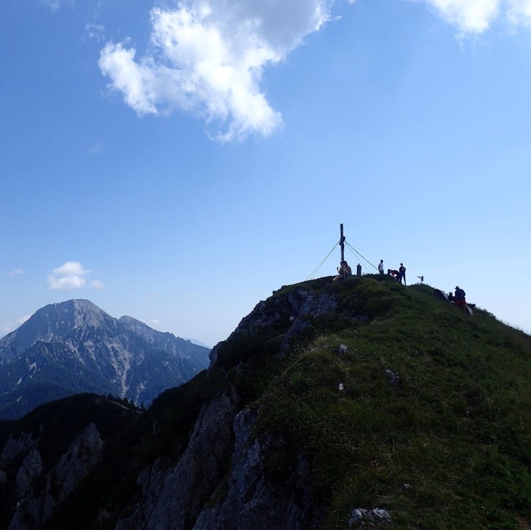
We didn’t spend long at the summit as every flat spot was covered with an incredible amount of fresh goat droppings, but headed down to the pass below for our lunch stop after taking in the fantastic view back over Baumgartnerhöhe, Velden, the Gerlitzen and the other Austrian summits passed along the way. This view had been concealed by the trees since the border, but we were finally able to take one last look at Austria before beginning our descent to Kranjska Gora.
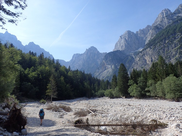
After lunch, the trail was very easy to follow and clearly marked through woods and the occasional alpine meadow, with glimpses of the ski runs above Kranjska Gora every now and then. However, it was far from easy walking and we came across something that would plague us all the way across Slovenia – stones. We had seen stony and root-riddled sections in Austria, but never anything like what we encountered after crossing the border. It no doubt had a lot to do with the friable nature of the rock but, over the next few days, it would seem like every stone in creation had been dumped on Slovenia’s trails, particularly on the descents. We’re not talking about pebbles or gravel here, which we could have easily dealt with, but rather large, unevenly shaped stones that would continually slip and roll beneath our feet. This, of course, made all progress irregular, slow and tiring as hiking such sections of trail was a permanent balancing act! And, as an introduction, we were treated to a 600-metre stony descent between our lunch stop and Srednji Vrh in the Kranjska Gora valley. Fortunately, we were able to stop halfway and give our poor feet a good soaking in a cold stream. But it was a pretty tough descent all the same, worthy of the black rating in the guidebook.
When we finally made it down to the valley, we were way behind schedule and had to text our Slovenian friends, just before the phone battery died, to warn them we were likely to arrive an hour later than planned. And, to make matters worse, just after Srednji Vrh, we missed a fork in the trail (that passed through the yard of a farm) and set off in the wrong direction along a road that headed uphill. The uphill bit was what alerted us after a while as we knew we should be heading downhill, but we’d already gone about a kilometre out of our way by that point, misled by markers for an Alpe-Adria Trail race that would be taking place the following week and that were hanging from the trees.
And so we turned back, found the right track through the farmyard and headed for Kranjska Gora along a very pleasant and easy path that slowly descended to the valley and the town. By now, we had both run out of water and were feeling pretty weary. However, with our goal just 4 km away, we kept soldiering on, eager to arrive more than anything.
And what an arrival it was. After making our way through the distinctly unprepossessing outskirts of Kranjska Gora and following a ring-road that led to our hotel via the Corona (sic) casino, we were greeted on the parking lot of the Best Western by my three Slovenian colleagues, Polona, Barbara and Jerca, who had driven up from Ljubljana to spend the evening with us. Barely able to utter a word at that point, from exhaustion and dehydration, we must have been one hell of a sight after almost 10 hours of tough hiking (even though all three kindly said we looked fresh as daisies). After we rather listlessly declined their offer to take a quick walk to visit the source of one of Slovenia’s two main rivers, they packed us off to our room to get washed while they went for tea on the hotel terrace. Half an hour later, we emerged, refreshed, to be driven by car (!) for dinner in an atmospheric inn in the centre of the town with a very sassy and funny waitress who more or less told us what to eat. It was a wonderful evening, with good, hearty food, excellent beer and a lot of laughs, especially when Polona pulled out a gift that her Irish partner, Finn, had suggested bringing: two bars of soap as we would probably be smelly! A gift that did indeed prove useful over the following two weeks. We finally said goodbye to them outside our hotel at around 10 pm, making it a late night for us on this trip when we had usually been sound asleep by that time.
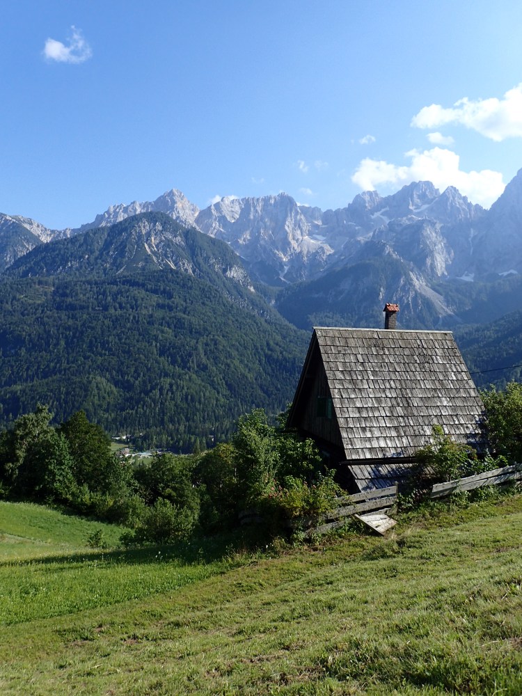
The next morning, we woke to glorious weather: blue skies with just a few light patches of cloud and such inspiring views from our room of the range towards which we would be heading that we couldn’t wait to get out there.
However, the day turned out to be particularly tough, for a number of reasons.
First, despite an excellent night’s sleep, we were more tired than we realized after the previous day’s exertions. Running out of water had left us a little dehydrated, no doubt, and our pace was pretty slow on the 1,000-metre ascent to the Vrsic Pass. From this day on, apart from a couple of shorter days, I began to carry an extra litre of water in my pack for emergencies, especially as water sources became rare as we headed further south.
Second, the trail markings were also pretty disastrous between Kranjska Gora and Trenta and we veered off the trail more than once. We always managed to find our way back onto it and didn’t go too far out of our way, but we did end up hiking along a very busy road at one point when we should have been in the woods.
And, third, the terrific breakfast buffet at the hotel, with loads of Slovenian specialties to sample (buckwheat porridge!), left us, well, a little heavy for the first few hours until we finally digested everything that we had stuffed ourselves with!
That said, the day began easily enough with a gentle walk out of Kranjska Gora to Lake Jasna at the end of the town before a gradual and steady ascent along the Velika Piscnica valley with the towering, rocky peaks ahead of us all the way. It was a very pleasant section of trail and easy to follow, which was a good job as we had seen very few Alpe-Adria signs since leaving Kranjska Gora.
After a while, the trail took a sharp right turn to head up to the Vrsic Pass and that was when things began to get tricky. After another pleasant section across some meadows, we headed into the woods and the markings more or less vanished. Fortunately, the trail was still clear at this point and we had no real problems making it as far as the Russian Chapel.
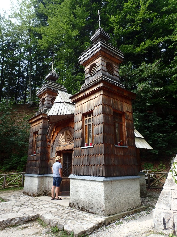
This beautiful, tiny chapel in the heart of the woods (albeit by the main road up to the pass) was built by Russian POWs during the First World War and now stands as a memorial to 200 prisoners of war and soldiers killed during an avalanche in 1916. Despite the large numbers of tourists, this was a very peaceful and moving spot.
It was on leaving the chapel that we lost the trail markings completely. There was a trail to follow, that more or less resembled the one in the guidebook, but the markings simply vanished. We carried on uphill through the woods, following the steep track before emerging onto the fairly busy main road to the pass. We were unable to spot the trail that was supposed to cut across the hairpin bends and were thus obliged to follow the road as it climbed, frequently hopping onto the narrow embankment to avoid the cars speeding by. Not a very pleasant 15 minutes.
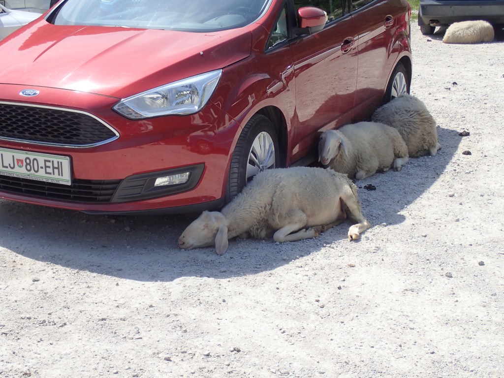
Fortunately, this section was soon over and, shortly after a small military cemetery (again from World War One, a conflict whose presence would become more and more visible along the remainder of the trail), we reached the car park of a small mountain restaurant were we stopped for a drink of blueberry juice and sparkling water. It was a beautiful little spot, made memorable by the huge numbers of sheep basking in the shade of the vehicles on the car park and that refused to move, even when drivers started their cars to leave.
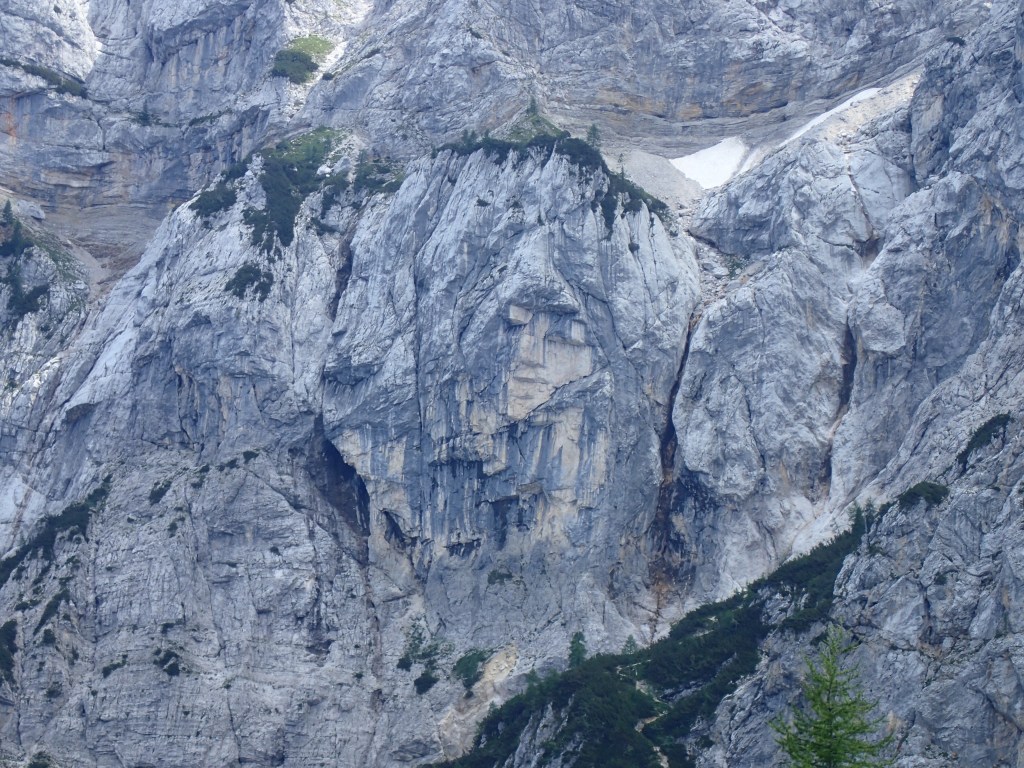
After our stop at the mountain hut, one guidebook showed the trail as following the road to the pass, which we did not want to do, while the other indicated a way through the woods. The latter, despite the total absence of trail markings, turned out to be the ideal solution. It seemed to be an old drover’s trail to the pass, fallen into disuse since the opening of the road and now only used by hikers. It made for a very easy climb with a lot of shade (that those sheep clearly didn’t know about!), avoiding the pass itself to lead us directly to a spot opposite the Pagan Girl rock, providing a terrific view of it. Legend says that a young maiden who prophesied the death of a legendary chamois buck was turned into a rock as punishment and has overlooked the Vrsic Pass ever since. A face could indeed be made out on the mountainside, as shown in the photo just below.
From this viewpoint, we headed down and joined the crowds again just below the pass where there was a small café-restaurant and a hut selling cold drinks, along with a huge grassy area where we flopped down now that the climb was over, along with what felt like everyone else – hikers, cyclists or drivers – crossing the pass that day!
We took a fairly long rest, before setting off along the busy road that we had to follow for about 200 metres. We then veered off onto a very steep and stony trail. This one was even more of a nightmare than the descent to Kranjska Gora the previous day. For a good hour, if not two, we stumbled our way over rocks and stones that kept slipping beneath our feet. Every step was a new balancing act. This was where the hiking poles came into their own as we made the 1200-metre descent from the pass to Trenta. Without them, it would have been almost impossible to stay upright and steady on the treacherous terrain. After a while, we began to hear water flowing to our right. That cheered us up as we thought it was the sound of the Soca, whose source we were due to pass. However, it turned out to be another watercourse entirely, just an ordinary mountain spring flowing into the larger river, and it wasn’t until about 45 minutes later that we emerged onto the road at the foot of the stony descent, with the Soca source 1.5-kilometre’s walk or so to our left. We decided to give it a miss and carry on to Trenta.
Shortly after emerging onto the road, we spotted someone lying flat out, with another person apparently trying to revive them. We ran towards them, shouting to ask if they needed help. They turned out to be two German ladies. The one lying down was perfectly fine, simply relaxing, while what we took for CPR from a distance were stretching exercises her friend was putting her through! They had both suffered on the descent and one of them told me that she had sworn never to hike over stony terrain again after a hike in Scotland, but had then had a very unpleasant surprise since arriving in Slovenia where the terrain was even worse.
Things got a little easier from this point on, with a fair bit of the trail on surfaced roads, something we usually hate but which came as a pleasant break after the hellish descent. However, poor signage made us lose our way more than once on the undulating trail. Looking at the day’s track later on my hiking app, I saw we had made a huge number of U-turns between the Soca source and Trenta.
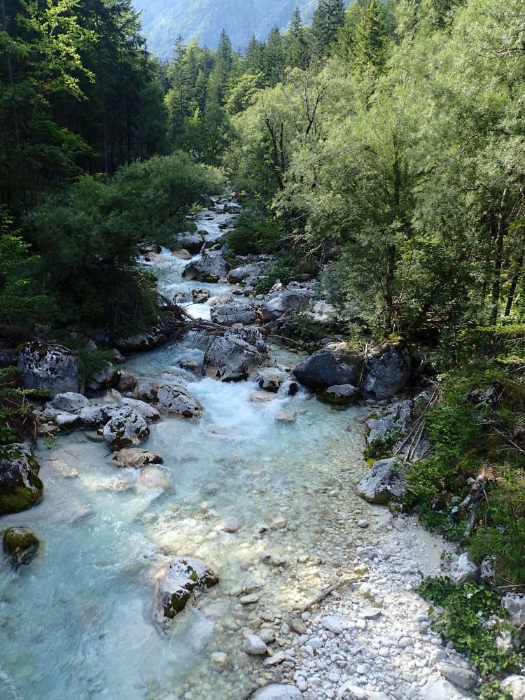
Despite our exhaustion (by the time we reached Trenta, we would have covered over 60 km since leaving Baumgartner Höhe), we were nonetheless delighted to finally discover the Soca, the river that would accompany us for a fair share of the remainder of the Alpe-Adria, either as the Soca or the Isonzo once we crossed into Italy. The photos we had seen before leaving hadn’t really prepared us for the beauty of this amazing river with its crystal-clear waters.
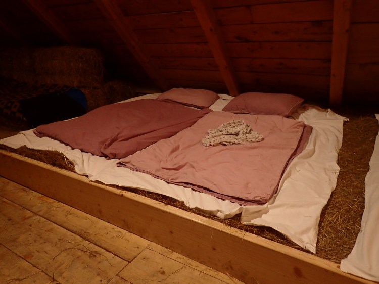
We finally staggered into Trenta at around 6 pm, eager to discover the organic farm and hostel run by Polona’s friend Stanka. However, on reaching the main square of the tiny village (and getting another marker point on our Alpe-Adria app) we discovered that the farm was another 2.5 km further on, with another climb to reach it along a narrow road, where we lost the trail again and went another few hundred metres out of our way. Fortunately, Polona had called ahead to say we would be wanting dinner. When we arrived at the farm at 6:40, Stanka’s youngest son informed us that dinner was at 7 o’clock. He showed us to our accommodation in the hayloft (more about that in the next paragraph) and, after a quick shower, we took our seats at 7:05 for a terrific dinner served by Stanka’s husband and their oldest son: lentil soup, then a salad of freshly picked tomatoes, followed by pork and lamb sausage, served with a blend of rice, spelt and barley, veggies and a little fresh sheep’s cheese, and finally, for dessert, a plum crumble with a layer of crème pâtisserie between the fruit and crust. This was washed down by a delicious local hemp beer before a bottle of “digestive” schnapps was left on our table to conclude the meal. Apart from the hemp beer, everything that we consumed (including the schnapps) had been produced on the farm. One of the best meals since setting off 21 days earlier. Stanka had been slaving away in the kitchen throughout dinner, but we got to talk to her after just outside the hayloft and she turned out to be a lovely lady, kind and generous (as we had sensed from her cooking).
After another exhausting day of over 10 hours on the trail, we were eager to sleep. On Polona’s advice, we had booked two places in the hayloft. We didn’t really know what to expect, and I feared that my allergies would kick in during the night, but we ended up having a terrific sleep in the loft that we shared with a German couple who had been traveling around Croatia and Slovenia, and a family of five from Ljubljana. We slept on sheets spread out over a wonderfully fresh smelling layer of hay, with warm quilts (we were still at 800 m altitude) and comfy pillows. We didn’t wake once in the night and there wasn’t the usual snoring that makes sleeping in mountain huts so problematic (maybe the fresh hay has an anti-snoring effect). A wonderful conclusion to a very tough day and the end of our third week of hiking.