Even though neither of us are particularly superstitious, after a night in room 13 at the Erlacherhaus, our 13th day on the trail turned out to be one of the worst where the weather was concerned. It was also a day when I realized I might have missed my true vocation!
Light rain was falling when we woke, but having had no access to weather reports because of the lack of phone cover, we had no idea what the forecast was. As I was paying the bill, the owner’s daughter told me that the rain was probably going to ease off by midday. As the day was described as “difficult” on the app and in the guidebook, requiring almost 7 hours for just 14 km, we decided to get into our rain gear and risk it, as did Katy and Mike, along with the guy hiking alone, and set off at around 8:20. The other three had much lighter packs (and longer legs), so we soon lost sight of them.
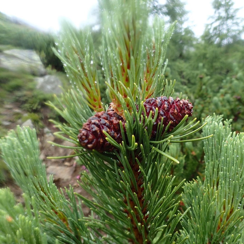
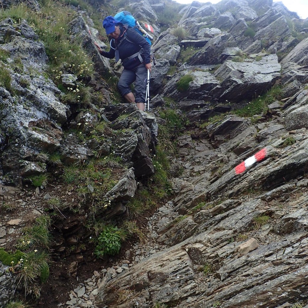
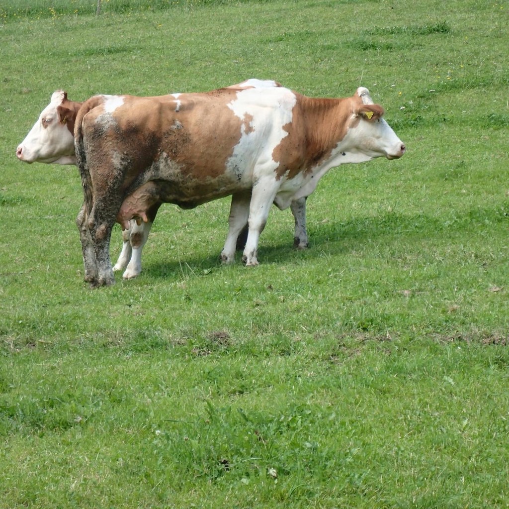
The trail initially followed a mountain road, where we passed Herr Erlacher tending to his cows, as we began the ascent from 1600 m to 2200 m. It was a steady, fairly easy climb at first but, after veering off the road, it became a little more complicated. The rain became heavier and banks of mist were shrouding the summits above. There were streams to ford, marshy areas to cross and, as we began to climb higher, a tricky expanse of huge, precariously balanced stones to cross while following the red and white markers. Looking back, we could see only one person behind us making the ascent. It turned out to be Birgit. She caught up with us in a forest of dwarf pines and asked if she could walk with us as she wasn’t feeling totally confident given the weather conditions. We agreed, of course, and the three of us set off again together.
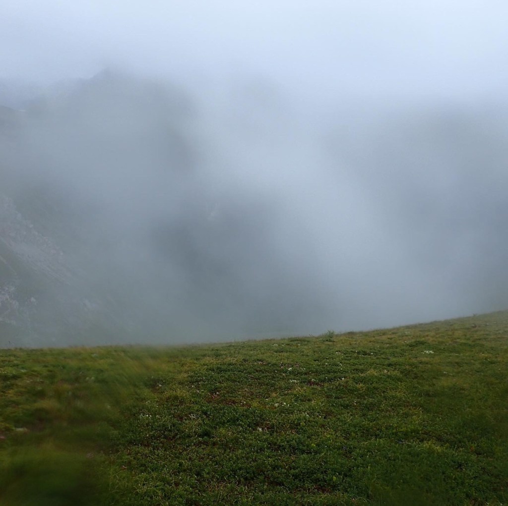
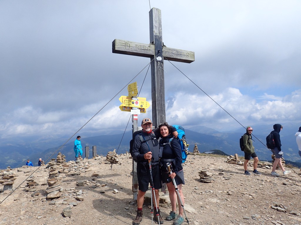
The trail continued to climb towards the first summit, the Predigerstuhl. The word means “pulpit” and the summit did indeed resemble a church pulpit at the end of a long line of cliffs. The trail led us up to a sort of saddle from which we had a steady climb to the summit cross, via the cliff tops. By this point, the wind was howling around us so much that Odile had to remove her rain poncho to avoid taking off like a kite! Great banks of mist would come rolling towards us, envelop us and then move on. We felt like Lear in the storm.
At the top, we set the camera up for a souvenir photo with Birgit, but the first attempt failed when the wind blew the camera off the pile of rocks where I had positioned it. It was only by jamming it in a sort of nest of stones that we managed to obtain the photo below.

We obviously didn’t linger long and soon set off again. This was when I began to wonder if I might not be happier as an outdoor guide than as a film translator. As I led the way for Odile and Birgit, finding the next markers and regularly checking both of them were okay, I felt totally in my element. At one point, on the steep climb to the next summit, the Kleine Pfannock, Odile’s vertigo kicked in momentarily, so I asked Birgit to take the lead and brought up the rear, talking to Odile all the time to reassure her. Obviously, at my age, I’m way too old to change careers and become an outdoor guide, but if I could turn back time…
We had the option of then climbing to the summit of the Pfannock, but the three of us decided there was no sense in going even higher in such conditions. The rain was easing off, but the wind and mist were still very present. And so we began the steep descent towards the two small lakes at the foot of the Pfannock. As we descended, I couldn’t help thinking of the opening scene of Werner Herzog’s “Aguirre” with the conquistadors descending a steep trail in the mist of the Andes. Even though there were only three of us, the setting and conditions made me see that whole scene again in my mind.
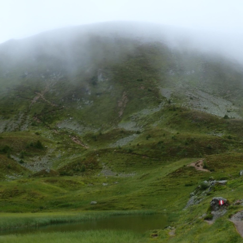
It was close to midday by this point and, as forecast, the conditions did indeed begin to improve. We made a brief refuelling stop below the lakes before carrying on, with another more modest climb to the next ridge where we had the option of climbing another 100 m to the summit of the Mallnock, which we also decided to skip.
From this point, the trail began its 600m descent to Falkerthaus, at first gently descending the ridge between two valleys from which we had great views back over the route covered. By now, the sun was out and we were able to remove the rain gear. At the point where the trail began to descend more steeply, Birgit decided to stop and take in the view while we carried on. The final kilometres were very steep, but the magnificent section of mossy pines that we were crossing took our minds off our howling thigh muscles.
We finally spotted the Falkerthaus through the trees, with Katy and Mike waving from the terrace. They were waiting for a taxi to Bad Kleinkirchheim as the Falkerthaus didn’t take dogs (there were no individual rooms). They too had suffered in the harsh conditions earlier, but agreed with us that it had been a great day. The other guy who was hiking alone was also there and looked pretty tired. The friendly and very lively hut manager served us a great strudel before we discovered the room we would be sharing with others – a long row of comfy beds in the attic of the house. In the end, only Birgit shared with us while three or four others shared a second room next door. The place was pretty basic – hardly any hot water, capricious power and no phone coverage but it was cheap, clean and had a great atmosphere thanks to the family running it.
A couple of hours after we arrived, Luis showed up (to camp just outside), followed shortly after by the little lady who was having her bags transported and then the Munich-Hamburg couple. They were surprised that we had left so early, but the place that they had stayed at the night before had had wifi and so they had known to wait until midday for the better weather before setting off.
We had a great evening, chatting to the others while savouring the terrific speck nudeln that were a speciality of the house and that we would never come across again. The two Austrian ladies arrived fairly late (having clearly had access to a precise weather forecast too!), but decided to carry on to the next hut on discovering that both group rooms had men in them!
Our fourteenth day of hiking was a pleasantly sunny one and the day when we began to invent our own trail at times. Until now, we had followed the Alpe-Adria religiously (apart from the shortcut we had taken to the Alexanderhütte), but Katy had told me that the trail had been designed to favour local businesses and that it was unnecessarily long at times to take in various restaurants and villages. This was also confirmed by the Falkerthaus hut manager who told us over breakfast that a number of shortcuts would be possible that day. Even so, on setting off, we were planning to follow that day’s trail, with its 1263 m in ascents and 1752 m in descents.
The day began with a fairly easy climb through the woods. Birgit and the guy hiking alone had left just before us, Luis was barely stirring in his tent when we set off and the Munich-Hamburg couple overtook us when we made a sunscreen stop after the first 300 m climbed. There was no sign of Katy and Mike who were supposed to return by taxi to Falkerthaus to pick up the trail. We never saw them again.
After our brief stop, the trail headed into the Hundsfeld valley where we began a very steep climb up to the pass between the Falkertköpfl and the Falkertspitz. The trail was tricky to follow at times because there were a lot of cows around and they had created alternative tracks that branched off from ours. However, by following the red and white markings, along with the other hikers above us, we managed to find our way up the steep mountainside, complete the first 700 m of ascent and reach the pass.
There was a strong wind blowing at the pass and the trail wasn’t easy to find. According to the app, we were supposed to carry straight on to reach a small lake at the foot of the Falkertspitz. At the same time, there was a path to the right that led to the Falkertspitz summit that a lot of people seemed to be taking. I left Odile with the packs and went to scout the “official” route from a vantage point. I could see the trail heading downhill in a long and gentle descent to the lake where there was a huge car park, the buildings of a ski resort and a number of restaurants. More importantly, not one of our fellow hikers could be seen on the trail heading downhill. They had all clearly turned right to head up to the Falkertspitz summit. So we decided to do the same. This was a major shortcut that saved us around two or three km and a steep climb back up from the lake to the trail after passing through the rather unappealing village below.
On reaching the Falkertspitz summit at 2308 m, we found all the others – Birgit, the Munich-Hamburg couple and even the little lady having her bags transported. Everyone had decided to give the lake and ski resort a miss.
We took a break at the summit, gazing at the terrific view back towards the Predigerstuhl and chatting to the others, unaware that it would be the last time that we would see the Munich-Hamburg couple and Birgit (even though the latter had a few more days to walk). We expected to find them in Bad Kleinkirchheim that evening, but the town proved to be so spread out along the valley without a clear centre, we lost track of them.
Shortly after the steep and tricky climb down from the summit (shown with a ladder next to it on my map!), it was possible to return to the official trail at the next pass or follow a more direct route to Bad Kleinkirchheim along the Totelitzen ridge (marked in red and white). As the official trail made a long detour to take in a mountain inn that had shut down for good during the pandemic, we opted for the more direct route.
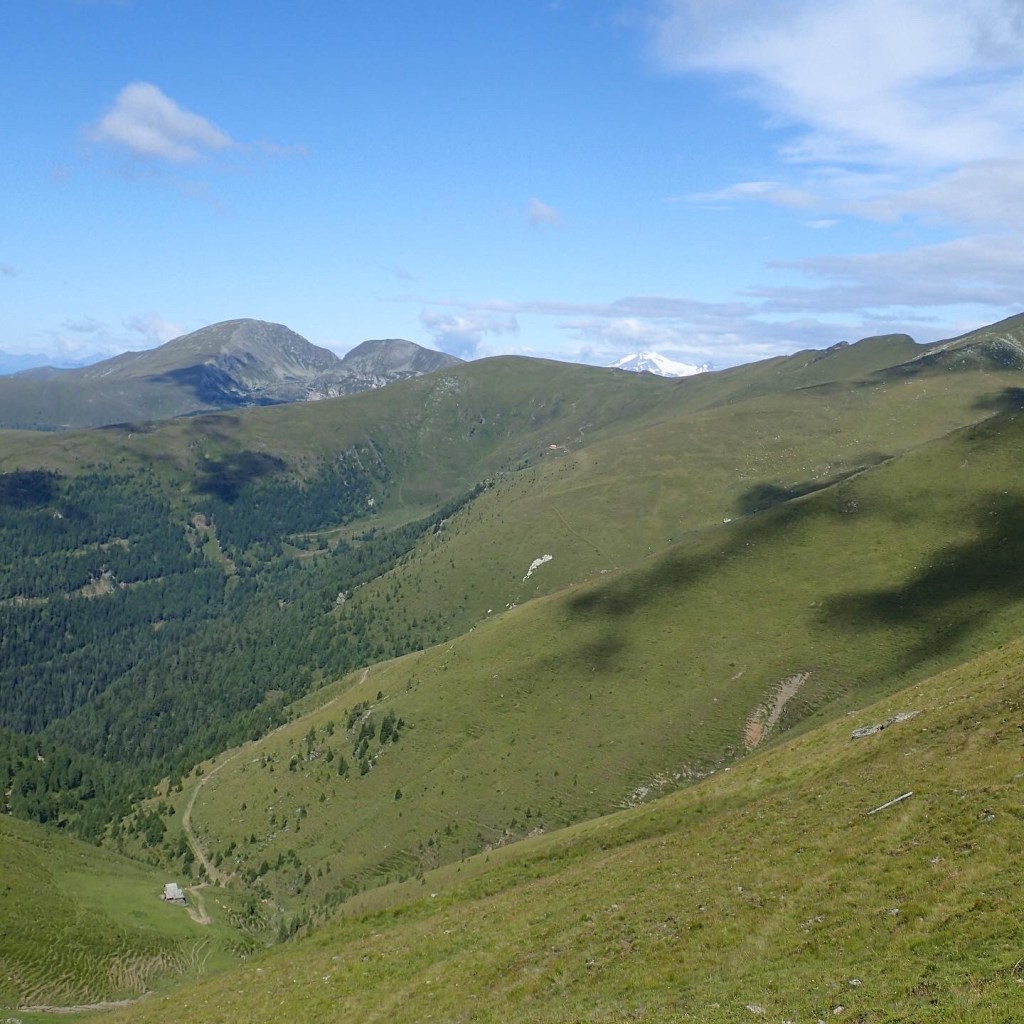
The track along the Totelitzen ridge was a delight – gently descending and easy to follow with lots of friendly cows. Ahead, we could see the Wöllaner Nock above Bad Kleinkirchheim and, beyond it, the Gerlitzen and the Karawanken range at the Slovenian border, all of which would be crossed in the coming days. About halfway along the ridge we found a mass of rocks where we were able to shelter from the wind for a lunch stop and a brief nap in the sun.
At the end of the ridge, the descent became much steeper with a combination of forestry tracks and steepish paths through the woods to descend almost 700 m to the valley. On reaching the village of Zirkitzen, we returned to the Alpe-Adria via a local Wanderweg that took us straight to Bad Kleinkirchheim.
On reaching the main road through the town, we stopped at a bakery for a slice of cake and tea (and to recharge our phones). The town was spread out over a distance of around 3 km and our hotel was at the other end of it. After a stop at the supermarket for lunch supplies for the coming days, we carried on towards the local tourist office where we found the guy hiking alone. He had finished his three days on the trail and was waiting for a friend to come and pick him up. Just as we were saying goodbye and setting off on the last 200 m to our hotel, Luis arrived to get information on local campsites.
The hotel was very modern and formed a stark contrast with our accommodation of the previous nights. The friendly Hungarian receptionist asked us all kinds of questions about our hike before serving us a couple of welcome beers on the terrace. For dinner, there was a terrific pizza place just across the street where we were able to make a booking for 8 pm. While waiting, we took a walk through the village, stopping for another beer at a cute little place with tables set out under the trees of a pretty garden.
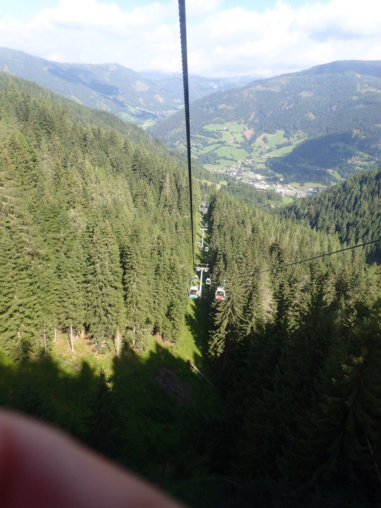
Over dinner, we decided to cheat a little the following morning and take the cable car to the Kaiserburg and so spare ourselves a 1000-metre climb. With some tough days ahead, notably the Gerlitzen summit and the Slovenian border, making the most of the only cable car along the trail struck us as the most logical solution.
As a result, we were able to have a bit of a lie-in the following morning before setting off at around 9 AM, back along the valley to cover the 2.5 km to the cable car station. Even though there were a lot of cyclists around, this was a very pleasant trail that kept pretty much away from the main road.
There was a fairly large crowd at the cable car station but things moved quickly and, in next to no time, we were in our gondola, heading for the summit. It was a pretty ride above magnificent pine forests, then alpine meadows as we approached the top.
It was sunny at the summit station, but an icy wind was blowing, requiring an extra layer of clothing for the climb to the Wöllaner Nock summit at 2145 m.
From the summit, there was a gradual descent along a wide ridge to the Vorderer Wöllaner Nock where we lost the majority of the day trippers who had taken the cable car from Bad Kleinkirchheim. We could make out Arriach, our destination for the day, far below. From there, we had a very steep and stony descent to a sort of plateau with a car park where model plane enthusiasts were flying huge radio-controlled gliders that we had initially taken from afar for birds of prey, until realizing that very few birds have red, shiny, metallic wings!
Shortly after, the trail left the road to head down through the woods over a carpet of grass and pine needles that was very pleasant underfoot. Unfortunately, this section ended abruptly at a barbed-wire fence that prevented us from going any further. We climbed back up to the road and, from there, we saw that a landslide had blocked the trail. This had clearly happened some time before, but the app had not been updated to take it into account.
We continued to head downhill, at times on the road, at others on paths that cut through the woods. It was a fairly easy and regular descent (of 1300 m). At one point, we met the little lady with the bag transfer who admitted that she too had taken the cable car that morning. So we weren’t the only cheats!
We made a brief lunch stop at Carinthia’s midpoint, a huge circle marked on the ground in a clearing. There were quite a few people around gathering chanterelles and, on emerging from the woods into a more agricultural area, we met a lady with a huge bag of them who was waiting for a couple of friends. We had passed them on our way down and so we were able to reassure her that they would be there soon.
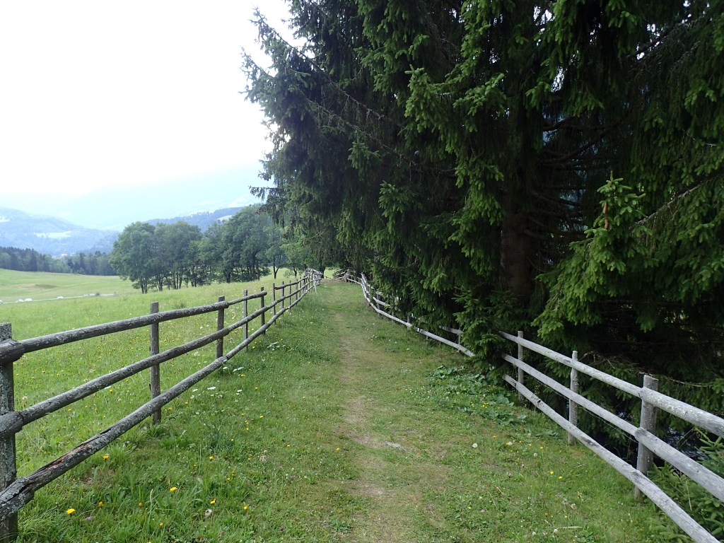
The section between the woods and Arriach was like walking through an agricultural museum again. It was called the Hofwanderweg (the farm hiking trail) and passed a number of beautiful old farm buildings, some of which were of a terrific size. The trail occasionally passed through meadows lined by old fences and there was something so charming and timeless about the setting that we were instantly entranced by it.
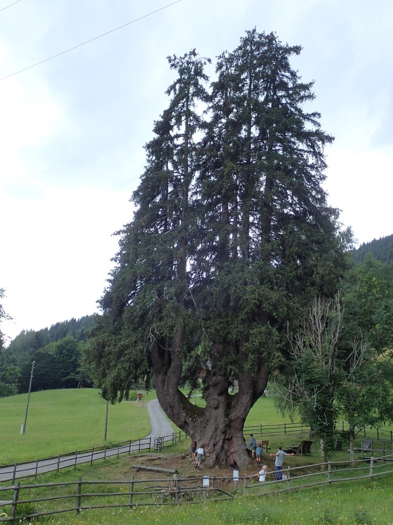
This feeling increased when we reached a huge candelabrum spruce about 3 or 4 km outside Arriach. We stopped to take a photo of this magnificent tree and, just then, the chanterelle pickers (the couple and the lady who had been waiting for them) arrived by car. They urged us to enter the small enclosure around the tree to sample the water from the spring flowing there and, more importantly, to use the Kneipp bath that we couldn’t see from where we were. If they hadn’t turned up, we would probably have carried on without this treat. The ice-cold water worked wonders and, when we set off again for the final descent to Arriach, our feet felt as if we had barely used them that day.
Shortly after , we arrived in the pretty village of Arriach. Our accommodation for the night was just outside the village, part way along the next day’s trail, in a beautiful gasthof run by two very friendly and hospitable Flemish Belgians with a parrot that had recently learned to say “I love you”. They cooked us a great dinner despite being run off their feet by a large group of Flemish visitors who had also booked to eat there. A wonderful atmosphere reigned in the place, as it did around Arriach in general and we had a terrific night’s sleep that set us up for the next day’s long climb to the Gerlitzen summit.
