This was the big one. I had two options, either head for El Vallecillo and pick up the trail there (around 45 km) or follow the route that Komoot had worked out for me via Frías di Albarracín to Guadalaviar (around 35 km). I of course opted for the latter, even if I changed part way and ended up walking 38 km, setting a new personal record.
I was able to get breakfast at 8:30, which meant I could set off earlier than most other days on this hike. I even took my pack down with me so I could leave straight away.
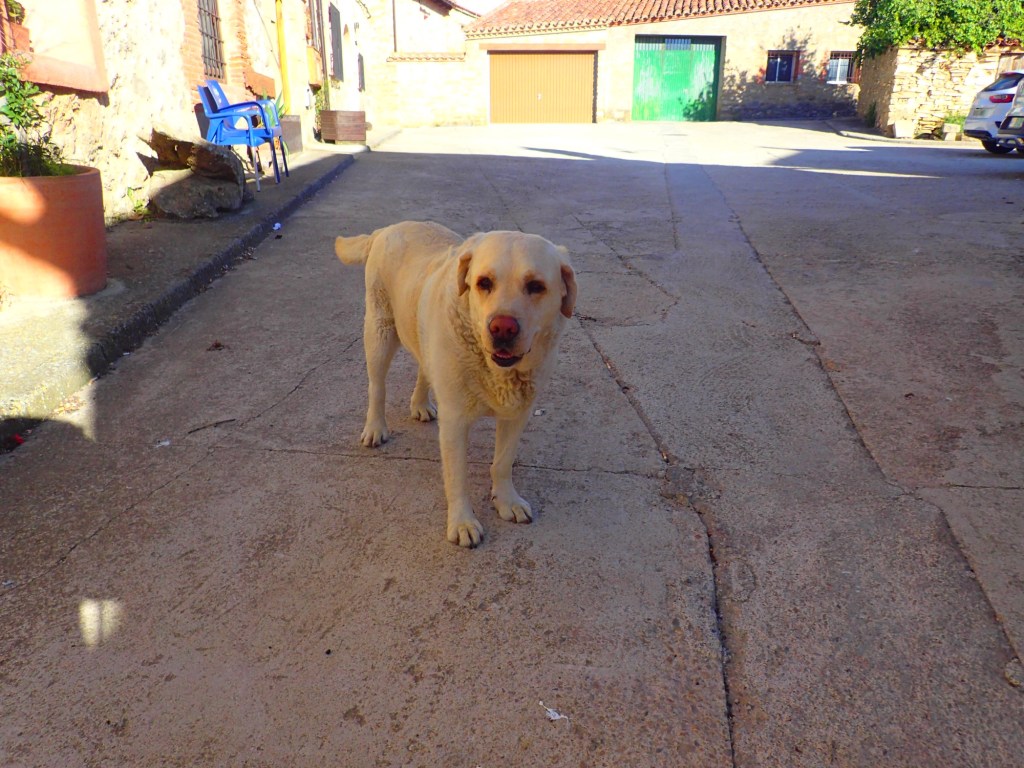
And so I was off before 9 am for once, with Elvis seeing me to the end of the street and Carlos telling me to call him if ever I needed help along the trail. He seemed to think that 35 km might be too much, but Komoot had provided me with a route that only entailed 600 m of ascents in total over the course of this very long day, mostly on gentle slopes, except for one final steep climb towards the end to reach the Portillo Pass above Guadalviar.
It was a cool and sunny morning, with a cold wind blowing again. I crossed the village and began a gentle, barely perceptible climb past a number of farm buildings. The first couple of kilometres followed the road before veering off onto a dirt track that continued to ascend just as gently. There were great views all the way over the plain of farmland below.

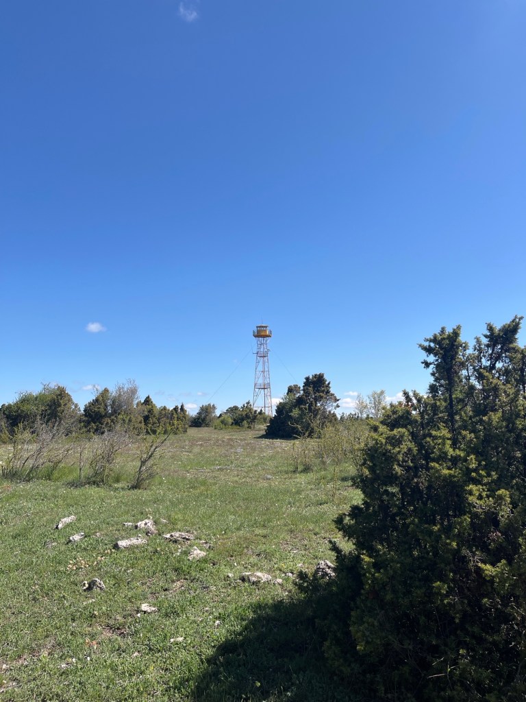
At more or less the highest point of this first section, there was a fire watchtower that didn’t seem manned at this time of year. At the refuge on the first night, the manager had told me that fires weren’t often a problem in the area, but they do occur (usually with criminal intent). I hadn’t seen any signs of past fires along the trail, but on this long day, I saw two of these watchtowers, located on the highest points, indicating that surveillance would probably be in place for the driest months of the year.
The trail began a gentle descent on a long curve at that point, taking me to an intersection where there was a sign for a spring called the Fuente del Buey at just over one kilometre away. On checking the map, I saw that it was possible to take in the spring, then follow a marked regional trail along the valley to hook up with my original trail at the source of the Tagus river. This would add an extra 2 km compared to the trail via Frias de Albarracín that Komoot had worked out for me, but I was feeling energized and the hiking looked as if it would be fairly easy, so I went for it. I had been planning on lunch in Frias, so it would now be a second rehydrated meal in a shady spot instead.
Just before arriving at the spring, I spotted some fellow humans: three guys in a field, moving around rather mysteriously. As I got closer I heard the chirping of countless frogs and realized that they were in a marshy patch of ground in the middle of the field. At first, I thought they might be hunting frogs, but from their gestures it became clear that they were observing or counting them. That was confirmed when I got to the spring and found a car from a local nature conservation group parked there.
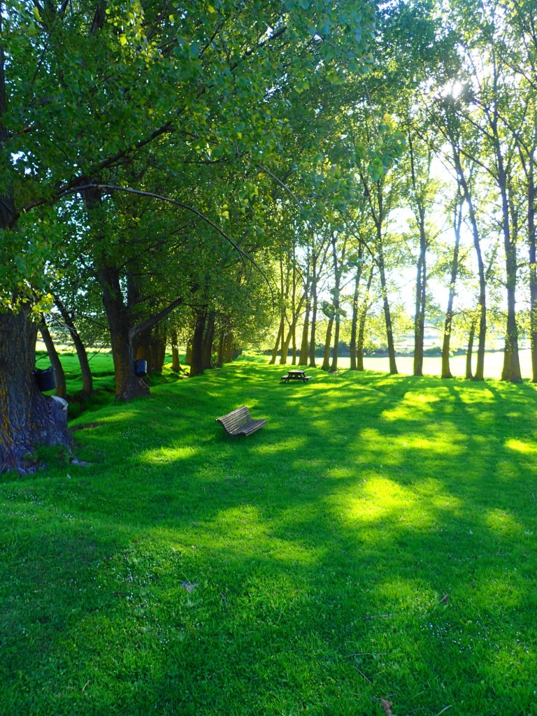
The Fuente de Buey was a gorgeous spot, with shady trees, picnic tables, a barbecue hut and the sweetest fresh water pouring out of the hillside. I swapped all my water from the hotel for this spring water before carrying on my way.
My new trail then led me along the valley that the spring was in for the next three of four kilometres to connect with a regional hiking trail that would then lead me back to the one that I would have been on if I had been able to sleep in El Vallecillo. It was a bit of a long slog along the valley over occasional marshy terrain but, in the end, I hit a dirt road and the markings of the regional trail. After a brief climb, I took a long lunch stop in the well-shaded woods where I messed up a second rehydrated meal (a decent taboulé that I had tested at home) by adding too much water to it!
After that bag of soupy mush and a rest of about an hour, I set off again, crossing the woods and open land of a sort of plateau. This was a beautiful section of trail, with easy hiking, a magnificent blue sky above and the air full of the scent of thyme and juniper. There were quite a few deer around that day and, at one point, I was treated to the glorious sight of three of them running in a line along the edge of the plateau against the sky, unfortunately too fast for me to grab a photo.

From the edge of the plateau, the trail headed downhill again and I began to see signposts for the source of the Tagus, first at 2.5 km, then at 3 km, then suddenly at 1.5 km, before going back up to 2 km. Maybe someone had been having fun swapping the signs around because, on my Garmin app, I saw later that I had followed a perfectly linear trail without veering off it.
As I emerged onto a dirt road and headed down to the source of the Tagus, which continually seemed to be around the next bend, I heard a sound that I had not heard once in the course of the five previous days (and would not hear again over the three ones): approaching bicycles. Yes, more fellow humans, three touring cyclists with all the gear, bringing the number of people encountered on the trail since leaving Arcos de las Salina dangerously close to double figures. They sped past me with friendly shouts of “hola” and I found them a couple of minutes later at the river’s source, posing for souvenir photos with the rather original statue that marks the spot.
That statue… Quite frankly, I hadn’t seen anything like it since a school trip to Romania in 1974 when we were shown around a hydroelectric plant near Bran Castle (supposedly Dracula’s abode) topped with a silvery metal statue of what looked like Iron Man brandishing a bolt of lightning above his head. This one at the source of the Tagus immediately reminded me of it. It seemed so out of place here in the middle of the mountains, at 1500 metres, as if it had been teleported from some house of culture in Eastern Europe before the Iron Curtain came down. After searching online, I found out the statue was placed here in 1974 (the year of that Romanian trip!) and represents Father Tagus. At least, after flowing through Spain and Portugal, the river’s end is marked by a much mort beautiful monument, the Monument of the Discoveries in Lisbon’s Belem district.

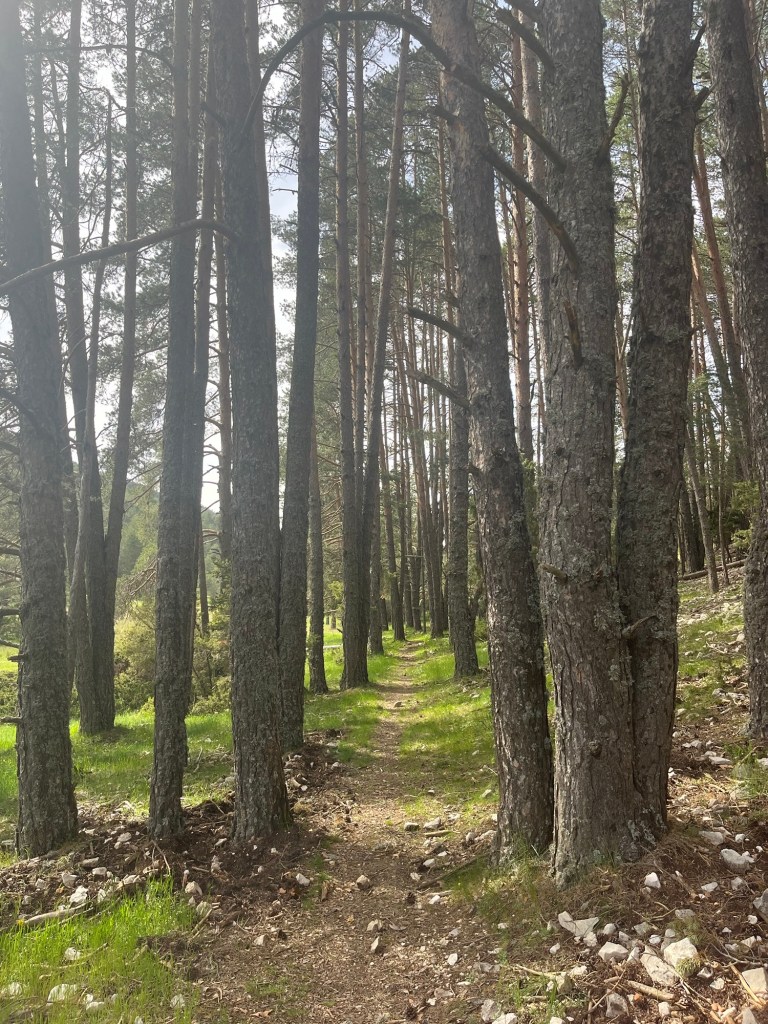
I was able to fill my water bottle with more cool water from the river’s spring and then set off along a trail that ran for about 3 km along the valley before a final climb to the pass above Guadalviar. This was a very pleasant section, with a few more deer passing, despite an initially marshy section where I got my feet wet when I had to cross the baby river at one point. Otherwise, it led mostly through some beautiful woods and the walking was very easy (even though I had done over 30 km by this point).
One delightful feature of this part of the trail was the sheer number of frogs singing away. Once again, every wet area seemed to be packed with them and, this being a river valley, there were plenty of damp spots. There was a small lake at one point were they were particularly noisy (make sure to turn the sound up on the video below).
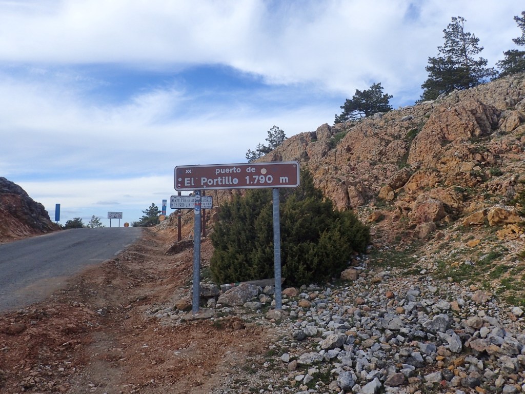
After the 3 km or so along the valley, the trail took a right turn to begin the ascent to the pass. It was only a 200-metre climb, but it was one of those that began gently before gradually getting steeper and steeper, stonier and stonier, giving the impression that the top was just ahead before revealing to the gasping hiker that there was still a bit more to climb. The last part up to the road at the Portillo Pass was particularly hairy as it was on some very unstable terrain. It was a relief to reach the pass and discover that I was almost at 1800 metres, the highest point since the first day of the hike.
I was hoping that the trail would descend gently from the pass but instead it immediately left the road and plunged steeply downhill over stony terrain where the markings were hard to follow at first. However, the trail then entered the woods and followed a very clear path down to the village. I took it slowly as it was fairly steep with some very stony sections and I knew a moment of inattention after this long day could cause me to trip if I wasn’t careful (by this point, I was beyond the 35 km initially planned). I was in no rush to get to the hotel as they had texted me with a code to collect my key from a safe-box. So I took it easy, descending 200 metres to the village in the golden light, arriving as the bells of the church rang 8 pm. It had been a long day, with 38 km covered, but surprisingly I didn’t feel exhausted. I’m not saying that I could have carried on much longer but I was far from being a total wreck.
I headed straight for the only restaurant in the village, where the hotel’s text had told me I would find food. The wonderfully named Bar Restaurante Tele Club de Guadalaviar was right in the heart of the village and, despite its humble appearance, was a terrific place to eat. The owners were a wonderful couple with a great sense of humour who offered to speak Catalan to me as they didn’t know French! I ordered three tapas and the lady thought that might be too much, but I told her not to worry as I was very hungry indeed. Unusually, there were a few other foreigners in the place, a German couple (the lady owner’s German was very impressive, as was her English) and a girl who I thought sounded Australian. There were a few old locals too, including one very old chap who wandered over to chat to me (not that I understood a word he said!) before trying to leave via the window behind me. The poor bloke was obviously suffering from some form of dementia and one of the locals quickly came to get him to steer him towards the real exit.
After polishing off my three tapas (to the surprised delight of the owner) and downing a couple of delicious Estrella beers, I said goodnight to the charming restaurant owners and headed off across the silent village to my hotel where I quickly found my key and my room (on the very top floor, as if I hadn’t done enough climbing for the day!). After a quick shower and a few stretching exercises, I went straight to bed for what turned out to be a pretty bad night. I had expected to sleep really well after the day’s efforts, but seemed to have an excess of adrenaline coursing through my veins and didn’t really doze off until 3 am. But with just 5 km to cover the next day, at least I didn’t have to be up too early.

38km is a lot! I’d need two days to cover that.
Estrella is one of the great discoveries I made in Spain. It’s not that I’d never heard of it, but I’d dismissed it as just another lager. But it’s lovely beer!
LikeLike