I woke refreshed after a good night’s sleep, ready to tackle the first day of the trail. The lovely lady serving breakfast was very tolerant with my basic Spanish, and even managed to teach me a new word, tomillo, the Spanish word for thyme. She said that after the recent heavy rain, the mountains would be fragrant with it. And with many more herbs as I discovered over the next few days. She also told me the rain meant that everything would be very green, something that I could see for myself from my hotel room window. She said that I wouldn’t be meeting many people because it was a very quiet time of the year. They get quite a few tourists in summer, often mountain bikers or motorbikers. But that night I had been the only guest at the hotel. As for the breakfast, it was a pretty frugal affair, a far cry from the huge spreads that I’m used to from my German hikes.
I set off at around 9 am for the first 19 km of this new trail, little knowing that the guy who was cutting the grass with a strimmer at the exit from the village would be the last person I would see until I found the manager of the refuge I was staying at doing exactly the same thing six or seven hours later.
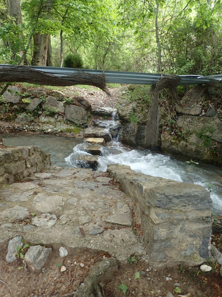
The first section of the trail followed the small river that flows through Arcos de la Salinas. It was a wonderfully bucolic section, with a lot of greenery and the rushing river flowing to one side. However, the tall grass that I was walking through was wet with a heavy dew and my hiking shoes were soon quite wet. They got even wetter when I had to cross the river on some stepping stones, two of which were too low, meaning that my shoes got soaked both inside and out. At that point, I recalled some advice from our guide Ben on our hike to the Western Brook Pond viewpoint in Newfoundland in 2022, a hike when we were at times wading through water up to our thighs. Ben told us to keep on walking in our soaked boots and not attempt to put on dry socks at a rest point, otherwise, we were sure to get blisters. It was sound advice that day and I applied it again. It worked, and by the end of the day, my shoes were dry, and there was no sign of a single blister.
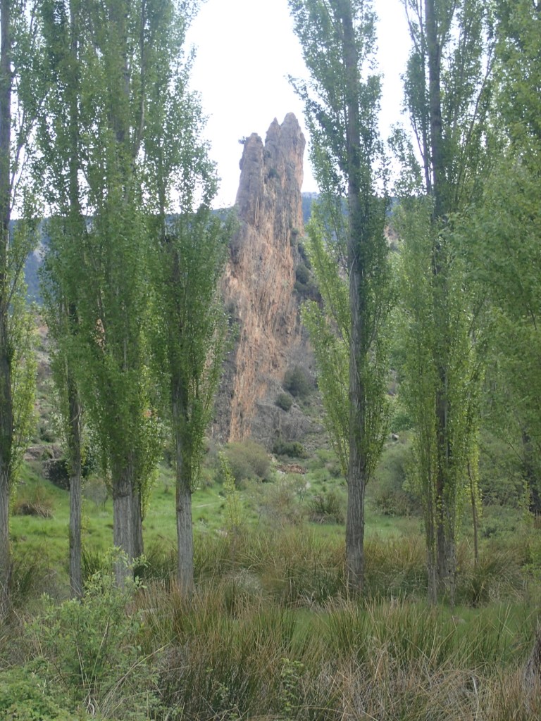
Shortly after, the trail joined a road heading uphill and a fair section of the 900 m ascent would be spent on it. I’m no fan of walking on roads, but it was nice to be on a dry surface after all the wet grass. Moreover, the road was far from busy. During the first 6 km along it, I didn’t see a single car, and just one deer. I did, however, see some pretty impressive rock formations.
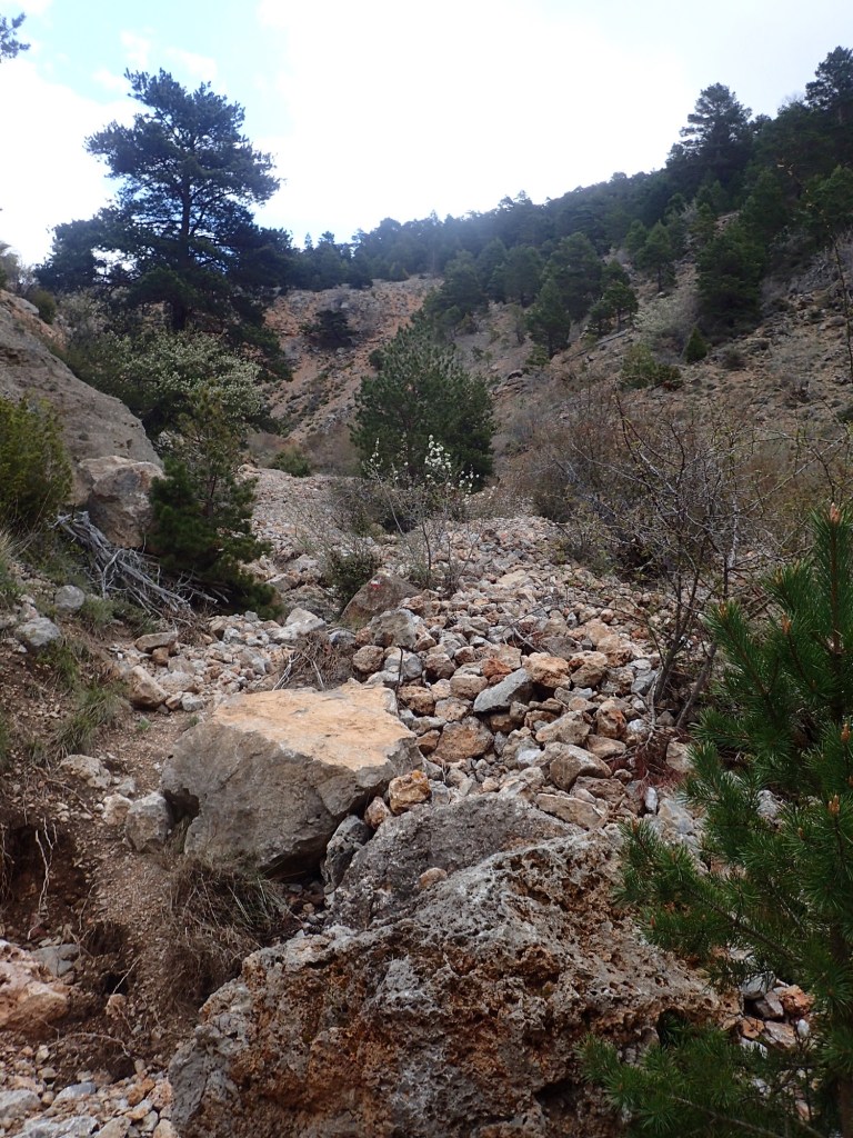
When the trail finally left the road, things became much more intense. I continued to head uphill, but now in an area that seemed to have been devastated by one of the flash floods that occurred in this area the previous year. I was heading along a gully where the terrain had been churned up to such an extent that I was hopping from rock to rock to make my way up. And, to add to the fun, some of those rocks were pretty unstable. It was a tricky and exhausting climb that left me cursing and drenched in sweat, even though it was a fairly cool morning.
After a while, I came to a section where the uneven terrain was held in place by long boards and I was able to climb a little more easily, but I still had to remain vigilant at all times as the boards didn’t seem particularly stable. The positive point was that I was gaining height fairly quickly, revealing some great views as I went.
The trail finally levelled off in some pleasant woods but then, at the kilometer 9 point, more or less disappeared in a section that had clearly been swept away by a landslide. The Komoot app showed the trail as running straight across this section before rising up to meet the road again. I took a couple of steps onto the fallen rocks, but realized right away that I needed to turn back and head up to the road by another route, unless I wanted to end up like this guy…

So I turned back and found a spot where it was quite easy to get up to the road through the trees. When I reached the point on the road where the trail joined it again in theory, I looked back along it and saw that it would indeed have been very dangerous, if not impossible, to have followed the trail marked on the app.

After another kilometre or so, the trail left the road for good. That was when I took a short break, sitting in the shade of a tree and basking in the silence broken only by birdsong and the buzzing of bees.
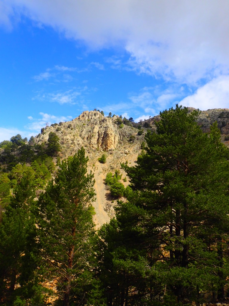
Over the next couple of kilometres the trail continued to climb gently across some barren and stony terrain where it was often hard to follow the red and white trail markers.

But then the trail turned onto a dirt road that made progress a lot easier. I continued to climb, but at a much easier pace now. Ahead, I could see the Javalambre, the highest peak in the area. It was possible to veer off the track I was on to climb it. But I didn’t think the views would be any more spectacular from 2000 m than they were from 1900 m, the altitude that I had now reached.
The dirt road skirted a couple of minor peaks as it continued to rise a gently towards a sort of pass below the Javalambre summit. At one point, in the damp earth, there were some rather intriguing tracks that I photographed, hoping that the people at the refuge would be able to tell me what they were made by. Whatever animal it was, it had some pretty impressive claws.

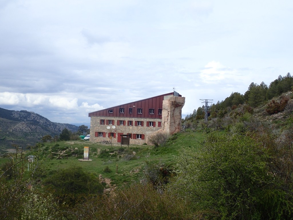
On reaching the pass, I was able to make out the Rabadá y Navarro refuge below, much further down than I had expected. When I had booked, the photos on the website showed a building that seemed to be on a mountain ridge. Stupidly, I didn’t check the altitude the building was at to compare it with that of the pass. And so I now discovered that I had a 300 m descent to reach it. And not the easiest of descents as it was riddled with loose stones (something that would become a regular feature over the following days and not my favourite kind of terrain). It took me quite a while to pick my way down the steep slope before emerging onto an open expanse of land that was in fact the centre of the ski resort that opens up here in winter.
The refuge was still further down, with one final short climb to reach it. One end of the huge building was taken up by an impressive climbing wall. As I approached, the whole place seemed to be deserted. The main door was closed and locked, and when I stepped around to the side of the building, there was no sign of life there either, apart from a guy, some 50 or 60 metres away cutting the grass along the access road with a strimmer. That was a bell to ring so I tried that, but there was no reply. The manager had called me that morning asking me what time I expected to arrive, so I knew someone would be around at some point. So I sat in the sun to wait. After a while, the guy using the strimmer stopped for a break and spotted me. He turned out to be the manager of the place and came running over, apologizing for not having noticed me sooner. He told me that his girlfriend was on the other side of the building, cleaning canyoning gear and probably hadn’t heard the bell. He went off to let her know I was there before going back to his strimmer and, a couple of minutes later, a friendly young woman popped out of the kitchen and told me to go round to the main door that she had just opened.
As she was checking me in, she told me I would be the only person staying that night, that I could go wild and have a karaoke party if I wanted because it wouldn’t disturb anyone! She told me which room I was sleeping in and said to come back down around 8 PM for dinner. They would light the stove and she and her boyfriend would eat with me to keep me company. Her English was very limited, but he had worked in the UK for a number of years so we were able to communicate more or less.
We had a very pleasant evening, chatting together, and discovered we have a similar mindset. The guy told me he’d been making much more money when he was working in London, but quite frankly since he and his girlfriend took over the refuge in 2021, he felt that his life had never been better. True, there is the maintenance work on the refuge, but otherwise they are outdoors most of the time and he felt that his life now was much richer. I have to admit I felt a little jealous of them as this is the kind of job I would have loved to do.
Plus, he identified the animal whose tracks I had photographed. A badger, tejón in Spanish. He told me that he would often see them on the road at night when he and his girlfriend went to the nearby town for a drink or a movie. Apparently, the animal is thriving in this area, which makes a nice change from home where they have been decimated by farmers and hunters.
Needless to say, after the day’s efforts (a hike of 20 km with 900m of positive elevation), nestled under a couple of thick blankets at 1600 m altitude, I had a terrific night’s sleep.

Interesting that the tracks were badger paw marks. I looked at that and thought “bear”.
LikeLike