This was a double one – two of the official stages of the Moselsteig in one day which ended up representing a total of 31 km by the time we arrived in Zell. The first part, from Traben-Trarbach to Reil, around 15 km would be tougher than the second part that had fewer steep ascents. In any case, we had decided to take a long stop for lunch in Reil before tackling that second stage.
After an early breakfast at our hotel, we were on our way by 8 AM, hoping that the heavy rain of the previous evening would not return. All the same, despite a few blue patches, the sky did not look exactly promising.
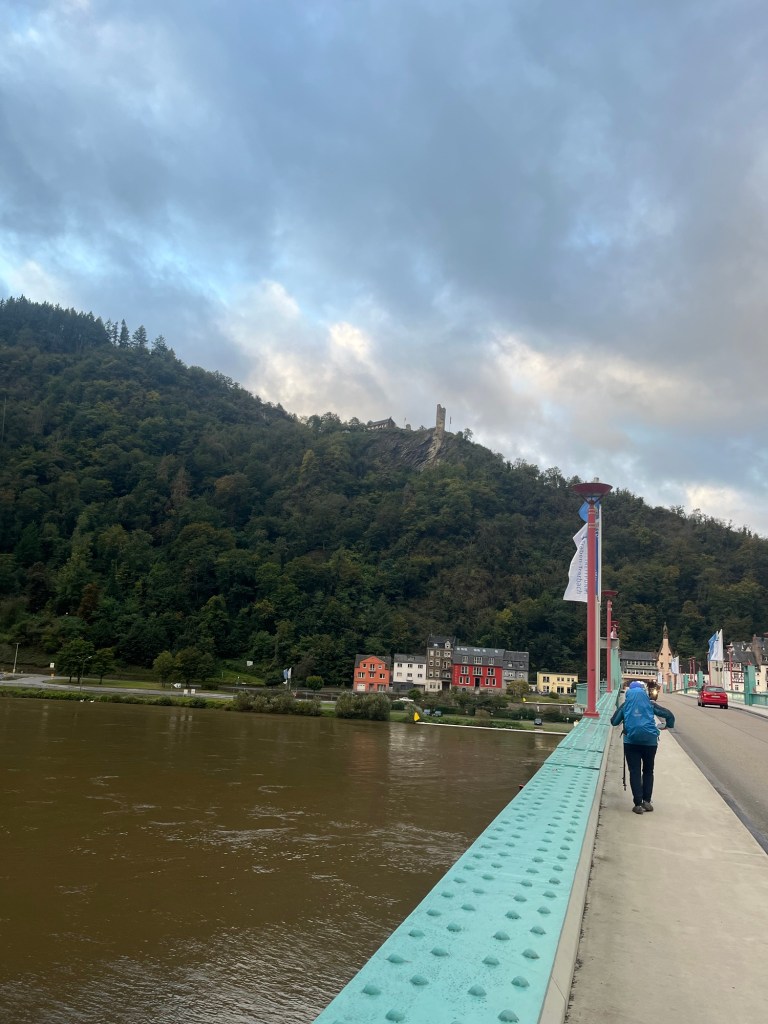
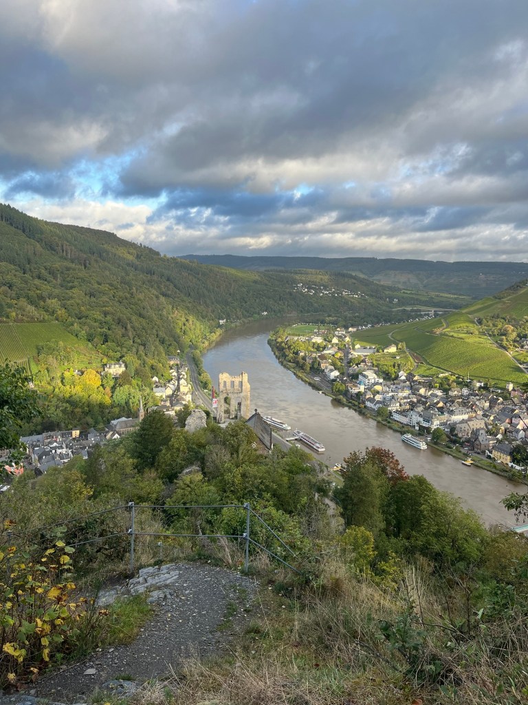
The first stage of this long hike saw us cross the Moselle to the Trarbach side and immediately start climbing up to the ruined castle above the town, Burg Grevenburg, an ascent of some 150 metres over a short distance. Needless to say, it was steep. But a steep, strenuous climb always means great views reasonably quickly and, in what felt like no time at all, we had reached the castle and had a plunging view of Traben-Trarbach below. There was a café up there that could have provided a welcome espresso if it had been open, but we were there way too early.
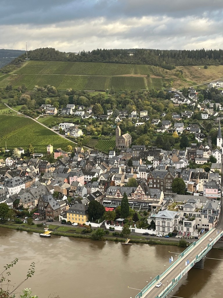
And the climb was not yet over, with another 180 metres to ascend to Bismarckhöhe. There was an alternative trail, a sort of via ferrata through the higher vineyards, but we stuck to the main trail that ascended at a much easier rate now. The view was even more impressive from the top.
From Bismarckhöhe, the highest point that we would reach that day elevation-wise, the trail began to descend gently, first towards the village of Starkenburg, that was unusual in the fact that it was perched high above the river rather than on its banks. It was a pretty little spot with a few places to stay, somewhere to return to on a future trip.
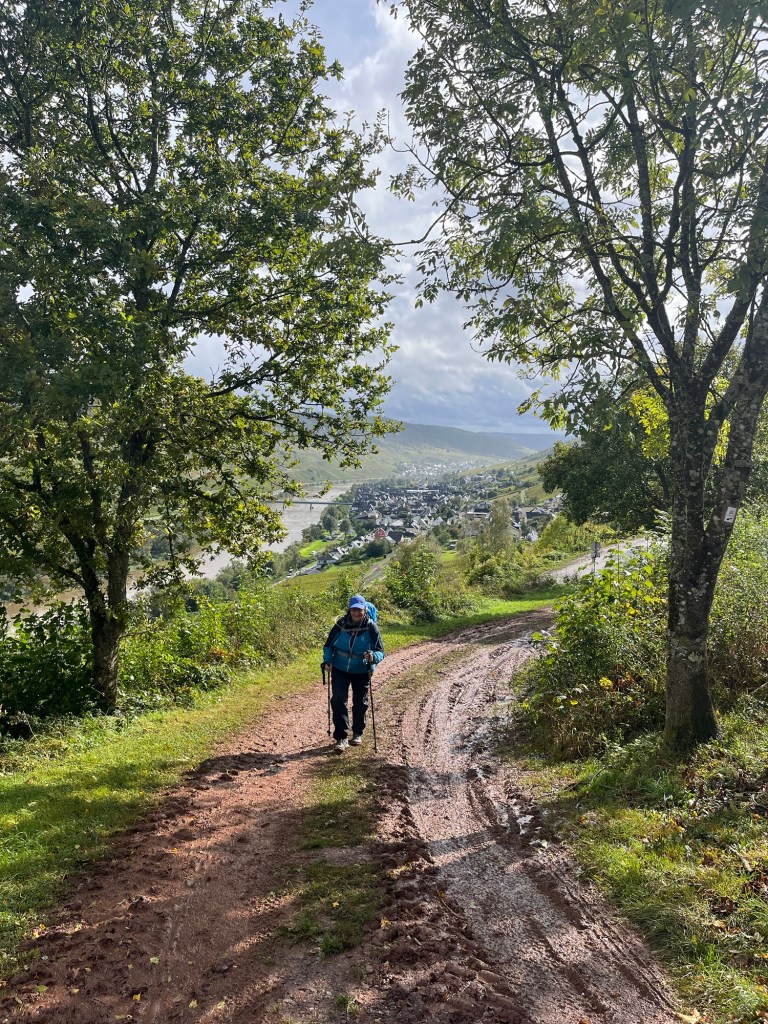
The dark clouds seem to be keeping their distance and walking in the woods with the sunlight cutting through the trees was very pleasant.

However, just before the village of Enkirch, the rain began to fall, forcing us into our rain gear.
Enkirch was a pretty little place, with hand-painted signs for every street and pathway. The trail led all the way down to the valley of a small river flowing into the Moselle before climbing steeply back up into the vineyards on the other other side.

From that point on, we were in vineyards, passing above the village of Burg before gently descending to the bridge over the Moselle that led us across to Reil. The rain let up from time to time, but when it fell, it fell with a vengeance.
Reil turned out to be a quiet little place. The winery restaurant that we had our eyes on for lunch didn’t open until 5:30 PM. However, just around the corner, facing the river, we found another spot with a large terrace covered with a corrugated plastic roof. As soon as we sat down to order our food, the heavens opened with a thunderous downpour that made a terrific din on the roof. The owner complimented us on our luck: we had arrived just in time. Lunch was a simple affair, soup and homemade cake for Odile, sausage and potato salad for me, washed down with a refreshing blend of grape juice and soda water. The rain eased off from time to time, and then came thundering down again, amplified by the roof above us. The place was full of other hikers and mostly cyclists seeking refuge from the downpours. It was a quirky spot, with life-size mannequins in the breakfast room, and even one in the restroom that gave both of us quite a shock when we used it.
At around 2 PM, we decided it was time to move on and tackle the second stage, about 3 1/2 hours of hiking according to the guidebook. As I was paying, the restaurant owner told me that there would be one more light shower and then the weather would improve for the rest of the weekend. And she was right!
The second stage of the day began with a gentle climb out of Reil. The final rain shower passed and the weather turned sunny, helped by a strong wind that cleared the clouds.
There were more fine views of the river below, notably from the Leofelsen cliffs. Shortly after, we found ourselves on a sort of isthmus, a narrow strip of high land with the Moselle on both sides of us. Further on, the land would broaden to form a sort of teardrop as the Moselle flowed around another huge lump of rock that it had been unable to erode over time. I don’t think I mentioned earlier in these posts that the reason why the Moselle is so winding is the geological makeup of its valley: all the way along its course, the river regularly comes up against massifs of rock that it has been unable to erode, and so is forced to flow around them, creating the numerous bends typical of the Moselle.
A little further on, we came to the Prinzenkopf tower that would no doubt have provided great views if we had had the nerve to climb it. But the tower was too high and exposed to the elements for us to be able to attack it without vertigo kicking in. Moreover, in the high wind that was blowing, the damn thing was singing or rather wailing! Not at all reassuring…

From this point, the trail led downhill, past the Marienburg, a castle that now seems to be used as a holiday centre for children, and reached a sort of pass at the foot of the Barl hill. Odile was feeling pretty tired at this point, but the option of following the road into Zell was rather unappealing, so we carried on along the Moselsteig, which meant one final climb to get us around the hill. And we were glad that we opted for this solution rather than the road because it allowed us to discover the village of Briedel on the opposite bank, a very pretty place whose houses stretched back along the valley perpendicular to the river. Another spot that we noted as somewhere to return to on a future trip.
After rounding the hill, the trail led gently down to the main road along the Moselle that we crossed to reach the footbridge to Zell.
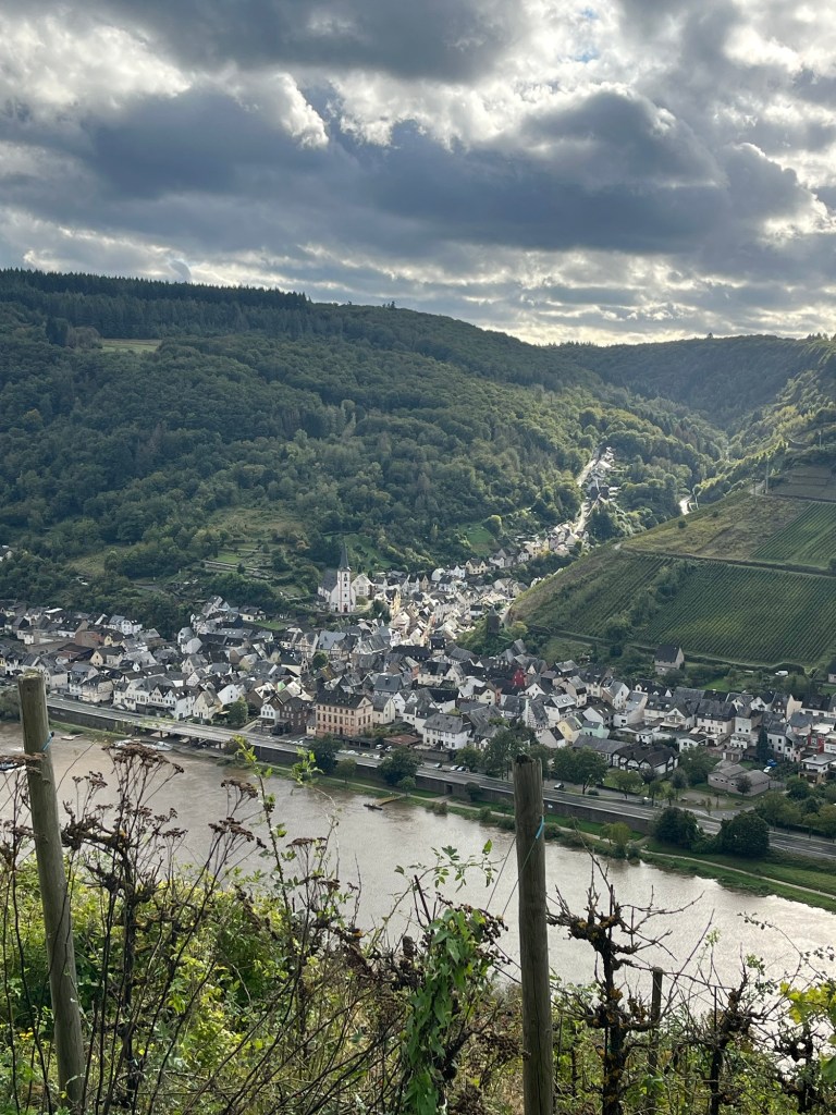
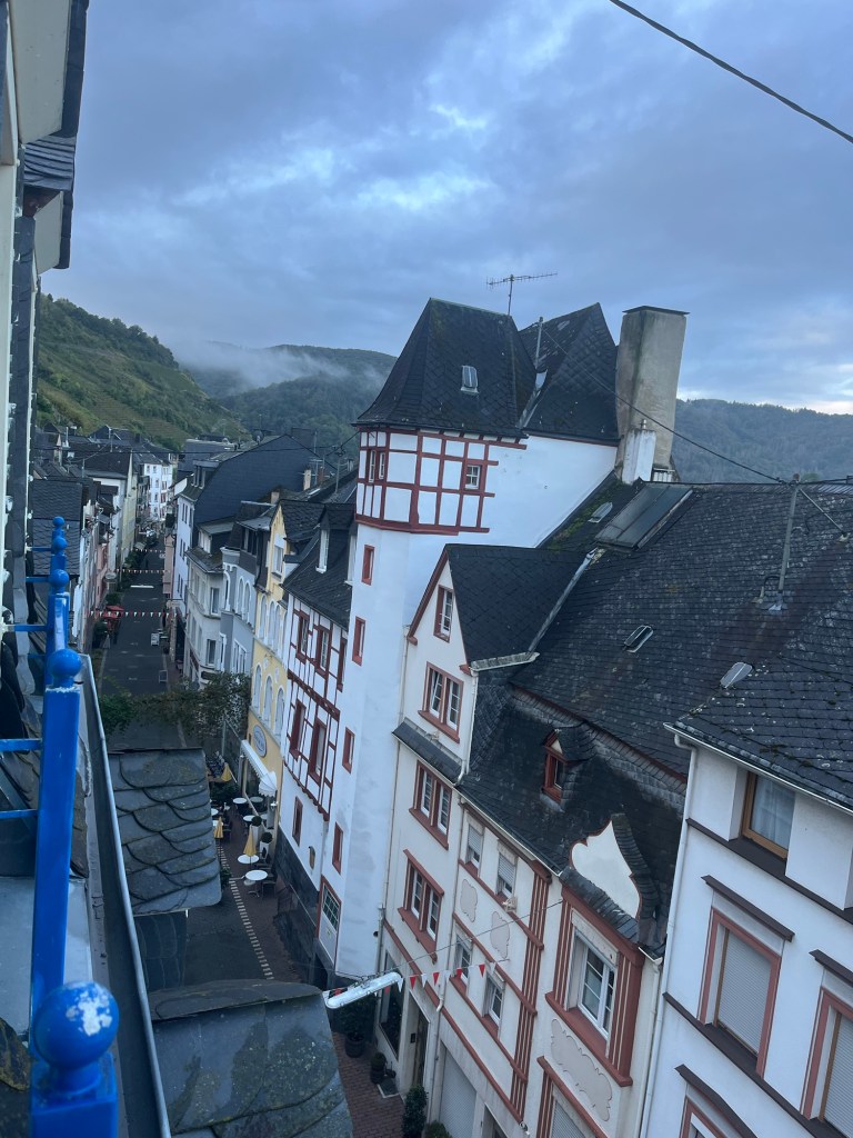
Because the main road does not pass through the town and because the one bridge across the river at this point is for pedestrians only, Zell was a beautifully peaceful little town full of old buildings and with a lively central pedestrian street lined with restaurants, wine shops and even an outdoor sports store. One of the nicest towns so far along the Moselle.
We got to our hotel only to discover that our room was on the fourth floor, without a lift. By that point, we had walked 31 km and looked so dismayed on hearing this news that the owner offered to help push us up the stairs!
For dinner, we had set our sights on a Greek restaurant, but unfortunately the place was full, so we ended up at the local Turkish kebab joint for a delicious and very cheap dinner served by the charming owners.
All in all, these two stages of the trail were perfectly doable in one day. The long break at Reil, about an hour and a half, made the second stage, feel quite easy, despite the accumulated distance. And the following day would be much easier.
P.S. I forgot to mention that the pain in my calf muscle faded completely over the course of the day, perhaps a blend of the previous evenings’s massages and stretching exercises, combined with the climb out of Zell that also stretched the muscle nicely.
