What should have been an easy morning hike of just over 13 km into Freudenstadt, estimated at 13 km, turned into a 21-km slog for a number of reasons, notably a huge amount of logging work at the start of the day that obliged me to make a long detour.
I set off from the hotel at around 9:20 after an excellent breakfast. I had worked out a way to return to the trail with the app as the Ostweg didn’t pass directly by the hotel.
However, shortly after I set off, first along the road passing the hotel before heading into the woods, I found myself in an area where some very heavy logging had just taken place.

Being pretty stubborn, I decided to carry on along the route that I had planned. After climbing over a number of trees, I found the Ostweg markers, but things only got worse from that point on. Plus it was Monday morning, meaning the loggers were back in the woods after the weekend and I could hear chainsaws nearby.

So I decided not to forge ahead like an idiot on the virtually blocked Ostweg but to turn back along it now I had found it. After climbing over and around countless trees, I came upon, from behind, a huge banner closing the trail for logging work that would have been immediately apparent if I had been on the Ostweg from Pfalzgrafenweiler and had approached from the right direction. By that time, through a mixture of stubbornness and stupidity, I’d wasted a good hour and was pretty tired from climbing over all the trees.
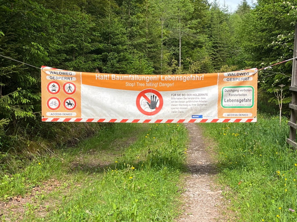
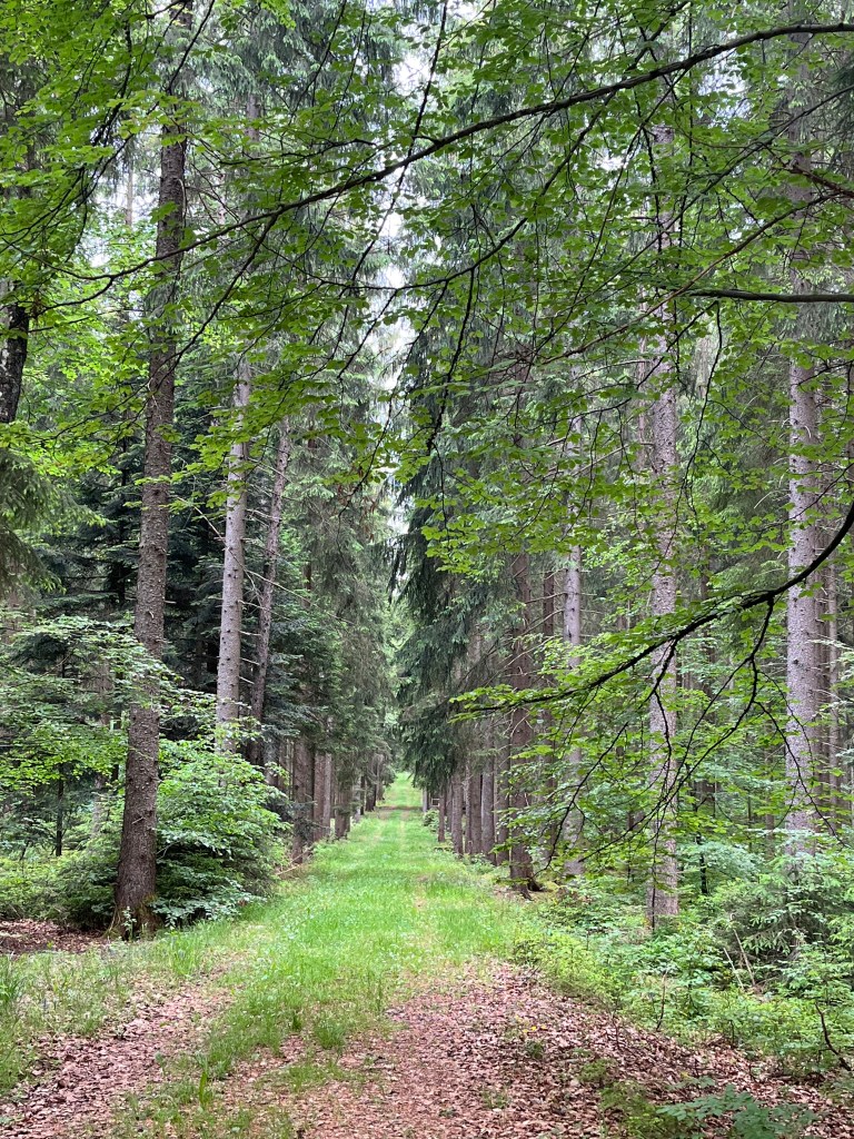
In well-organized German fashion, there were signs posted on nearby trees indicating the detour around the logging work that would add a good 5 km to the day’s hike. Once I was on that detour, things were a lot easier as the trail ran through beautiful and peaceful woods where the shrieking chainsaws soon faded into the distance. There was nobody else around and, in fact, I would only encounter a couple of other hikers in the course of the day.
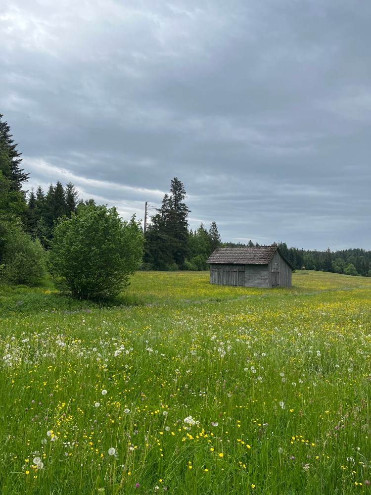
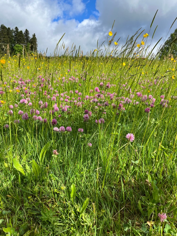
I missed a turn at one point on emerging into an area of meadows and went another couple of kilometres out of my way before realizing it had been a while since I last saw a trail marker! Clearly not my best day ever…
The rest of the day felt like an endless series of descents and ascents, albeit small ones, as I made my way to Freudenstadt. The sky began to darken for the first time since setting off from Pforzheim and, at one point, the heavens opened with a terrific downpour that required full rain gear and the pack cover.
The rain didn’t last long, maybe not even an hour, but this part of the day’s hike was mostly across farmland, with the edge of a wood here and there, so there was no avoiding the rain which was very heavy indeed. However, by the time I reached the outskirts of Freudenstadt, the sun was back out.
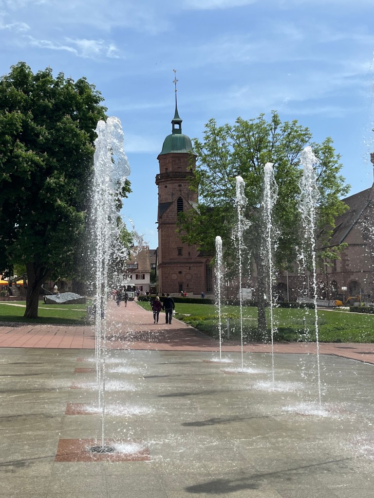
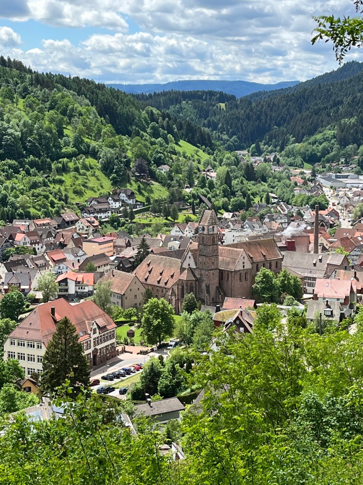
After passing the peaceful cemetery, I stopped at the first bench I found to remove my rain gear before going for a good slice of Black Forest cake and a cappuccino at the café on the huge main square where I had stopped when walking the Mittelweg.
The hotel for the night was a simple place just off the main square with a self-check-in, assisted by another guest who had read the email of instructions that I had somehow missed. After a hearty dinner at the friendly local craft brewery, I hit the sack for a good sleep after this supposedly easy day that had turned out to be harder and longer than expected.
On day five, after a simple breakfast and best wishes from the sweet lady at reception, I set off at around 7:45. Freudenstadt was fairly quiet at that hour, but a few people were already up and about (often walking dogs). However, after leaving the town behind, I didn’t see anyone else for the rest of the day until I reached Alpirsbach that afternoon. Moreover, this would turn out to be the easiest day so far, despite the distance of 24 km, without me straying off the trail or encountering any pesky logging work.
The trail headed up out of Freudenstadt into the hills above the town. It was a long and steady climb that wasn’t too tough but not necessarily welcome first thing in the morning.
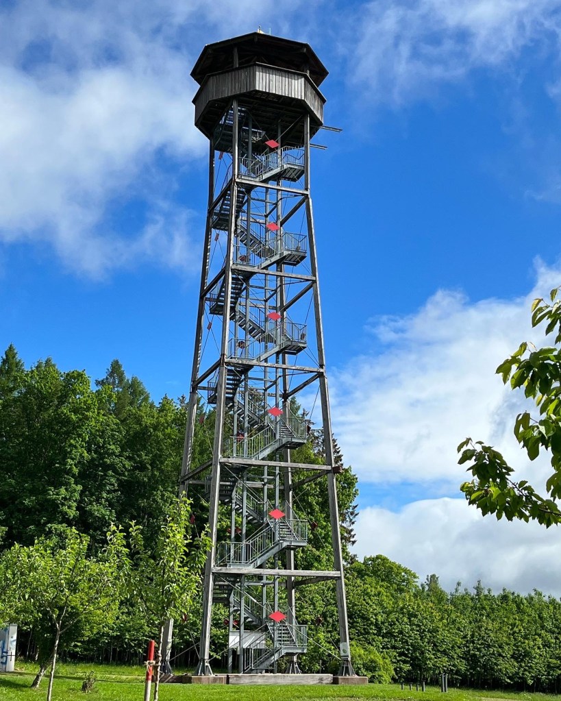
After reaching the Kienberg sculpture park at the top of the climb, at an altitude of 800 m, where there was another viewing tower, the trail entered the woods. At this point, it began to rain. However, it was not very heavy so I just put on my jacket and the pack cover.

After the initial climb out of Freudenstadt, the rest of the day unfolded between woods and meadows at an altitude of between 800 and 750 metres (before the descent to Alpirsbach). And, an hour and a half after leaving the Kienberg park, the rain had moved on and blue skies had returned.
I gave the day’s second viewing tower, the Vogteiturm in Lossburg, a miss as it didn’t look sturdy enough to overcome my vertigo, even though the views from the top must have been spectacular.
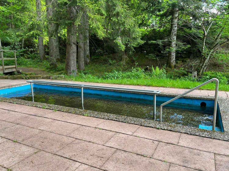
Shortly after, there was the treat of discovering a Kneipp bath that wasn’t mentioned in the Rother guide. It was about a hundred metres off the trail and I found it thanks to a highlight on the Komoot app (my favourite hiking app with AllTrails). I stopped to give my feet a good soak before setting off again through the woods to the pretty village of Schömberg.
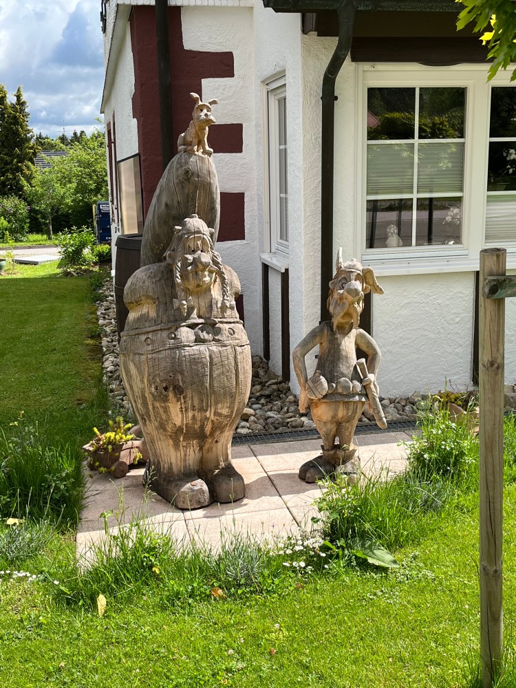
There, I had the surprise of coming across an Asterix and Obelix sculpture outside someone’s house. I guess that shows the appeal of the characters internationally. A year earlier, we had encountered them on a section of the Alpe-Adria in Austria, again outside a private home..
I was making good time, advancing at a steady pace and, before I knew it, at around 1 PM, I started picking up the yeasty aroma from the Alpirsbach brewery before spotting the pretty little town below, huddled around the spectacular abbey.
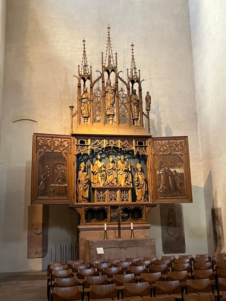
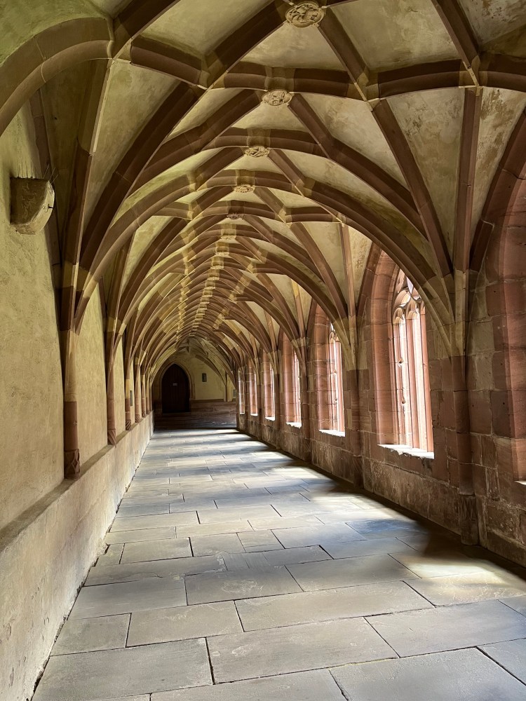
As I had arrived so early, I went to take a look around the abbey which turned out to be a very interesting place with lots to see, including some fine carvings and a beautiful cloister.
After the abbey, I went for a tasty slice of cake and fruit tea at the café across the street before going to the hotel where it turned out to be their “ruhetag”, meaning my keycard was in an envelope taped to the door, along with a list of recommended restaurants for dinner. My room was very comfortable and peaceful with a huge balcony overlooking the Kinzig river.
For dinner, I had an excellent burger at a place just around the corner from the hotel, eating early enough – at an outside table – to avoid the chill as evening began to fall.
Day 6 was another relatively easy one with a steady climb up from Alpirsbach at 441 metres to Aichhalden at 716 metres before descending to Schramberg for the night. It was another fine day, without any rain, and with a spectacular surprise in the shape of the evening’s hotel waiting at the end of the day.
The sign for the trail in Alpirsbach said 19.5 km to Schramberg, but once again it turned out to be a bit longer, 23.6 km from hotel to hotel.
The day began easily with a pleasant walk through the outskirts of Alpirsbach before a very steep climb at the cemetery, just after a beautiful Kneipp bath that it was a little too early in the day to use.
The trail continued to climb before entering some woods after a series of meadows, then returned to open land again to pass some fine old farmhouses, one of which had an ingenious well system to provide cool drinks for passing hikers. The drinks were kept cool underground and could be raised by turning a handle. If I’d passed later in the day, I’d have treated myself to a cool Apfelschorle, but it wasn’t even 9:30 when I passed.

I carried on my way, passing a few fields of cows and then a paddock full of deer. The walking was beautiful and fairly easy, despite the occasional steep climb, with no one around, apart from a farmer here and there.
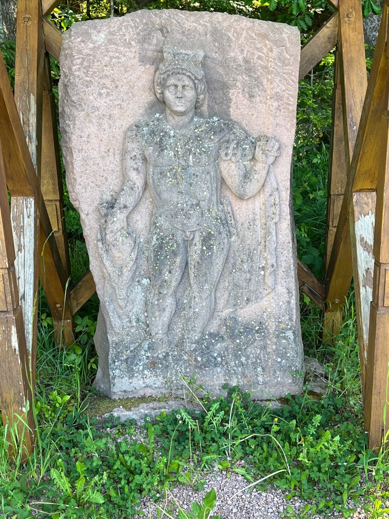
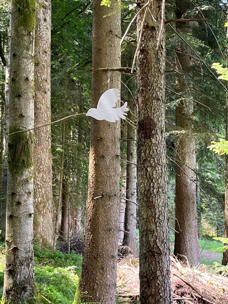
At one point, I found myself on an old Roman road, with markers and statues. Alongside it, there was a narrower trail that the Ostweg followed and that had a peace theme, with quotations on signs and cut-out doves hanging from the trees.
In the small village of Aichhalden, a bakery was open so I stopped for a coffee and a slice of Linzertorte around midday to set me up for the six or seven kilometres left.
After that break, apart from a brief patch of woodland before the descent to Schramberg, the trail mostly followed surfaced roads, occasionally through residential areas – not my favourite – but mostly across open farmland.
The final descent to Schramberg was, as so often, pretty steep, and I arrived in the town at around 2 PM with plenty of time to kill before checking in to the hotel at 4. I took a look at a local cake shop that didn’t inspire me, so I ended up with a huge Italian ice cream instead to pass the time.
The hotel, the Villa Jurghans, stood in a beautiful park above the town and looked like an elegant residence from the late 19th century. When I opened the door of my room, I could barely believe my eyes – it was huge! I could have rollerskated around it. The shower even had a steam bath function, so I had a good 30-minute steam to ease the day’s aches before an excellent dinner of roast pork in a wild garlic crust at the hotel restaurant. I had a terrific night’s sleep in the huge bed and the place was incredible value for money at 90 euros, breakfast included. Ideal to attack day 7, which would turn out to be a little agitated…
