After a huge breakfast and a troubled night because of an overly soft bed (not great after day’s hiking, I find), I set off from Einruhr at around 8:10 for the 20 km or so to Gemünd. The day was cloudy, with rain forecast for 2 PM, so I didn’t want to waste any time.
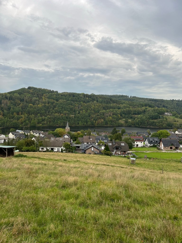
The trail left from the very centre of Einruhr, up a steep flight of steps that took me to the meadows above the village with views over the lake. After about 10 minutes hiking through the meadows, the trail turned into the forest lining the lake. The Rur lake has a highly irregular shape with countless bays and inlets. As a result, there were numerous switchbacks and turns on the trail as it followed the shoreline. There were a few of a hikers about: the friendly lady I met a few days earlier, for whom this would be the last day on the trail, and a couple of guys whom I suspected of having their bags transferred each day because their packs were minute.
In an open area of land, near a derelict old farm, I began noticing signs forbidding access to the fields. I suddenly realized that I must be entering the old Vogelsang military training area. There was a memorial at the side of the trail to the Royal Engineers dated 1983 and it dawned on me that the decrepit farm had probably been used for target practice. The fields were off limits because of unexploded shells and land mines.

Indeed, a little further on, there were signs warning hikers not to stray from the trail.
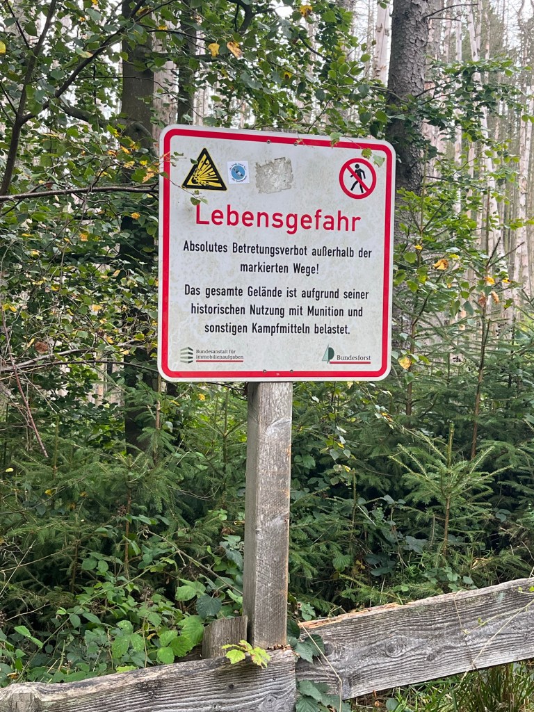
They’d be well advised to get that second one translated. I managed to understand it but it may not be within everyone’s grasp. Basically it says not to leave the marked path because the whole area is infested with munitions from its “historical” use as a military area. Nice! I’d heard of such hazards in Cambodia and the former Yugoslavia, but this was my first experience of this within the EU. Needless to say, I stuck religiously to the path, not even stepping off it to relieve myself!
After one last clear view of the lake…

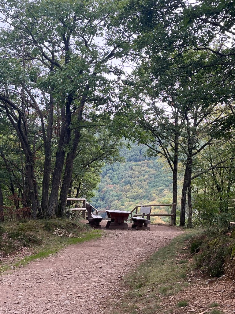
…the steepest climb of the day began. And God it was steep. In what felt like no time at all, I was 200 m higher, drenched in sweat and sorely in need of my 8 km rest. The ideal spot awaited me, vacated as I arrived by the two guys with the light packs.
It had a wonderful view of the Rur lake that was cut at this point by a dam behind which there was very little water. Rather than the effect of a drought, I suspect it had been deliberately drained as renovation work was underway on the dam wall.
The lady finishing her time on the trail that day arrived just as I was getting ready to set off again. She looked as hot and sweaty as I did when arriving, but did not stop and carried on uphill. I followed a short distance behind as the trail continued to climb, a little less steeply now, before reaching a summit, and an open expanse of moorland. The enormous buildings of the Vogelsang complex could be made out in the distance, but more of that later.
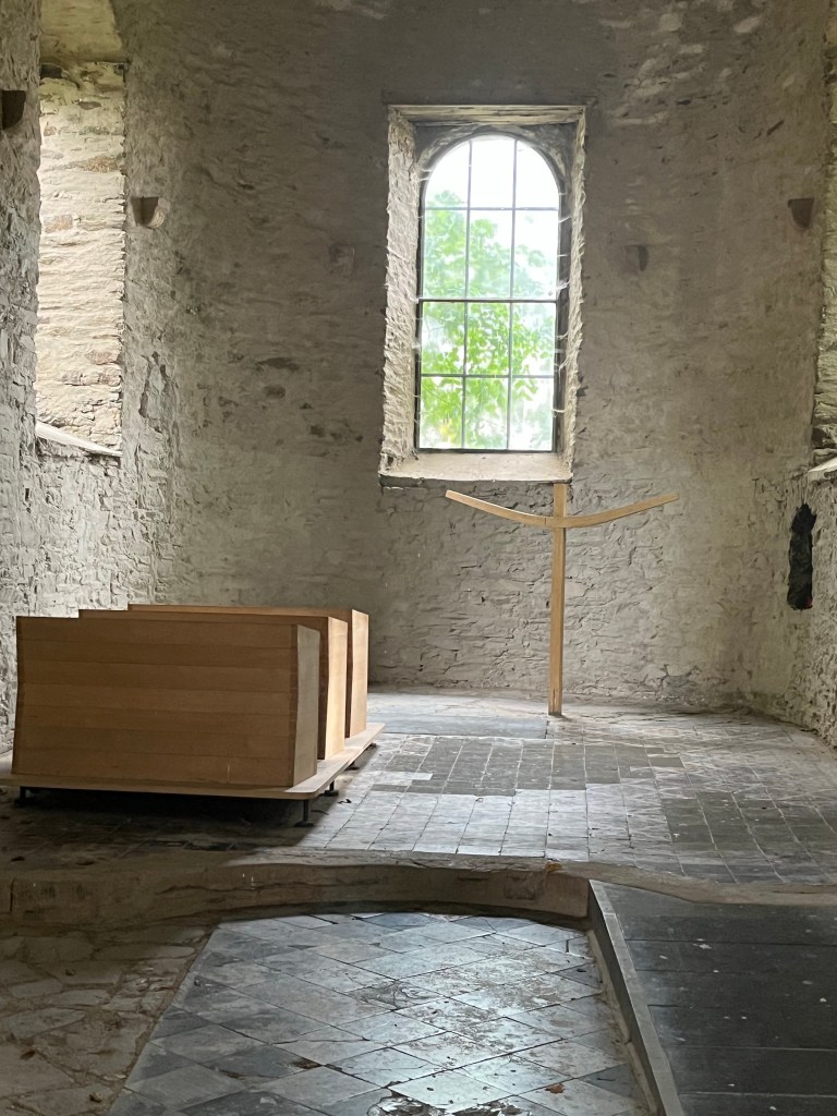
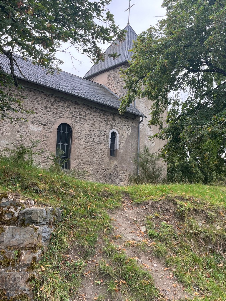
The trail across the moor led to Wollseifen, a fairly eerie place. On logging onto Wikipedia, I discovered that the villagers had been evicted after the war, and the village used for target practice by the Belgian and British armies that had taken over Vogelsang after Germany’s defeat. On the site, there was a model of the village in 1944, and it was quite a sizeable place. All that remains now is the old church, which had clearly taken a battering, and some modern looking apartment blocks that were obviously placed there as targets.
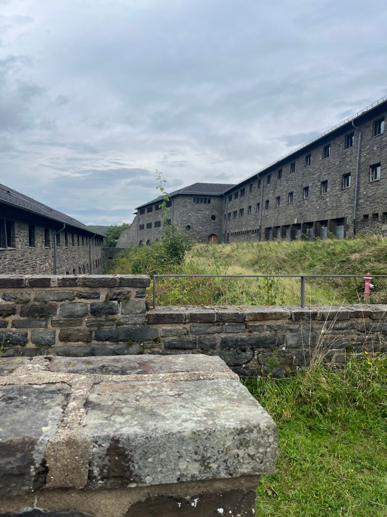
From Wollseifen, the trail led across moors and through forests to Vogelsang. The trail skirted the place, but I added an extra kilometre or two to the day by going in to take a look around. The complex was originally built as a training centre for the Nazi elite. Following the war, it was taken over by the British army, which then shared the place with the Belgians and other NATO forces until 2005. Since 2006, it has become a museum and part of the complex, in a neat twist of fate, is now used to house refugees.
The place is absolutely huge, covering the whole hillside. And parts of it are closed off because they are falling into disrepair, but the central building houses a museum and a pretty spectacular café with views of the surrounding hills. I saw numerous tour groups being guided around the place. Apparently, there is a fine swimming pool on the site too but, unfortunately, it did not open until 3 PM that day. So I contented myself with an espresso and a slice of cake in the café before heading off again.


It took me about 20 minutes to finally exit the whole complex, it is so spread out. My final image of it was of a hideous piece of national socialist artwork.

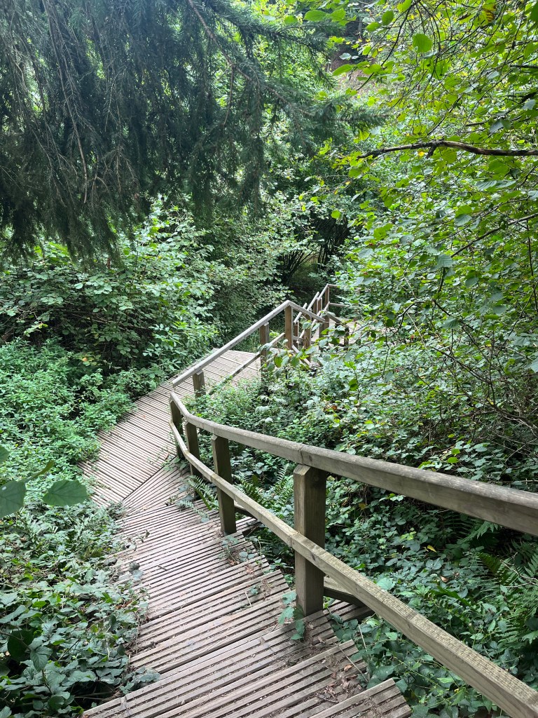
The trail descended via a series of stairways…
… before climbing to a spot where I had a clear view of Gemünd, my destination. There seemed to be a problem with the signposts indicating distances at this point. One said that Gemünd was 4.4 km away…
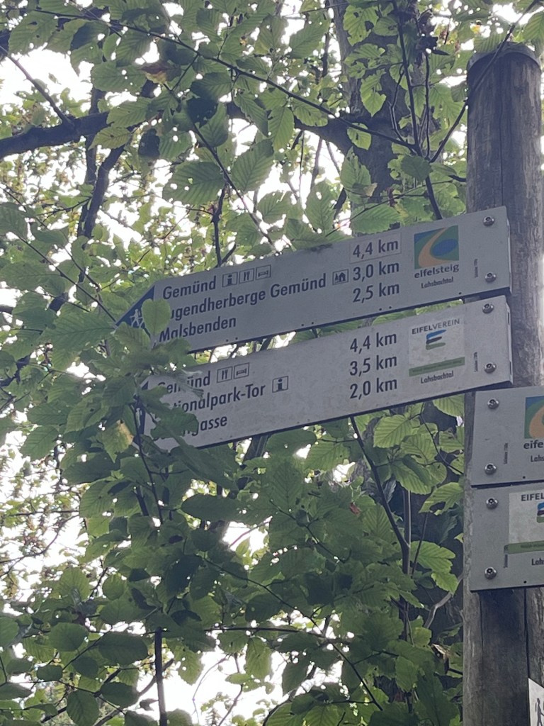
…while another, just ten metres further on, gave the distance as 3.7 km.
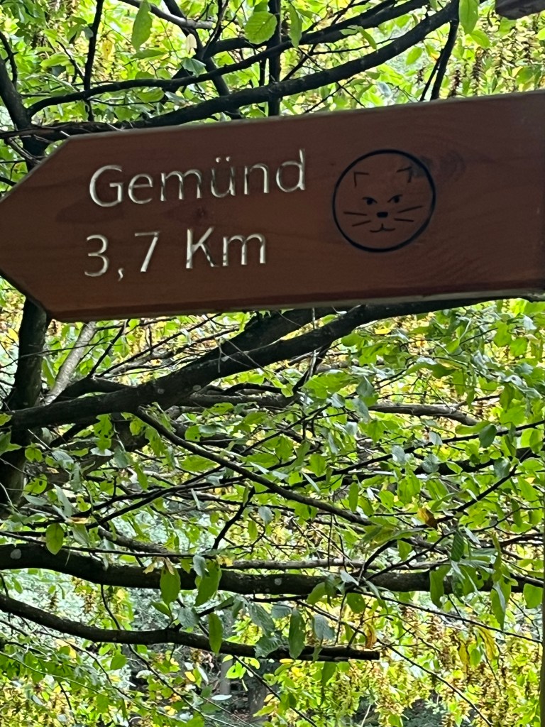
I discovered later that they were each indicating different areas of the town and I ended up walking the 4.4 km on the official trail.
A little rain began to fall at this point, but by the time I paused to put the pack cover on, it had stopped.
The trail brought me into town just next to the park, where there was finally a Kneipp bath.
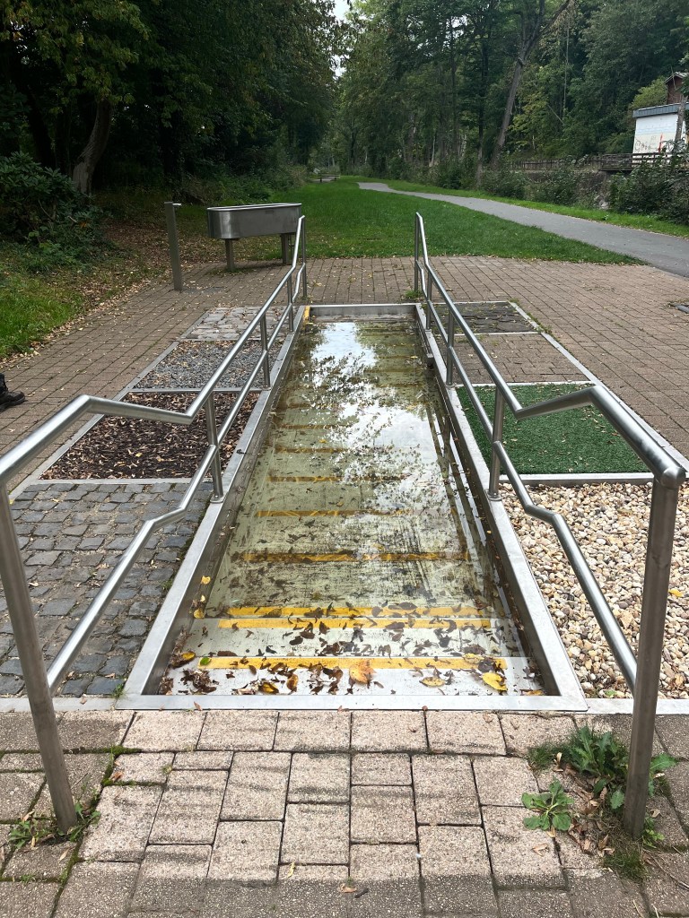
After wading through it a few times, and walking over the different surfaces at the side, my feet felt like new. Just as well, because that was when I discovered that my hotel was at the top of a very steep hill on the way out of town!
Even worse, it was the restaurant’s closing day, so that meant a trek into town again for dinner. There was a terrific thunderstorm just after I arrived which eased off the time it took me to get to a friendly Greek restaurant. The rain then bucketed down again while I was eating but, fortunately, eased off enough to allow me to get back without being drenched.
According to the forecast, the next few days are going to be dry and sunny. We’ll see if that is indeed the case.
