After two very easy days, day 3 was when things started getting serious. For the first time I would be doing over 20 km [26 by the end of the day] with a fair number of steep climbs [a total of 800 m].
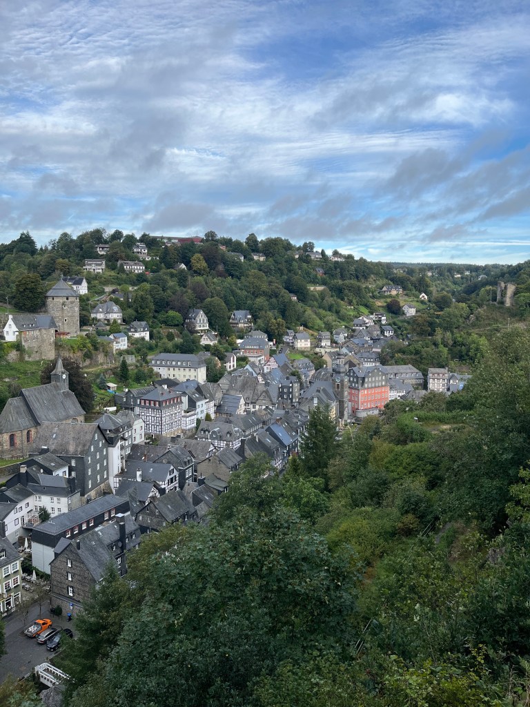
I began the day with a good breakfast at the hotel before setting off at around 8:30. Monschau was very quiet without the tourists as I descended to the main square to pick up the trail.
The day, of course, began with a climb out of the valley that Monschau is located in. Several steep flights of steps led to a number of viewpoints overlooking the town before heading down to the Rur river that I would follow for most of the day.
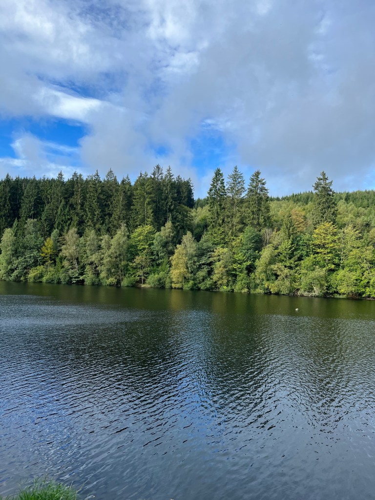
After leaving Monschau, the trail soon reached the Perlenbachtal reservoir whose banks it followed for a couple of kilometers. As I went along, I thought to myself that maybe I was doing this trail a few weeks too early. All the deciduous trees that make up a large part of the forest were still green. No doubt a couple of weeks later, they would be a riot of colour.
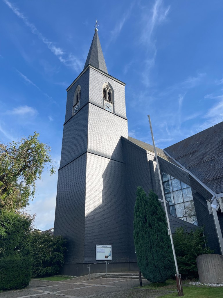
From the reservoir, the trail headed steeply uphill to the village of Höfen, gateway to the Eifel National Park with a visitors’ centre that was unfortunately closed on Wednesdays. There was not a lot to see in the village, except for the church, which was entirely covered with slate on the outside, like some of the buildings in Monschau
As I left Höfen and returned to the countryside, crossing a few areas of farmland, I realized all of a sudden that I had been here before. On a trip to Aachen a few years ago, we had attempted to do a hike in the area, but had been forced to turn back because of logging work. This time, I was able to follow the trail in it entirety.
After a brief rest stop, where I briefly caught sight of the lady from the previous day as I was setting off again, the trail entered the woods to follow the Rur for the rest of the day.
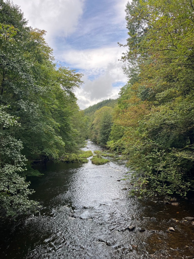
It was pretty easy going, even though, from time to time, there was a terrifically steep climb to do. I would be close to the river and then, all of a sudden, the trail would lead steeply uphill to follow it from a height before descending to the water again. It was continually interesting, with great views now and then, an old sawmill at one point, a bridge that provided a fine view of the river and the sound of water as a permanent accompaniment.
I particularly liked the higher sections above the river and I was often surprised to be so far above it when I had been following its banks a few minutes earlier. Those steep climbs got me up there in no time!
The trail signposts and my guidebook mentioned a restaurant in the village of Hammer, so I was planning to stop there for a bite to eat. However, when I arrived (up to 17.5 km at that point), I found the place closed with major renovation work being carried out. There was a café in the nearby campsite, but it wasn’t open until 3 PM, more or less the time I expected to arrive in Einruhr. So I soldiered on, stopping for a rest and an energy bar in a small meadow just outside Hammer.
They had been one sobering moment just before Hammer when I came across a memorial to someone who had been blown up by a landmine in late 1945. I know that I had to be careful the next day, because I would be crossing an area with a lot of unexploded ordnance and shouldn’t stray from the path, but I hadn’t expected to find evidence of it so soon.
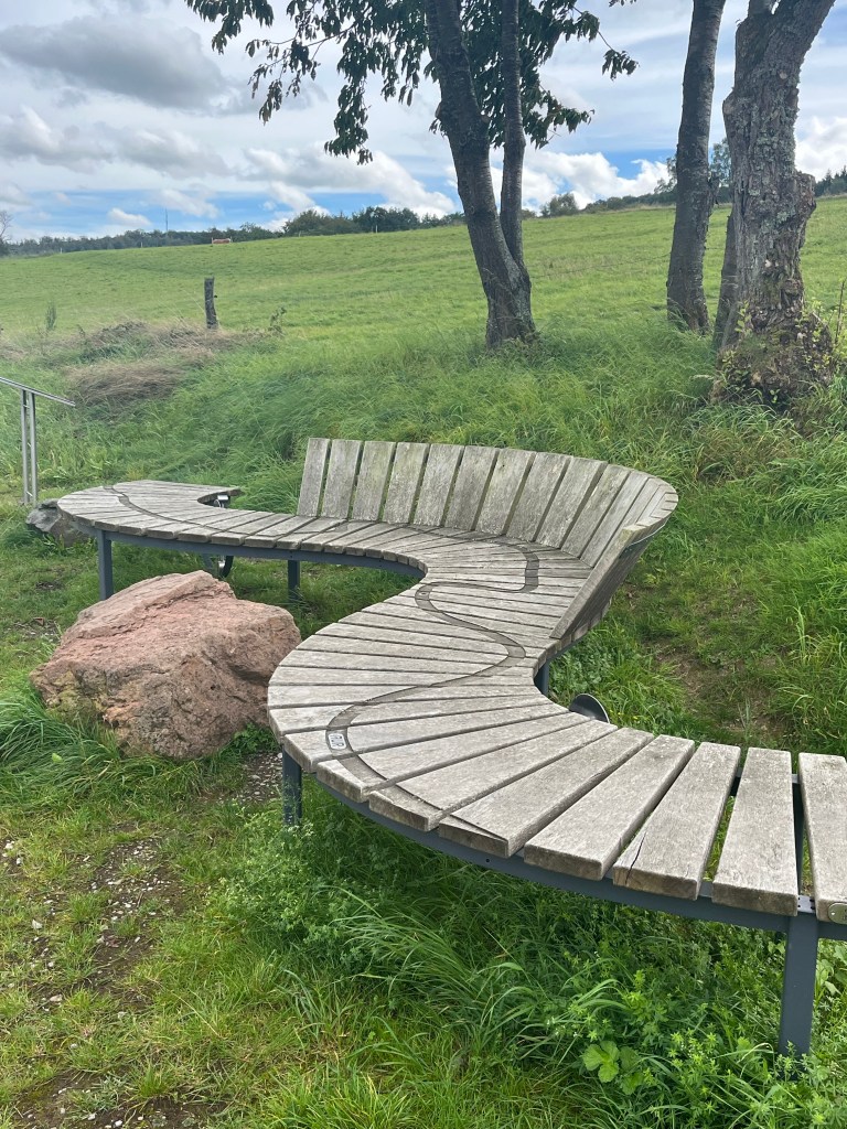
There was another steep climb to a farm track through some meadows (a rarity since Höfen). The Rur was far below, with a road following it now. At one point, I came across a magnificent rest bench for hikers with the Rur’s course marked out on it. A truly beautiful piece of work.
In the village of Dedenborn, the trail headed steeply uphill through a residential area before descending again. On looking at the map, I realized that I could have taken a shortcut and missed the climb, but at least I can say I will have done the full trail.

After Dedendorn, there was one more gentle climb before the trail turned onto a forestry track that headed down to Einruhr. At one point, I had to step to the side of the track to let a huge tractor with a gigantic trailer pass by. God only knows where it was going. I could hear it jolting its way along the track for at least five minutes after.
Just before Einruhr, there was a fabulous view of the village and the lake. From there, the trail headed steeply downhill and I arrived six and a half hours after leaving Monschau, having covered just over 26 km, an average of 4 km an hour, which is not bad, considering the 10 kg pack and all the climbs I did in the course of the day.

I stopped for refreshments in the shape of a a rather overindulgent waffle at a café at the entrance to the village before going to my hotel. The room was distinctly strange with the shower cubicle in the middle of the bedroom and various buttons to heat the water and activate a pump. I tried telling the owner that I didn’t need hot water as I only take cold showers, but he seemed very proud of the installation and insisted on showing me how it worked. As for the pump, it made a hideous din while I showered and it was a relief to turn the damn thing off.
I went to find a place to eat and discovered nearly everywhere in the village was closed, apart from a very swank hotel that wasn’t my cup of tea at all. So I ended up back at the café where I had stopped on arriving as it was the only other place open. They had a terrific local beer and a fine line in burgers, so I was pretty content.
Rain is forecast for day 4, but not before 2 PM. With just 20 km to walk, setting off around 8 AM should get me to Gemünd before I get drenched. Find out if I make it in time tomorrow.
